Peatmoor Lagoon
Lake, Pool, Pond, Freshwater Marsh in Wiltshire
England
Peatmoor Lagoon

Peatmoor Lagoon is a small freshwater marsh located in the county of Wiltshire, England. Situated in the Peatmoor area, the lagoon is a popular attraction for both locals and tourists alike.
Spanning an area of approximately 5 acres, Peatmoor Lagoon is primarily characterized by its calm and tranquil waters. Surrounded by lush vegetation and reed beds, the lagoon provides a haven for a diverse range of plant and animal species.
The lagoon is a designated Site of Special Scientific Interest (SSSI) due to its ecological significance. It serves as a habitat for a variety of water-dwelling creatures, including numerous species of fish, amphibians, and insects. Bird enthusiasts frequent the lagoon to catch a glimpse of the various waterfowl, such as swans, ducks, and herons, that inhabit the area.
The surrounding marshland is rich in biodiversity, with a plethora of plant species such as reeds, bulrushes, and water lilies. These plants not only enhance the lagoon's aesthetic appeal but also provide crucial habitats and food sources for the resident wildlife.
Peatmoor Lagoon offers a range of recreational activities for visitors. Nature lovers can explore the lagoon's surroundings through walking trails that wind around the water's edge. Fishing enthusiasts can also indulge in their hobby, as the lagoon is well-stocked with fish.
Overall, Peatmoor Lagoon is a scenic and biologically diverse freshwater marsh that offers visitors a chance to connect with nature and observe a multitude of plant and animal species in their natural habitat.
If you have any feedback on the listing, please let us know in the comments section below.
Peatmoor Lagoon Images
Images are sourced within 2km of 51.575639/-1.8349297 or Grid Reference SU1186. Thanks to Geograph Open Source API. All images are credited.


![Purton houses [4] A glimpse of Purton House built circa 1840 which stands in its own grounds. Now a wedding and other events venue. Listed, grade II, with details at: <span class="nowrap"><a title="https://historicengland.org.uk/listing/the-list/list-entry/1023172" rel="nofollow ugc noopener" href="https://historicengland.org.uk/listing/the-list/list-entry/1023172">Link</a><img style="margin-left:2px;" alt="External link" title="External link - shift click to open in new window" src="https://s1.geograph.org.uk/img/external.png" width="10" height="10"/></span>
Originally built round the parish church, manor and Tithe barn, the village moved and is now mostly spread out along the Bristol and Oxford coach road.](https://s2.geograph.org.uk/geophotos/06/35/37/6353702_182f3029.jpg)
![Purton houses [5] Number 5 Church End, is a substantial detached house.
Originally built round the parish church, manor and Tithe barn, the village moved and is now mostly spread out along the Bristol and Oxford coach road.](https://s2.geograph.org.uk/geophotos/06/35/37/6353710_4a9124ad.jpg)
![Parish church [14] The churchyard contains a large number of fine monuments, many of which are listed. This monument is to members of the Power family, two of whom were vicars at St Marys. Listed, grade II, with details at: <span class="nowrap"><a title="https://historicengland.org.uk/listing/the-list/list-entry/1356056" rel="nofollow ugc noopener" href="https://historicengland.org.uk/listing/the-list/list-entry/1356056">Link</a><img style="margin-left:2px;" alt="External link" title="External link - shift click to open in new window" src="https://s1.geograph.org.uk/img/external.png" width="10" height="10"/></span>
The church of St Mary has parts from the 13th, 14th and 15th centuries and was restored and the chancel rebuilt in 1872. One of only three parish churches in the country with both a central tower and spire and a western tower. The others are at Wanborough in Wiltshire and Ormskirk in Lancashire. The central tower was built circa 1325 and the west tower was built in the latter part of the 15th century. The church has possibly had three dedications as in a document of 1336 it is referred to as St. Nicholas and there is also a local tradition that the dedication was to St. Michael. The church contains a large number of memorials. Listed, grade I, with details at: <span class="nowrap"><a title="https://historicengland.org.uk/listing/the-list/list-entry/1283956" rel="nofollow ugc noopener" href="https://historicengland.org.uk/listing/the-list/list-entry/1283956">Link</a><img style="margin-left:2px;" alt="External link" title="External link - shift click to open in new window" src="https://s1.geograph.org.uk/img/external.png" width="10" height="10"/></span>](https://s2.geograph.org.uk/geophotos/06/35/45/6354546_e06af21d.jpg)
![Parish church [15] The gateway to the church is dated 1923. See <a href="https://www.geograph.org.uk/photo/6354549">SU0987 : Parish church [16]</a>.
The church of St Mary has parts from the 13th, 14th and 15th centuries and was restored and the chancel rebuilt in 1872. One of only three parish churches in the country with both a central tower and spire and a western tower. The others are at Wanborough in Wiltshire and Ormskirk in Lancashire. The central tower was built circa 1325 and the west tower was built in the latter part of the 15th century. The church has possibly had three dedications as in a document of 1336 it is referred to as St. Nicholas and there is also a local tradition that the dedication was to St. Michael. The church contains a large number of memorials. Listed, grade I, with details at: <span class="nowrap"><a title="https://historicengland.org.uk/listing/the-list/list-entry/1283956" rel="nofollow ugc noopener" href="https://historicengland.org.uk/listing/the-list/list-entry/1283956">Link</a><img style="margin-left:2px;" alt="External link" title="External link - shift click to open in new window" src="https://s1.geograph.org.uk/img/external.png" width="10" height="10"/></span>](https://s0.geograph.org.uk/geophotos/06/35/45/6354548_2250ddd0.jpg)
![Parish church [16] An inscribed stone in the gateway seen at <a href="https://www.geograph.org.uk/photo/6354548">SU0987 : Parish church [15]</a>.
The church of St Mary has parts from the 13th, 14th and 15th centuries and was restored and the chancel rebuilt in 1872. One of only three parish churches in the country with both a central tower and spire and a western tower. The others are at Wanborough in Wiltshire and Ormskirk in Lancashire. The central tower was built circa 1325 and the west tower was built in the latter part of the 15th century. The church has possibly had three dedications as in a document of 1336 it is referred to as St. Nicholas and there is also a local tradition that the dedication was to St. Michael. The church contains a large number of memorials. Listed, grade I, with details at: <span class="nowrap"><a title="https://historicengland.org.uk/listing/the-list/list-entry/1283956" rel="nofollow ugc noopener" href="https://historicengland.org.uk/listing/the-list/list-entry/1283956">Link</a><img style="margin-left:2px;" alt="External link" title="External link - shift click to open in new window" src="https://s1.geograph.org.uk/img/external.png" width="10" height="10"/></span>](https://s1.geograph.org.uk/geophotos/06/35/45/6354549_e3029d01.jpg)
![Purton features [1] An elderly tractor outside Purton Farm Shop.
Originally built round the parish church, manor and Tithe barn, the village moved and is now mostly spread out along the Bristol and Oxford coach road.](https://s2.geograph.org.uk/geophotos/06/35/45/6354554_a1643392.jpg)


Peatmoor Lagoon is located at Grid Ref: SU1186 (Lat: 51.575639, Lng: -1.8349297)
Unitary Authority: Swindon
Police Authority: Wiltshire
What 3 Words
///decimals.sudden.octopus. Near Lydiard Millicent, Wiltshire
Nearby Locations
Related Wikis

Renault Centre
The Renault Centre (or the Renault Distribution Centre) is a high tech building in Swindon commissioned by the French car company Renault for their UK...

Moredon Halt railway station
Moredon Halt railway station was on the Midland and South Western Junction Railway in Wiltshire. The station, a few miles north west of Swindon, opened...
Mouldon Hill railway station
Mouldon Hill railway station is the proposed southern terminus of the Swindon and Cricklade Railway, a heritage railway line in England. The station will...

Mouldon Hill Country Park
Mouldon Hill Country Park is a country park to the north west of the town centre of Swindon, within the parish of Haydon Wick and close to Thamesdown Drive...
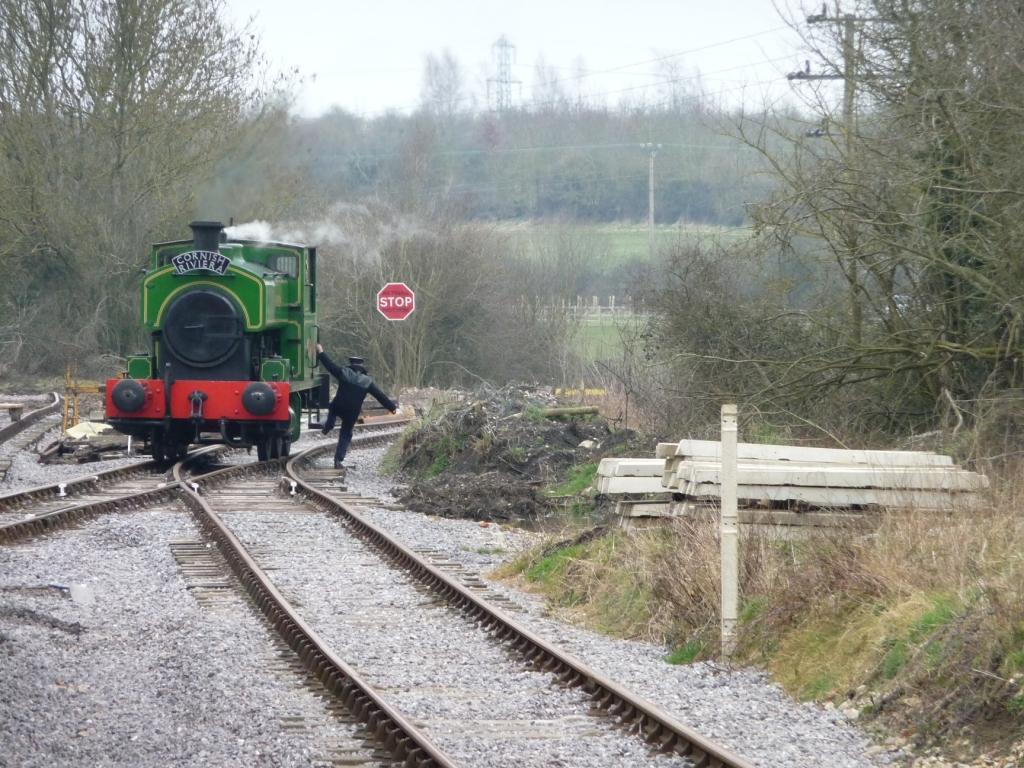
Taw Valley Halt railway station
Taw Valley Halt railway station is the current (and temporary) southern terminus of the Swindon and Cricklade Railway, a heritage railway line in Wiltshire...
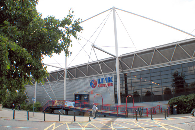
Link Centre
The Link Centre is a leisure centre in Swindon, England. The building, owned by Swindon Borough Council and operated by Greenwich Leisure under the brand...

Lydiard Millicent
Lydiard Millicent is a village and civil parish in Wiltshire, England, about 3+1⁄2 miles (6 km) west of the centre of Swindon. The parish contains the...

Lydiard Tregoze
Lydiard Tregoze is a small village and civil parish on the western edge of Swindon in the county of Wiltshire, in the south-west of England. Its name has...
Nearby Amenities
Located within 500m of 51.575639,-1.8349297Have you been to Peatmoor Lagoon?
Leave your review of Peatmoor Lagoon below (or comments, questions and feedback).