Peatmoor Community Woodland

Wood, Forest in Wiltshire

England

Peatmoor Community Woodland

Lydiard Millicent On the edge of the village of Lydiard Millicent.
Lydiard Millicent Credit: Wayland Smith

Peatmoor Community Woodland is a picturesque woodland located in Wiltshire, England. Covering an area of approximately 30 hectares, it is an important part of the local ecosystem and a popular destination for nature lovers and outdoor enthusiasts.

The woodland is predominantly composed of deciduous trees such as oak, birch, and beech, creating a lush and diverse habitat for a wide range of plant and animal species. The woodland floor is adorned with an array of wildflowers including bluebells, primroses, and foxgloves, adding bursts of color to the scenery.

Peatmoor Community Woodland offers a network of well-maintained footpaths and trails, making it ideal for leisurely walks or more energetic hikes. These paths wind through the woodland, allowing visitors to explore its hidden corners and discover its natural beauty.

The woodland also features a variety of wildlife habitats, including ponds, wetlands, and meadows, which attract a diverse range of animals. Birdwatchers can spot species such as woodpeckers, kingfishers, and herons, while small mammals like foxes, badgers, and squirrels can often be seen scurrying through the undergrowth.

Managed by a dedicated team of volunteers and supported by the local community, Peatmoor Community Woodland offers educational programs and events to engage visitors of all ages. These activities aim to increase awareness of the woodland's importance and promote its conservation.

Overall, Peatmoor Community Woodland is a serene and enchanting natural haven in Wiltshire, providing a tranquil escape for those seeking solace in nature's embrace.

If you have any feedback on the listing, please let us know in the comments section below.

Peatmoor Community Woodland Images

Images are sourced within 2km of 51.575214/-1.8396209 or Grid Reference SU1186. Thanks to Geograph Open Source API. All images are credited.

Lydiard Millicent On the edge of the village of Lydiard Millicent.
Lydiard Millicent
On the edge of the village of Lydiard Millicent.
All Saints, Lydiard Millicent: tower
All Saints, Lydiard Millicent: stained glass window (a) Intricate and colourful windows in churches and cathedrals greatly add to the ambience, although many early examples in England were smashed by the Puritans and replaced with plain glass. There was a huge revival in the 19th Century with many elaborate new stained glass windows created. The 20th century saw the development of new techniques, including Gemmail, which overlaps pieces of stained glass without using lead. New windows are still being commissioned today, while the oldest known ones are still in place within the Ancestors of Christ window on the south side of Canterbury Cathedral.
All Saints, Lydiard Millicent: stained glass window (a)
Intricate and colourful windows in churches and cathedrals greatly add to the ambience, although many early examples in England were smashed by the Puritans and replaced with plain glass. There was a huge revival in the 19th Century with many elaborate new stained glass windows created. The 20th century saw the development of new techniques, including Gemmail, which overlaps pieces of stained glass without using lead. New windows are still being commissioned today, while the oldest known ones are still in place within the Ancestors of Christ window on the south side of Canterbury Cathedral.
All Saints, Lydiard Millicent: stained glass window (b)
All Saints, Lydiard Millicent: stained glass window (c)
All Saints, Lydiard Millicent: stained glass window (d)
All Saints, Lydiard Millicent: stained glass window (e)
All Saints, Lydiard Millicent: porch
All Saints, Lydiard Millicent: side altar In many churches, the altar is the structure upon which the Eucharist is celebrated. It is usually centrally located in the sanctuary, and as such the focus of attention. It may have certain objects placed upon it such as a cross, candles or flowers. Many larger churches have a side altar, often used for smaller services such as Matins or by church affiliated groups such as the Mothers' Union.
All Saints, Lydiard Millicent: side altar
In many churches, the altar is the structure upon which the Eucharist is celebrated. It is usually centrally located in the sanctuary, and as such the focus of attention. It may have certain objects placed upon it such as a cross, candles or flowers. Many larger churches have a side altar, often used for smaller services such as Matins or by church affiliated groups such as the Mothers' Union.
All Saints, Lydiard Millicent: main altar In many churches, the altar is the structure upon which the Eucharist is celebrated. It is usually centrally located in the sanctuary, and as such the focus of attention. It may have certain objects placed upon it such as a cross, candles or flowers. Many larger churches have a side altar, often used for smaller services such as Matins or by church affiliated groups such as the Mothers' Union.
All Saints, Lydiard Millicent: main altar
In many churches, the altar is the structure upon which the Eucharist is celebrated. It is usually centrally located in the sanctuary, and as such the focus of attention. It may have certain objects placed upon it such as a cross, candles or flowers. Many larger churches have a side altar, often used for smaller services such as Matins or by church affiliated groups such as the Mothers' Union.
All Saints, Lydiard Millicent: war memorial (1914-1918)
All Saints, Lydiard Millicent: war memorial (1939-1945)
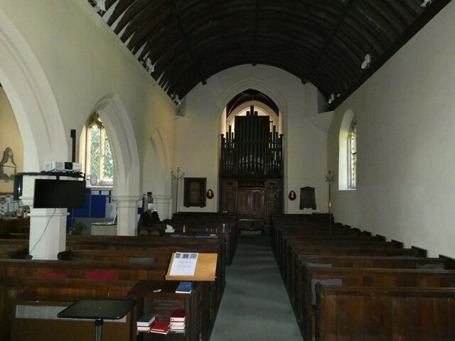
All Saints, Lydiard Millicent: nave
All Saints, Lydiard Millicent: war memorial (churchyard) Many war memorials appeared in British towns and cities after the South African War of 1899-1902 (known popularly as the Boer War), but most were constructed after the First World War, known to contemporaries as the Great War (1914-19). These were updated after the Second World War (1939-45), usually by adding a plaque with the names of those killed in that conflict. Almost every town and village in Britain has a memorial erected after the Great War, the commonest types taking the form of a cross, an obelisk or a statue of a soldier. Some occupy a prominent public space; others stand in the local cemetery or can be found inside the local church. Memorials usually commemorate the inhabitants of a particular locality, the former pupils of a school, or the members of a military unit or branch of the armed forces. Other memorials, often bronze plaques placed indoors, commemorate the employees of a private company or public institution.
All Saints, Lydiard Millicent: war memorial (churchyard)
Many war memorials appeared in British towns and cities after the South African War of 1899-1902 (known popularly as the Boer War), but most were constructed after the First World War, known to contemporaries as the Great War (1914-19). These were updated after the Second World War (1939-45), usually by adding a plaque with the names of those killed in that conflict. Almost every town and village in Britain has a memorial erected after the Great War, the commonest types taking the form of a cross, an obelisk or a statue of a soldier. Some occupy a prominent public space; others stand in the local cemetery or can be found inside the local church. Memorials usually commemorate the inhabitants of a particular locality, the former pupils of a school, or the members of a military unit or branch of the armed forces. Other memorials, often bronze plaques placed indoors, commemorate the employees of a private company or public institution.
All Saints, Lydiard Millicent: memorial (a) Harrison was educated at Pembroke College, Oxford <span class="nowrap"><a title="https://en.wikipedia.org/wiki/Pembroke_College,_Oxford" rel="nofollow ugc noopener" href="https://en.wikipedia.org/wiki/Pembroke_College,_Oxford">Link</a><img style="margin-left:2px;" alt="External link" title="External link - shift click to open in new window" src="https://s1.geograph.org.uk/img/external.png" width="10" height="10"/></span> and ordained in 1883. After a curacy in Brompton <span class="nowrap"><a title="https://en.wikipedia.org/wiki/Brompton,_London" rel="nofollow ugc noopener" href="https://en.wikipedia.org/wiki/Brompton,_London">Link</a><img style="margin-left:2px;" alt="External link" title="External link - shift click to open in new window" src="https://s1.geograph.org.uk/img/external.png" width="10" height="10"/></span> he was Vicar of Ixworth <a title="https://www.geograph.org.uk/photo/2102092" href="https://www.geograph.org.uk/photo/2102092">Link</a> before coming here.
All Saints, Lydiard Millicent: memorial (a)
Harrison was educated at Pembroke College, Oxford LinkExternal link and ordained in 1883. After a curacy in Brompton LinkExternal link he was Vicar of Ixworth Link before coming here.
All Saints, Lydiard Millicent: memorial (b)
All Saints, Lydiard Millicent: memorial (c)
St Mary, Purton: tower
Show me another place!

Peatmoor Community Woodland is located at Grid Ref: SU1186 (Lat: 51.575214, Lng: -1.8396209)

Unitary Authority: Swindon

Police Authority: Wiltshire

What 3 Words

///shorts.behalf.nutty. Near Lydiard Millicent, Wiltshire

Related Wikis

Renault Centre

The Renault Centre (or the Renault Distribution Centre) is a high tech building in Swindon commissioned by the French car company Renault for their UK...

Moredon Halt railway station

Moredon Halt railway station was on the Midland and South Western Junction Railway in Wiltshire. The station, a few miles north west of Swindon, opened...

Lydiard Millicent

Lydiard Millicent is a village and civil parish in Wiltshire, England, about 3+1⁄2 miles (6 km) west of the centre of Swindon. The parish contains the...

Mouldon Hill railway station

Mouldon Hill railway station is the proposed southern terminus of the Swindon and Cricklade Railway, a heritage railway line in England. The station will...

Nearby Amenities

Located within 500m of 51.575214,-1.8396209
Mini Roundabout
Lat/Long: 51.5778046/-1.8337603
Leisure: playground
Lat/Long: 51.5721373/-1.8414111
Bus Stop
Braybrooke Close
Bus: yes
Naptan AtcoCode: 4680SWA10654
Naptan Bearing: S
Naptan CommonName: Braybrooke Close
Naptan Indicator: S-bound
Naptan NaptanCode: swiadmw
Naptan PlusbusZoneRef: SDON
Naptan Street: Sandacre Road
Naptan Verified: no
Public Transport: platform
Source: naptan;bing
Lat/Long: 51.571545/-1.8427968
Atm
Fee: no
Operator: CoOp
Lat/Long: 51.5771192/-1.8354902
Crossing
Crossing: unmarked
Crossing Markings: no
Lat/Long: 51.5737592/-1.841628
Nine Elms
Is In: Swindon
Place: neighbourhood
Lat/Long: 51.5719415/-1.841354
Bicycle Parking
Bicycle Parking: stands
Capacity: 4
Covered: no
Lat/Long: 51.5767967/-1.8359165
Bicycle Parking
Bicycle Parking: stands
Capacity: 4
Covered: no
Lat/Long: 51.5769107/-1.8360541
Post Box
Operator: Royal Mail
Operator Wikidata: Q638098
Ref: SN5 97
Lat/Long: 51.5769221/-1.8356359
Crossing
Crossing: unmarked
Crossing Markings: no
Lat/Long: 51.5737083/-1.8416971
Traffic Calming: bump
Lat/Long: 51.5734528/-1.8340619
Traffic Calming: bump
Lat/Long: 51.5735472/-1.833116
Post Box
Operator: Royal Mail
Operator Wikidata: Q638098
Post Box Type: lamp
Ref: SN5 411
Royal Cypher: EIIR
Royal Cypher Wikidata: Q33102113
Lat/Long: 51.5728687/-1.8416136
Post Box
Operator: Royal Mail
Operator Wikidata: Q638098
Post Box Type: lamp
Ref: SN5 19
Royal Cypher: EIIR
Royal Cypher Wikidata: Q33102113
Lat/Long: 51.57667/-1.8411007
Post Box
Operator: Royal Mail
Operator Wikidata: Q638098
Post Box Type: pillar
Ref: SN5 170
Royal Cypher: EIIR
Royal Cypher Wikidata: Q33102113
Lat/Long: 51.5789278/-1.8430911
Entrance: yes
Lat/Long: 51.5772106/-1.8338289
Entrance: yes
Lat/Long: 51.5771151/-1.8348172
Entrance: yes
Lat/Long: 51.5772131/-1.8348774
Entrance: yes
Lat/Long: 51.5775913/-1.8348868
Entrance: yes
Lat/Long: 51.5776547/-1.8348735
Bench
Lat/Long: 51.5768326/-1.8353684
Bench
Lat/Long: 51.5768596/-1.8354106
Bench
Lat/Long: 51.576869/-1.8353106
Bench
Lat/Long: 51.5768955/-1.8353536
Clock
Display: analog
Support: wall_mounted
Visibility: street
Lat/Long: 51.5769458/-1.8358353
Man Made: flagpole
Lat/Long: 51.5780524/-1.8352536
Entrance: yes
Lat/Long: 51.5777786/-1.8353822
Waste Basket
Waste: dog_excrement
Lat/Long: 51.5767024/-1.835136
Bench
Lat/Long: 51.576685/-1.8358817
Bench
Lat/Long: 51.5766868/-1.8357846
Bench
Lat/Long: 51.5767061/-1.8359253
Bench
Lat/Long: 51.5767139/-1.8357318
Bench
Lat/Long: 51.5767517/-1.8357622
Bench
Lat/Long: 51.5767528/-1.8359041
Entrance: yes
Lat/Long: 51.5775418/-1.8358211
Entrance: yes
Lat/Long: 51.5776592/-1.8356573
Roughmoor
Place: neighbourhood
Lat/Long: 51.5750308/-1.8397782
Washpool
Place: locality
Lat/Long: 51.5735073/-1.8450362
Crossing
Bicycle: yes
Crossing: traffic_signals
Crossing Ref: toucan
Lat/Long: 51.5740672/-1.8382288
Crossing
Bicycle: yes
Crossing: traffic_signals
Crossing Ref: toucan
Lat/Long: 51.5741525/-1.8382291
Generator Method: photovoltaic
Generator Output Electricity: yes
Generator Source: solar
Generator Type: solar_photovoltaic_panel
Location: roof
Power: generator
Lat/Long: 51.57264/-1.8438799
Generator Method: photovoltaic
Generator Output Electricity: yes
Generator Source: solar
Generator Type: solar_photovoltaic_panel
Location: roof
Power: generator
Lat/Long: 51.5773293/-1.8387055
Generator Method: photovoltaic
Generator Output Electricity: yes
Generator Source: solar
Generator Type: solar_photovoltaic_panel
Location: roof
Power: generator
Lat/Long: 51.5751296/-1.8411556
Generator Method: photovoltaic
Generator Output Electricity: yes
Generator Source: solar
Generator Type: solar_photovoltaic_panel
Location: roof
Power: generator
Lat/Long: 51.5761496/-1.8405156
Generator Method: photovoltaic
Generator Output Electricity: yes
Generator Source: solar
Generator Type: solar_photovoltaic_panel
Location: roof
Power: generator
Lat/Long: 51.5774829/-1.8389119
Generator Method: photovoltaic
Generator Output Electricity: yes
Generator Source: solar
Generator Type: solar_photovoltaic_panel
Location: roof
Power: generator
Lat/Long: 51.5776581/-1.838394
Generator Method: photovoltaic
Generator Output Electricity: yes
Generator Source: solar
Generator Type: solar_photovoltaic_panel
Location: roof
Power: generator
Lat/Long: 51.5744239/-1.8441182
Generator Method: photovoltaic
Generator Output Electricity: yes
Generator Source: solar
Generator Type: solar_photovoltaic_panel
Location: roof
Power: generator
Lat/Long: 51.577164/-1.8390726
Generator Method: photovoltaic
Generator Output Electricity: yes
Generator Source: solar
Generator Type: solar_photovoltaic_panel
Location: roof
Power: generator
Lat/Long: 51.5733207/-1.8444085
Generator Method: photovoltaic
Generator Output Electricity: yes
Generator Source: solar
Generator Type: solar_photovoltaic_panel
Location: roof
Power: generator
Lat/Long: 51.574786/-1.8425965
Generator Method: photovoltaic
Generator Output Electricity: yes
Generator Source: solar
Generator Type: solar_photovoltaic_panel
Location: roof
Power: generator
Lat/Long: 51.5772588/-1.8380543
Generator Method: photovoltaic
Generator Output Electricity: yes
Generator Source: solar
Generator Type: solar_photovoltaic_panel
Location: roof
Power: generator
Lat/Long: 51.5773567/-1.8380403
Generator Method: photovoltaic
Generator Output Electricity: yes
Generator Source: solar
Generator Type: solar_photovoltaic_panel
Location: roof
Power: generator
Lat/Long: 51.5773759/-1.8394368
Generator Method: photovoltaic
Generator Output Electricity: yes
Generator Source: solar
Generator Type: solar_photovoltaic_panel
Location: roof
Power: generator
Lat/Long: 51.5773241/-1.8379843
Generator Method: photovoltaic
Generator Output Electricity: yes
Generator Source: solar
Generator Type: solar_photovoltaic_panel
Location: roof
Power: generator
Lat/Long: 51.5781334/-1.8373348
Barrier: stile
Bicycle: no
Foot: yes
Horse: no
Material: wood
Motor Vehicle: no
Stile: stepover
Lat/Long: 51.5728726/-1.844556
Peatmoor
Place: suburb
Lat/Long: 51.5776359/-1.8377073
Barrier: height_restrictor
Lat/Long: 51.5746368/-1.8354531
Turning Circle
Turning Circle: square
Lat/Long: 51.5707683/-1.839584
Bench
Lat/Long: 51.5750499/-1.8417852
Bench
Lat/Long: 51.5751042/-1.8417943
Crossing
Crossing: zebra
Crossing Island: no
Crossing Markings: zebra
Tactile Paving: yes
Lat/Long: 51.5770144/-1.837136
Crossing
Lat/Long: 51.5769355/-1.8365991
Crossing
Lat/Long: 51.576937/-1.8368351
Bus Stop
Webbs Wood
Bus: yes
Naptan AtcoCode: 4680SWA10640
Naptan Bearing: S
Naptan CommonName: Webbs Wood
Naptan Indicator: S-bound
Naptan NaptanCode: swiagdj
Naptan PlusbusZoneRef: SDON
Naptan Street: Swinley Drive
Naptan Verified: no
Public Transport: platform
Lat/Long: 51.5789123/-1.8372605
Bus Stop
Nightwood Copse
Bus: yes
Naptan AtcoCode: 4680SWA10643
Naptan Bearing: S
Naptan CommonName: Nightwood Copse
Naptan Indicator: S-bound
Naptan NaptanCode: swiagdp
Naptan PlusbusZoneRef: SDON
Naptan Street: Swinley Drive
Naptan Verified: no
Public Transport: platform
Lat/Long: 51.576571/-1.8372307
Bus Stop
Horseshoe Crescent
Bus: yes
Naptan AtcoCode: 4680SWA10644
Naptan Bearing: W
Naptan CommonName: Horseshoe Crescent
Naptan Indicator: W-bound
Naptan NaptanCode: swiadwp
Naptan PlusbusZoneRef: SDON
Naptan Street: Swinley Drive
Naptan Verified: no
Public Transport: platform
Lat/Long: 51.5766813/-1.8401256
Bus Stop
Russley Close
Bus: yes
Naptan AtcoCode: 4680SWA10647
Naptan Bearing: S
Naptan CommonName: Russley Close
Naptan Indicator: S-bound
Naptan NaptanCode: swiadpm
Naptan PlusbusZoneRef: SDON
Naptan Street: Swinley Drive
Naptan Verified: no
Public Transport: platform
Lat/Long: 51.5755704/-1.8421068
Bus Stop
Bishopdale Close
Bus: yes
Naptan AtcoCode: 4680SWA10652
Naptan Bearing: S
Naptan CommonName: Bishopdale Close
Naptan Indicator: S-bound
Naptan NaptanCode: swiadtg
Naptan PlusbusZoneRef: SDON
Naptan Street: Sandacre Road
Naptan Verified: no
Public Transport: platform
Lat/Long: 51.5730831/-1.8414645
Barrier: cycle_barrier
Lat/Long: 51.5749676/-1.8442706
The data included in this document is from www.openstreetmap.org. The data is made available under ODbL.

Have you been to Peatmoor Community Woodland?

Leave your review of Peatmoor Community Woodland below (or comments, questions and feedback).