Detchant Pond

Lake, Pool, Pond, Freshwater Marsh in Northumberland

England

Detchant Pond

Minor Road off the A1 south of Buckton
Minor Road off the A1 south of Buckton Credit: David Dixon

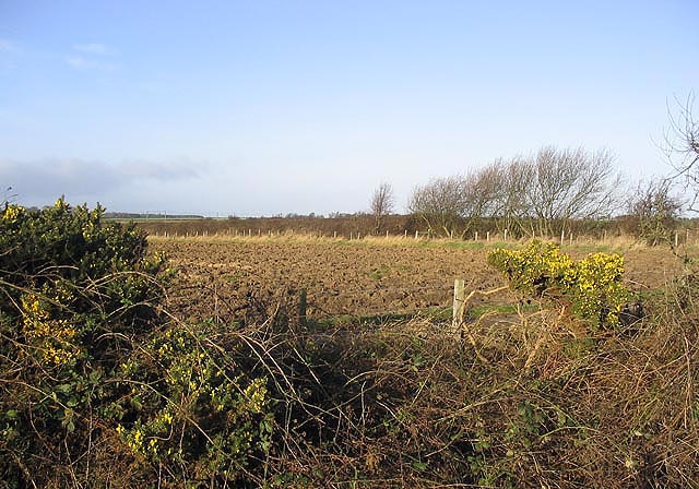
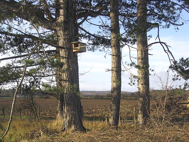
Detchant Pond is a small freshwater body located in the county of Northumberland, in the northeast of England. It is situated near the village of Detchant, within the Northumberland Coast Area of Outstanding Natural Beauty. Spanning an area of approximately 1.5 acres, the pond serves as a vital habitat for a variety of wildlife.

Surrounded by lush vegetation and reeds, Detchant Pond is a haven for numerous bird species. It attracts a diverse range of waterfowl, including mallards, tufted ducks, and coots, which can be observed swimming and diving in its clear waters. The pond also provides an important breeding ground for various amphibians, such as frogs and newts, which can be spotted around its edges.

The pond is fed by natural springs and rainfall, ensuring a constant supply of fresh water. Its shallow depths and nutrient-rich sediment create ideal conditions for the growth of aquatic plants, including water lilies and pondweed, which provide both food and shelter for the resident wildlife.

Visitors to Detchant Pond can enjoy a peaceful and tranquil environment, with well-maintained footpaths and viewing areas. The surrounding area offers picturesque views of the Northumberland countryside, making it a popular spot for nature lovers and photographers alike.

The conservation of Detchant Pond is actively managed by local authorities and wildlife organizations, ensuring its continued ecological importance. The preservation of this freshwater marsh contributes to the overall biodiversity of the Northumberland region, serving as a vital link in the local ecosystem.

If you have any feedback on the listing, please let us know in the comments section below.

Detchant Pond Images

Images are sourced within 2km of 55.619716/-1.8629631 or Grid Reference NU0836. Thanks to Geograph Open Source API. All images are credited.

Minor Road off the A1 south of Buckton
Smeafield Farmhouse
Smeafield Farmhouse
Minor Road Joining the A1 north of Middleton
Conifer House, Smeafield Presumably, so named after the conifers lining a burn nearby. Beyond is Smeafield Station House. It is hard to imagine how such a tiny settlement as Smeafield merited a station. Possibly originally a private station, it operated as a public station between 1871 and 1930 with only a dozen or so trains calling in a week.
Conifer House, Smeafield
Presumably, so named after the conifers lining a burn nearby. Beyond is Smeafield Station House. It is hard to imagine how such a tiny settlement as Smeafield merited a station. Possibly originally a private station, it operated as a public station between 1871 and 1930 with only a dozen or so trains calling in a week.
Smeafield crossing on the East Coast Main Line On the site of the former Smeafield station. It is hard to imagine how such a tiny settlement as Smeafield merited a station. Possibly originally a private station, it operated as a public station between 1871 and 1930 with only a dozen or so trains calling in a week.
Smeafield crossing on the East Coast Main Line
On the site of the former Smeafield station. It is hard to imagine how such a tiny settlement as Smeafield merited a station. Possibly originally a private station, it operated as a public station between 1871 and 1930 with only a dozen or so trains calling in a week.
Road to Smeafield Crossing The wooded strip to the right lies along the Buckton Burn.
Road to Smeafield Crossing
The wooded strip to the right lies along the Buckton Burn.
Old Milestone by road (was A1), Middleton The Milestone is located on grass verge on the East of the road.  Parish of Belford (Berwick upon Tweed District). Metal post with attached metal plate, BEL/BER L top iron post design, erected by the Berwick, Norham & Islandshires turnpike trust in the 19th Century. An earlier photograph can be found here: <a title="https://www.geograph.org.uk/photo/6076602" href="https://www.geograph.org.uk/photo/6076602">Link</a> 

Inscription reads:-  
B / 1½  : : BER / 13  

Milestone Society National ID: NB_BWBF13
Old Milestone by road (was A1), Middleton
The Milestone is located on grass verge on the East of the road.  Parish of Belford (Berwick upon Tweed District). Metal post with attached metal plate, BEL/BER L top iron post design, erected by the Berwick, Norham & Islandshires turnpike trust in the 19th Century. An earlier photograph can be found here: Link  Inscription reads:- B / 1½ : : BER / 13 Milestone Society National ID: NB_BWBF13
Level crossing at Smeafield
Old Milepost north of Belford Metal post with attached metal plate by the A1, in the parish of BELFORD (BERWICK UPON TWEED District), on the eastern verge of the A1, 70m south of Smeafield Lodge. BEL/BER L top iron post, erected by the Berwick, Norham & Islandshires turnpike trust in the 19th century. 

Inscription reads:-
: B / 2½ :: L / 322 :: BER/ 12 :
(To Belford and Berwick-upon-Tweed) 

Milestone Society National ID: NB_BWBF12
Old Milepost north of Belford
Metal post with attached metal plate by the A1, in the parish of BELFORD (BERWICK UPON TWEED District), on the eastern verge of the A1, 70m south of Smeafield Lodge. BEL/BER L top iron post, erected by the Berwick, Norham & Islandshires turnpike trust in the 19th century. Inscription reads:- : B / 2½ :: L / 322 :: BER/ 12 : (To Belford and Berwick-upon-Tweed) Milestone Society National ID: NB_BWBF12
Ancient Wooden Barn This barn near Swinhoe Farm is over 200 years old. The tiles on the roof are made of elm wood.
Ancient Wooden Barn
This barn near Swinhoe Farm is over 200 years old. The tiles on the roof are made of elm wood.
Craggyhall Lime Kiln, Belford A small lime kiln which would have been used by the farm.
Craggyhall Lime Kiln, Belford
A small lime kiln which would have been used by the farm.
Forest Track A forest track leading to Swinhoe Lakes
Forest Track
A forest track leading to Swinhoe Lakes
Inhabitants of Swinhoe Farm Calves looking forward to Spring.
Inhabitants of Swinhoe Farm
Calves looking forward to Spring.
Junction of the old & new A1 north of Belford Belford is now bypassed
Junction of the old & new A1 north of Belford
Belford is now bypassed
Woodland along Buckton Burn
Gorse and ploughed field Near Smeafield.
Gorse and ploughed field
Near Smeafield.
Kestrel box on a pine tree This nest box is in a small clump of pines by the road to Elwick Farm.
Kestrel box on a pine tree
This nest box is in a small clump of pines by the road to Elwick Farm.
Show me another place!

Detchant Pond is located at Grid Ref: NU0836 (Lat: 55.619716, Lng: -1.8629631)

Unitary Authority: Northumberland

Police Authority: Northumbria

What 3 Words

///mint.snacking.unleashed. Near Belford, Northumberland

Related Wikis

Middleton, Northumberland

Middleton is a settlement and civil parish in Northumberland, England. The parish is situated on the North Sea coast, south of the island of Lindisfarne...

Middleton Hall, Middleton, Northumberland

Middleton Hall is a country house near the settlement of Middleton, Northumberland, in that parish, that dates from 1871. It is listed Grade II on the...

Smeafield railway station

Smeafield railway station served the farmstead of Smeafield, Northumberland, England from 1871 to 1930 on the East Coast Main Line. == History == The station...

Buckton, Northumberland

Buckton is a small village in Northumberland, North East England, located just over 5 km north of Belford.Buckton consists of a farm and a few cottages...

Westhall, Northumberland

Westhall is a privately owned 19th-century castellated house at Belford in Northumberland, England now in use as a farm. It is on a site with older historical...

Belford Hall

Belford Hall is a Grade I listed building, an 18th-century mansion house situated at Belford, Northumberland. The Manor of Belford was acquired by the...

Crag Mill railway station

Crag Mill railway station served the village of Belford, Northumberland, England from around 1862 to 1877 on the East Coast Main Line. == History == The...

Belford, Northumberland

Belford is a village and civil parish in Northumberland, England, about halfway between Alnwick and Berwick-upon-Tweed, a few miles inland from the east...

Nearby Amenities

Located within 500m of 55.619716,-1.8629631
Detchant
Place: hamlet
Lat/Long: 55.6225275/-1.8631381
Post Box
Postal Code: NE70
Ref: NE70 93
Source: survey
Lat/Long: 55.6221614/-1.8638821
Direction: 170
Generator Method: photovoltaic
Generator Output Electricity: yes
Generator Solar Modules: 10
Generator Source: solar
Generator Type: solar_photovoltaic_panel
Location: roof
Power: generator
Lat/Long: 55.6222608/-1.8651706
The data included in this document is from www.openstreetmap.org. The data is made available under ODbL.

Have you been to Detchant Pond?

Leave your review of Detchant Pond below (or comments, questions and feedback).