Doe Park Reservoir

Lake, Pool, Pond, Freshwater Marsh in Yorkshire

England

Doe Park Reservoir

Southwest face of Hewenden Viaduct Former railway viaduct on the Great Northern Railway Trail.
Southwest face of Hewenden Viaduct Credit: David Martin

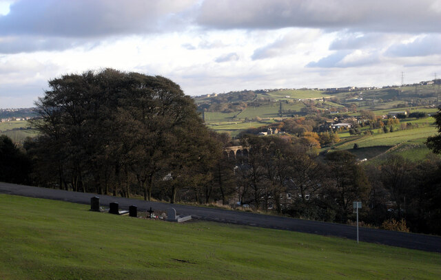
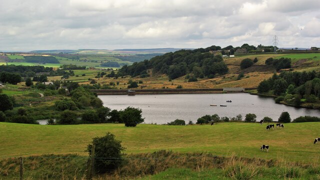
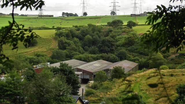
Doe Park Reservoir, located in Yorkshire, is a picturesque freshwater body that serves as a popular recreational spot for locals and tourists alike. Spanning over an area of approximately 50 acres, this reservoir offers a serene and tranquil environment for visitors to unwind and connect with nature.

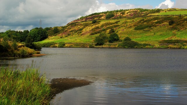
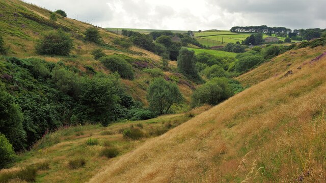
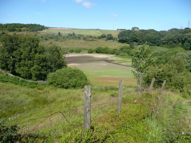
Surrounded by lush greenery and rolling hills, Doe Park Reservoir is a stunning sight to behold. Its crystal-clear waters glisten under the sun, making it an ideal spot for outdoor activities such as fishing, boating, and birdwatching. The reservoir is well-stocked with various species of fish, including trout and perch, making it a haven for anglers of all skill levels.

The reservoir's shoreline is dotted with several strategically placed fishing platforms and picnic areas, providing visitors with ample opportunities to relax and enjoy a picnic while admiring the scenic beauty that surrounds them. Additionally, the reservoir boasts a walking trail that encircles the water body, allowing visitors to explore the area at their own pace while taking in the breathtaking views.

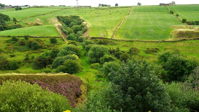
Doe Park Reservoir is also home to a thriving ecosystem, hosting an array of wildlife and plant species. Freshwater marshes can be found along the edges of the reservoir, providing a habitat for numerous bird species, amphibians, and insects. Birdwatchers can spot a variety of waterfowl, including swans, ducks, and herons, making it a haven for nature enthusiasts and photographers.

Overall, Doe Park Reservoir is a hidden gem in Yorkshire, offering a perfect blend of natural beauty and recreational opportunities. It provides a peaceful retreat from the bustling city life and serves as a sanctuary for both wildlife and humans seeking solace in nature.

If you have any feedback on the listing, please let us know in the comments section below.

Doe Park Reservoir Images

Images are sourced within 2km of 53.802217/-1.8840841 or Grid Reference SE0733. Thanks to Geograph Open Source API. All images are credited.

Southwest face of Hewenden Viaduct Former railway viaduct on the Great Northern Railway Trail.
Southwest face of Hewenden Viaduct
Former railway viaduct on the Great Northern Railway Trail.
Derelict Thornton Pressure Filters building, Close Head Lane, Thornton A sign above the entrance (see <a href="https://www.geograph.org.uk/photo/7034532">SE0832 : Derelict Thornton Pressure Filters building, Close Head Lane, Thornton</a>) reads:
"B.C.W.W.
THORNTON PRESSURE FILTERS
1926"
Derelict Thornton Pressure Filters building, Close Head Lane, Thornton
A sign above the entrance (see SE0832 : Derelict Thornton Pressure Filters building, Close Head Lane, Thornton) reads: "B.C.W.W. THORNTON PRESSURE FILTERS 1926"
Derelict Thornton Pressure Filters building, Close Head Lane, Thornton The sign above the entrance reads:
"B.C.W.W.
THORNTON PRESSURE FILTERS
1926"
Derelict Thornton Pressure Filters building, Close Head Lane, Thornton
The sign above the entrance reads: "B.C.W.W. THORNTON PRESSURE FILTERS 1926"
Inside the derelict Thornton Pressure Filters building, Close Head Lane, Thornton A sign above the entrance to the building (see <a href="https://www.geograph.org.uk/photo/7034532">SE0832 : Derelict Thornton Pressure Filters building, Close Head Lane, Thornton</a>) reads:
"B.C.W.W.
THORNTON PRESSURE FILTERS
1926"
Inside the derelict Thornton Pressure Filters building, Close Head Lane, Thornton
A sign above the entrance to the building (see SE0832 : Derelict Thornton Pressure Filters building, Close Head Lane, Thornton) reads: "B.C.W.W. THORNTON PRESSURE FILTERS 1926"
The side of the derelict Thornton Pressure Filters building, Close Head Lane, Thornton A sign above the entrance (see <a href="https://www.geograph.org.uk/photo/7034532">SE0832 : Derelict Thornton Pressure Filters building, Close Head Lane, Thornton</a>) reads:
"B.C.W.W.
THORNTON PRESSURE FILTERS
1926"
The side of the derelict Thornton Pressure Filters building, Close Head Lane, Thornton
A sign above the entrance (see SE0832 : Derelict Thornton Pressure Filters building, Close Head Lane, Thornton) reads: "B.C.W.W. THORNTON PRESSURE FILTERS 1926"
A view from Thornton Cemetery
Doe Park Reservoir & Quarried Hill Top View to the site of Lowe Quarry above the reservoir
Doe Park Reservoir & Quarried Hill Top
View to the site of Lowe Quarry above the reservoir
Dam Wall of Doe Park Reservoir View North from Birk Hill
Dam Wall of Doe Park Reservoir
View North from Birk Hill
Old Railway Route to Thornton Wells Head Tunnel View from on top of Birk Hill Tunnel South of Denholme Station site. The cuttings leading into the tunnels are full of trees
Old Railway Route to Thornton Wells Head Tunnel
View from on top of Birk Hill Tunnel South of Denholme Station site. The cuttings leading into the tunnels are full of trees
Carperley Beck Valley View West from Station Sawmills. The level skyline in the centre is the dam of Thornton Moor Reservoir
Carperley Beck Valley
View West from Station Sawmills. The level skyline in the centre is the dam of Thornton Moor Reservoir
Station Sawmills Sawmills on the site of Denholme Railway Station Yard and the tree filled cutting leading to Birk Hill Tunnel beyond. The sawmills have in turn gone and this is now a housing estate.
Station Sawmills
Sawmills on the site of Denholme Railway Station Yard and the tree filled cutting leading to Birk Hill Tunnel beyond. The sawmills have in turn gone and this is now a housing estate.
Hewenden Viaduct On the Great Northern Railway Trail south of Cullingworth
Hewenden Viaduct
On the Great Northern Railway Trail south of Cullingworth
View of the bed of Doe Park Reservoir, Denholme This was taken from Denholme Footpath 59. After a long period of mainly dry weather the bed is exposed in the upper parts of the reservoir.
View of the bed of Doe Park Reservoir, Denholme
This was taken from Denholme Footpath 59. After a long period of mainly dry weather the bed is exposed in the upper parts of the reservoir.
Denholme Footpath 59 Here the path is descending towards the footbridge over Denholme Beck.
Denholme Footpath 59
Here the path is descending towards the footbridge over Denholme Beck.
Denholme Footpath 57
Mural next to Emily's Eatery, Denholme Gate This cafe has very good reviews Unfortunately it closes at 2:30, but is said to be a good place for lunch. Their facebook page has lots of illustrations of women in a similar (American) style.
Mural next to Emily's Eatery, Denholme Gate
This cafe has very good reviews Unfortunately it closes at 2:30, but is said to be a good place for lunch. Their facebook page has lots of illustrations of women in a similar (American) style.
Gate on Denholme Footpath 57 From here the path goes down steeply into the valley. In some places stone paving has survived.
Gate on Denholme Footpath 57
From here the path goes down steeply into the valley. In some places stone paving has survived.
Denholme Footpath 59 This is a pleasant path that descends gently down a ridge.
Denholme Footpath 59
This is a pleasant path that descends gently down a ridge.
Show me another place!

Doe Park Reservoir is located at Grid Ref: SE0733 (Lat: 53.802217, Lng: -1.8840841)

Division: West Riding

Unitary Authority: Bradford

Police Authority: West Yorkshire

What 3 Words

///dripping.keeps.crunched. Near Denholme, West Yorkshire

Related Wikis

Denholme railway station

Denholme railway station was a station on the Keighley-Queensbury section of the Queensbury Lines which ran between Keighley, Bradford and Halifax via...

Denholme

Denholme is a town and civil parish in the Bradford Metropolitan Borough, West Yorkshire, England. It is 8 miles (13 km) west of Bradford, 7 miles (11...

Denholme Clough Fault

The Denholme Clough Fault is a small fault located in Denholme, England. The fault is approximately 500 metres (1,600 ft) long. The fault has produced...

Wilsden railway station

Wilsden railway station was a station on the Queensbury Lines which ran between Keighley, Bradford and Halifax. == History == The station was built by...

Egypt, Bradford

Egypt is a hamlet near Thornton, in the City of Bradford, West Yorkshire, England. == Geography == Egypt is situated about one mile (1.6 km) north-west...

Hewenden Reservoir

Hewenden Reservoir is a fresh-water reservoir near to Cullingworth in West Yorkshire, England. The Bradford Corporation built the reservoir, which was...

Harden Beck

Harden Beck is a stream that flows from Hewenden Reservoir, over Goit Stock Waterfall to the River Aire in Bingley, West Yorkshire. The route starts out...

Hewenden Viaduct

Hewenden Viaduct, situated near Cullingworth, West Yorkshire, England, originally served as a railway viaduct along the Queensbury Lines. Being one of...

Nearby Amenities

Located within 500m of 53.802217,-1.8840841
Denholme
Abandoned Railway: station
Railway: site
Wikidata: Q5257008
Wikipedia: en:Denholme railway station
Lat/Long: 53.8001038/-1.8886008
Historic: mine_shaft
Source: OS 1:25k
Lat/Long: 53.8055616/-1.8833251
Birk Hill
Natural: peak
Source: OS 1:25k
Lat/Long: 53.799707/-1.8865652
Turning Circle
Lat/Long: 53.8034767/-1.890448
Barrier: stile
Stile: hipster
Lat/Long: 53.8047232/-1.8875566
Barrier: stile
Stile: squeezer
Lat/Long: 53.8053739/-1.8823751
Power: tower
Lat/Long: 53.801293/-1.8874833
Power: tower
Lat/Long: 53.8036048/-1.8868744
Design: barrel
Power: tower
Lat/Long: 53.8053436/-1.8813647
Barrier: stile
Source: gps:local knowledge
Lat/Long: 53.7994556/-1.8797296
Barrier: stile
Lat/Long: 53.7989097/-1.8822976
Barrier: stile
Stile: stepover
Lat/Long: 53.8043855/-1.8903318
Barrier: stile
Lat/Long: 53.8055252/-1.8890472
Barrier: stile
Lat/Long: 53.8035015/-1.8822089
Leisure: slipway
Lat/Long: 53.80327/-1.8850671
Leisure: slipway
Lat/Long: 53.8030984/-1.8850008
Barrier: stile
Stile: stepover
Lat/Long: 53.7985431/-1.8881253
Barrier: stile
Stile: stepover
Lat/Long: 53.7985654/-1.8881484
Leisure: slipway
Lat/Long: 53.8030605/-1.884979
Power: pole
Lat/Long: 53.8054819/-1.8846416
Power: pole
Lat/Long: 53.8051081/-1.8837886
Power: pole
Lat/Long: 53.8055417/-1.8854631
Power: pole
Lat/Long: 53.8056098/-1.8866647
Power: pole
Lat/Long: 53.805666/-1.8875057
Power: pole
Lat/Long: 53.8057678/-1.8884978
The data included in this document is from www.openstreetmap.org. The data is made available under ODbL.

Have you been to Doe Park Reservoir?

Leave your review of Doe Park Reservoir below (or comments, questions and feedback).