Black Dub

Lake, Pool, Pond, Freshwater Marsh in Yorkshire Richmondshire

England

Black Dub

Track towards Waitgate Barn Feldom Range on a Sunday is rarely in use for those purposes defined in the Feldom Byelaws which justify the exclusion of the public (indicated by the flying of red flags or lighting of red lights). This makes it the ideal time to exploit the much-needed "presumption of public access" made clear on the MoD estates website. This track leads generally northwards from the Cordilleras road to connect up with a public right of way (still within the range area) about 1.5 kilometres ahead. Sheep graze peacefully, unconcerned that military debris "might explode and kill them" despite the fact that they are not remotely sticking to the tracks which might be expected to be rather safer.
Track towards Waitgate Barn Credit: Andy Waddington

Black Dub is a picturesque freshwater body located in the county of Yorkshire, England. This serene water feature is a combination of a lake, pool, pond, and freshwater marsh, making it a unique and diverse natural habitat.

The main body of water, known as Black Dub Lake, stretches across an area of approximately 10 acres, presenting a stunning view of still and calm waters. The lake is surrounded by lush greenery, including a variety of trees and shrubs, creating a tranquil and scenic environment.

Adjacent to the lake is a smaller pool, which adds to the charm of Black Dub. This pool is shallower than the lake and provides a habitat for various species of aquatic plants, insects, and amphibians.

Furthermore, Black Dub features a small pond, tucked away amidst the marshy areas surrounding the lake. This pond is teeming with life, providing a thriving ecosystem for many water-dwelling creatures such as fish, frogs, and waterfowl.

The freshwater marsh at Black Dub further enhances the ecological diversity of the area. It is characterized by its wet and marshy terrain, home to an array of plant species like reeds, rushes, and water lilies. The marsh offers a habitat for numerous bird species, including ducks, herons, and reed warblers, attracting birdwatchers and nature enthusiasts alike.

Overall, Black Dub in Yorkshire is a captivating natural gem, encompassing a combination of a lake, pool, pond, and freshwater marsh. Its diverse ecosystem, scenic surroundings, and abundant wildlife make it a popular destination for those seeking solace in nature.

If you have any feedback on the listing, please let us know in the comments section below.

Black Dub Images

Images are sourced within 2km of 54.433025/-1.8884654 or Grid Reference NZ0704. Thanks to Geograph Open Source API. All images are credited.
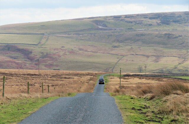
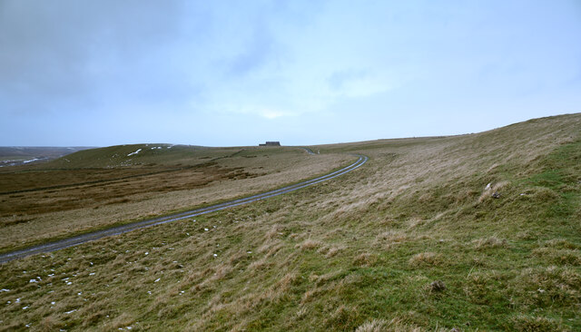
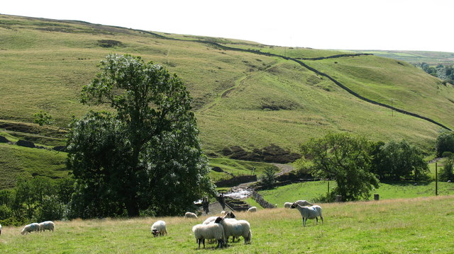
Track towards Waitgate Barn Feldom Range on a Sunday is rarely in use for those purposes defined in the Feldom Byelaws which justify the exclusion of the public (indicated by the flying of red flags or lighting of red lights). This makes it the ideal time to exploit the much-needed "presumption of public access" made clear on the MoD estates website. This track leads generally northwards from the Cordilleras road to connect up with a public right of way (still within the range area) about 1.5 kilometres ahead. Sheep graze peacefully, unconcerned that military debris "might explode and kill them" despite the fact that they are not remotely sticking to the tracks which might be expected to be rather safer.
Track towards Waitgate Barn
Feldom Range on a Sunday is rarely in use for those purposes defined in the Feldom Byelaws which justify the exclusion of the public (indicated by the flying of red flags or lighting of red lights). This makes it the ideal time to exploit the much-needed "presumption of public access" made clear on the MoD estates website. This track leads generally northwards from the Cordilleras road to connect up with a public right of way (still within the range area) about 1.5 kilometres ahead. Sheep graze peacefully, unconcerned that military debris "might explode and kill them" despite the fact that they are not remotely sticking to the tracks which might be expected to be rather safer.
Military ranges Entrance to the ranges on the east side of the Cordilleras road. Unnamed block of conifers on a nearby ridge.
Military ranges
Entrance to the ranges on the east side of the Cordilleras road. Unnamed block of conifers on a nearby ridge.
Valley of Rake Beck Rake Beck is one of the feeder streams for Marske Beck, following a deeply incised valley heading south. The valley bears all the hallmarks of having been a channel cut by glacial meltwaters overflowing from the Stainmoor glacier further north, whilst the deep cut channel would have been cut by water far more powerful than the current small beck.
Valley of Rake Beck
Rake Beck is one of the feeder streams for Marske Beck, following a deeply incised valley heading south. The valley bears all the hallmarks of having been a channel cut by glacial meltwaters overflowing from the Stainmoor glacier further north, whilst the deep cut channel would have been cut by water far more powerful than the current small beck.
Road towards Rake Gate The photo would suggest that the road is heading towards Long Green Farm which can be seen in the distance, but this little road must follow a serpentine course down into the valley bottom before heading back to the south west. The distant farm is still more than 3 miles away by road.
Road towards Rake Gate
The photo would suggest that the road is heading towards Long Green Farm which can be seen in the distance, but this little road must follow a serpentine course down into the valley bottom before heading back to the south west. The distant farm is still more than 3 miles away by road.
Grouse butt on the moor The moorland and rough grassland here has that 'miles from anywhere' feel. This is Holgate Pasture where there are lines of grouse butts, this one looking rather new.
Grouse butt on the moor
The moorland and rough grassland here has that 'miles from anywhere' feel. This is Holgate Pasture where there are lines of grouse butts, this one looking rather new.
Heading for Helwith A lonely road across the moor to the tiny community of Helwith which is tucked into the valley bottom. Vehicles can go no further, but the other side of the valley is in more familiar territory being easily accessed from Marske or Hurst. I suspect that Helwith is a corruption of 'Helwath' as wath is a local name for a ford.
Heading for Helwith
A lonely road across the moor to the tiny community of Helwith which is tucked into the valley bottom. Vehicles can go no further, but the other side of the valley is in more familiar territory being easily accessed from Marske or Hurst. I suspect that Helwith is a corruption of 'Helwath' as wath is a local name for a ford.
Path across the moor The current OS map shows several paths criss-crossing this area of open moorland to the north of Helwith, and one has to wonder why there are so many. One can assume that the local population was once greater and that the area had several small lead mines, plus a school marked on the first edition OS map. The paths now must see very few pedestrians as this area is close to the 'back of beyond'. Smoke in the distance from heather burning.
Path across the moor
The current OS map shows several paths criss-crossing this area of open moorland to the north of Helwith, and one has to wonder why there are so many. One can assume that the local population was once greater and that the area had several small lead mines, plus a school marked on the first edition OS map. The paths now must see very few pedestrians as this area is close to the 'back of beyond'. Smoke in the distance from heather burning.
Moorland south of Long Green A faint track, not marked on the OS map heading east across heather moorland. Ahead and to the left is improved grassland and a check on the geological map confirms that this whole area is underlain by the Great Limestone of Carboniferous age, although the presence of heather would suggest a covering of acid soils.
Moorland south of Long Green
A faint track, not marked on the OS map heading east across heather moorland. Ahead and to the left is improved grassland and a check on the geological map confirms that this whole area is underlain by the Great Limestone of Carboniferous age, although the presence of heather would suggest a covering of acid soils.
Goats Road An odd name for a dead end road near Hurst. No goats visible, but several Swaledale sheep in adjoining fields. Look carefully and you might spot the two old chimneys on the hillside associated with the lead mining industry of the 19thC.
Goats Road
An odd name for a dead end road near Hurst. No goats visible, but several Swaledale sheep in adjoining fields. Look carefully and you might spot the two old chimneys on the hillside associated with the lead mining industry of the 19thC.
Sheep on Shaw Moor If these sheep were a little brighter they might be over the nearby wall into the improved pasture on the other side where the grass is tastier. The green humps of two old lead mining shafts can be seen in the distance.
Sheep on Shaw Moor
If these sheep were a little brighter they might be over the nearby wall into the improved pasture on the other side where the grass is tastier. The green humps of two old lead mining shafts can be seen in the distance.
Skeg Dale Not many visitors to the Yorkshire Dales will claim to have visited Skeg Dale, but then why would they bother? This tiny valley is no more than a marshy hollow on the moor.
Skeg Dale
Not many visitors to the Yorkshire Dales will claim to have visited Skeg Dale, but then why would they bother? This tiny valley is no more than a marshy hollow on the moor.
Road to Schoolmaster Pasture The tarmacked road ends at the bottom of the dip, beyond which there are only tracks, including the one ahead to the oddly named Schoolmaster Pasture [the same name occurs on the  1854 OS map]. From that house to Holgate is some 800m in a straight line and can be walked in some 20 minutes, but by motorable road it is a very long way round via Marske.
Road to Schoolmaster Pasture
The tarmacked road ends at the bottom of the dip, beyond which there are only tracks, including the one ahead to the oddly named Schoolmaster Pasture [the same name occurs on the 1854 OS map]. From that house to Holgate is some 800m in a straight line and can be walked in some 20 minutes, but by motorable road it is a very long way round via Marske.
Footpath to Holgate The sign points directly across the moor, but there's no trace of a path on the ground. This is a little visited area close to the 'back of beyond'. The path is number 20.42/11.
Footpath to Holgate
The sign points directly across the moor, but there's no trace of a path on the ground. This is a little visited area close to the 'back of beyond'. The path is number 20.42/11.
Moorland south of Long Green Farm Long Green is among the fields rising to the left out of the image. A tributary of Rake Beck descends close to the wall reaching the location Rake Gate in around a kilometre. A public footpath descends that way too.
Moorland south of Long Green Farm
Long Green is among the fields rising to the left out of the image. A tributary of Rake Beck descends close to the wall reaching the location Rake Gate in around a kilometre. A public footpath descends that way too.
Erosion to north bank of Shaw Beck The erosion to the river bank and so to the path along it is clear. Upstream, behind the camera position are the remains of the Prys Lead Mine where there are significant features that will be at risk if the erosion continues, which is probably inevitable.
Erosion to north bank of Shaw Beck
The erosion to the river bank and so to the path along it is clear. Upstream, behind the camera position are the remains of the Prys Lead Mine where there are significant features that will be at risk if the erosion continues, which is probably inevitable.
Finely divided material on north side of Shaw Beck Shaw Beck is the location of the disused Prys Mine where there are extensive surface remains, mainly behind the camera position. The pale waste at the stream side will be discarded remains following the processing of mined lead ore, (galena). A significant cost in lead production was the transport of ore to a smelt mill and so it was desirable to remove as much waste rock as possible at, or close to the mine site.
Finely divided material on north side of Shaw Beck
Shaw Beck is the location of the disused Prys Mine where there are extensive surface remains, mainly behind the camera position. The pale waste at the stream side will be discarded remains following the processing of mined lead ore, (galena). A significant cost in lead production was the transport of ore to a smelt mill and so it was desirable to remove as much waste rock as possible at, or close to the mine site.
Skelton Moor, Munn End Gate According to the 1913 OS map, at this location there was a benchmark, likely cut into a stone or rock. Nothing was found.
Skelton Moor, Munn End Gate
According to the 1913 OS map, at this location there was a benchmark, likely cut into a stone or rock. Nothing was found.
Skelton Moor, Munn End Gate According to the 1913 OS map there was a benchmark cut at this location. It was likely to be a gatepost or stone in the wall. Nothing was found, and parts of this wall have been rebuilt.
Skelton Moor, Munn End Gate
According to the 1913 OS map there was a benchmark cut at this location. It was likely to be a gatepost or stone in the wall. Nothing was found, and parts of this wall have been rebuilt.
Show me another place!

Black Dub is located at Grid Ref: NZ0704 (Lat: 54.433025, Lng: -1.8884654)

Division: North Riding

Administrative County: North Yorkshire

District: Richmondshire

Police Authority: North Yorkshire

What 3 Words

///postage.fillers.searching. Near Barningham, Co. Durham

Nearby Locations

Holgate Pasture Black Dub

Related Wikis

Helwith

Helwith is a hamlet and farm in North Yorkshire, England about 6 miles north-west of Richmond. It lies in the valley of Marske Beck, a tributary of the...

New Forest, North Yorkshire

New Forest is a civil parish in the Richmondshire district of North Yorkshire, England. It lies 6 miles (10 km) west of Richmond. There is no village...

Skelton, west North Yorkshire

Skelton is a small hamlet in the Richmondshire district of North Yorkshire, England. It is within the Yorkshire Dales National Park near the larger village...

Fremington Edge

Fremington Edge is a 3-mile (5 km) long wall of crags and scree slopes that is situated to the north of the village of Reeth in Swaledale in the Yorkshire...

Nearby Amenities

Located within 500m of 54.433025,-1.8884654
old lead mines
Historic: mine
Is In County: North Yorkshire
Is In Historic County: Yorkshire
Mineral: lead
Source: NPE
Lat/Long: 54.4310124/-1.8834963
Holgate Pasture
Is In County: North Yorkshire
Is In Historic County: Yorkshire
Place: locality
Source: NPE
Lat/Long: 54.4367036/-1.8871012
Lummas House
Place: farm
Lat/Long: 54.4287617/-1.8901115
The data included in this document is from www.openstreetmap.org. The data is made available under ODbL.

Have you been to Black Dub?

Leave your review of Black Dub below (or comments, questions and feedback).