Sparth Reservoir

Lake, Pool, Pond, Freshwater Marsh in Yorkshire

England

Sparth Reservoir

Manor House Farm A farm just up the hill from Marsden.
Manor House Farm Credit: John Illingworth

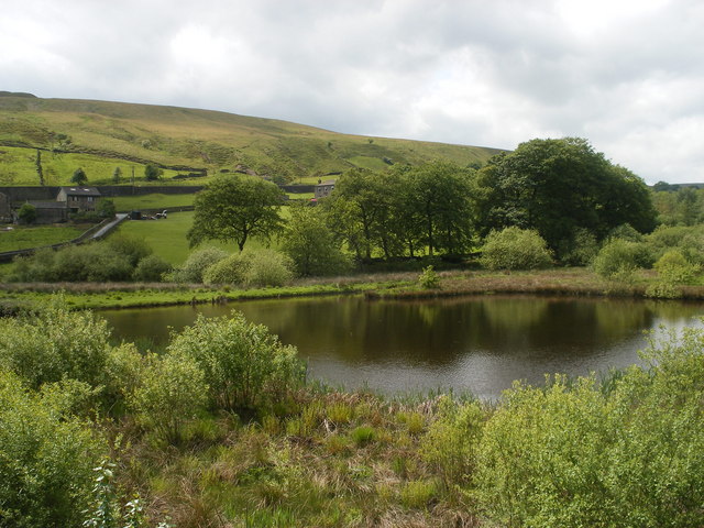
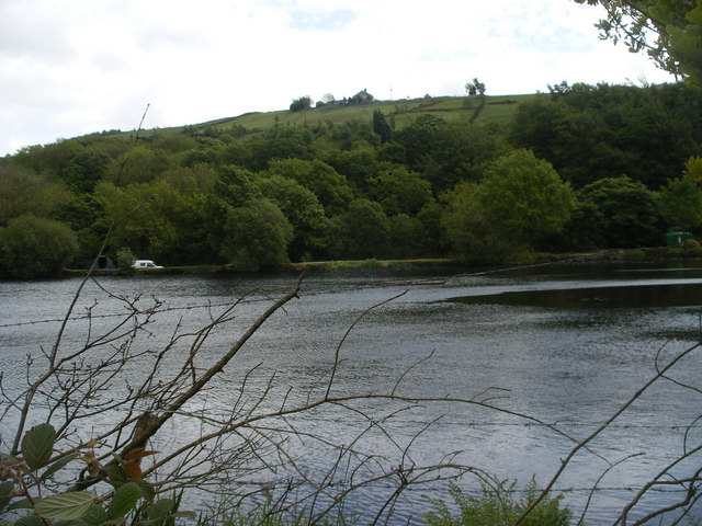
Sparth Reservoir, located in Yorkshire, England, is a serene freshwater marsh encompassing an area of approximately 20 acres. Nestled amidst picturesque landscapes, the reservoir is a popular destination for nature lovers, birdwatchers, and anglers alike.

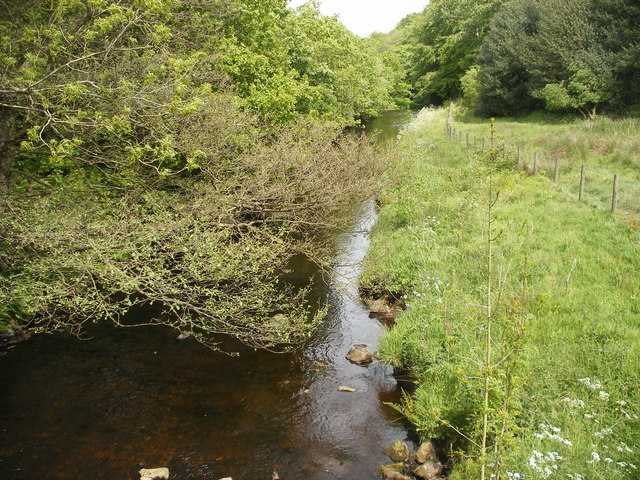
This man-made reservoir serves as a vital water source for the surrounding region. It was created in the early 1900s by damming the local river, resulting in a tranquil body of water that is surrounded by lush vegetation and trees. The reservoir's waters are primarily fed by rainfall and natural springs, ensuring a constant supply of freshwater.

With its calm and peaceful ambiance, Sparth Reservoir is an ideal habitat for a diverse range of flora and fauna. The marshy areas surrounding the reservoir provide a fertile environment for various wetland plants, including reeds and rushes, which thrive in the damp soil.

The reservoir also supports a rich variety of birdlife, making it a haven for bird enthusiasts. Species such as herons, ducks, swans, and various migratory birds can be spotted throughout the year, particularly during the breeding season. These birds are attracted to the reservoir's abundant food sources, including small fish, insects, and aquatic plants.

Anglers frequent Sparth Reservoir to indulge in the sport of fishing. The reservoir is home to a healthy population of fish, including perch, roach, and pike. Fishing permits are required to fish in the reservoir, ensuring the preservation of the ecosystem and maintaining a sustainable angling experience.

Overall, Sparth Reservoir is a scenic and ecologically significant freshwater marsh that offers a tranquil retreat for nature enthusiasts, birdwatchers, and anglers in the beautiful Yorkshire countryside.

If you have any feedback on the listing, please let us know in the comments section below.

Sparth Reservoir Images

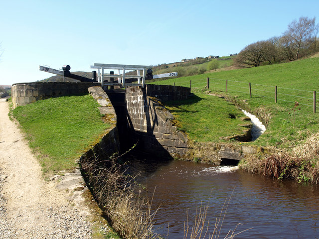
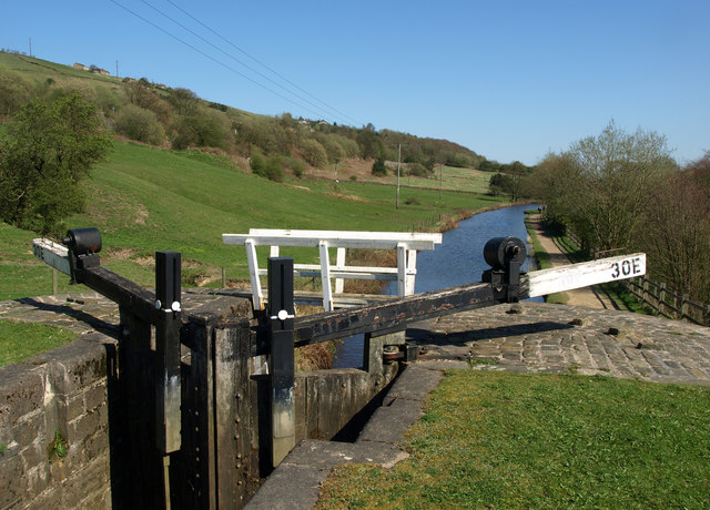
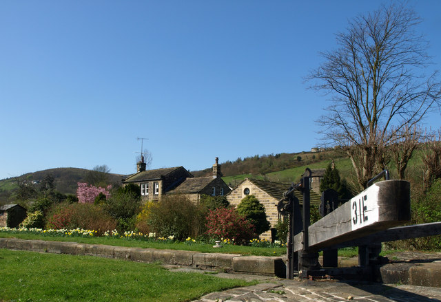
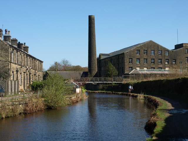
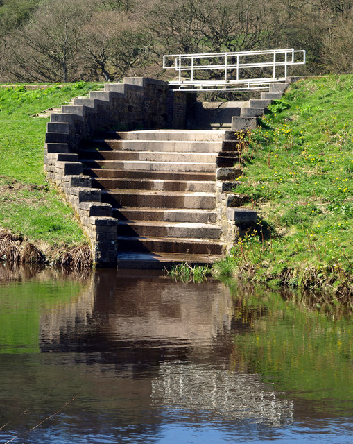
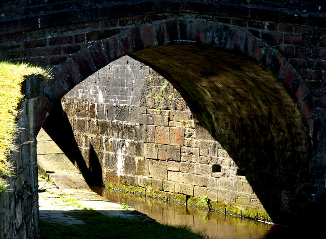
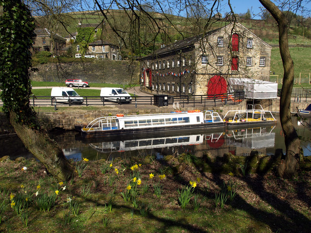
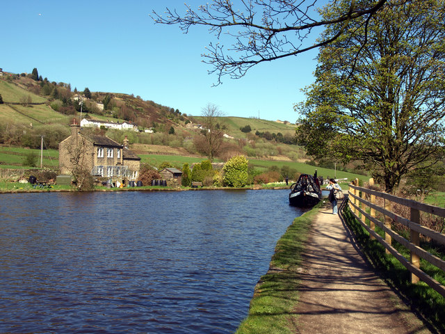
Images are sourced within 2km of 53.6091/-1.9179084 or Grid Reference SE0512. Thanks to Geograph Open Source API. All images are credited.

Manor House Farm A farm just up the hill from Marsden.
Manor House Farm
A farm just up the hill from Marsden.
Lock 30E on the Huddersfield Narrow Canal Lovely weather; lovely walk!
Lock 30E on the Huddersfield Narrow Canal
Lovely weather; lovely walk!
The view from north eastwards from Lock 30E
At Lock 31E on the Huddersfield Narrow Canal
Clough Mill and the Huddersfield Narrow Canal
Canal Feeder Steps
Canal Feeder Steps
Underneath the Arch One of many bridges on the Huddersfield Narrow Canal.
Underneath the Arch
One of many bridges on the Huddersfield Narrow Canal.
Trip Boat on the Huddersfield Narrow Canal The boat takes visitors into the nearby Standedge canal tunnel (there are four tunnels at this point - three railway and one canal).

Unfortunately on this day, there wasn't enough water in the canal for tunnel tripping!
Trip Boat on the Huddersfield Narrow Canal
The boat takes visitors into the nearby Standedge canal tunnel (there are four tunnels at this point - three railway and one canal). Unfortunately on this day, there wasn't enough water in the canal for tunnel tripping!
The Huddersfield Narrow Canal above Lock 31E There is a winding point (boat turning area) at this point - one of few on this stretch of the Huddersfield Narrow Canal.
The Huddersfield Narrow Canal above Lock 31E
There is a winding point (boat turning area) at this point - one of few on this stretch of the Huddersfield Narrow Canal.
Marsden in 2002 The clock tower is on the Mechanics' Institute. The big mill beyond is Bank Bottom Mills. The Pennines dominate the background and are wild upland country.
Marsden in 2002
The clock tower is on the Mechanics' Institute. The big mill beyond is Bank Bottom Mills. The Pennines dominate the background and are wild upland country.
Cellars Clough Mill, Marsden Former textile mill, now reported as derelict. The pond would have supplied a water turbine.
Cellars Clough Mill, Marsden
Former textile mill, now reported as derelict. The pond would have supplied a water turbine.
Marsden Station
Marsden Station
A62 near Tunnel End
A62 near Tunnel End
Small reservoir above Tunnel End
Cottages near Tunnel End
Sparth Reservoir
Sparth Reservoir
Railway bridge near canal
River Colne looking downstream from a footbridge
Show me another place!

Sparth Reservoir is located at Grid Ref: SE0512 (Lat: 53.6091, Lng: -1.9179084)

Division: West Riding

Unitary Authority: Kirklees

Police Authority: West Yorkshire

What 3 Words

///baths.scripted.tuned. Near Marsden, West Yorkshire

Related Wikis

Marsden, West Yorkshire

Marsden is a large village in the Colne Valley, in the metropolitan borough of Kirklees, West Yorkshire, England. It is in the South Pennines close to...

Marsden railway station

Marsden railway station serves the village of Marsden near Huddersfield in West Yorkshire, England. The station is on the Huddersfield Line, operated by...
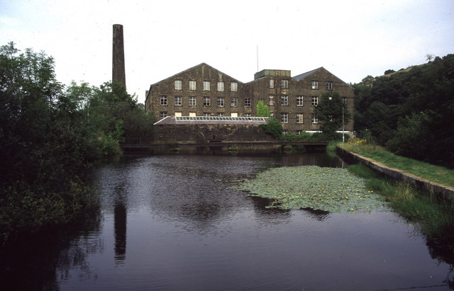
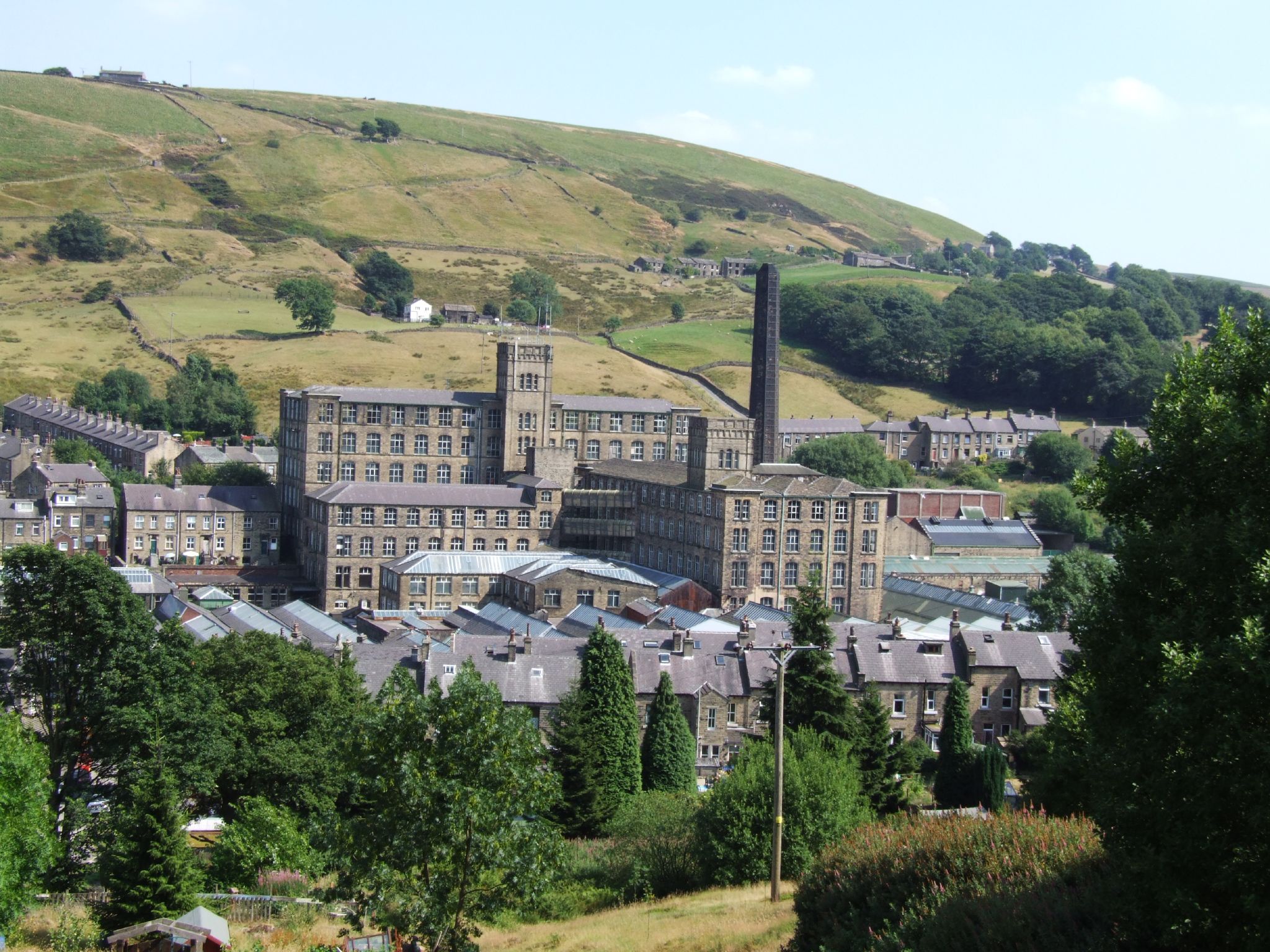
Bank Bottom Mill

Bank Bottom Mill, later known as Marsden Mill, was from 1824 an important centre for the production of woollen cloth in Marsden, West Yorkshire, England...

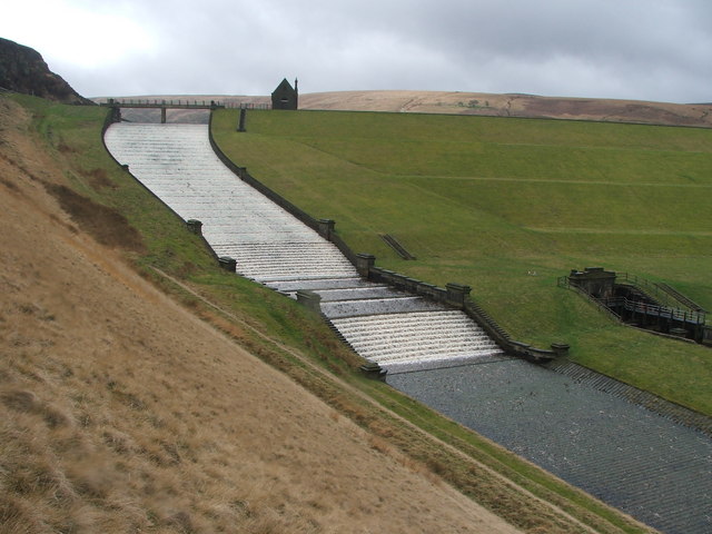
Butterley Reservoir, West Yorkshire

Butterley Reservoir is a reservoir located near Marsden, West Yorkshire, near the Peak District National Park boundary. It was completed in 1906. The reservoir...

Nearby Amenities

Located within 500m of 53.6091,-1.9179084
Seamark Type: gate
Waterway: lock_gate
Lat/Long: 53.6060092/-1.9208485
Seamark Type: gate
Waterway: lock_gate
Lat/Long: 53.6064314/-1.9204894
Seamark Type: gate
Waterway: lock_gate
Lat/Long: 53.608908/-1.917201
Height: 2
Waterway: waterfall
Lat/Long: 53.6069304/-1.9195709
Bus Stop
Marsden, Manchester Road / Council Houses
Bench: no
Bus: yes
Local Ref: 45019372
Naptan AtcoCode: 450019372
Naptan Bearing: SW
Naptan CommonName: Manchester Road Stubbin Road
Naptan Crossing: Nr-At Stubbin Road
Naptan Indicator: Stop 45019372
Naptan PlusbusZoneRef: LEEDS
Naptan ShortCommonName: Stubbin Road
Naptan Street: Manchester Road
Naptan Verified: no
Network: WY Metro
Operator: WY Metro
Public Transport: platform
Shelter: no
Source: naptan_import
Lat/Long: 53.6052689/-1.918692
Bus Stop
Marsden, Manchester Road / opposite Stubbin Road
Bench: no
Bus: yes
Local Ref: 45019373
Naptan AtcoCode: 450019373
Naptan Bearing: NE
Naptan CommonName: Manchester Road Stubbin Road
Naptan Crossing: Nr-Opp Stubbin Road
Naptan Indicator: Stop 45019373
Naptan PlusbusZoneRef: LEEDS
Naptan ShortCommonName: Stubbin Road
Naptan Street: Manchester Road
Naptan Verified: no
Network: WY Metro
Operator: WY Metro
Public Transport: platform
Shelter: no
Source: naptan_import
Lat/Long: 53.6053589/-1.918843
Bus Stop
Marsden, Manchester Road / Stubbin Road
Bench: no
Bin: no
Bus: yes
Local Ref: 45019374
Naptan AtcoCode: 450019374
Naptan Bearing: SW
Naptan CommonName: Manchester Road Stubbin Road
Naptan Crossing: Stubbin Road
Naptan Indicator: Stop 45019374
Naptan Landmark: Adj Stubbin Farm
Naptan PlusbusZoneRef: LEEDS
Naptan ShortCommonName: Stubbin Rd Marsden
Naptan Street: Manchester Road
Naptan Verified: no
Network: WY Metro
Operator: WY Metro
Public Transport: platform
Shelter: no
Source: naptan_import
Lat/Long: 53.6073971/-1.9156198
Bus Stop
Marsden, Manchester Road / at Lingards Wood
Bench: no
Bin: no
Bus: yes
Local Ref: 45019375
Naptan AtcoCode: 450019375
Naptan Bearing: NE
Naptan CommonName: Manchester Road Lingards Wood
Naptan Crossing: Stubbin Road
Naptan Indicator: Stop 45019375
Naptan Landmark: Stubbin Farm
Naptan PlusbusZoneRef: LEEDS
Naptan ShortCommonName: Stubbin Rd Marsden
Naptan Street: Manchester Road
Naptan Verified: no
Network: WY Metro
Operator: WY Metro
Public Transport: platform
Shelter: no
Source: naptan_import
Lat/Long: 53.6077293/-1.9151658
Park Gate Road
Local Ref: 45024559
Naptan AtcoCode: 450024559
Naptan Bearing: NE
Naptan BusStopType: CUS
Naptan CommonName: Park Gate Road
Naptan Crossing: Netherwood Lane
Naptan Indicator: Stop 45024559
Naptan PlusbusZoneRef: LEEDS
Naptan ShortCommonName: Netherwood Lane
Naptan Street: Park Gate Road
Naptan Verified: no
Source: naptan_import
Lat/Long: 53.6102604/-1.9178977
Seamark Type: gate
Waterway: lock_gate
Lat/Long: 53.6058078/-1.9210103
Seamark Type: gate
Waterway: lock_gate
Lat/Long: 53.6081323/-1.9186452
Seamark Type: gate
Waterway: lock_gate
Lat/Long: 53.6083124/-1.9184343
Seamark Type: gate
Waterway: lock_gate
Lat/Long: 53.609001/-1.9168421
Seamark Type: gate
Waterway: lock_gate
Lat/Long: 53.60663/-1.9203159
Slaithwaite Hall
Place: hamlet
Lat/Long: 53.613396/-1.9175054
Note: There's no wall going SE from this point, so deleted
Lat/Long: 53.6071047/-1.9113586
Information: board
Tourism: information
Lat/Long: 53.6083578/-1.9181413
Bench
Lat/Long: 53.6063016/-1.9203971
Generator Method: photovoltaic
Generator Output Electricity: yes
Generator Source: solar
Generator Type: solar_photovoltaic_panel
Location: roof
Power: generator
Lat/Long: 53.6049552/-1.915169
Barrier: swing_gate
Height: 1.2
Locked: yes
Material: metal
Lat/Long: 53.608892/-1.9142959
Information: route_marker
Material: stone
Tourism: information
Lat/Long: 53.6112256/-1.9180044
Barrier: stile
Lat/Long: 53.6101098/-1.9217404
Historic: memorial
Lat/Long: 53.6071248/-1.911483
Generator Method: photovoltaic
Generator Output Electricity: yes
Generator Source: solar
Generator Type: solar_photovoltaic_panel
Power: generator
Lat/Long: 53.6064926/-1.9233386
Barrier: stile
Material: stone
Step Height: 0.7
Stile: stepover
Lat/Long: 53.6071082/-1.9114792
Barrier: bollard
Bollard Count: 1
Height: 1.4
Material: metal
Width: 0.3
Lat/Long: 53.6084624/-1.916106
Bench
Backrest: no
Direction: NE;SW
Material: wood
Lat/Long: 53.6079957/-1.9180208
Barrier: kissing_gate
Height: 1.2
Material: metal
Width: 0.7
Lat/Long: 53.6090139/-1.9166108
Bench
Backrest: yes
Direction: NW
Material: wood
Lat/Long: 53.608898/-1.9169882
Entrance: yes
Lat/Long: 53.6088947/-1.9121416
Barrier: entrance
Lat/Long: 53.6084468/-1.9117076
Parking
Capacity: 10
Parking: surface
Surface: unpaved
Lat/Long: 53.6086752/-1.9142002
Barrier: stile
Height: 1.4
Material: wood
Note: This is a stepover stile with 4 wooden bars above the platform
Stile: ladder
Width: 1
Lat/Long: 53.6071348/-1.9146524
The data included in this document is from www.openstreetmap.org. The data is made available under ODbL.

Have you been to Sparth Reservoir?

Leave your review of Sparth Reservoir below (or comments, questions and feedback).