Long Mere

Lake, Pool, Pond, Freshwater Marsh in Staffordshire Stafford

England

Long Mere

Groot Tree, Brockton Coppice, Cannock Chase Old Oak Tree, maybe 500+ years old.
Groot Tree, Brockton Coppice, Cannock Chase Credit: Brian Deegan

Long Mere is a picturesque freshwater lake located in Staffordshire, England. Nestled amidst the stunning countryside, this natural marvel covers an area of approximately 40 hectares and is a popular destination for nature enthusiasts and locals alike.

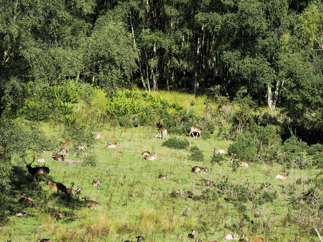
The lake is a haven for various species of birds, making it a prime spot for birdwatching. Its tranquil waters attract an array of waterfowl, including Canada geese, swans, and ducks. Additionally, Long Mere is home to a diverse range of aquatic life such as fish, frogs, and newts, creating a thriving ecosystem.

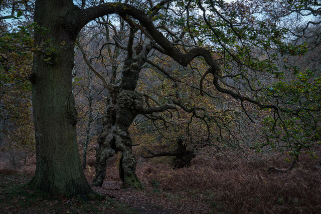
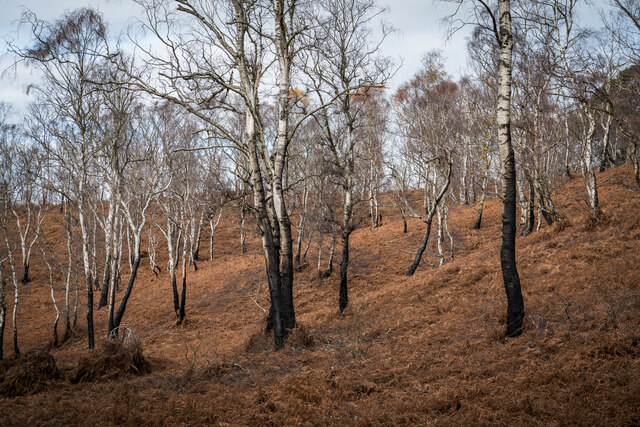
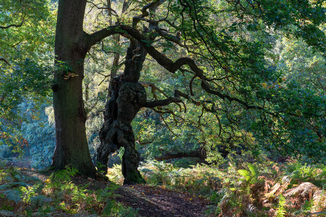
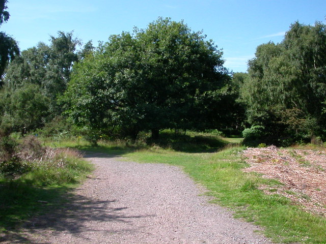
Surrounded by lush vegetation and reed beds, the lake seamlessly blends with its natural surroundings, offering a serene and idyllic setting for visitors. The tranquil atmosphere provides a perfect escape from the hustle and bustle of everyday life, making it a popular spot for picnics, leisurely walks, and outdoor activities.

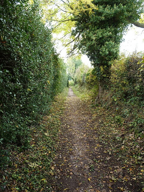
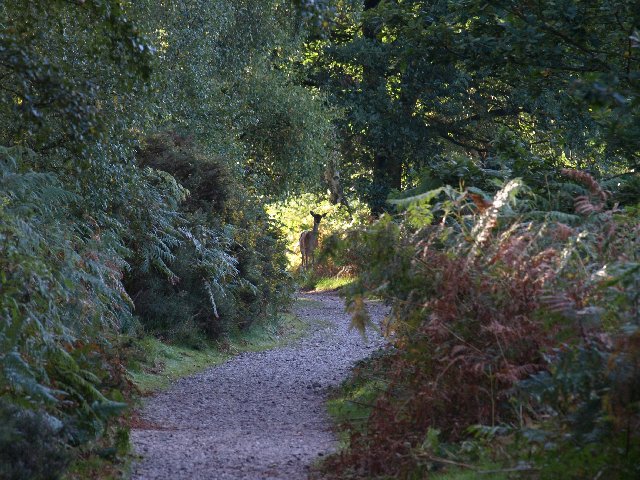
Long Mere also boasts a well-maintained walking trail that encircles the lake. This path allows visitors to fully immerse themselves in the beauty of the area, offering breathtaking views and opportunities to spot wildlife along the way. The trail is suitable for all ages and abilities, with benches strategically placed for resting and soaking in the scenery.

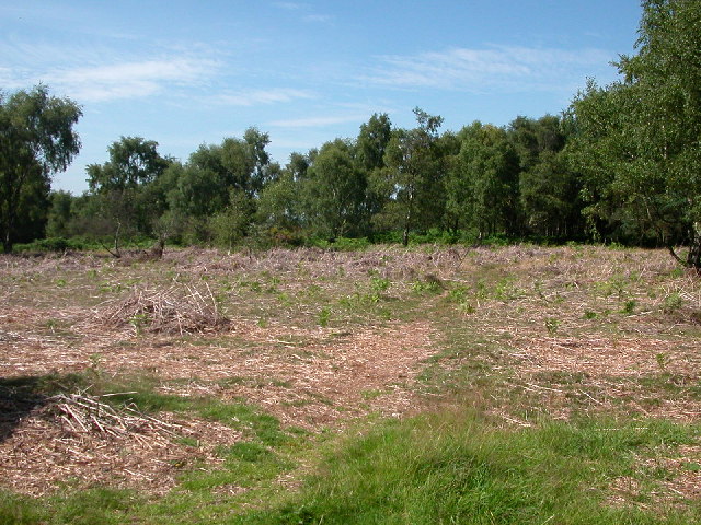
In addition to the lake itself, Long Mere features a freshwater marsh and a smaller pool, further enhancing its natural diversity. This dynamic ecosystem supports a wide range of plant life, including water lilies, rushes, and reeds, creating a rich habitat for numerous species.

Overall, Long Mere in Staffordshire is a stunning natural attraction that offers a peaceful retreat for anyone seeking to connect with nature in a tranquil and scenic environment.

If you have any feedback on the listing, please let us know in the comments section below.

Long Mere Images

Images are sourced within 2km of 52.78318/-2.0375867 or Grid Reference SJ9720. Thanks to Geograph Open Source API. All images are credited.

Groot Tree, Brockton Coppice, Cannock Chase Old Oak Tree, maybe 500+ years old.
Groot Tree, Brockton Coppice, Cannock Chase
Old Oak Tree, maybe 500+ years old.
Silver Burnt Trees, Cannock Chase Looks like there has been a fire early this year or last.
Silver Burnt Trees, Cannock Chase
Looks like there has been a fire early this year or last.
Southern end of the bridleway The track from Walton on the Hill, which runs in a generally southeasterly direction, emerges here onto Sawpit Lane at Brocton.
Southern end of the bridleway
The track from Walton on the Hill, which runs in a generally southeasterly direction, emerges here onto Sawpit Lane at Brocton.
Dovecot at Brocton Hall In the grounds of Brocton Hall, which is now the golf club, this 18th century former dovecot was Grade II listed <span class="nowrap"><a title="https://britishlistedbuildings.co.uk/101116692-dovecote-at-brocton-hall-brocton#.Yle9wOjMI2w" rel="nofollow ugc noopener" href="https://britishlistedbuildings.co.uk/101116692-dovecote-at-brocton-hall-brocton#.Yle9wOjMI2w">Link</a><img style="margin-left:2px;" alt="External link" title="External link - shift click to open in new window" src="https://s1.geograph.org.uk/img/external.png" width="10" height="10"/></span> & <span class="nowrap"><a title="https://historicengland.org.uk/listing/the-list/list-entry/1116692" rel="nofollow ugc noopener" href="https://historicengland.org.uk/listing/the-list/list-entry/1116692">Link</a><img style="margin-left:2px;" alt="External link" title="External link - shift click to open in new window" src="https://s1.geograph.org.uk/img/external.png" width="10" height="10"/></span> in 1968.
Dovecot at Brocton Hall
In the grounds of Brocton Hall, which is now the golf club, this 18th century former dovecot was Grade II listed LinkExternal link & LinkExternal link in 1968.
Brocton Hall Originally the 18th century hall had a third floor, but this was lost to a fire around the start of WWII, and was never rebuilt. The hall is now the clubhouse of the golf club, and attracted a Grade II listing <span class="nowrap"><a title="https://britishlistedbuildings.co.uk/101116688-brocton-hall-brocton#.Yle__ujMI2w" rel="nofollow ugc noopener" href="https://britishlistedbuildings.co.uk/101116688-brocton-hall-brocton#.Yle__ujMI2w">Link</a><img style="margin-left:2px;" alt="External link" title="External link - shift click to open in new window" src="https://s1.geograph.org.uk/img/external.png" width="10" height="10"/></span> & <span class="nowrap"><a title="https://historicengland.org.uk/listing/the-list/list-entry/1116688" rel="nofollow ugc noopener" href="https://historicengland.org.uk/listing/the-list/list-entry/1116688">Link</a><img style="margin-left:2px;" alt="External link" title="External link - shift click to open in new window" src="https://s1.geograph.org.uk/img/external.png" width="10" height="10"/></span> in 1953.
Brocton Hall
Originally the 18th century hall had a third floor, but this was lost to a fire around the start of WWII, and was never rebuilt. The hall is now the clubhouse of the golf club, and attracted a Grade II listing LinkExternal link & LinkExternal link in 1953.
Ruins of a medieval building behind Brocton Hall Tucked away, attached to the wall of the large rear kitchen garden of <a href="https://www.geograph.org.uk/photo/7146661">SJ9619 : Brocton Hall</a>, these stone arches are the remains of an unknown building that once lay somewhere nearby. Despite the lack of detail, they were Grade II listed <span class="nowrap"><a title="https://britishlistedbuildings.co.uk/101116745-ruins-to-north-west-of-brocton-hall-brocton#.YlfBVujMI2w" rel="nofollow ugc noopener" href="https://britishlistedbuildings.co.uk/101116745-ruins-to-north-west-of-brocton-hall-brocton#.YlfBVujMI2w">Link</a><img style="margin-left:2px;" alt="External link" title="External link - shift click to open in new window" src="https://s1.geograph.org.uk/img/external.png" width="10" height="10"/></span> & <span class="nowrap"><a title="https://historicengland.org.uk/listing/the-list/list-entry/1116745" rel="nofollow ugc noopener" href="https://historicengland.org.uk/listing/the-list/list-entry/1116745">Link</a><img style="margin-left:2px;" alt="External link" title="External link - shift click to open in new window" src="https://s1.geograph.org.uk/img/external.png" width="10" height="10"/></span> in 1968.
Ruins of a medieval building behind Brocton Hall
Tucked away, attached to the wall of the large rear kitchen garden of SJ9619 : Brocton Hall, these stone arches are the remains of an unknown building that once lay somewhere nearby. Despite the lack of detail, they were Grade II listed LinkExternal link & LinkExternal link in 1968.
Freda's Grave, Brockton, Cannock Chase A marble memorial for the mascot of the New Zealand Rifle Brigade, Freda was a Harlequin Great Dane dog who died on Cannock Chase in 1918.  

The Grave was replaced in 1964 after being vandalised and again in 2001.
Freda's Grave, Brockton, Cannock Chase
A marble memorial for the mascot of the New Zealand Rifle Brigade, Freda was a Harlequin Great Dane dog who died on Cannock Chase in 1918. The Grave was replaced in 1964 after being vandalised and again in 2001.
Fallow deer in hollow of old quarry There are around fifty deer in the image in open ground close to the village of Brocton on Cannock Chase. Maps indicate a quarry face of unknown height beyond the animals, screened by the woodland.
Fallow deer in hollow of old quarry
There are around fifty deer in the image in open ground close to the village of Brocton on Cannock Chase. Maps indicate a quarry face of unknown height beyond the animals, screened by the woodland.
Summer Groot, Cannock Chase I can't walk around Cannock without calling to see if he is still standing
Summer Groot, Cannock Chase
I can't walk around Cannock without calling to see if he is still standing
Oak at Brocton Coppice The Oak at the three way intersection of Walking Tracks at the Western entrance to the Brocton Coppice Ancient Oak Woodland.
Oak at Brocton Coppice
The Oak at the three way intersection of Walking Tracks at the Western entrance to the Brocton Coppice Ancient Oak Woodland.
Site of P.O.W. Camp at Cannock Chase 1914-1918 A small P.O.W. camp for U Boat crew was part of the Army Base. Some of the Prison Guards were men from the New Zealand Rifles, including my Father.
Site of P.O.W. Camp at Cannock Chase 1914-1918
A small P.O.W. camp for U Boat crew was part of the Army Base. Some of the Prison Guards were men from the New Zealand Rifles, including my Father.
Freda's Grave, Cannock Chase It is said that Freda was a Dalmatian dog, but others say she was a Harlequin Great Dane.  Her collar and lead are kept in a military museum in New Zealand.
Freda's Grave, Cannock Chase
It is said that Freda was a Dalmatian dog, but others say she was a Harlequin Great Dane. Her collar and lead are kept in a military museum in New Zealand.
The Green, Brocton
The Green, Brocton
Village Green, Brocton
All Saints, Brocton
All Saints, Brocton
All Saints, Brocton
All Saints, Brocton
The Green, Brocton
The Green, Brocton
Curious deer on Cannock Chase We tried to get closer but the presence of 2 dogs says it all and she turned to her right and vanished into the undergrowth. Quite a common sight in this part of the world :-)
Curious deer on Cannock Chase
We tried to get closer but the presence of 2 dogs says it all and she turned to her right and vanished into the undergrowth. Quite a common sight in this part of the world :-)
Show me another place!

Long Mere is located at Grid Ref: SJ9720 (Lat: 52.78318, Lng: -2.0375867)

Administrative County: Staffordshire

District: Stafford

Police Authority: Staffordshire

What 3 Words

///miss.melts.schools. Near Great Haywood, Staffordshire

Related Wikis

Milford, Staffordshire

Milford is a village in the county of Staffordshire, England. It lies at the edge of Cannock Chase, on the A513 road between Stafford and Rugeley. Just...

Milford and Brocton railway station

Milford and Brocton railway station served the villages of Milford and Brocton in Staffordshire, England from 1877 to 1950 on the Trent Valley line....

Shugborough Tunnel

The Shugborough Tunnel is a 777-yard (710 m) railway tunnel on the Trent Valley line running under part of the Shugborough Estate in Colwich, Staffordshire...
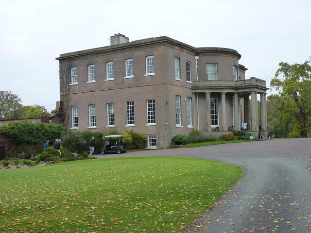
Milford Hall

Milford Hall is a privately owned 18th-century English country house at Milford, near Stafford. It is the family seat of the Levett Haszard family and...

Brocton, Staffordshire

Brocton is a village and civil parish in the English county of Staffordshire. It is within the borough of Stafford. The village describes itself as the...

Walton-on-the-Hill, Staffordshire

Walton-on-the-Hill is a village in the Borough of Stafford in Staffordshire, England. It is about 5 km east of the centre of Stafford, and lies on the...

Tixall

Tixall is a small village and civil parish in the Stafford district, in the English county of Staffordshire lying on the western side of the Trent valley...

Walton High School, Stafford

Walton High School is a large mixed secondary school and sixth form serving a community in the southern part of Stafford, England.There are approximately...

Nearby Amenities

Located within 500m of 52.78318,-2.0375867
Bus Stop
Broc Hill Way
Bus: yes
Naptan AtcoCode: 3800C744601
Naptan Bearing: N
Naptan CommonName: Broc Hill Way
Naptan Indicator: Opp
Naptan Landmark: Broc Hill Way
Naptan Street: Pool Lane
Naptan Verified: no
Public Transport: platform
Source: naptan_import
Lat/Long: 52.7799075/-2.041719
Bus Stop
Broc Hill Way
Bus: yes
Naptan AtcoCode: 3800C744602
Naptan Bearing: S
Naptan CommonName: Broc Hill Way
Naptan Indicator: Adj
Naptan Landmark: Broc Hill Way
Naptan Street: Pool Lane
Naptan Verified: no
Public Transport: platform
Source: naptan_import
Lat/Long: 52.779449/-2.0416741
Bus Stop
Sister Dora Rest Home
Bus: yes
Naptan AtcoCode: 3800C744701
Naptan Bearing: N
Naptan BusStopType: CUS
Naptan CommonName: Sister Dora Rest Home
Naptan Indicator: Opp
Naptan Landmark: Sister Dora Rest Home
Naptan Street: Brocton Road
Naptan Verified: no
Public Transport: platform
Source: naptan_import
Lat/Long: 52.7857777/-2.0419619
Bus Stop
Sister Dora Rest Home
Bus: yes
Naptan AtcoCode: 3800C744702
Naptan Bearing: S
Naptan BusStopType: CUS
Naptan CommonName: Sister Dora Rest Home
Naptan Indicator: Adj
Naptan Landmark: Sister Dora Rest Home
Naptan Street: Brocton Rd
Naptan Verified: no
Public Transport: platform
Source: naptan_import
Lat/Long: 52.7854182/-2.041754
Oat Hill
Ele: 161
Natural: peak
Lat/Long: 52.7813038/-2.033636
The data included in this document is from www.openstreetmap.org. The data is made available under ODbL.

Have you been to Long Mere?

Leave your review of Long Mere below (or comments, questions and feedback).