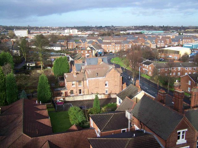
Dudley Junction

Lake, Pool, Pond, Freshwater Marsh in Staffordshire

England

Dudley Junction

Tesco Extra Scene The view in the supermarket at Burnt Tree, Dudley.
Tesco Extra Scene Credit: Gordon Griffiths

Dudley Junction, located in Staffordshire, is a picturesque area known for its natural beauty and serene surroundings. Situated amidst lush greenery and surrounded by rolling hills, Dudley Junction is blessed with an array of water bodies, including a lake, pool, pond, and freshwater marsh.

The lake at Dudley Junction is a large expanse of water, shimmering under the sunlight. It is a popular spot for recreational activities such as fishing and boating. The crystal-clear waters of the lake teem with various species of fish, making it a haven for anglers. The tranquility of the lake attracts visitors who seek solace in its peaceful ambiance.

Adjacent to the lake, there is a pool that serves as a natural habitat for a diverse range of aquatic plants and animals. This pool is a source of fascination for nature enthusiasts and provides a unique opportunity for wildlife observation. It is not uncommon to spot various water birds and small mammals frolicking in and around the pool.

A smaller pond can also be found in Dudley Junction, surrounded by reeds and water lilies. The pond is a miniature ecosystem, attracting frogs, dragonflies, and other water-dwelling creatures. Its serene ambiance provides a calming setting for those seeking a moment of respite from the bustle of everyday life.

Lastly, Dudley Junction is home to a freshwater marsh, characterized by its marshy terrain and abundant vegetation. This marsh serves as a vital habitat for numerous plant and animal species, providing a safe haven for them to thrive.

Overall, Dudley Junction in Staffordshire offers a rich tapestry of water bodies, each with its own unique charm, contributing to the area's natural splendor and making it a haven for nature lovers and wildlife enthusiasts.

If you have any feedback on the listing, please let us know in the comments section below.

Dudley Junction Images

Images are sourced within 2km of 52.525123/-2.0727533 or Grid Reference SO9591. Thanks to Geograph Open Source API. All images are credited.

Tesco Extra Scene The view in the supermarket at Burnt Tree, Dudley.
Tesco Extra Scene
The view in the supermarket at Burnt Tree, Dudley.
St Johns Road Path The view towards Dixon Green Road, Dudley.
St Johns Road Path
The view towards Dixon Green Road, Dudley.
Dixons Green The view from Kate's Hill in Dudley.
Dixons Green
The view from Kate's Hill in Dudley.
Brereton Close, Dudley The turning area at the bottom of this cul-de-sac.
Brereton Close, Dudley
The turning area at the bottom of this cul-de-sac.
Factory entrance off Hall Street A private entrance into a factory south west of Hall Street.
Factory entrance off Hall Street
A private entrance into a factory south west of Hall Street.
Brereton Close, Dudley View NNW up the close with a large open grass area on the left.
Brereton Close, Dudley
View NNW up the close with a large open grass area on the left.
Black Country Living Museum - Red by Night, sparks are flying! A special after dark event to live up to the saying that the Black Country was black by day and red by night. Here the chain maker is striking the first blow to fire weld the newly made link shut.

This is an available light shot at ISO 6400 and is therefore less than perfect. However, it captures the drama of the moment.

In the foreground is a board to prompt the audience - ISSOTT. Indeed, it is hot!
Black Country Living Museum - Red by Night, sparks are flying!
A special after dark event to live up to the saying that the Black Country was black by day and red by night. Here the chain maker is striking the first blow to fire weld the newly made link shut. This is an available light shot at ISO 6400 and is therefore less than perfect. However, it captures the drama of the moment. In the foreground is a board to prompt the audience - ISSOTT. Indeed, it is hot!
Black Country Living Museum - Racecourse Colliery in steam at night A special night time event - Red at Night - with the colliery plant in steam. It was properly dark with the colliery tub and head gear floodlit. The quality is not great as it was hand held at ISO 6400. Nonetheless, I felt it was worth submitting it for sheer atmosphere.
Black Country Living Museum - Racecourse Colliery in steam at night
A special night time event - Red at Night - with the colliery plant in steam. It was properly dark with the colliery tub and head gear floodlit. The quality is not great as it was hand held at ISO 6400. Nonetheless, I felt it was worth submitting it for sheer atmosphere.
Black Country Living Museum - Red by Night, sparks are flying! This is the anchor forge seen after dark for a special event celebrating the saying about the Black Country - black by day and red by night. The steam hammer has just struck the workpiece and slag and sparks are flying off. The hammer (or 'ommer) driver is on the left. This was a very atmospheric event. 

Apparently the weekend uses 1000 litres of oil and is only held twice a year or so. This day was the first time I had seen the hammer run (both in daylight and after dark). 

There are very few places in the UK where you can see a steam hammer running on steam. There are still thought to be a few in industry that use compressed air (the visuals are very much the same).
Black Country Living Museum - Red by Night, sparks are flying!
This is the anchor forge seen after dark for a special event celebrating the saying about the Black Country - black by day and red by night. The steam hammer has just struck the workpiece and slag and sparks are flying off. The hammer (or 'ommer) driver is on the left. This was a very atmospheric event. Apparently the weekend uses 1000 litres of oil and is only held twice a year or so. This day was the first time I had seen the hammer run (both in daylight and after dark). There are very few places in the UK where you can see a steam hammer running on steam. There are still thought to be a few in industry that use compressed air (the visuals are very much the same).
Black Country Living Museum - Red by Night, the anchor forge This was a special night time event - Red by Night - and the steam hammer was being demonstrated. This is an expensive business and only happens about two weekends a year. It is apparently next due to happen in May 2022.
Black Country Living Museum - Red by Night, the anchor forge
This was a special night time event - Red by Night - and the steam hammer was being demonstrated. This is an expensive business and only happens about two weekends a year. It is apparently next due to happen in May 2022.
Black Country Living Museum - mind your toes A demonstration of the steam hammer at the anchor forge. This gentleman has just pulled this yellow hot cube of metal out of the furnace and it has landed at his feet. The next move is to pick it up with tongs and literally throw it across the floor to the next operative who picks it up with tongs and places it on the steam hammer's anvil.
Black Country Living Museum - mind your toes
A demonstration of the steam hammer at the anchor forge. This gentleman has just pulled this yellow hot cube of metal out of the furnace and it has landed at his feet. The next move is to pick it up with tongs and literally throw it across the floor to the next operative who picks it up with tongs and places it on the steam hammer's anvil.
A steam hammer in the Black Country A once common sight and in monochrome this has a timelessness. It was actually 2021 at the Black Country Living Museum and the anchor forge was being demonstrated in steam. This event only happens about two weekends a year and this was the first time I had seen this in steam. 

They were only rather gently bashing hot cubes of metal, knocking them out of shape and then squaring them up again. Still, it gives a flavour of the real thing and very few people have now seen forging with this sort of hammer (I am lucky enough to have seen this done for real).
A steam hammer in the Black Country
A once common sight and in monochrome this has a timelessness. It was actually 2021 at the Black Country Living Museum and the anchor forge was being demonstrated in steam. This event only happens about two weekends a year and this was the first time I had seen this in steam. They were only rather gently bashing hot cubes of metal, knocking them out of shape and then squaring them up again. Still, it gives a flavour of the real thing and very few people have now seen forging with this sort of hammer (I am lucky enough to have seen this done for real).
Black Country Living Museum - metal bashing A demonstration of the Charles Ross steam hammer (approximately 1 ton) at the anchor forge. This was done both in daylight and for a special event after dark. This only happens about two weekends a year and this was the first time I had seen it.
Black Country Living Museum - metal bashing
A demonstration of the Charles Ross steam hammer (approximately 1 ton) at the anchor forge. This was done both in daylight and for a special event after dark. This only happens about two weekends a year and this was the first time I had seen it.
Black Country Living Museum - new boiler The museum has a full size replica of the 1712 atmospheric engine of Thomas Newcomen. This has been out of use for some time while a new boiler is being fitted. This was a special behind the scenes visit to see the new boiler that is now well advanced. It is a steel haystack type boiler in a brick setting with wheel draught. The cylinder is above and connected via a flexible expansion joint. The top will be covered with lead sheeting to simulate the original boiler that was a mixture of copper and lead. The engine should be operational again in 2022.
Black Country Living Museum - new boiler
The museum has a full size replica of the 1712 atmospheric engine of Thomas Newcomen. This has been out of use for some time while a new boiler is being fitted. This was a special behind the scenes visit to see the new boiler that is now well advanced. It is a steel haystack type boiler in a brick setting with wheel draught. The cylinder is above and connected via a flexible expansion joint. The top will be covered with lead sheeting to simulate the original boiler that was a mixture of copper and lead. The engine should be operational again in 2022.
Black Country Living Museum - steam air compressor By the reconstructed racecourse colliery. This used to be covered by a tarpaulin but is now exposed and is pretty much what I thought it was. It is a return connecting rod steam engine with the compressing cylinder in tandem. The slide valve is on top of the steam cylinder. It was built by W Neill & Son of St Helens, Lancashire.
Black Country Living Museum - steam air compressor
By the reconstructed racecourse colliery. This used to be covered by a tarpaulin but is now exposed and is pretty much what I thought it was. It is a return connecting rod steam engine with the compressing cylinder in tandem. The slide valve is on top of the steam cylinder. It was built by W Neill & Son of St Helens, Lancashire.
Black Country Living Museum - Racecourse Colliery boiler house A vertical boiler by the Cradley Boiler Company of Cradley Heath. This was in steam. On the left is a duplex non-rotative steam feed pump, one of two in the boiler house.
Black Country Living Museum - Racecourse Colliery boiler house
A vertical boiler by the Cradley Boiler Company of Cradley Heath. This was in steam. On the left is a duplex non-rotative steam feed pump, one of two in the boiler house.
Black Country Living Museum - Wanted, pit bank wenches Not a sign you would see in the 21st century.
Black Country Living Museum - Wanted, pit bank wenches
Not a sign you would see in the 21st century.
Black Country Living Museum - blowdown receiver The replica of Newcomen's 1712 engine has had a new boiler fitted and as part of the project this new buried blowdown receiver and atmospheric vent pipe have been fitted to one side of the engine house.
Black Country Living Museum - blowdown receiver
The replica of Newcomen's 1712 engine has had a new boiler fitted and as part of the project this new buried blowdown receiver and atmospheric vent pipe have been fitted to one side of the engine house.
Show me another place!

Dudley Junction is located at Grid Ref: SO9591 (Lat: 52.525123, Lng: -2.0727533)

Unitary Authority: Sandwell

Police Authority: West Midlands

What 3 Words

///issue.candy.frogs. Near Tipton, West Midlands

Nearby Locations

Dudley Junction

Related Wikis

Tipton

Tipton is an industrial town in the Metropolitan Borough of Sandwell in the West Midlands County in England. It had a population of 38,777 at the 2011...

St James's School, Dudley

St. James's School opened in the Eve Hill area of Dudley in 1842 for pupils aged 5–11. In 1989–1990 it was demolished, then rebuilt at the Black Country...

Black Country Living Museum Pawnbrokers Shop

The Black Country Living Museum Pawnbrokers Shop is a recreation of a pawnbroker's at the Black Country Living Museum. It is one of a pair of cottages...

Emile Doo's Chemist Shop

Emile Doo's Chemist Shop is an exhibition at the Black Country Living Museum in England. It was originally situated at 358 Halesowen Road, Netherton, before...

Nearby Amenities

Located within 500m of 52.525123,-2.0727533
Tipton
Is In County: West Midlands
Is In District: Sandwell
Is In Historic County: Staffordshire
Place: town
Population: 47000
Source: NPE
Wikidata: Q1684337
Wikipedia: en:Tipton
Lat/Long: 52.5290396/-2.0693747
Tipton Junction
Lat/Long: 52.5251127/-2.0727206
Traffic Signals
Lat/Long: 52.5235149/-2.0740717
Traffic Signals
Lat/Long: 52.5235039/-2.0742973
Traffic Signals
Lat/Long: 52.5231695/-2.07381
Traffic Signals
Lat/Long: 52.523455/-2.0743547
Traffic Signals
Lat/Long: 52.5259657/-2.0740939
Post Box
Lat/Long: 52.5241024/-2.0656484
Mini Roundabout
Direction: clockwise
Lat/Long: 52.5270992/-2.0690812
Bus Stop
Sedgley Road West / Bell St (Stop TA)
Bus: yes
Naptan AtcoCode: 43000956402
Naptan Bearing: SE
Naptan BusStopType: MKD
Naptan CommonName: Bell St
Naptan Indicator: Stop TA
Naptan NaptanCode: nwmtjpta
Naptan PlusbusZoneRef: BHAMNWS
Naptan Status: ACT
Naptan StopType: BCT
Naptan Street: SEDGLEY ROAD WEST
Naptan Towards: Dudley
Naptan Verified: no
Public Transport: platform
Route Ref: 229
Source: WMCA
Lat/Long: 52.5282195/-2.0716395
Bus Stop
Owen St / Wood St
NaPTANAreaCode: 43000967302
Bus: yes
Naptan AtcoCode: 43000967302
Naptan Bearing: NE
Naptan BusStopType: MKD
Naptan CommonName: Wood St
Naptan Indicator: Stop TC
Naptan NaptanCode: nwmdmgwa
Naptan PlusbusZoneRef: BHAMNWS
Naptan Status: ACT
Naptan StopType: BCT
Naptan Street: OWEN ST
Naptan Towards: Wednesbury
Public Transport: platform
Route Ref: 42
Shelter: yes
Shelter Ref: 304321
Source: WMCA
Lat/Long: 52.5289982/-2.0692171
Bus Stop
Owen St / Coronation Gardens
Bus: yes
Naptan AtcoCode: 43000967401
Naptan Bearing: SW
Naptan BusStopType: MKD
Naptan CommonName: Coronation Gardens
Naptan Indicator: Stop TB
Naptan NaptanCode: nwmdmgwd
Naptan PlusbusZoneRef: BHAMNWS
Naptan Status: ACT
Naptan StopType: BCT
Naptan Street: OWEN ST
Naptan Towards: Dudley, Sedgley
Public Transport: platform
Route Ref: 42;229
Shelter: no
Source: WMCA
Lat/Long: 52.5279489/-2.0708619
Bus Stop
Waterloo St / New St
Bus: yes
Naptan AtcoCode: 43004841301
Naptan Bearing: NE
Naptan BusStopType: MKD
Naptan CommonName: New St
Naptan Indicator: Stop TH
Naptan NaptanCode: nwmtmagd
Naptan PlusbusZoneRef: BHAMNWS
Naptan Status: ACT
Naptan StopType: BCT
Naptan Street: WATERLOO ST
Naptan Towards: Dudley, Sedgley
Naptan Verified: no
Public Transport: platform
Route Ref: 229
Source: WMCA
Lat/Long: 52.5274942/-2.0668182
Bus Stop
Park Lane West / Leasowe Rd
NaPTANAreaCode: 43000868901
Bus: yes
Naptan AtcoCode: 43000868901
Naptan Bearing: SE
Naptan BusStopType: MKD
Naptan CommonName: Leasowe Road
Naptan Indicator: Stop TL
Naptan NaptanCode: nwmpadmp
Naptan PlusbusZoneRef: BHAMNWS
Naptan Status: ACT
Naptan StopType: BCT
Naptan Street: PARK LANE WEST
Naptan Towards: Great Bridge
Public Transport: platform
Route Ref: 42;229
Shelter: yes
Shelter Ref: 305529
Source: WMCA
Lat/Long: 52.5264218/-2.0694069
Bus Stop
Tipton Rd / Tipton Cross Rds
NaPTANAreaCode: 43000879501
Bus: yes
Naptan AtcoCode: 43000879501
Naptan Bearing: S
Naptan BusStopType: MKD
Naptan CommonName: Tipton Cross Rds
Naptan Indicator: opp
Naptan NaptanCode: nwmdjwja
Naptan PlusbusZoneRef: BHAMNWS
Naptan Status: ACT
Naptan StopType: BCT
Naptan Street: TIPTON RD
Naptan Towards: Dudley
Naptan Verified: no
Public Transport: platform
Route Ref: 11;13;24;229;311;313
Shelter: yes
Shelter Ref: 405502
Source: WMCA
Lat/Long: 52.5226083/-2.0739591
Bus Stop
Dudley Rd / Bell St
NaPTANAreaCode: 43000967801
Bus: yes
Naptan AtcoCode: 43000967801
Naptan Bearing: S
Naptan BusStopType: MKD
Naptan CommonName: Bell St
Naptan Indicator: Stop TQ
Naptan Landmark: The Victoria
Naptan NaptanCode: nwmpgtma
Naptan PlusbusZoneRef: BHAMNWS
Naptan Status: ACT
Naptan StopType: BCT
Naptan Street: DUDLEY RD
Naptan Towards: Dudley
Public Transport: platform
Route Ref: 11;13;311
Shelter: yes
Shelter Ref: 305531
Source: WMCA
Lat/Long: 52.5272396/-2.0745137
Bus Stop
Dudley Rd / High St
NaPTANAreaCode: 43000967902
Bus: yes
Naptan AtcoCode: 43000967902
Naptan Bearing: S
Naptan BusStopType: MKD
Naptan CommonName: High St
Naptan Indicator: Stop TN
Naptan Landmark: Wagon and Horses
Naptan NaptanCode: nwmpgtmd
Naptan PlusbusZoneRef: BHAMNWS
Naptan Status: ACT
Naptan StopType: BCT
Naptan Street: DUDLEY RD
Naptan Towards: Dudley
Naptan Verified: no
Public Transport: platform
Route Ref: 11;13;229;311;313
Shelter: yes
Shelter Ref: 305519
Source: WMCA
Lat/Long: 52.5255105/-2.0740215
Bus Stop
Dudley Rd / High St
NaPTANAreaCode: 43000967903
Bus: yes
Naptan AtcoCode: 43000967903
Naptan Bearing: N
Naptan BusStopType: MKD
Naptan CommonName: High St
Naptan Indicator: Stop TP
Naptan Landmark: Wagon and Horses
Naptan NaptanCode: nwmpgtmg
Naptan PlusbusZoneRef: BHAMNWS
Naptan Status: ACT
Naptan StopType: BCT
Naptan Street: DUDLEY RD
Naptan Towards: Wednesbury
Naptan Verified: no
Public Transport: platform
Route Ref: 11;13;311;313
Shelter: yes
Shelter Ref: 0967903
Source: WMCA
Lat/Long: 52.52633/-2.0742749
Bus Stop
TK
Bus: yes
Naptan AtcoCode: 43000968001
Naptan Bearing: SE
Naptan BusStopType: MKD
Naptan CommonName: Silvertrees Rd
Naptan Indicator: Stop TK
Naptan NaptanCode: nwmpgtmj
Naptan PlusbusZoneRef: BHAMNWS
Naptan Status: ACT
Naptan StopType: BCT
Naptan Street: PARK LANE WEST
Naptan Towards: Both directions
Naptan Verified: no
Public Transport: platform
Route Ref: 229
Source: WMCA
Lat/Long: 52.5254703/-2.0685332
Bus Stop
Dudley Rd / Tipton Cross Roads
NaPTANAreaCode: 43009760102
Bus: yes
Naptan AtcoCode: 43009760102
Naptan Bearing: N
Naptan BusStopType: MKD
Naptan CommonName: Tipton Cross Roads
Naptan Indicator: after
Naptan NaptanCode: nwmdpagj
Naptan PlusbusZoneRef: BHAMNWS
Naptan Status: ACT
Naptan StopType: BCT
Naptan Street: DUDLEY RD
Naptan Towards: Tipton
Naptan Verified: no
Public Transport: platform
Route Ref: 11;13;229;311;313
Shelter: yes
Shelter Ref: 305526
Source: WMCA
Lat/Long: 52.5240128/-2.0741609
Bus Stop
High St / The Wagon & Horses
Bus: yes
Naptan AtcoCode: 43009760501
Naptan Bearing: NE
Naptan BusStopType: MKD
Naptan CommonName: The Wagon & Horses
Naptan Indicator: Stop TM
Naptan NaptanCode: nwmdpagm
Naptan PlusbusZoneRef: BHAMNWS
Naptan Status: ACT
Naptan StopType: BCT
Naptan Street: HIGH ST
Naptan Towards: Sedgley
Naptan Verified: no
Public Transport: platform
Route Ref: 229
Source: WMCA
Lat/Long: 52.5262405/-2.0736262
Bus Stop
Birmingham New Rd / Tipton Cross Roads
Bus: yes
Naptan AtcoCode: 43009761003
Naptan Bearing: NW
Naptan BusStopType: MKD
Naptan CommonName: Tipton Cross Roads
Naptan Indicator: adj
Naptan NaptanCode: nwmpmwgw
Naptan PlusbusZoneRef: BHAMNWS
Naptan Status: ACT
Naptan StopType: BCT
Naptan Street: BIRMINGHAM NEW RD
Naptan Towards: Foxyards
Naptan Verified: no
Public Transport: platform
Route Ref: 24
Source: WMCA
Lat/Long: 52.5235339/-2.0747397
Bus Stop
Sedgley Road West / Neptune Health Park
Bus: yes
Naptan AtcoCode: 43009762001
Naptan Bearing: NW
Naptan BusStopType: CUS
Naptan CommonName: Neptune Health Park
Naptan Indicator: opp
Naptan NaptanCode: nwmptamd
Naptan Status: ACT
Naptan StopType: BCT
Naptan Street: SEDGLEY ROAD WEST
Naptan Towards: Sedgley
Naptan Verified: no
Public Transport: platform
Source: WMCA
Lat/Long: 52.5285787/-2.0724361
Bus Stop
Sedgley Road West / Neptune Park
NaPTANAreaCode: 43009762002
Bus: yes
Naptan AtcoCode: 43009762002
Naptan Bearing: SE
Naptan BusStopType: MKD
Naptan CommonName: Neptune Health Park
Naptan Indicator: Stop TA
Naptan NaptanCode: nwmtgtmj
Naptan PlusbusZoneRef: BHAMNWS
Naptan Status: ACT
Naptan StopType: BCT
Naptan Street: SEDGLEY ROAD WEST
Naptan Towards: Dudley
Naptan Verified: no
Public Transport: platform
Route Ref: 229
Shelter: yes
Shelter Ref: 304331
Source: WMCA
Lat/Long: 52.5285788/-2.0722592
Post Box
Ref: DY4 185
Lat/Long: 52.5224875/-2.0721676
Addr Housenumber: 3
Lat/Long: 52.5225806/-2.071794
Addr Housenumber: 49
Lat/Long: 52.5214732/-2.0700868
Tipton Green
Place: locality
Source: OS_OpenData_StreetView
Lat/Long: 52.5280578/-2.0770901
Mini Roundabout
Direction: clockwise
Source: BING
Lat/Long: 52.5273651/-2.0747855
Mini Roundabout
Direction: clockwise
Lat/Long: 52.5266766/-2.0768868
Turning Circle
Lat/Long: 52.5247274/-2.076667
Turning Circle
Lat/Long: 52.5255833/-2.0790697
Turning Circle
Lat/Long: 52.5279897/-2.0672578
Turning Circle
Lat/Long: 52.5238786/-2.0721946
Bus Stop
Bus: yes
Public Transport: platform
Tram: yes
Lat/Long: 52.5227735/-2.0757079
Traffic Signals
Lat/Long: 52.5231001/-2.0741152
Traffic Signals
Lat/Long: 52.5231221/-2.0738733
Historic: mine
Mineral: coal
Source: OS 1:25k
Lat/Long: 52.526026/-2.0673387
Turning Circle
Lat/Long: 52.5290807/-2.0762161
Barrier: height_restrictor
Maxheight: 2.17
Lat/Long: 52.5239259/-2.078667
Historic: lock_gate
Lat/Long: 52.5274724/-2.0700826
Historic: lock_gate
Lat/Long: 52.5275339/-2.0697969
Historic: lock_gate
Lat/Long: 52.5278093/-2.0688741
Historic: lock_gate
Lat/Long: 52.5278895/-2.0685401
William Perry - the Tipton Slasher
Historic: memorial
Source: survey
Lat/Long: 52.5276774/-2.0706804
Grit Bin
Source: survey
Lat/Long: 52.5285893/-2.0701262
Addr Housenumber: 100
Source: survey
Lat/Long: 52.5273637/-2.0750174
Addr Housenumber: 106
Source: survey
Lat/Long: 52.527761/-2.0755176
Addr Housenumber: 168
Source: survey
Lat/Long: 52.5262258/-2.0695179
Phoenix House
Source: survey
Tourism: artwork
Lat/Long: 52.5265805/-2.0725974
Post Box
Fixme: check ref -- box located outside DY6 postal district
Ref: DY6 275
Source: survey
Lat/Long: 52.5262518/-2.0693934
Power: substation
Ref: 4113
Source: survey
Lat/Long: 52.5264634/-2.0722453
Source: survey
Tourism: artwork
Lat/Long: 52.5285412/-2.0705497
Blue Plaque: John Wesley
Historic: memorial
Operator: Tipton Civic Society
Source: Tipton Civic Society
Lat/Long: 52.5267207/-2.0696273
Blue Plaque: Henry Pershouse Parkes
Historic: memorial
Operator: Tipton Civic Society
Source: Tipton Civic Society
Lat/Long: 52.5264042/-2.0725705
Blue Plaque: The Red Lion Tipton's Oldest Pub
Historic: memorial
Lat/Long: 52.5264802/-2.0697329
Blue Plaque: Tipton Wakes
Historic: memorial
Operator: Tipton Civic Society
Source: Tipton Civic Society
Lat/Long: 52.5265695/-2.067473
Blue Plaque: the Neptune Forge
Historic: memorial
Operator: Tipton Civic Society
Source: Tipton Civic Society
Lat/Long: 52.5288599/-2.0712949
Crossing
Crossing: uncontrolled
Source: bing
Lat/Long: 52.5279733/-2.0755576
Cafe
The Workers' Institute Cafe
Addr Postcode: DY1 4SQ
Addr Street: Tipton Road
Fhrs Id: 501984
Operator: The Black Country Living Museum
Source Addr: FHRS Open Data
Website: https://www.bclm.co.uk/locations/the-workers-institute/52.htm
Lat/Long: 52.5224618/-2.0776078
Crossing
Crossing: uncontrolled
Crossing Island: no
Crossing Markings: zebra
Tactile Paving: no
Lat/Long: 52.5226762/-2.0766666
Post Box
Listed Status: Grade II
Post Box Design: penfold
Post Box Type: pillar
Royal Cypher: VR
Royal Cypher Wikidata: Q33102356
Lat/Long: 52.5228557/-2.0767854
Cafe
The Gongoozler
Addr Housenumber: 501
Addr Postcode: DY1 4SB
Addr Street: Birmingham New Road
Fhrs Id: 962812
Source: survey
Source Addr: FHRS Open Data
Lat/Long: 52.5234616/-2.0781514
Information: board
Tourism: information
Lat/Long: 52.5233827/-2.0789955
Source: survey
Tourism: picnic_site
Lat/Long: 52.5235582/-2.0788541
Bicycle Parking
Capacity: 10
Covered: yes
Source: survey
Lat/Long: 52.523599/-2.0788045
Information: guidepost
Tourism: information
Lat/Long: 52.5239185/-2.0787461
Tourism: picnic_site
Lat/Long: 52.5234935/-2.0750022
Toilets
Lat/Long: 52.5234152/-2.0746955
Toilets
Check Date: 2022-12-31
Lat/Long: 52.5234259/-2.0772768
Toilets
Lat/Long: 52.5236299/-2.0777957
Sedgley Road West / Bell St
Naptan AtcoCode: 43000956401
Naptan Bearing: NW
Naptan BusStopType: CUS
Naptan CommonName: Bell St
Naptan NaptanCode: nwmtjpmw
Naptan Status: ACT
Naptan StopType: BCT
Naptan Street: SEDGLEY ROAD WEST
Public Transport: platform
Route Ref: 229
Source: WMCA
Lat/Long: 52.5281818/-2.0719476
Car Wash
Super Hand Car Wash
Automated: no
Self Service: no
Lat/Long: 52.5226439/-2.073857
Fast Food
Chopsticks
Lat/Long: 52.522776/-2.0736372
Fast Food
Britannia Pizza
Lat/Long: 52.522763/-2.073731
Generator Method: photovoltaic
Generator Output Electricity: yes
Generator Source: solar
Generator Type: solar_photovoltaic_panel
Power: generator
Lat/Long: 52.5245901/-2.076247
Generator Method: photovoltaic
Generator Output Electricity: yes
Generator Source: solar
Generator Type: solar_photovoltaic_panel
Power: generator
Lat/Long: 52.525331/-2.0720226
Generator Method: photovoltaic
Generator Output Electricity: yes
Generator Source: solar
Generator Type: solar_photovoltaic_panel
Power: generator
Lat/Long: 52.525872/-2.070137
Generator Method: photovoltaic
Generator Output Electricity: yes
Generator Source: solar
Generator Type: solar_photovoltaic_panel
Power: generator
Lat/Long: 52.5269726/-2.0678383
Generator Method: photovoltaic
Generator Output Electricity: yes
Generator Source: solar
Generator Type: solar_photovoltaic_panel
Power: generator
Lat/Long: 52.5284184/-2.0684928
Crossing
Lat/Long: 52.5219267/-2.0718369
Crossing
Crossing: marked
Lat/Long: 52.5233948/-2.0743885
Crossing
Crossing: marked
Lat/Long: 52.5230999/-2.0740185
Crossing
Crossing: marked
Lat/Long: 52.5232144/-2.0737514
Entrance: main
Lat/Long: 52.5230207/-2.0768112
Give Way
Direction: forward
Lat/Long: 52.5231814/-2.0714547
Give Way
Direction: backward
Lat/Long: 52.5230919/-2.0717669
Give Way
Direction: backward
Lat/Long: 52.5225674/-2.0724311
Give Way
Direction: forward
Lat/Long: 52.5226537/-2.0722408
Power: transformer
Lat/Long: 52.5232662/-2.0718051
Entrance: main
Lat/Long: 52.5224914/-2.077259
Entrance: main
Lat/Long: 52.5224959/-2.0771635
Entrance: main
Lat/Long: 52.5224991/-2.077103
Entrance: main
Lat/Long: 52.5224274/-2.0772719
Entrance: main
Lat/Long: 52.5224436/-2.0770891
Entrance: main
Lat/Long: 52.5224665/-2.0770569
Entrance: main
Lat/Long: 52.5224067/-2.0769576
Entrance: main
Lat/Long: 52.5222517/-2.0772123
Entrance: main
Lat/Long: 52.5223316/-2.0772772
Entrance: main
Lat/Long: 52.5223402/-2.0771664
Entrance: main
Lat/Long: 52.5223746/-2.077196
Entrance: main
Lat/Long: 52.522252/-2.0771349
Entrance: main
Lat/Long: 52.5223492/-2.0770926
Entrance: main
Lat/Long: 52.5222524/-2.0770276
Entrance: main
Lat/Long: 52.5223497/-2.0770257
Entrance: main
Lat/Long: 52.5222528/-2.0769449
Entrance: main
Lat/Long: 52.5223578/-2.0769617
Entrance: main
Lat/Long: 52.522253/-2.0768701
Entrance: main
Lat/Long: 52.5223426/-2.0769125
Entrance: main
Lat/Long: 52.5223613/-2.076881
Entrance: main
Lat/Long: 52.5222533/-2.0768111
Entrance: main
Lat/Long: 52.5223531/-2.0767997
Entrance: main
Lat/Long: 52.5223614/-2.0768504
Entrance: main
Lat/Long: 52.5224255/-2.076858
Entrance: main
Lat/Long: 52.5222758/-2.0766312
Entrance: main
Lat/Long: 52.5223481/-2.0766755
Entrance: main
Lat/Long: 52.5222873/-2.0765765
Entrance: main
Lat/Long: 52.5223658/-2.0765535
Entrance: main
Lat/Long: 52.5223736/-2.0766252
Entrance: main
Lat/Long: 52.5224073/-2.0766434
Entrance: main
Lat/Long: 52.5224651/-2.0766745
Entrance: main
Lat/Long: 52.5220873/-2.0766909
Entrance: main
Lat/Long: 52.5220887/-2.0768853
Entrance: main
Lat/Long: 52.522089/-2.0772657
Entrance: main
Lat/Long: 52.5221018/-2.0771498
Entrance: main
Lat/Long: 52.5219471/-2.077216
Entrance: main
Lat/Long: 52.5218271/-2.0771645
Entrance: main
Lat/Long: 52.5219669/-2.0771733
Entrance: main
Lat/Long: 52.5219842/-2.0770697
Entrance: main
Lat/Long: 52.5217848/-2.077144
Entrance: main
Lat/Long: 52.521696/-2.0771063
Entrance: main
Lat/Long: 52.5217884/-2.0770317
Entrance: main
Lat/Long: 52.5217309/-2.0770073
Entrance: main
Lat/Long: 52.5218506/-2.0760184
Entrance: main
Lat/Long: 52.5218954/-2.0760662
Crossing
Crossing: zebra
Crossing Island: no
Crossing Markings: zebra
Source: http://planningdocuments.dudley.gov.uk/AnitePublicDocs
Tactile Paving: no
Lat/Long: 52.5221878/-2.0767786
Man Made: chimney
Lat/Long: 52.5217026/-2.0770276
Man Made: chimney
Lat/Long: 52.5217996/-2.077071
Man Made: chimney
Lat/Long: 52.5218961/-2.0771123
Man Made: chimney
Lat/Long: 52.5222944/-2.0771566
Man Made: chimney
Lat/Long: 52.522301/-2.0769942
Man Made: chimney
Lat/Long: 52.5223154/-2.0769174
Man Made: chimney
Lat/Long: 52.5222764/-2.0769164
Man Made: chimney
Lat/Long: 52.5223214/-2.0768042
Man Made: chimney
Lat/Long: 52.522319/-2.0765374
Man Made: chimney
Lat/Long: 52.5224675/-2.0771182
Man Made: chimney
Lat/Long: 52.5224831/-2.0772068
Man Made: chimney
Lat/Long: 52.522422/-2.0772295
Playground: swing
Lat/Long: 52.5223276/-2.0781834
Playground: slide
Lat/Long: 52.522387/-2.0781169
Playground: springy
Lat/Long: 52.5223789/-2.0782598
Playground: roundabout
Lat/Long: 52.5225085/-2.0782305
Bench
Lat/Long: 52.5221753/-2.0781967
Bench
Lat/Long: 52.5223907/-2.0781976
Bench
Lat/Long: 52.522347/-2.0780894
Bench
Lat/Long: 52.5220284/-2.0776225
Bench
Lat/Long: 52.5218502/-2.0776456
Bench
Lat/Long: 52.5224863/-2.0782908
Tourism: picnic_site
Lat/Long: 52.5220619/-2.0777388
Tourism: picnic_site
Lat/Long: 52.522036/-2.0780982
Tourism: picnic_site
Lat/Long: 52.5222914/-2.0780876
Toilets
Lat/Long: 52.5223863/-2.0765974
Entrance: main
Lat/Long: 52.5224197/-2.0762549
Entrance: main
Lat/Long: 52.522577/-2.0763411
Barrier: swing_gate
Lat/Long: 52.5226079/-2.0767543
Barrier: swing_gate
Lat/Long: 52.522644/-2.076571
Barrier: swing_gate
Lat/Long: 52.5223572/-2.0772583
Entrance: main
Lat/Long: 52.5226927/-2.0759482
Entrance: main
Lat/Long: 52.5226375/-2.0762469
Entrance: main
Lat/Long: 52.5226593/-2.0764995
Entrance: main
Lat/Long: 52.5226341/-2.0766165
Entrance: main
Lat/Long: 52.5226186/-2.0766876
Entrance: main
Lat/Long: 52.5225957/-2.0768284
Entrance: main
Lat/Long: 52.522581/-2.0768984
Entrance: main
Lat/Long: 52.5225609/-2.0769953
Entrance: main
Lat/Long: 52.522478/-2.0769038
Entrance: main
Lat/Long: 52.5224823/-2.0768837
Entrance: main
Lat/Long: 52.522525/-2.0767762
Entrance: main
Lat/Long: 52.5225225/-2.0766537
Entrance: main
Lat/Long: 52.5225637/-2.0765824
Entrance: main
Lat/Long: 52.5225689/-2.0765061
Entrance: main
Lat/Long: 52.5225867/-2.0763989
Man Made: chimney
Lat/Long: 52.5226283/-2.0764285
Man Made: chimney
Lat/Long: 52.5225836/-2.0767235
Man Made: chimney
Lat/Long: 52.5225392/-2.0767112
Man Made: chimney
Lat/Long: 52.5225796/-2.0767786
Man Made: chimney
Lat/Long: 52.52251/-2.0768526
Man Made: chimney
Lat/Long: 52.5224883/-2.0769577
Man Made: chimney
Lat/Long: 52.522547/-2.0769334
Man Made: fuel_pump
Lat/Long: 52.5225201/-2.0759394
Man Made: fuel_pump
Lat/Long: 52.5225206/-2.0759176
Man Made: fuel_pump
Lat/Long: 52.5225212/-2.0758968
Leisure: outdoor_seating
Lat/Long: 52.5225526/-2.0758542
Entrance: main
Lat/Long: 52.5223545/-2.0777553
Entrance: main
Lat/Long: 52.5223736/-2.0778393
Entrance: main
Lat/Long: 52.5225143/-2.0776281
Entrance: main
Lat/Long: 52.522518/-2.077861
Leisure: outdoor_seating
Lat/Long: 52.5223544/-2.0775779
Entrance: main
Lat/Long: 52.5224353/-2.0774593
Entrance: main
Lat/Long: 52.5225258/-2.0774773
Bench
Lat/Long: 52.5224646/-2.0774556
Bench
Lat/Long: 52.5224977/-2.0774619
Leisure: outdoor_seating
Lat/Long: 52.5227216/-2.0768512
Natural: cave_entrance
Lat/Long: 52.5228184/-2.0781022
Natural: cave_entrance
Lat/Long: 52.5228318/-2.078008
Natural: cave_entrance
Lat/Long: 52.5228418/-2.0779343
Natural: cave_entrance
Lat/Long: 52.5228539/-2.0778484
Natural: cave_entrance
Lat/Long: 52.5228659/-2.0777622
Natural: cave_entrance
Lat/Long: 52.5228937/-2.0775587
Entrance: main
Lat/Long: 52.5230944/-2.0772496
Entrance: main
Lat/Long: 52.5231379/-2.0771118
Entrance: main
Lat/Long: 52.5230802/-2.0770727
Entrance: main
Lat/Long: 52.5230254/-2.0770354
Entrance: main
Lat/Long: 52.523015/-2.0770283
Entrance: main
Lat/Long: 52.5229964/-2.0771653
Entrance: main
Lat/Long: 52.5229859/-2.0771589
Entrance: main
Lat/Long: 52.5229767/-2.0771758
Entrance: main
Lat/Long: 52.5230085/-2.077198
Entrance: main
Lat/Long: 52.5229555/-2.0773172
Entrance: main
Lat/Long: 52.5229761/-2.0773025
Entrance: main
Lat/Long: 52.5229485/-2.0773989
Entrance: main
Lat/Long: 52.5230495/-2.0771998
Entrance: main
Lat/Long: 52.5230219/-2.0772181
Entrance: main
Lat/Long: 52.5230125/-2.0773424
Entrance: main
Lat/Long: 52.5231852/-2.0772756
Man Made: chimney
Lat/Long: 52.5229734/-2.0770343
Man Made: chimney
Lat/Long: 52.5229646/-2.0770975
Man Made: chimney
Lat/Long: 52.5230306/-2.0771465
Man Made: chimney
Lat/Long: 52.5230455/-2.0770858
Man Made: chimney
Lat/Long: 52.52307/-2.0771952
Man Made: chimney
Lat/Long: 52.5230875/-2.0771228
Man Made: chimney
Lat/Long: 52.5231339/-2.0772334
Man Made: chimney
Lat/Long: 52.5231491/-2.0771752
Man Made: chimney
Lat/Long: 52.5230233/-2.0772677
Man Made: chimney
Lat/Long: 52.5229951/-2.0772408
Man Made: chimney
Lat/Long: 52.522967/-2.0772234
Leisure: outdoor_seating
Lat/Long: 52.5229453/-2.0776784
Leisure: outdoor_seating
Lat/Long: 52.5228831/-2.0781843
Entrance: main
Lat/Long: 52.5228843/-2.0780465
Man Made: chimney
Lat/Long: 52.5231849/-2.0774762
Man Made: chimney
Lat/Long: 52.5231401/-2.07745
Man Made: chimney
Lat/Long: 52.5233193/-2.0780007
Man Made: chimney
Lat/Long: 52.5232715/-2.0779778
Man Made: chimney
Lat/Long: 52.5233675/-2.0777458
Man Made: chimney
Lat/Long: 52.5234014/-2.0775595
Entrance: main
Lat/Long: 52.5233484/-2.0775489
Entrance: main
Lat/Long: 52.5232996/-2.0776683
Drinking Water: yes
Man Made: water_tap
Lat/Long: 52.5233612/-2.077369
Entrance: main
Lat/Long: 52.5233376/-2.077366
Entrance: main
Lat/Long: 52.5233087/-2.0773662
Entrance: main
Lat/Long: 52.5233015/-2.0772119
Entrance: main
Lat/Long: 52.5233585/-2.0772137
Leisure: outdoor_seating
Lat/Long: 52.5234224/-2.0771411
Bench
Lat/Long: 52.5233083/-2.0771496
Man Made: chimney
Lat/Long: 52.5233134/-2.0772794
Man Made: chimney
Lat/Long: 52.5233348/-2.0771548
Man Made: chimney
Lat/Long: 52.5233829/-2.0773093
Entrance: main
Lat/Long: 52.5233507/-2.0769809
Entrance: main
Lat/Long: 52.5233752/-2.0768697
Entrance: main
Lat/Long: 52.5233885/-2.0768089
Man Made: chimney
Lat/Long: 52.5233665/-2.0769991
Man Made: chimney
Lat/Long: 52.5233916/-2.0768858
Man Made: chimney
Lat/Long: 52.5234146/-2.076786
Man Made: chimney
Lat/Long: 52.5234431/-2.0768584
Man Made: chimney
Lat/Long: 52.5234506/-2.076828
Man Made: chimney
Lat/Long: 52.5234154/-2.0767245
Man Made: chimney
Lat/Long: 52.5234257/-2.0766819
Entrance: main
Lat/Long: 52.5234067/-2.0766581
Seamark Mooring Category: post
Seamark Type: mooring
Lat/Long: 52.5237677/-2.0764012
Leisure: outdoor_seating
Lat/Long: 52.5232535/-2.0767984
Man Made: chimney
Lat/Long: 52.5231032/-2.0767768
Man Made: chimney
Lat/Long: 52.5230132/-2.076678
Man Made: chimney
Lat/Long: 52.5230393/-2.0767582
Man Made: chimney
Lat/Long: 52.5230496/-2.0766914
Man Made: chimney
Lat/Long: 52.523053/-2.076869
Man Made: chimney
Lat/Long: 52.523095/-2.0768442
Man Made: chimney
Lat/Long: 52.5231228/-2.0768901
Man Made: chimney
Lat/Long: 52.5231176/-2.0769088
Man Made: chimney
Lat/Long: 52.5231907/-2.0769419
Man Made: chimney
Lat/Long: 52.5232184/-2.0767054
Entrance: main
Lat/Long: 52.5232841/-2.0765851
Entrance: main
Lat/Long: 52.5232905/-2.076562
Entrance: main
Lat/Long: 52.5233522/-2.0766345
Entrance: main
Lat/Long: 52.5233575/-2.0766151
Man Made: chimney
Lat/Long: 52.5233182/-2.076683
Man Made: chimney
Lat/Long: 52.5232843/-2.0766579
Man Made: chimney
Lat/Long: 52.5233225/-2.0765181
Man Made: chimney
Lat/Long: 52.5233564/-2.0765433
Man Made: chimney
Lat/Long: 52.5231934/-2.076487
Man Made: chimney
Lat/Long: 52.5232081/-2.0764571
Man Made: chimney
Lat/Long: 52.5230702/-2.0765014
Man Made: chimney
Lat/Long: 52.5232456/-2.0759701
Man Made: chimney
Lat/Long: 52.5231036/-2.0765006
Man Made: chimney
Lat/Long: 52.5231239/-2.076525
Man Made: chimney
Lat/Long: 52.5231617/-2.0765272
Man Made: chimney
Lat/Long: 52.5231951/-2.0764606
Man Made: silo
Lat/Long: 52.5232388/-2.0760403
Man Made: silo
Lat/Long: 52.5232605/-2.0760503
Man Made: chimney
Lat/Long: 52.5232787/-2.0764672
Man Made: chimney
Lat/Long: 52.5232894/-2.0764191
Man Made: chimney
Lat/Long: 52.5233255/-2.0764535
Man Made: chimney
Lat/Long: 52.5233613/-2.0765217
Entrance: main
Lat/Long: 52.5230558/-2.0768321
Entrance: main
Lat/Long: 52.5230855/-2.0766711
Entrance: main
Lat/Long: 52.5230461/-2.0766723
Entrance: main
Lat/Long: 52.5230992/-2.0765829
Entrance: main
Lat/Long: 52.5232828/-2.0769233
Entrance: main
Lat/Long: 52.5231494/-2.0769755
Entrance: main
Lat/Long: 52.5231374/-2.0769665
Entrance: main
Lat/Long: 52.5231991/-2.0770133
Entrance: main
Lat/Long: 52.5232538/-2.0770468
Entrance: main
Lat/Long: 52.5230734/-2.0769191
Entrance: main
Lat/Long: 52.5230798/-2.0769239
Entrance: main
Lat/Long: 52.5230761/-2.0768029
Entrance: main
Lat/Long: 52.5231289/-2.0768426
Entrance: main
Lat/Long: 52.5231352/-2.0767771
Entrance: main
Lat/Long: 52.5232714/-2.0764805
Entrance: main
Lat/Long: 52.523238/-2.0764887
Entrance: main
Lat/Long: 52.5232153/-2.0765343
Entrance: main
Lat/Long: 52.523155/-2.0765519
Entrance: main
Lat/Long: 52.5233963/-2.0764912
Entrance: main
Lat/Long: 52.523259/-2.0766709
Leisure: outdoor_seating
Lat/Long: 52.523599/-2.0754099
Seamark Type: mooring
Lat/Long: 52.5233053/-2.0755586
Seamark Type: mooring
Lat/Long: 52.5232461/-2.0754728
Man Made: silo
Lat/Long: 52.5218266/-2.0748488
Railway: tram_level_crossing
Lat/Long: 52.521485/-2.0759523
Tourism: viewpoint
Lat/Long: 52.5229175/-2.0759928
The data included in this document is from www.openstreetmap.org. The data is made available under ODbL.

Have you been to Dudley Junction?

Leave your review of Dudley Junction below (or comments, questions and feedback).