Gailey Upper Reservoir

Lake, Pool, Pond, Freshwater Marsh in Staffordshire South Staffordshire

England

Gailey Upper Reservoir

Rodbaston Lock near Gailey in Staffordshire Rodbaston Lock is No 35 on the Staffordshire and Worcestershire Canal south of Penkridge. It provides a rise (or fall) of 8ft 6in (26 metres). Rodbaston Lock Bridge in the foreground is No 80 and used to be at the end of Gailey Lea Lane. Following construction of the nearby M6 motorway by 1968, the bridge became redundant, though a public footpath still crosses it.
Rodbaston Lock near Gailey in Staffordshire Credit: Roger Kidd

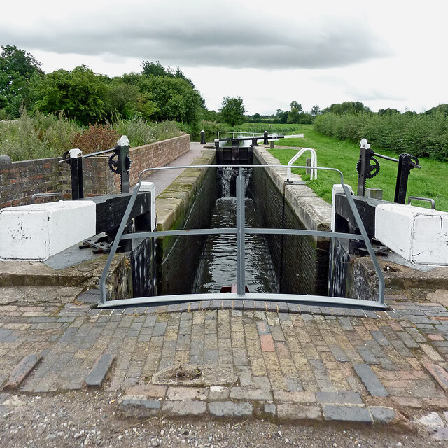
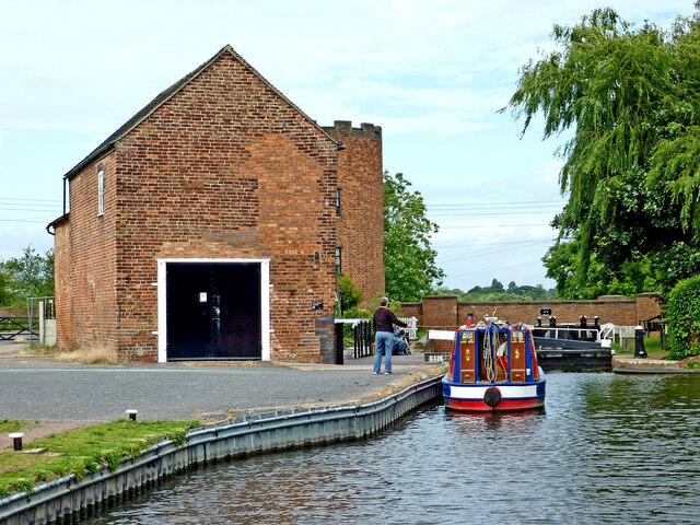
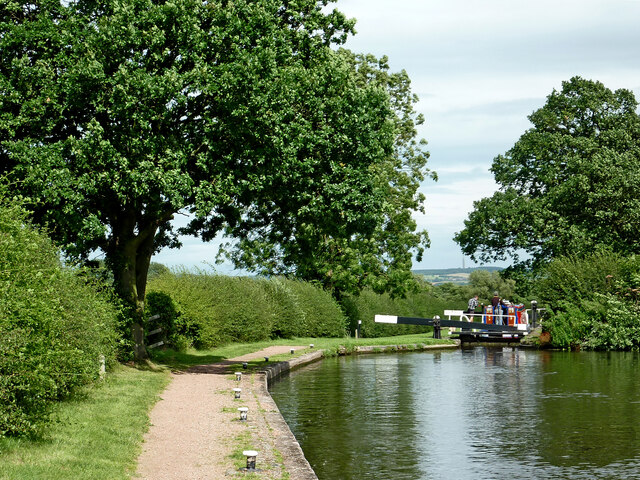
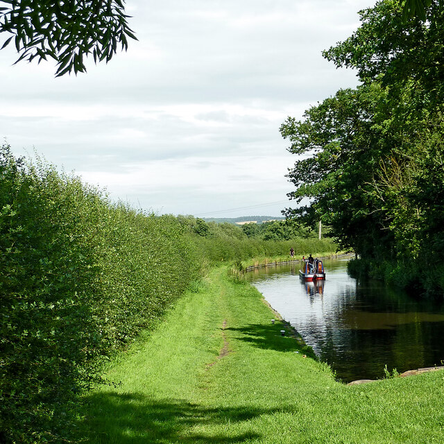
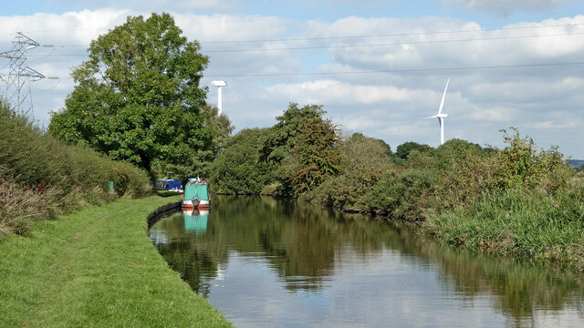
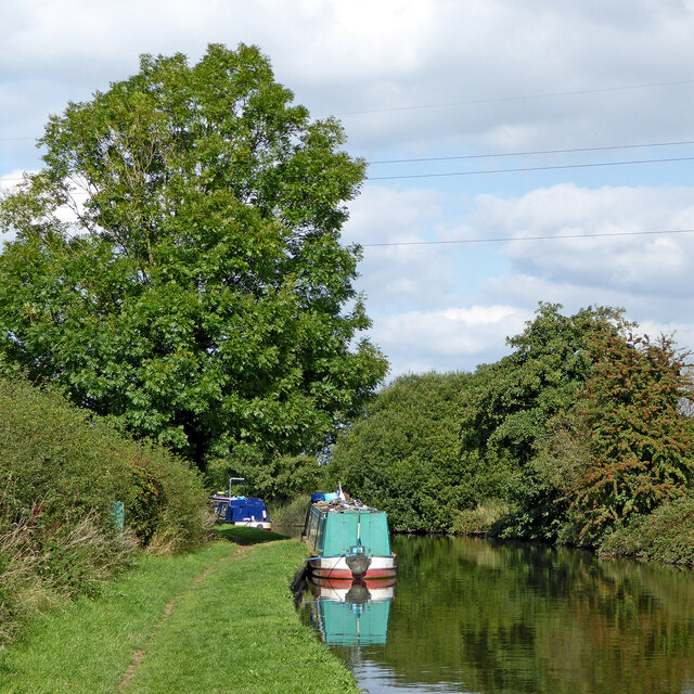
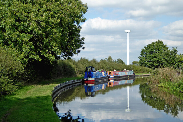
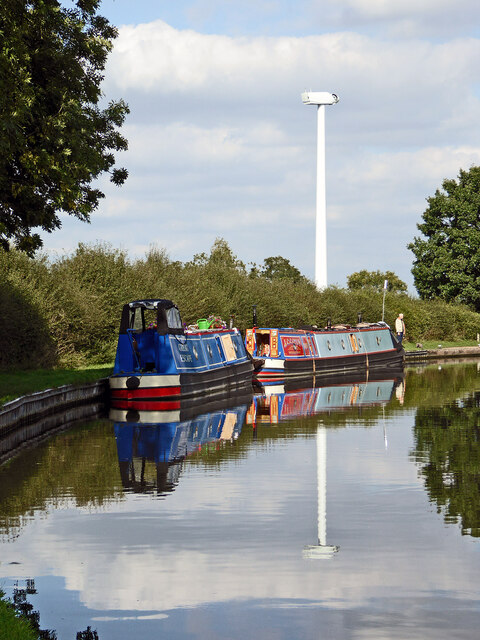
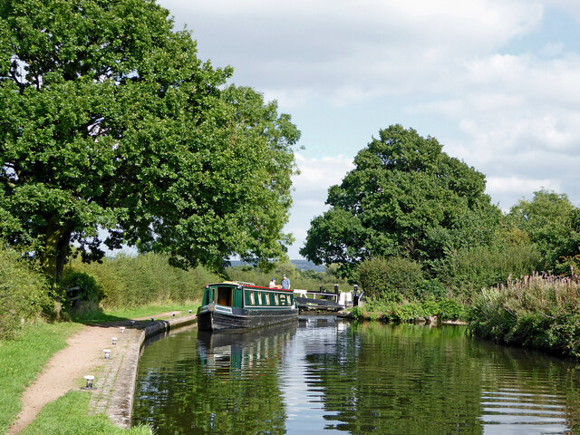
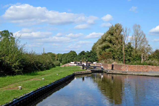
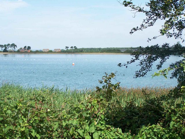
Gailey Upper Reservoir, located in Staffordshire, is a man-made freshwater body encompassing an area of approximately 44 acres. Originally constructed in the late 18th century to provide water for the nearby Shropshire Union Canal, it has since evolved into a popular recreational spot for locals and tourists alike.

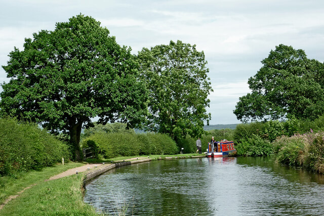
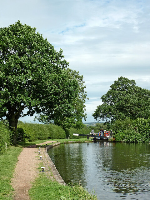
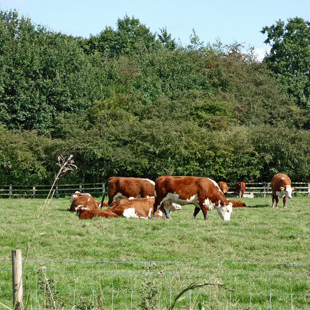
Surrounded by picturesque countryside, Gailey Upper Reservoir boasts an assortment of natural features, including lush vegetation, marshy areas, and tranquil open waters. The reservoir's diverse ecosystem supports a variety of flora and fauna, making it an ideal location for nature enthusiasts and birdwatchers. Visitors can expect to encounter a wide range of bird species, such as ducks, swans, herons, and various waterfowl.

The reservoir also offers ample opportunities for outdoor activities. Fishing enthusiasts can cast their lines in the hopes of catching carp, pike, perch, and roach, among other fish species. Additionally, the surrounding area provides scenic trails for walkers, joggers, and cyclists to explore, with numerous picnic spots dotted along the reservoir's edge.

Gailey Upper Reservoir's peaceful ambiance and serene setting are complemented by its accessibility. The site features ample parking facilities and is suitably equipped with amenities, including public toilets and seating areas. Its close proximity to nearby villages and towns further adds to its appeal, making it an easily accessible destination for day trips or a quick escape into nature.

Overall, Gailey Upper Reservoir's combination of natural beauty, recreational opportunities, and convenient location make it an attractive destination for individuals seeking to immerse themselves in Staffordshire's idyllic countryside.

If you have any feedback on the listing, please let us know in the comments section below.

Gailey Upper Reservoir Images

Images are sourced within 2km of 52.689183/-2.0908538 or Grid Reference SJ9310. Thanks to Geograph Open Source API. All images are credited.

Rodbaston Lock near Gailey in Staffordshire Rodbaston Lock is No 35 on the Staffordshire and Worcestershire Canal south of Penkridge. It provides a rise (or fall) of 8ft 6in (26 metres). Rodbaston Lock Bridge in the foreground is No 80 and used to be at the end of Gailey Lea Lane. Following construction of the nearby M6 motorway by 1968, the bridge became redundant, though a public footpath still crosses it.
Rodbaston Lock near Gailey in Staffordshire
Rodbaston Lock is No 35 on the Staffordshire and Worcestershire Canal south of Penkridge. It provides a rise (or fall) of 8ft 6in (26 metres). Rodbaston Lock Bridge in the foreground is No 80 and used to be at the end of Gailey Lea Lane. Following construction of the nearby M6 motorway by 1968, the bridge became redundant, though a public footpath still crosses it.
Canal at Gailey Lock and Bridge, Staffordshire Gailey Top Lock is No 32 on the Staffordshire and Worcestershire Canal. This is the first of four fairly widely spaced locks. The A5 Watling Street crosses the canal here.
Canal at Gailey Lock and Bridge, Staffordshire
Gailey Top Lock is No 32 on the Staffordshire and Worcestershire Canal. This is the first of four fairly widely spaced locks. The A5 Watling Street crosses the canal here.
Staffordshire and Worcestershire Canal near Gailey in Staffordshire The narrowboat is about to move into Brick Kiln Lock, No 33.
Staffordshire and Worcestershire Canal near Gailey in Staffordshire
The narrowboat is about to move into Brick Kiln Lock, No 33.
Canal at Brick Kiln Lock near Gailey, Staffordshire Brick Kiln Lock is No 33 on the Staffordshire and Worcestershire Canal near Gailey. It is one of four fairly widely spaced locks descending from Gailey Top Lock by Watling Street.
Canal at Brick Kiln Lock near Gailey, Staffordshire
Brick Kiln Lock is No 33 on the Staffordshire and Worcestershire Canal near Gailey. It is one of four fairly widely spaced locks descending from Gailey Top Lock by Watling Street.
Canal at Brick Kiln Lock near Gailey, Staffordshire Looking north-east towards Penkridge, Stafford and Great Haywood Junction (with the Trent and Mersey Canal).
Brick Kiln Lock is No 33 on the Staffordshire and Worcestershire Canal near Gailey. It is one of four fairly widely spaced locks descending from Gailey Top Lock by Watling Street.
Canal at Brick Kiln Lock near Gailey, Staffordshire
Looking north-east towards Penkridge, Stafford and Great Haywood Junction (with the Trent and Mersey Canal). Brick Kiln Lock is No 33 on the Staffordshire and Worcestershire Canal near Gailey. It is one of four fairly widely spaced locks descending from Gailey Top Lock by Watling Street.
Staffordshire and Worcestershire Canal near Gailey in Staffordshire Looking north-east towards Penkridge, from Brick Kiln Lock, No 33..
Staffordshire and Worcestershire Canal near Gailey in Staffordshire
Looking north-east towards Penkridge, from Brick Kiln Lock, No 33..
Boggs Lock near Gailey in Staffordshire Boggs Lock is No 34 on the Staffordshire and Worcestershire Canal south of Penkridge. It provides a rise (or fall) of 8ft 6in (2·6 metres).
Boggs Lock near Gailey in Staffordshire
Boggs Lock is No 34 on the Staffordshire and Worcestershire Canal south of Penkridge. It provides a rise (or fall) of 8ft 6in (2·6 metres).
Staffordshire and Worcestershire Canal near Gailey, Staffordshire Looking north towards Penkridge.
Staffordshire and Worcestershire Canal near Gailey, Staffordshire
Looking north towards Penkridge.
Canal near Gailey in Staffordshire Looking north towards Penkridge.
Canal near Gailey in Staffordshire
Looking north towards Penkridge.
Moored narrowboats near Gailey in Staffordshire This is the Staffordshire and Worcestershire Canal, about two miles south of Penkridge. The new wind turbine awaits the fitting of its blades.
Moored narrowboats near Gailey in Staffordshire
This is the Staffordshire and Worcestershire Canal, about two miles south of Penkridge. The new wind turbine awaits the fitting of its blades.
Narrowboats and a new wind turbine, Staffordshire This is the Staffordshire and Worcestershire Canal near Gailey in Staffordshire. The wind turbine awaits the fitting of its blades, and looks like a giant alien surveillance unit in a sci-fi scenario.
The moorings are near Brick Kiln Lock, No 33.
Narrowboats and a new wind turbine, Staffordshire
This is the Staffordshire and Worcestershire Canal near Gailey in Staffordshire. The wind turbine awaits the fitting of its blades, and looks like a giant alien surveillance unit in a sci-fi scenario. The moorings are near Brick Kiln Lock, No 33.
Brick Kiln Lock near Gailey in Staffordshire This is the Staffordshire and Worcestershire Canal, about two miles south of Penkridge. Brick Kiln Lock is No 33. The narrow boat has left the lock, and hadn't seen me coming or they would not have closed the top gate.
Brick Kiln Lock near Gailey in Staffordshire
This is the Staffordshire and Worcestershire Canal, about two miles south of Penkridge. Brick Kiln Lock is No 33. The narrow boat has left the lock, and hadn't seen me coming or they would not have closed the top gate.
Staffordshire pasture with wind turbines near Gailey Looking north-north-east towards Penkridge from Brick Kiln Lock on the Staffordshire and Worcestershire Canal. One turbine still awaits the fitting of its blades. The turbines are on Rodbaston College (agriculture) land.
Staffordshire pasture with wind turbines near Gailey
Looking north-north-east towards Penkridge from Brick Kiln Lock on the Staffordshire and Worcestershire Canal. One turbine still awaits the fitting of its blades. The turbines are on Rodbaston College (agriculture) land.
Wind turbine under construction The wind turbine near Rodbaston (agricultural) College in Staffordshire awaits the fitting of its blades, and looks more like a giant alien surveillance and laser gun unit in a sci-fi scenario.
Wind turbine under construction
The wind turbine near Rodbaston (agricultural) College in Staffordshire awaits the fitting of its blades, and looks more like a giant alien surveillance and laser gun unit in a sci-fi scenario.
Canal and wind turbine near Rodbaston in Staffordshire This us the Staffordshire and Worcestershire Canal about two miles south of Penkridge. The wind turbine is newly erected on Rodbaston College land 460 metres to the north.
Canal and wind turbine near Rodbaston in Staffordshire
This us the Staffordshire and Worcestershire Canal about two miles south of Penkridge. The wind turbine is newly erected on Rodbaston College land 460 metres to the north.
Cattle grazing south of Penkridge in Staffordshire The pasture is by the Staffordshire and Worcestershire Canal. The M6 motorway is behind the woodland.
Cattle grazing south of Penkridge in Staffordshire
The pasture is by the Staffordshire and Worcestershire Canal. The M6 motorway is behind the woodland.
Rodbaston Lock south of Penkridge in Staffordshire Looking north-east, Rodbaston Lock is No 35 on the Staffordshire and Worcestershire Canal, about a mile and a half south of Penkridge.
The M6 motorway is off to the right behind the trees.
Rodbaston Lock south of Penkridge in Staffordshire
Looking north-east, Rodbaston Lock is No 35 on the Staffordshire and Worcestershire Canal, about a mile and a half south of Penkridge. The M6 motorway is off to the right behind the trees.
Show me another place!

Gailey Upper Reservoir is located at Grid Ref: SJ9310 (Lat: 52.689183, Lng: -2.0908538)

Administrative County: Staffordshire

District: South Staffordshire

Police Authority: Staffordshire

What 3 Words

///sprouted.tagging.flasks. Near Cannock, Staffordshire

Related Wikis

Gailey Reservoirs

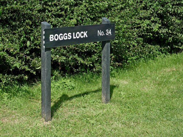
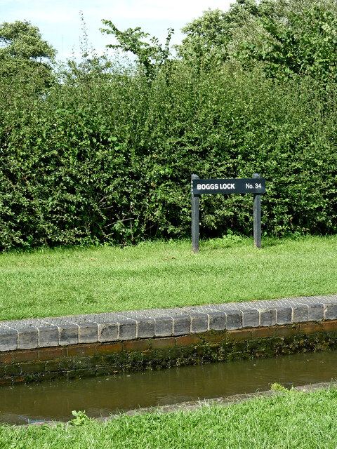
Gailey Reservoir is a pair of canal feeder reservoirs in South Staffordshire, separated by a dam, and owned by the Canal & River Trust. Gailey Upper Reservoir...

Cuttleston

Cuttleston or Cuttlestone is a hundred in the county of Staffordshire, England, located in the centre of that county, south of Stafford. Cuttleston was...

Hatherton Canal

The Hatherton Canal is a derelict branch of the Staffordshire and Worcestershire Canal in south Staffordshire, England. It was constructed in two phases...

Cannock Hockey Club

Cannock Hockey Club are an English professional field hockey team. They were established in 1905, and are based in the village of Hatherton, near Cannock...

Four Crosses, Staffordshire

Four Crosses in South Staffordshire, Staffordshire, England. Is a scattered hamlet located between Cannock and Wolverhampton. As well as Penkridge and...

Hatherton, Staffordshire

Hatherton is a settlement and civil parish located 3+1⁄4 miles (5.2 km) south-east of Penkridge, and on the western edge of modern-day Cannock, Staffordshire...

Penkridge weather station

Penkridge weather station is a weather station at Penkridge in Staffordshire, England, operated by the Met Office. It is situated on the site of Rodbaston...

The Rural Enterprise Academy

The Rural Enterprise Academy is a coeducational high school and sixth form located in Penkridge, Staffordshire, UK. It was the first dedicated land-based...

Nearby Amenities

Located within 500m of 52.689183,-2.0908538
Traffic Signals
Source: bing
Lat/Long: 52.687869/-2.0954721
Traffic Signals
Source: bing
Lat/Long: 52.6880358/-2.0955427
Traffic Signals
Source: bing
Lat/Long: 52.6879579/-2.0950225
The data included in this document is from www.openstreetmap.org. The data is made available under ODbL.

Have you been to Gailey Upper Reservoir?

Leave your review of Gailey Upper Reservoir below (or comments, questions and feedback).