The Pool
Lake, Pool, Pond, Freshwater Marsh in Northumberland
England
The Pool
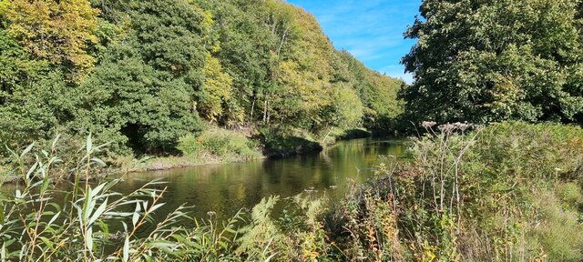
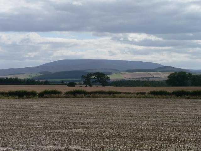
The Pool, located in Northumberland, is a serene and picturesque body of water encompassing various habitats, including a lake, pool, pond, and freshwater marsh. Nestled amidst lush greenery and bordered by rolling hills, this natural oasis offers a tranquil retreat for nature enthusiasts and outdoor lovers.
The main attraction at The Pool is its expansive lake, which stretches over several acres. With crystal-clear waters reflecting the surrounding landscape, it provides a stunning backdrop for leisurely walks along its banks or peaceful boat rides. The lake is teeming with diverse flora and fauna, including numerous species of waterfowl, fish, and aquatic plants.
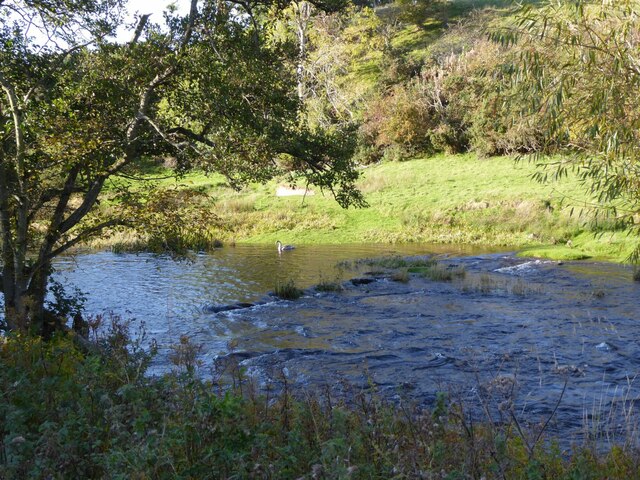
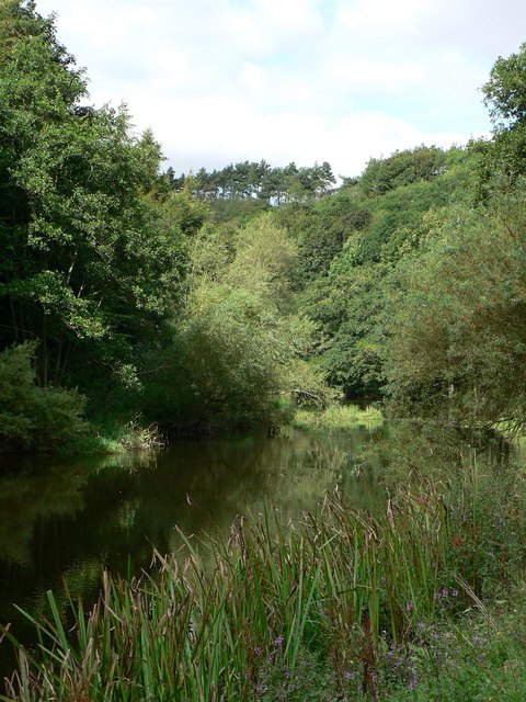
Adjacent to the lake is a smaller pool, which is more sheltered and secluded. This intimate waterbody offers a peaceful spot for visitors to relax and enjoy the soothing sounds of nature. Surrounding the pool, the area transforms into a lush wetland, forming a freshwater marsh. This marshland is a haven for various bird species, including herons, ducks, and geese, making it a perfect spot for birdwatching.
Additionally, The Pool features a charming pond, complete with lily pads and vibrant aquatic life. This smaller body of water adds to the overall diversity of habitats, providing a unique ecosystem for flora and fauna to thrive.
The Pool, Northumberland, is not just a place of natural beauty, but also a haven for wildlife and a sanctuary for those seeking tranquility in the heart of nature. Whether it's a leisurely stroll around the lake, birdwatching in the marsh, or simply enjoying the peaceful ambiance, The Pool offers a truly enchanting experience for all who visit.
If you have any feedback on the listing, please let us know in the comments section below.
The Pool Images
Images are sourced within 2km of 55.655189/-2.1194991 or Grid Reference NT9240. Thanks to Geograph Open Source API. All images are credited.


The Pool is located at Grid Ref: NT9240 (Lat: 55.655189, Lng: -2.1194991)
Unitary Authority: Northumberland
Police Authority: Northumbria
What 3 Words
///zinc.surprise.painting. Near Ford, Northumberland
Nearby Locations
Related Wikis

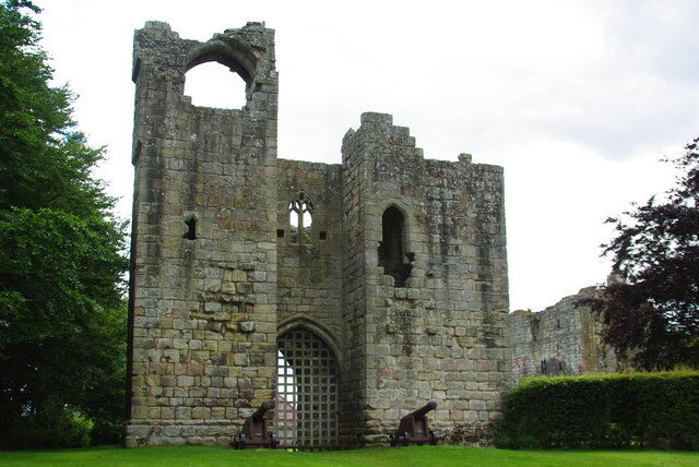
Etal Castle
Etal Castle is a ruined medieval fortification in the village of Etal, Northumberland, England. It was built around 1341 by Robert Manners, and comprised...

Etal, Northumberland
Etal ( EE-təl) is a small village in the far north of the county of Northumberland, England, in the civil parish of Ford. It lies on a bridging point of...

Ford Forge
Ford Forge (Ford Mill), Northumberland, England is located on the River Till between the villages of Ford and Etal. Buildings housing a water-powered forge...

Heatherslaw Mill
Heatherslaw Mill is a water mill situated on the Ford and Etal Estate, 7 miles north of the town of Wooler in the English county of Northumberland. It...

Crookham, Northumberland
Crookham is a village on the River Till in Northumberland, in England. It is situated approximately 8 km (5.0 mi) to the east of Coldstream and 14 km...

Duddo Tower
Duddo Tower is a Scheduled Ancient Monument and a Grade II listed building comprising the ruinous remains of an ancient pele tower and 16th century tower...
Duddo
Duddo is a village and civil parish in Northumberland, about 8 miles (13 km) southwest of Berwick-upon-Tweed. == History == Duddo Five Stones is a stone...
Heaton Castle
Heaton Castle (anciently Heton) in the parish of Cornhill-on-Tweed, Northumberland, England, is a ruined historic castle near the Scottish border. It is...
Nearby Amenities
Located within 500m of 55.655189,-2.1194991Have you been to The Pool?
Leave your review of The Pool below (or comments, questions and feedback).