Boundary Flash

Lake, Pool, Pond, Freshwater Marsh in Staffordshire Stafford

England

Boundary Flash

Wind turbines near Doxey, Staffordshire
Wind turbines near Doxey, Staffordshire Credit: Roy Hughes

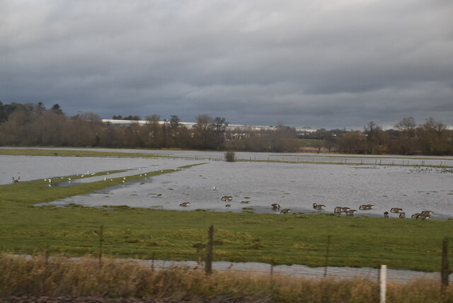
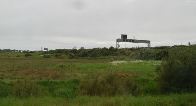
Boundary Flash is a freshwater wetland located in the county of Staffordshire, England. It is classified as a lake, pool, pond, and freshwater marsh, making it a diverse and ecologically important habitat.

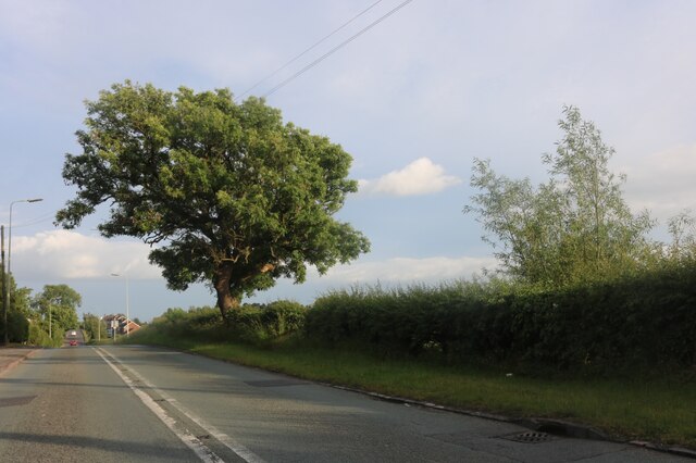
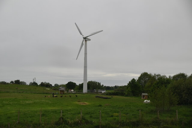
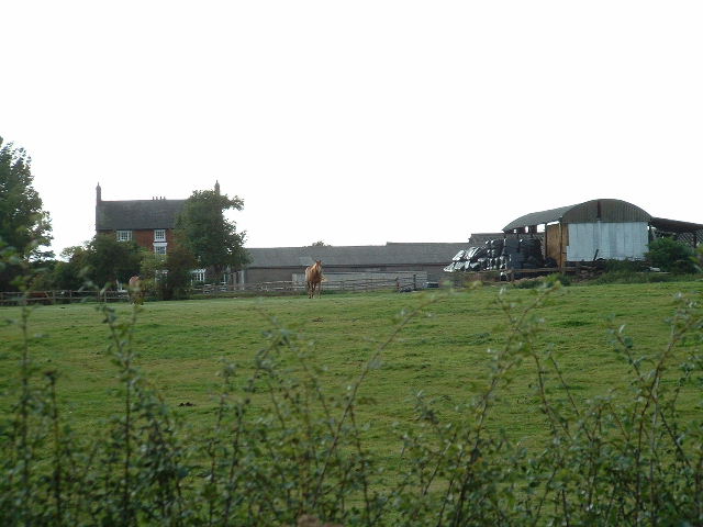
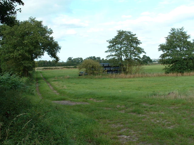
The flash covers an area of approximately 20 hectares and is situated near the village of Boundary, hence its name. It is surrounded by lush greenery and is known for its tranquil and picturesque setting. The water in the flash is sourced from nearby streams and underground springs, ensuring a constant flow of fresh water throughout the year.

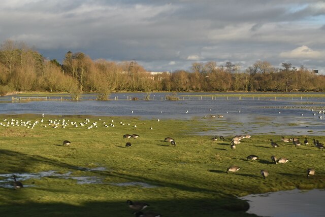
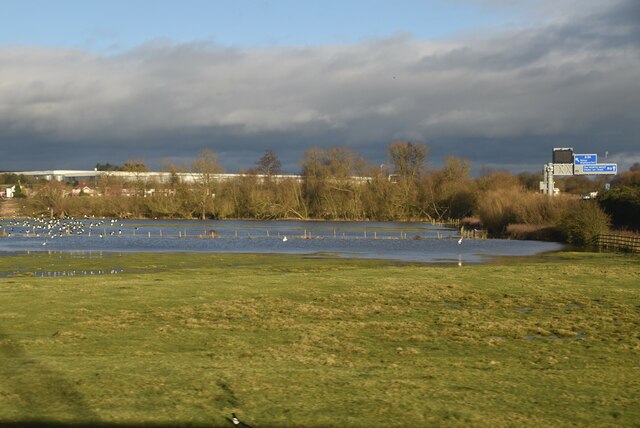
The main feature of Boundary Flash is its diverse plant and animal life. The freshwater marsh supports a wide variety of aquatic plants, such as reeds, rushes, and water lilies. These plants provide important shelter and food sources for many species of birds, insects, and fish.

Birdwatchers flock to Boundary Flash to observe the rich bird population that resides there. It is home to several species of waterfowl, including mallards, coots, and moorhens. Additionally, many migratory birds make a stop at the flash during their long journeys, adding to its avian diversity.

The flash also attracts recreational visitors who enjoy activities such as fishing and boating. Anglers come to Boundary Flash to catch species like perch, pike, and roach, while boaters can navigate the calm waters and take in the beautiful surroundings.

Overall, Boundary Flash in Staffordshire is a valuable wetland ecosystem that supports a diverse range of plant and animal life. Its scenic beauty and recreational opportunities make it a popular destination for nature enthusiasts and visitors seeking a peaceful escape.

If you have any feedback on the listing, please let us know in the comments section below.

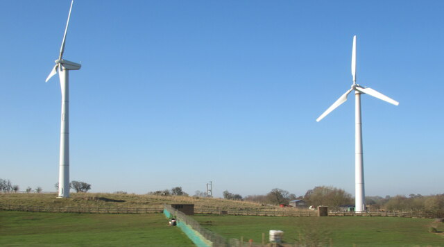
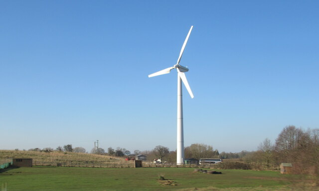
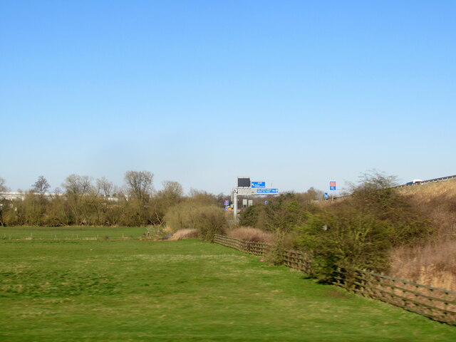
Boundary Flash Images

Images are sourced within 2km of 52.81891/-2.1381923 or Grid Reference SJ9024. Thanks to Geograph Open Source API. All images are credited.

Wind turbines near Doxey, Staffordshire
A wind turbine near Doxey, Staffordshire
Railway passing underneath the M6 Motorway south of Junction 14
Localised flooding by River Sow
Creswell Grove heading for Stafford
Wildfowl and localised flooding
Localised flooding
Localised flooding
M6 looking north to J14 from Aston Bank bridge The M6 between junctions 13 and 15 was converted to a managed motorway which was opened in August 2022
M6 looking north to J14 from Aston Bank bridge
The M6 between junctions 13 and 15 was converted to a managed motorway which was opened in August 2022
Gantry, M6 The M6 motorway runs from junction 19 of the M1 at the Catthorpe Interchange, near Rugby to the Gretna junction (J45). Here it becomes the A74(M) and M74 which continues to Glasgow.

The M6 is the longest motorway in the United Kingdom (232 miles) and one of the busiest. It incorporates the first length of motorway opened in the UK (the Preston bypass in 1958) and forms part of a motorway "Backbone of Britain", running north-south between London and Glasgow via the industrial north of England. It is also part of the east-west route between the Midlands and the east coast ports.
Gantry, M6
The M6 motorway runs from junction 19 of the M1 at the Catthorpe Interchange, near Rugby to the Gretna junction (J45). Here it becomes the A74(M) and M74 which continues to Glasgow. The M6 is the longest motorway in the United Kingdom (232 miles) and one of the busiest. It incorporates the first length of motorway opened in the UK (the Preston bypass in 1958) and forms part of a motorway "Backbone of Britain", running north-south between London and Glasgow via the industrial north of England. It is also part of the east-west route between the Midlands and the east coast ports.
Wind turbine
Wind turbine
Aston Hill Farm Looking West
Aston Hill Farm
Looking West
Farmland Farmland  - looking NE into square
Farmland
Farmland - looking NE into square
Wilkes Wood, Stafford This is Wilkes Wood, a housing estate on the very fringes of north Stafford.
Wilkes Wood, Stafford
This is Wilkes Wood, a housing estate on the very fringes of north Stafford.
Farm Track to Wilkes Wood This track leads from the housing estate of Wilkes Wood to the small woodland called Wilkes Wood.  This is private land so I was not able to get to photograph the woodland.
Farm Track to Wilkes Wood
This track leads from the housing estate of Wilkes Wood to the small woodland called Wilkes Wood. This is private land so I was not able to get to photograph the woodland.
Chapel Ruins Creswell Chapel on the A5013 near Stafford. The story (I was told today) is that this chapel dates back about 1000yrs. A ruin for many years, this C of E chapel had an annual service held here until about 5 years ago.
Chapel Ruins
Creswell Chapel on the A5013 near Stafford. The story (I was told today) is that this chapel dates back about 1000yrs. A ruin for many years, this C of E chapel had an annual service held here until about 5 years ago.
A5013 to Stafford This is the A5013 at Creswell. The trees on the left are the edge of Rowe's Wood, named after a former head gamekeeper.
A5013 to Stafford
This is the A5013 at Creswell. The trees on the left are the edge of Rowe's Wood, named after a former head gamekeeper.
Rowe's Wood, Creswell This field and woodland are at the side of the A5013, Stafford to Eccleshall Road at Creswell. The wood is called Rowe's Wood after a former Head Gamekeeper.
Rowe's Wood, Creswell
This field and woodland are at the side of the A5013, Stafford to Eccleshall Road at Creswell. The wood is called Rowe's Wood after a former Head Gamekeeper.
A5013 to Eccleshall This is a view of the A5013 near Creswell looking in the direction of Eccleshall. A treacherous road for cyclists; we are forced to use the narrow footpath (unless very brave!).
A5013 to Eccleshall
This is a view of the A5013 near Creswell looking in the direction of Eccleshall. A treacherous road for cyclists; we are forced to use the narrow footpath (unless very brave!).
Show me another place!

Boundary Flash is located at Grid Ref: SJ9024 (Lat: 52.81891, Lng: -2.1381923)

Administrative County: Staffordshire

District: Stafford

Police Authority: Staffordshire

What 3 Words

///slip.finger.scout. Near Stafford, Staffordshire

Related Wikis

Doxey Marshes

Doxey Marshes is a 150 hectares (370 acres) nature reserve located within two miles of Stafford town centre, and is managed by Staffordshire Wildlife Trust...

Holmcroft

Holmcroft is the name of a Stafford, Staffordshire, England, residential estate approximately 1½ miles north of Stafford town centre, situated in a geographic...

Tillington, Staffordshire

Tillington is an area of Stafford, in Staffordshire, England. The area lies about 1½ miles north of the town centre. Essentially, the district lies within...

Doxey

Doxey is a village and civil parish in the borough of Stafford in Staffordshire, England. It is a north-western suburb of Stafford. The village became...

Sir Graham Balfour School

Sir Graham Balfour School is a coeducational secondary school and sixth form located in Stafford, England. It is named after Graham Balfour, son of the...

Creswell, Staffordshire

Creswell is a small village on the north-western edge of Stafford, the county town of Staffordshire, England situated on elevated ground above the wide...

Stafford Common railway station

Stafford Common railway station was a former British railway station on the outskirts of Stafford. It was opened by the Stafford and Uttoxeter Railway...
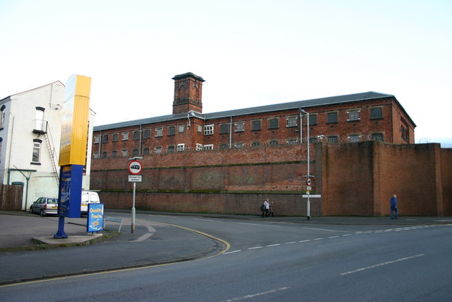
HM Prison Stafford

HM Prison Stafford is a Category C men's prison, located in Stafford, Staffordshire, England. The prison is operated by His Majesty's Prison Service. In...

Nearby Amenities

Located within 500m of 52.81891,-2.1381923
Turning Circle
Lat/Long: 52.8209647/-2.1323548
Post Box
Brand: Royal Mail
Brand Wikidata: Q638098
Brand Wikipedia: en:Royal Mail
Collection Times: Mo-Fr 16:15; Sa 09:00
Operator: Royal Mail
Operator Wikidata: Q638098
Post Box Type: lamp
Ref: ST16 47
Royal Cypher: EIIR
Royal Cypher Wikidata: Q33102113
Lat/Long: 52.8192546/-2.1320534
Crossing
Lat/Long: 52.8217273/-2.1324609
The Co-operative Food
Addr Housenumber: 52-56
Addr Postcode: ST16 1JB
Addr Street: Holmcroft Road
Fhrs Id: 1196047
Opening Hours: Mo-Su 07:00-22:00
Operator: Central England Co-operative
Operator Wikidata: Q16986583
Shop: supermarket
Source Addr: FHRS Open Data
Website: https://stores.centralengland.coop/staffordshire/stafford/52-56-holmcroft-road
Lat/Long: 52.8212531/-2.1326065
Atm
Lat/Long: 52.8213029/-2.132575
Noexit: yes
Lat/Long: 52.8213367/-2.1361229
Noexit: yes
Lat/Long: 52.8206239/-2.1349829
Bench
Lat/Long: 52.8216133/-2.1338502
Bus Stop
Brooklands School
Bus: yes
Naptan AtcoCode: 3800C736501
Naptan Bearing: SE
Naptan CommonName: Brooklands School
Naptan Indicator: Opp
Naptan Landmark: Brooklands School
Naptan PlusbusZoneRef: STAFFRD
Naptan Street: Eccleshall Road
Naptan Verified: no
Public Transport: platform
Source: naptan_import
Lat/Long: 52.8194317/-2.1323934
Bus Stop
Brooklands School
Bus: yes
Naptan AtcoCode: 3800C736502
Naptan Bearing: NW
Naptan CommonName: Brooklands School
Naptan Indicator: Adj
Naptan Landmark: Brooklands School
Naptan PlusbusZoneRef: STAFFRD
Naptan Street: Eccleshall Road
Naptan Verified: no
Public Transport: platform
Source: naptan_import
Lat/Long: 52.8186958/-2.1313079
Bus Stop
Holmcroft Road
Bus: yes
Naptan AtcoCode: 3800C736701
Naptan Bearing: N
Naptan CommonName: Holmcroft Road
Naptan Indicator: Opp
Naptan Landmark: Croft Road
Naptan PlusbusZoneRef: STAFFRD
Naptan Street: Eccleshall Road
Naptan Verified: no
Public Transport: platform
Source: naptan_import
Lat/Long: 52.8203911/-2.1345925
Bus Stop
Tillington Hall Hotel
Bus: yes
Naptan AtcoCode: 3800C736702
Naptan Bearing: SE
Naptan CommonName: Tillington Hall Hotel
Naptan Indicator: Adj
Naptan Landmark: Tillington Hall Hotel
Naptan PlusbusZoneRef: STAFFRD
Naptan Street: Eccleshall Rd
Naptan Verified: no
Public Transport: platform
Source: naptan_import
Lat/Long: 52.8216123/-2.1358428
Bus Stop
Woodlands Road
Bus: yes
Naptan AtcoCode: 3800C737001
Naptan Bearing: SE
Naptan CommonName: Woodlands Road
Naptan Indicator: Adj
Naptan Landmark: Woodlands Road
Naptan PlusbusZoneRef: STAFFRD
Naptan Street: Eccleshall Road
Naptan Verified: no
Public Transport: platform
Source: naptan_import
Lat/Long: 52.8226527/-2.1379533
Bus Stop
Meakin Grove
Bus: yes
Naptan AtcoCode: 3800C737002
Naptan Bearing: NW
Naptan CommonName: Meakin Grove
Naptan Indicator: Opp
Naptan Landmark: Meakin Grove
Naptan PlusbusZoneRef: STAFFRD
Naptan Street: Eccleshall Road
Naptan Verified: no
Public Transport: platform
Source: naptan_import
Lat/Long: 52.8222756/-2.1375366
Dentist
PURE Dental Solutions
Healthcare: dentist
Lat/Long: 52.8219129/-2.1374316
Man Made: pumping_station
Pumping Station: wastewater
Lat/Long: 52.8214875/-2.1435432
Clean Express
Shop: laundry
Lat/Long: 52.8213721/-2.1324764
Shop: hairdresser
Lat/Long: 52.8213993/-2.1324285
Coral
Brand: Coral
Brand Wikidata: Q54621344
Brand Wikipedia: en:Coral (bookmaker)
Shop: bookmaker
Lat/Long: 52.8214248/-2.1324117
Barrier: kissing_gate
Lat/Long: 52.8199693/-2.1397922
Bench
Lat/Long: 52.8154652/-2.1369477
Bench
Lat/Long: 52.8181667/-2.1392353
Bench
Lat/Long: 52.817898/-2.1389951
Bench
Lat/Long: 52.8150554/-2.1355898
Board Type: wildlife
Information: map;board
Tourism: information
Lat/Long: 52.8182899/-2.1394942
Entrance: yes
Lat/Long: 52.8166141/-2.1412459
Post Box
Brand: Royal Mail
Brand Wikidata: Q638098
Brand Wikipedia: en:Royal Mail
Operator: Royal Mail
Operator Wikidata: Q638098
Post Box Type: pillar
Postal Code: ST16
Royal Cypher: GR
Royal Cypher Wikidata: Q33102273
Lat/Long: 52.8220075/-2.1370185
Generator Method: photovoltaic
Generator Output Electricity: yes
Generator Source: solar
Generator Type: solar_photovoltaic_panel
Location: roof
Power: generator
Lat/Long: 52.822621/-2.1399951
Generator Method: photovoltaic
Generator Output Electricity: yes
Generator Source: solar
Generator Type: solar_photovoltaic_panel
Location: roof
Power: generator
Lat/Long: 52.8224832/-2.1397376
Generator Method: photovoltaic
Generator Output Electricity: yes
Generator Source: solar
Generator Type: solar_photovoltaic_panel
Location: roof
Power: generator
Lat/Long: 52.8228722/-2.1404591
Generator Method: photovoltaic
Generator Output Electricity: yes
Generator Source: solar
Generator Type: solar_photovoltaic_panel
Location: roof
Power: generator
Lat/Long: 52.8219824/-2.1406174
Generator Method: photovoltaic
Generator Output Electricity: yes
Generator Source: solar
Generator Type: solar_photovoltaic_panel
Location: roof
Power: generator
Lat/Long: 52.8223276/-2.1404243
Generator Method: photovoltaic
Generator Output Electricity: yes
Generator Source: solar
Generator Type: solar_photovoltaic_panel
Location: roof
Power: generator
Lat/Long: 52.8224232/-2.1405637
Generator Method: photovoltaic
Generator Output Electricity: yes
Generator Source: solar
Generator Type: solar_photovoltaic_panel
Location: roof
Power: generator
Lat/Long: 52.8222903/-2.1407917
Generator Method: photovoltaic
Generator Output Electricity: yes
Generator Source: solar
Generator Type: solar_photovoltaic_panel
Location: roof
Power: generator
Lat/Long: 52.8222206/-2.1408802
Generator Method: photovoltaic
Generator Output Electricity: yes
Generator Source: solar
Generator Type: solar_photovoltaic_panel
Location: roof
Power: generator
Lat/Long: 52.8220731/-2.1416795
Generator Method: photovoltaic
Generator Output Electricity: yes
Generator Source: solar
Generator Type: solar_photovoltaic_panel
Location: roof
Power: generator
Lat/Long: 52.8222158/-2.1419343
Generator Method: photovoltaic
Generator Output Electricity: yes
Generator Source: solar
Generator Type: solar_photovoltaic_panel
Location: roof
Power: generator
Lat/Long: 52.8212351/-2.139751
Generator Method: photovoltaic
Generator Output Electricity: yes
Generator Source: solar
Generator Type: solar_photovoltaic_panel
Location: roof
Power: generator
Lat/Long: 52.8199919/-2.1386755
Generator Method: photovoltaic
Generator Output Electricity: yes
Generator Source: solar
Generator Type: solar_photovoltaic_panel
Location: roof
Power: generator
Lat/Long: 52.8200778/-2.1394399
Generator Method: photovoltaic
Generator Output Electricity: yes
Generator Source: solar
Generator Type: solar_photovoltaic_panel
Location: roof
Power: generator
Lat/Long: 52.8204733/-2.1370983
Generator Method: photovoltaic
Generator Output Electricity: yes
Generator Source: solar
Generator Type: solar_photovoltaic_panel
Location: roof
Power: generator
Lat/Long: 52.8201362/-2.136822
Generator Method: photovoltaic
Generator Output Electricity: yes
Generator Source: solar
Generator Type: solar_photovoltaic_panel
Location: roof
Power: generator
Lat/Long: 52.8201378/-2.1366343
Generator Method: photovoltaic
Generator Output Electricity: yes
Generator Source: solar
Generator Type: solar_photovoltaic_panel
Location: roof
Power: generator
Lat/Long: 52.8201021/-2.1365297
Generator Method: photovoltaic
Generator Output Electricity: yes
Generator Source: solar
Generator Type: solar_photovoltaic_panel
Location: roof
Power: generator
Lat/Long: 52.8201897/-2.1348479
Generator Method: photovoltaic
Generator Output Electricity: yes
Generator Source: solar
Generator Type: solar_photovoltaic_panel
Location: roof
Power: generator
Lat/Long: 52.8198412/-2.1343973
Generator Method: photovoltaic
Generator Output Electricity: yes
Generator Source: solar
Generator Type: solar_photovoltaic_panel
Location: roof
Power: generator
Lat/Long: 52.8194181/-2.1333995
Generator Method: photovoltaic
Generator Output Electricity: yes
Generator Source: solar
Generator Type: solar_photovoltaic_panel
Location: roof
Power: generator
Lat/Long: 52.8193792/-2.1333191
Generator Method: photovoltaic
Generator Output Electricity: yes
Generator Source: solar
Generator Type: solar_photovoltaic_panel
Location: roof
Power: generator
Lat/Long: 52.818311/-2.1322703
Generator Method: photovoltaic
Generator Output Electricity: yes
Generator Source: solar
Generator Type: solar_photovoltaic_panel
Location: roof
Power: generator
Lat/Long: 52.8183872/-2.1324232
Generator Method: photovoltaic
Generator Output Electricity: yes
Generator Source: solar
Generator Type: solar_photovoltaic_panel
Location: roof
Power: generator
Lat/Long: 52.8184245/-2.1325493
Generator Method: photovoltaic
Generator Output Electricity: yes
Generator Source: solar
Generator Type: solar_photovoltaic_panel
Location: roof
Power: generator
Lat/Long: 52.8185023/-2.1327156
Generator Method: photovoltaic
Generator Output Electricity: yes
Generator Source: solar
Generator Type: solar_photovoltaic_panel
Location: roof
Power: generator
Lat/Long: 52.8222482/-2.1379834
Generator Method: photovoltaic
Generator Output Electricity: yes
Generator Source: solar
Generator Type: solar_photovoltaic_panel
Location: roof
Power: generator
Lat/Long: 52.8226258/-2.1374041
Entrance: main
Lat/Long: 52.8217593/-2.1329337
The data included in this document is from www.openstreetmap.org. The data is made available under ODbL.

Have you been to Boundary Flash?

Leave your review of Boundary Flash below (or comments, questions and feedback).