Cresswell Flash

Lake, Pool, Pond, Freshwater Marsh in Staffordshire Stafford

England

Cresswell Flash

Wind turbines near Doxey, Staffordshire
Wind turbines near Doxey, Staffordshire Credit: Roy Hughes

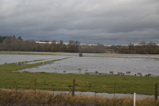
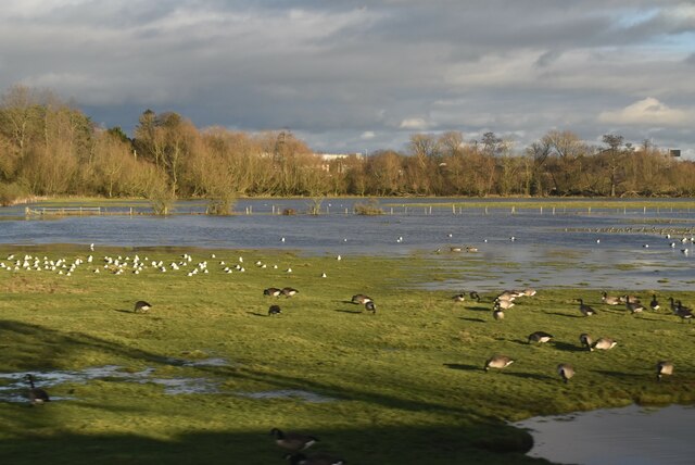
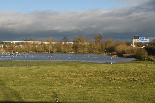
Cresswell Flash, located in Staffordshire, is a natural freshwater marsh that encompasses a lake, pool, and pond. It is a picturesque and ecologically diverse area, attracting both nature enthusiasts and visitors looking for a peaceful retreat.

The flash is well-known for its stunning lake, which spans over a considerable area. The lake is characterized by clear, calm waters, surrounded by lush vegetation and tall reeds that provide habitat for various bird species. It offers a serene environment for fishing, boating, and wildlife watching.

Adjacent to the lake, there is a pool that adds to the charm of Cresswell Flash. This smaller body of water is often frequented by waterfowl, such as ducks and geese, which can be observed from designated viewing areas. The pool is also popular among birdwatchers who come to spot and identify different avian species.

Furthermore, Cresswell Flash features a tranquil pond, perfect for those seeking a peaceful spot to relax and enjoy the natural surroundings. The pond is adorned with water lilies and other aquatic plants, creating a visually pleasing atmosphere.

The freshwater marsh surrounding the lake, pool, and pond is teeming with biodiversity. It supports a wide range of plant and animal life, including rare and protected species. Visitors can explore the marsh on well-maintained trails, immersing themselves in the rich natural heritage of the area.

Cresswell Flash in Staffordshire is a haven for nature lovers, offering a unique blend of water bodies, marshland, and diverse wildlife. Its serene beauty and ecological importance make it a must-visit destination for those seeking a tranquil escape in the heart of nature.

If you have any feedback on the listing, please let us know in the comments section below.

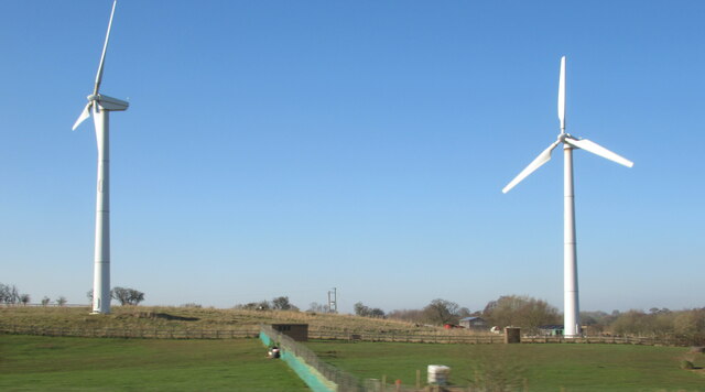
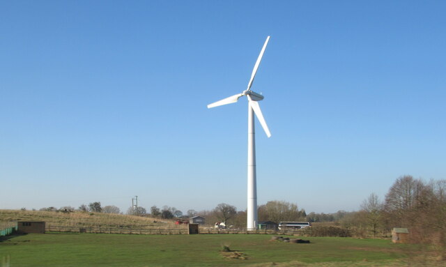
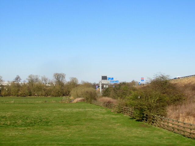
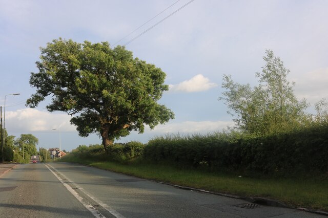
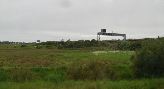
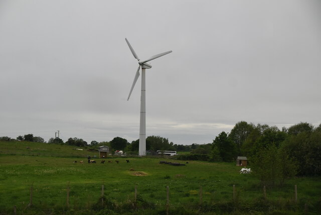
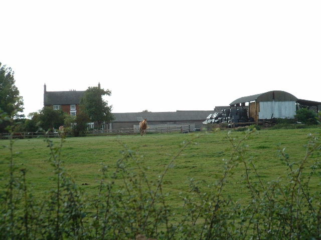
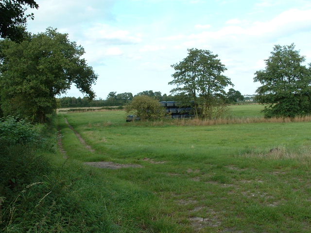
Cresswell Flash Images

Images are sourced within 2km of 52.820485/-2.1441032 or Grid Reference SJ9024. Thanks to Geograph Open Source API. All images are credited.

Wind turbines near Doxey, Staffordshire
A wind turbine near Doxey, Staffordshire
Railway passing underneath the M6 Motorway south of Junction 14
Localised flooding by River Sow
Creswell Grove heading for Stafford
Wildfowl and localised flooding
Localised flooding
Localised flooding
M6 looking north to J14 from Aston Bank bridge The M6 between junctions 13 and 15 was converted to a managed motorway which was opened in August 2022
M6 looking north to J14 from Aston Bank bridge
The M6 between junctions 13 and 15 was converted to a managed motorway which was opened in August 2022
Gantry, M6 The M6 motorway runs from junction 19 of the M1 at the Catthorpe Interchange, near Rugby to the Gretna junction (J45). Here it becomes the A74(M) and M74 which continues to Glasgow.

The M6 is the longest motorway in the United Kingdom (232 miles) and one of the busiest. It incorporates the first length of motorway opened in the UK (the Preston bypass in 1958) and forms part of a motorway "Backbone of Britain", running north-south between London and Glasgow via the industrial north of England. It is also part of the east-west route between the Midlands and the east coast ports.
Gantry, M6
The M6 motorway runs from junction 19 of the M1 at the Catthorpe Interchange, near Rugby to the Gretna junction (J45). Here it becomes the A74(M) and M74 which continues to Glasgow. The M6 is the longest motorway in the United Kingdom (232 miles) and one of the busiest. It incorporates the first length of motorway opened in the UK (the Preston bypass in 1958) and forms part of a motorway "Backbone of Britain", running north-south between London and Glasgow via the industrial north of England. It is also part of the east-west route between the Midlands and the east coast ports.
Wind turbine
Wind turbine
Aston Hill Farm Looking West
Aston Hill Farm
Looking West
Farmland Farmland  - looking NE into square
Farmland
Farmland - looking NE into square
Wilkes Wood, Stafford This is Wilkes Wood, a housing estate on the very fringes of north Stafford.
Wilkes Wood, Stafford
This is Wilkes Wood, a housing estate on the very fringes of north Stafford.
Farm Track to Wilkes Wood This track leads from the housing estate of Wilkes Wood to the small woodland called Wilkes Wood.  This is private land so I was not able to get to photograph the woodland.
Farm Track to Wilkes Wood
This track leads from the housing estate of Wilkes Wood to the small woodland called Wilkes Wood. This is private land so I was not able to get to photograph the woodland.
Chapel Ruins Creswell Chapel on the A5013 near Stafford. The story (I was told today) is that this chapel dates back about 1000yrs. A ruin for many years, this C of E chapel had an annual service held here until about 5 years ago.
Chapel Ruins
Creswell Chapel on the A5013 near Stafford. The story (I was told today) is that this chapel dates back about 1000yrs. A ruin for many years, this C of E chapel had an annual service held here until about 5 years ago.
A5013 to Stafford This is the A5013 at Creswell. The trees on the left are the edge of Rowe's Wood, named after a former head gamekeeper.
A5013 to Stafford
This is the A5013 at Creswell. The trees on the left are the edge of Rowe's Wood, named after a former head gamekeeper.
Rowe's Wood, Creswell This field and woodland are at the side of the A5013, Stafford to Eccleshall Road at Creswell. The wood is called Rowe's Wood after a former Head Gamekeeper.
Rowe's Wood, Creswell
This field and woodland are at the side of the A5013, Stafford to Eccleshall Road at Creswell. The wood is called Rowe's Wood after a former Head Gamekeeper.
A5013 to Eccleshall This is a view of the A5013 near Creswell looking in the direction of Eccleshall. A treacherous road for cyclists; we are forced to use the narrow footpath (unless very brave!).
A5013 to Eccleshall
This is a view of the A5013 near Creswell looking in the direction of Eccleshall. A treacherous road for cyclists; we are forced to use the narrow footpath (unless very brave!).
Show me another place!

Cresswell Flash is located at Grid Ref: SJ9024 (Lat: 52.820485, Lng: -2.1441032)

Administrative County: Staffordshire

District: Stafford

Police Authority: Staffordshire

What 3 Words

///minds.drag.passes. Near Stafford, Staffordshire

Related Wikis

Doxey Marshes

Doxey Marshes is a 150 hectares (370 acres) nature reserve located within two miles of Stafford town centre, and is managed by Staffordshire Wildlife Trust...

Doxey

Doxey is a village and civil parish in the borough of Stafford in Staffordshire, England. It is a north-western suburb of Stafford. The village became...

Holmcroft

Holmcroft is the name of a Stafford, Staffordshire, England, residential estate approximately 1½ miles north of Stafford town centre, situated in a geographic...

Creswell, Staffordshire

Creswell is a small village on the north-western edge of Stafford, the county town of Staffordshire, England situated on elevated ground above the wide...

Tillington, Staffordshire

Tillington is an area of Stafford, in Staffordshire, England. The area lies about 1½ miles north of the town centre. Essentially, the district lies within...

Sir Graham Balfour School

Sir Graham Balfour School is a coeducational secondary school and sixth form located in Stafford, England. It is named after Graham Balfour, son of the...

Stafford Common railway station

Stafford Common railway station was a former British railway station on the outskirts of Stafford. It was opened by the Stafford and Uttoxeter Railway...

Stafford power station

Stafford power station supplied electricity to the town of Stafford, England and the surrounding area from 1895 to 1958. It was initially owned and operated...

Nearby Amenities

Located within 500m of 52.820485,-2.1441032
Bus Stop
Woodlands Road
Bus: yes
Naptan AtcoCode: 3800C737001
Naptan Bearing: SE
Naptan CommonName: Woodlands Road
Naptan Indicator: Adj
Naptan Landmark: Woodlands Road
Naptan PlusbusZoneRef: STAFFRD
Naptan Street: Eccleshall Road
Naptan Verified: no
Public Transport: platform
Source: naptan_import
Lat/Long: 52.8226527/-2.1379533
Bus Stop
Meakin Grove
Bus: yes
Naptan AtcoCode: 3800C737002
Naptan Bearing: NW
Naptan CommonName: Meakin Grove
Naptan Indicator: Opp
Naptan Landmark: Meakin Grove
Naptan PlusbusZoneRef: STAFFRD
Naptan Street: Eccleshall Road
Naptan Verified: no
Public Transport: platform
Source: naptan_import
Lat/Long: 52.8222756/-2.1375366
Bus Stop
Creswell Farm Drive
Bus: yes
Naptan AtcoCode: 3800C790900
Naptan Bearing: SE
Naptan CommonName: Creswell Farm Drive
Naptan Indicator: Opp
Naptan Landmark: Creswell Farm Drive
Naptan PlusbusZoneRef: STAFFRD
Naptan Street: Eccleshall Rd
Naptan Verified: no
Public Transport: platform
Source: naptan_import
Lat/Long: 52.8239718/-2.1399907
Bus Stop
Creswell Farm Drive
Bus: yes
Naptan AtcoCode: 3800C790901
Naptan Bearing: NW
Naptan CommonName: Creswell Farm Drive
Naptan Indicator: Adj
Naptan Landmark: Creswell Farm Drive
Naptan PlusbusZoneRef: STAFFRD
Naptan Street: Eccleshall Road
Naptan Verified: no
Public Transport: platform
Source: naptan_import
Lat/Long: 52.8241975/-2.1407041
Turning Circle
Lat/Long: 52.8237301/-2.1445984
Turning Circle
Lat/Long: 52.8239102/-2.1445377
Dentist
PURE Dental Solutions
Healthcare: dentist
Lat/Long: 52.8219129/-2.1374316
Man Made: pumping_station
Pumping Station: wastewater
Lat/Long: 52.8214875/-2.1435432
Barrier: bollard
Lat/Long: 52.8234034/-2.1449668
Barrier: kissing_gate
Lat/Long: 52.8199693/-2.1397922
Barrier: kissing_gate
Lat/Long: 52.8243008/-2.146718
Barrier: bollard
Lat/Long: 52.8224404/-2.1445251
Man Made: surveillance
Source: survey
Lat/Long: 52.8219384/-2.1504225
Bench
Lat/Long: 52.8181667/-2.1392353
Bench
Lat/Long: 52.817898/-2.1389951
Board Type: wildlife
Information: map;board
Tourism: information
Lat/Long: 52.8182899/-2.1394942
Entrance: yes
Lat/Long: 52.8166141/-2.1412459
Generator Method: photovoltaic
Generator Output Electricity: yes
Generator Source: solar
Generator Type: solar_photovoltaic_panel
Location: roof
Power: generator
Lat/Long: 52.8241461/-2.1410492
Generator Method: photovoltaic
Generator Output Electricity: yes
Generator Source: solar
Generator Type: solar_photovoltaic_panel
Location: roof
Power: generator
Lat/Long: 52.822621/-2.1399951
Generator Method: photovoltaic
Generator Output Electricity: yes
Generator Source: solar
Generator Type: solar_photovoltaic_panel
Location: roof
Power: generator
Lat/Long: 52.8224832/-2.1397376
Generator Method: photovoltaic
Generator Output Electricity: yes
Generator Source: solar
Generator Type: solar_photovoltaic_panel
Location: roof
Power: generator
Lat/Long: 52.8228722/-2.1404591
Generator Method: photovoltaic
Generator Output Electricity: yes
Generator Source: solar
Generator Type: solar_photovoltaic_panel
Location: roof
Power: generator
Lat/Long: 52.8219824/-2.1406174
Generator Method: photovoltaic
Generator Output Electricity: yes
Generator Source: solar
Generator Type: solar_photovoltaic_panel
Location: roof
Power: generator
Lat/Long: 52.8223276/-2.1404243
Generator Method: photovoltaic
Generator Output Electricity: yes
Generator Source: solar
Generator Type: solar_photovoltaic_panel
Location: roof
Power: generator
Lat/Long: 52.8224232/-2.1405637
Generator Method: photovoltaic
Generator Output Electricity: yes
Generator Source: solar
Generator Type: solar_photovoltaic_panel
Location: roof
Power: generator
Lat/Long: 52.8222903/-2.1407917
Generator Method: photovoltaic
Generator Output Electricity: yes
Generator Source: solar
Generator Type: solar_photovoltaic_panel
Location: roof
Power: generator
Lat/Long: 52.8222206/-2.1408802
Generator Method: photovoltaic
Generator Output Electricity: yes
Generator Source: solar
Generator Type: solar_photovoltaic_panel
Location: roof
Power: generator
Lat/Long: 52.8220731/-2.1416795
Generator Method: photovoltaic
Generator Output Electricity: yes
Generator Source: solar
Generator Type: solar_photovoltaic_panel
Location: roof
Power: generator
Lat/Long: 52.8222158/-2.1419343
Generator Method: photovoltaic
Generator Output Electricity: yes
Generator Source: solar
Generator Type: solar_photovoltaic_panel
Location: roof
Power: generator
Lat/Long: 52.8212351/-2.139751
Generator Method: photovoltaic
Generator Output Electricity: yes
Generator Source: solar
Generator Type: solar_photovoltaic_panel
Location: roof
Power: generator
Lat/Long: 52.8199919/-2.1386755
Generator Method: photovoltaic
Generator Output Electricity: yes
Generator Source: solar
Generator Type: solar_photovoltaic_panel
Location: roof
Power: generator
Lat/Long: 52.8200778/-2.1394399
Generator Method: photovoltaic
Generator Output Electricity: yes
Generator Source: solar
Generator Type: solar_photovoltaic_panel
Location: roof
Power: generator
Lat/Long: 52.8204733/-2.1370983
Generator Method: photovoltaic
Generator Output Electricity: yes
Generator Source: solar
Generator Type: solar_photovoltaic_panel
Location: roof
Power: generator
Lat/Long: 52.8201362/-2.136822
Generator Method: photovoltaic
Generator Output Electricity: yes
Generator Source: solar
Generator Type: solar_photovoltaic_panel
Location: roof
Power: generator
Lat/Long: 52.8234865/-2.1389383
Generator Method: photovoltaic
Generator Output Electricity: yes
Generator Source: solar
Generator Type: solar_photovoltaic_panel
Location: roof
Power: generator
Lat/Long: 52.8222482/-2.1379834
Barrier: stile
Foot: yes
Lat/Long: 52.8230784/-2.145961
Noexit: yes
Lat/Long: 52.8238098/-2.1456291
The data included in this document is from www.openstreetmap.org. The data is made available under ODbL.

Have you been to Cresswell Flash?

Leave your review of Cresswell Flash below (or comments, questions and feedback).