Upper Pool
Lake, Pool, Pond, Freshwater Marsh in Staffordshire South Staffordshire
England
Upper Pool
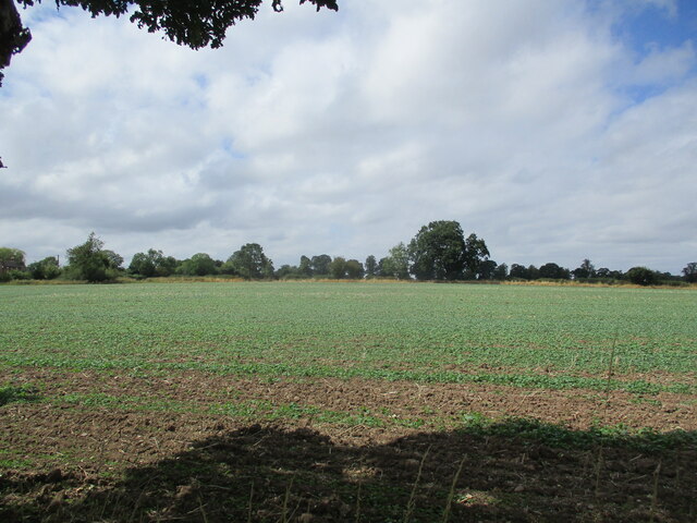
Upper Pool is a freshwater lake located in Staffordshire, England. Spanning an area of approximately 50 acres, it is known for its serene beauty and abundance of wildlife. The lake is situated within a larger nature reserve, surrounded by lush vegetation and rolling hills.
Upper Pool is a popular spot for outdoor enthusiasts, offering a variety of recreational activities. Fishing is a common pastime here, with the lake being home to various species of fish, including pike, perch, and roach. Anglers can enjoy the peace and tranquility of the surroundings while trying to land their catch.
Nature lovers are also drawn to Upper Pool due to its diverse ecosystem. The lake is surrounded by reed beds and wetlands, creating a thriving habitat for a wide range of bird species. Visitors can observe migratory birds, such as grebes and herons, as well as resident species, including swans and ducks. The surrounding marshland supports an array of plant life, including water lilies and bulrushes.
For those seeking a more active experience, Upper Pool offers opportunities for boating and canoeing. The calm waters and peaceful atmosphere make it an ideal location for paddling and exploring the lake at a leisurely pace.
Overall, Upper Pool in Staffordshire is an idyllic freshwater lake that offers a haven for both wildlife and outdoor enthusiasts. With its stunning natural surroundings and range of recreational activities, it provides a perfect escape from the hustle and bustle of everyday life.
If you have any feedback on the listing, please let us know in the comments section below.
Upper Pool Images
Images are sourced within 2km of 52.69926/-2.1656184 or Grid Reference SJ8811. Thanks to Geograph Open Source API. All images are credited.
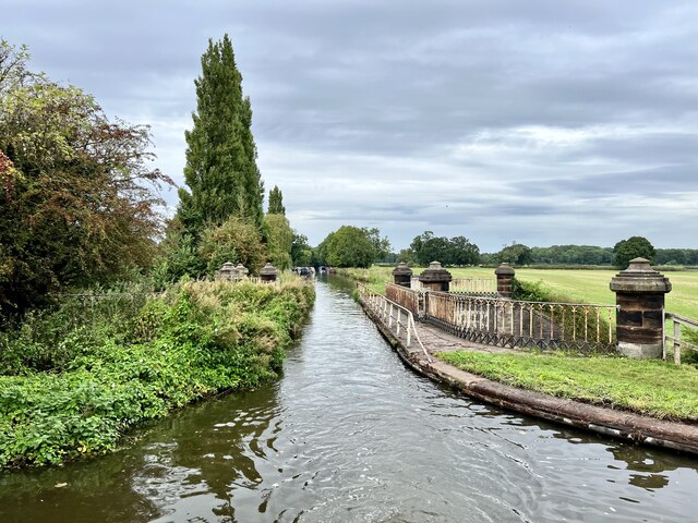
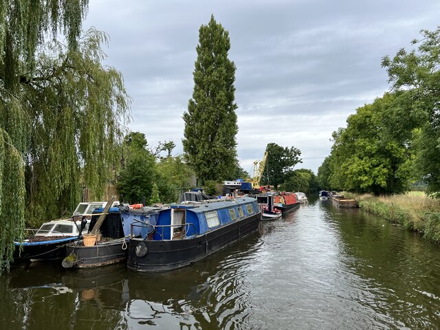
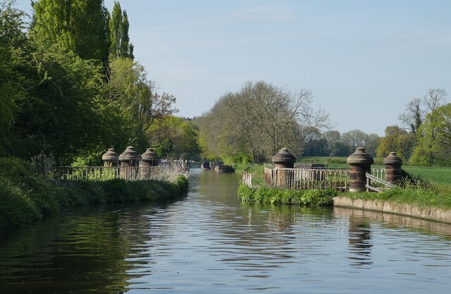
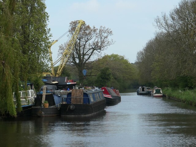
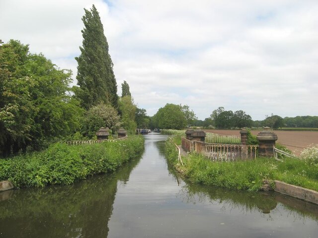
![Stretton Aqueduct, Shropshire Union Canal The text on the iron trough aqueduct proclaims this to be the Birmingham and Liverpool [Junction] Canal, which ran from Nantwich to Autherley Junction outside Wolverhampton and later became part of the Shropshire Union system. The name of the engineer Thomas Telford is below. Telford also engineered the turnpike road that passes beneath it, the A5 London to Holyhead road.](https://s1.geograph.org.uk/geophotos/07/39/45/7394513_0848dcc4.jpg)
![Stretton Aqueduct, Shropshire Union Canal (detail) The text on the iron trough aqueduct proclaims this to be the Birmingham and Liverpool [Junction] Canal, which ran from Nantwich to Autherley Junction outside Wolverhampton and later became part of the Shropshire Union system. The name of the engineer Thomas Telford is below. Telford also engineered the turnpike road that passes beneath it, the A5 London to Holyhead road.](https://s2.geograph.org.uk/geophotos/07/39/45/7394514_344d265d.jpg)
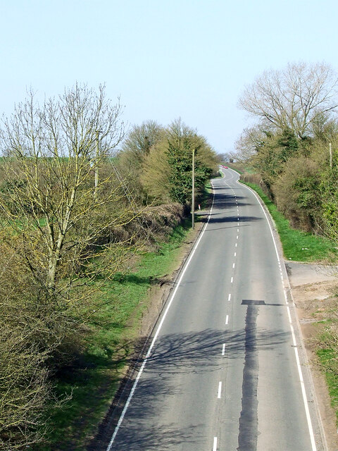
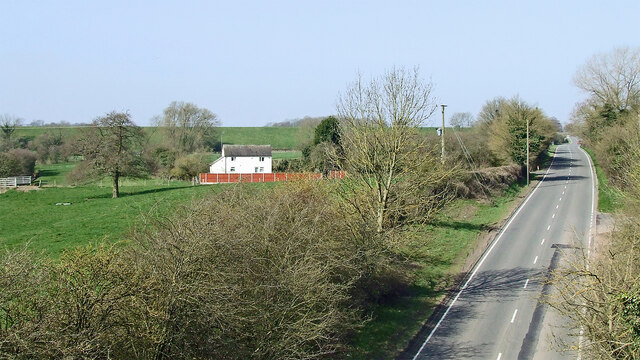
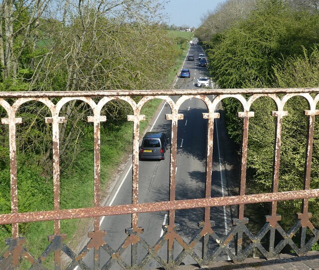
![Watling Street [A5], from Stretton Aqueduct The aqueduct railings could do with a repaint. The former Roman road is also a civil parish boundary here - Brewood &amp; Coven to the left/south, Lapley, Stretton &amp; Wheaton Aston to the right/north.](https://s2.geograph.org.uk/geophotos/07/51/37/7513782_52dce46e.jpg)
Upper Pool is located at Grid Ref: SJ8811 (Lat: 52.69926, Lng: -2.1656184)
Administrative County: Staffordshire
District: South Staffordshire
Police Authority: Staffordshire
What 3 Words
///conjured.october.trendy. Near Brewood, Staffordshire
Nearby Locations
Related Wikis
Stretton, South Staffordshire
Stretton is a village and former civil parish, now in the parish of Lapley, Stretton and Wheaton Aston, in the South Staffordshire district, in the county...
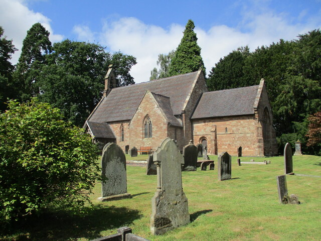
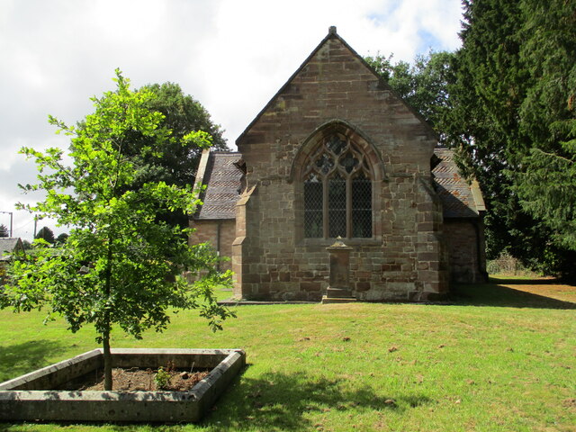
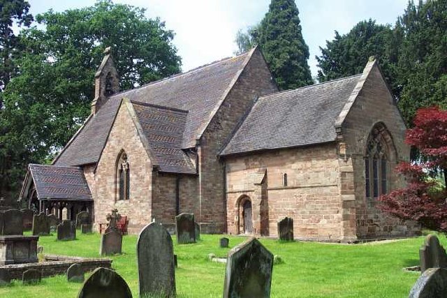
St John's Church, Stretton
St John's Church, Stretton is the Church of England parish church of Stretton, South Staffordshire. == History == The chancel is 12th century. The nave...

Stretton Hall, Staffordshire
Stretton Hall is an early 18th-century mansion house at Stretton, South Staffordshire. It is the home of a branch of the Monckton family descended from...

Pennocrucium
Pennocrucium was a Romano-British settlement and military complex located at present day Water Eaton, just south of Penkridge, Staffordshire, with evidence...

Stretton Aqueduct
Stretton Aqueduct is a short cast iron canal aqueduct between Stretton and Brewood, and near to Belvide Reservoir, in south Staffordshire, England. Designed...
Cannock Rural District
Cannock was a rural district in Staffordshire, England from 1894 to 1974. It was created by the Local Government Act 1894, based on the Cannock rural sanitary...

Lapley
Lapley is a village and former civil parish, now in the parish of Lapley, Stretton and Wheaton Aston, in the South Staffordshire district, in the county...

Lapley Priory
Lapley Priory was a priory in Staffordshire, England. Founded at the very end of the Anglo-Saxon period, it was an alien priory, a satellite house of the...
Nearby Amenities
Located within 500m of 52.69926,-2.1656184Have you been to Upper Pool?
Leave your review of Upper Pool below (or comments, questions and feedback).