Kidd's Hole

Lake, Pool, Pond, Freshwater Marsh in Northumberland

England

Kidd's Hole

Haydon Bridge Station carpark viewed through station platform fence This side for trains to Carlisle.
Haydon Bridge Station carpark viewed through station platform fence Credit: Luke Shaw

Kidd's Hole is a picturesque freshwater marsh located in Northumberland, England. This serene natural habitat is nestled within the beautiful countryside, offering a tranquil escape for nature enthusiasts and wildlife lovers. Spanning a considerable area, Kidd's Hole comprises a lake, pool, pond, and freshwater marsh, creating a diverse ecosystem that supports a wide range of flora and fauna.

The lake at Kidd's Hole is a prominent feature, characterized by its calm, reflective waters. It serves as a vital water source for the surrounding vegetation and provides a habitat for various aquatic species. The pool and pond are smaller bodies of water that add to the overall charm of the area. These bodies of water are home to a variety of aquatic plants, including water lilies and reeds, which create a lush and vibrant environment.

The freshwater marsh at Kidd's Hole is a thriving ecosystem, characterized by its waterlogged soil and abundance of vegetation. Marsh grasses, sedges, and rushes dominate the landscape, providing shelter and food for numerous bird species, insects, and small mammals. This marshland acts as a crucial breeding ground for various amphibians and reptiles as well.

The diverse range of wildlife found at Kidd's Hole includes ducks, geese, swans, herons, and kingfishers. These avian species are attracted to the area due to the plentiful food sources and peaceful surroundings. Visitors to Kidd's Hole can often witness these majestic birds in their natural habitat, making it a popular destination for birdwatchers.

Overall, Kidd's Hole in Northumberland showcases the beauty and importance of freshwater marshes, lakes, pools, and ponds in supporting a rich and vibrant ecosystem. Its tranquil atmosphere and diverse wildlife make it a haven for nature enthusiasts seeking a peaceful retreat.

If you have any feedback on the listing, please let us know in the comments section below.
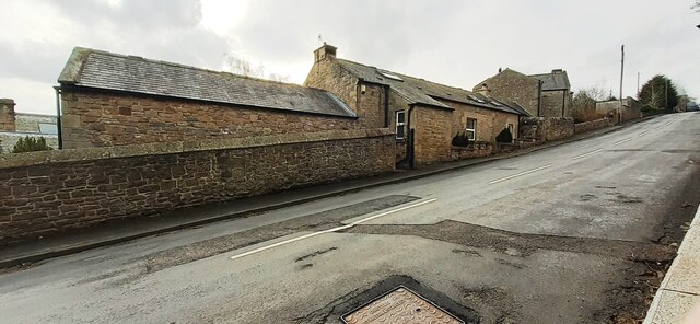
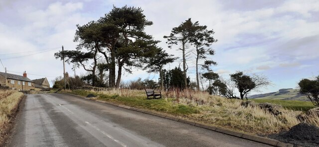
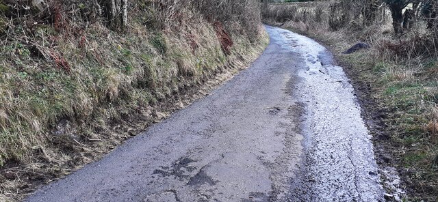
Kidd's Hole Images

Images are sourced within 2km of 54.971009/-2.2500458 or Grid Reference NY8464. Thanks to Geograph Open Source API. All images are credited.

Haydon Bridge Station carpark viewed through station platform fence This side for trains to Carlisle.
Haydon Bridge Station carpark viewed through station platform fence
This side for trains to Carlisle.
Benchmark on stone wall on NE side of North Bank Ordnance Survey cut mark benchmark levelled at 70.455m above Newlyn Datum verified 1954
Benchmark on stone wall on NE side of North Bank
Ordnance Survey cut mark benchmark levelled at 70.455m above Newlyn Datum verified 1954
Looking NW along North Bank as it passes Haydon Lodge There is an Ordnance Survey benchmark <a href="https://www.geograph.org.uk/photo/7106376">NY8464 : Benchmark on stone wall on NE side of North Bank</a> on the stone wall about 2m right of its corner near the right hand edge of the image
Looking NW along North Bank as it passes Haydon Lodge
There is an Ordnance Survey benchmark NY8464 : Benchmark on stone wall on NE side of North Bank on the stone wall about 2m right of its corner near the right hand edge of the image
Benchmark on roadside jut of Haydon Park House on south side of North Bank Ordnance Survey cut mark benchmark levelled at 96.168m above Newlyn Datum in 1954
Benchmark on roadside jut of Haydon Park House on south side of North Bank
Ordnance Survey cut mark benchmark levelled at 96.168m above Newlyn Datum in 1954
Haydon Park House, south side North Bank There is an Ordnance Survey benchmark <a href="https://www.geograph.org.uk/photo/7106391">NY8364 : Benchmark on roadside jut of Haydon Park House on south side of North Bank</a> on the house jut at the right hand side of the metal entrance gate
Haydon Park House, south side North Bank
There is an Ordnance Survey benchmark NY8364 : Benchmark on roadside jut of Haydon Park House on south side of North Bank on the house jut at the right hand side of the metal entrance gate
Village road towards The Tofts passing viewpoint
Benchmark on stone on west side of rural road south of East Haydon Farm Ordnance Survey cut mark benchmark levelled at 164.738m above Newlyn Datum verified 1954
Benchmark on stone on west side of rural road south of East Haydon Farm
Ordnance Survey cut mark benchmark levelled at 164.738m above Newlyn Datum verified 1954
Rural road heading south at East Haydon Farm There is an Ordnance Survey benchmark <a href="https://www.geograph.org.uk/photo/7106474">NY8465 : Benchmark on stone on west side of rural road south of East Haydon Farm</a> on a stone at the left hand side of the road in the left foreground
Rural road heading south at East Haydon Farm
There is an Ordnance Survey benchmark NY8465 : Benchmark on stone on west side of rural road south of East Haydon Farm on a stone at the left hand side of the road in the left foreground
Benchmark on St Cuthbert's Church Ordnance Survey 1GL bolt benchmark levelled at 64.535m above Newlyn Datum verified 1954. The mark was previously levelled at 211.499 feet above Liverpool Datum during the 1GL Carlisle to North Shields survey of 1844-1845. The surveyor's description was 'No. 106. Bolt in South-west corner of tower of Haydonbridge Parish Church ; 2.12 ft. above surface'
Benchmark on St Cuthbert's Church
Ordnance Survey 1GL bolt benchmark levelled at 64.535m above Newlyn Datum verified 1954. The mark was previously levelled at 211.499 feet above Liverpool Datum during the 1GL Carlisle to North Shields survey of 1844-1845. The surveyor's description was 'No. 106. Bolt in South-west corner of tower of Haydonbridge Parish Church ; 2.12 ft. above surface'
St Cuthbert's Church on east side of Church Street There is an Ordnance Survey benchmark <a href="https://www.geograph.org.uk/photo/7115512">NY8464 : Benchmark on St Cuthbert's Church</a> on the near corner, left hand face, of the church tower
St Cuthbert's Church on east side of Church Street
There is an Ordnance Survey benchmark NY8464 : Benchmark on St Cuthbert's Church on the near corner, left hand face, of the church tower
Benchmark on St John of Beverley Church Ordnance Survey cut mark benchmark levelled at 75.993m above Newlyn Datum verified 1954
Benchmark on St John of Beverley Church
Ordnance Survey cut mark benchmark levelled at 75.993m above Newlyn Datum verified 1954
St John of Beverley Church There is an Ordnance Survey benchmark <a href="https://www.geograph.org.uk/photo/7115529">NY8464 : Benchmark on St John of Beverley Church</a> on the near corner, left hand face, of the church
St John of Beverley Church
There is an Ordnance Survey benchmark NY8464 : Benchmark on St John of Beverley Church on the near corner, left hand face, of the church
Benchmark on the west side of 3 South View, North Bank Ordnance Survey cut mark benchmark levelled at 82.598m above Newlyn Datum verified 1954
Benchmark on the west side of 3 South View, North Bank
Ordnance Survey cut mark benchmark levelled at 82.598m above Newlyn Datum verified 1954
Houses of South View on north side of North Bank There is an Ordnance Survey benchmark <a href="https://www.geograph.org.uk/photo/7115544">NY8464 : Benchmark on the west side of 3 South View, North Bank</a> on the front corner, left hand face, of the nearest house
Houses of South View on north side of North Bank
There is an Ordnance Survey benchmark NY8464 : Benchmark on the west side of 3 South View, North Bank on the front corner, left hand face, of the nearest house
Benchmark on gatepost in wall on south side of North Bank opposite Bank House Ordnance Survey cut mark benchmark levelled in 1954 at 111.462m above Newlyn Datum
Benchmark on gatepost in wall on south side of North Bank opposite Bank House
Ordnance Survey cut mark benchmark levelled in 1954 at 111.462m above Newlyn Datum
North Bank at entrances to Rowan Rigg and Maresfield There is an Ordnance Survey benchmark <a href="https://www.geograph.org.uk/photo/115569">ST3738 : Chilton Priory</a> on the road face of the gatepost at the right hand side of the near entrance
North Bank at entrances to Rowan Rigg and Maresfield
There is an Ordnance Survey benchmark ST3738 : Chilton Priory on the road face of the gatepost at the right hand side of the near entrance
Benchmark on east face of Highfield Ordnance Survey cut mark benchmark levelled at 118.025m above Newlyn Datum verified 1954
Benchmark on east face of Highfield
Ordnance Survey cut mark benchmark levelled at 118.025m above Newlyn Datum verified 1954
Highfield and Burnbrae on south side of North Bank There is an Ordnance Survey benchmark <a href="https://www.geograph.org.uk/photo/7115750">NY8364 : Benchmark on east face of Highfield</a> on the left hand side of the left hand house at its front corner
Highfield and Burnbrae on south side of North Bank
There is an Ordnance Survey benchmark NY8364 : Benchmark on east face of Highfield on the left hand side of the left hand house at its front corner
Show me another place!

Kidd's Hole is located at Grid Ref: NY8464 (Lat: 54.971009, Lng: -2.2500458)

Unitary Authority: Northumberland

Police Authority: Northumbria

What 3 Words

///crispier.raking.hairspray. Near Haydon Bridge, Northumberland

Nearby Locations

Kidd's Hole Gee's Wood

Related Wikis

Haydon Bridge

Haydon Bridge is a village in Northumberland, England, which had a population of 2,184 in the 2011 census. Its most distinctive features are the two bridges...

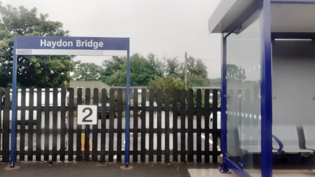
Haydon Bridge railway station

Haydon Bridge is a railway station on the Tyne Valley Line, which runs between Newcastle and Carlisle via Hexham. The station, situated 29 miles 68 chains...

Haydon Bridge High School

Haydon Bridge High School is a mixed secondary day school located in Haydon Bridge in the English county of Northumberland. The current headteacher is...

Chesterwood

Chesterwood is a hamlet in Northumberland, in England. It is situated a short distance to the north-west of Haydon Bridge on the South Tyne, west of Hexham...
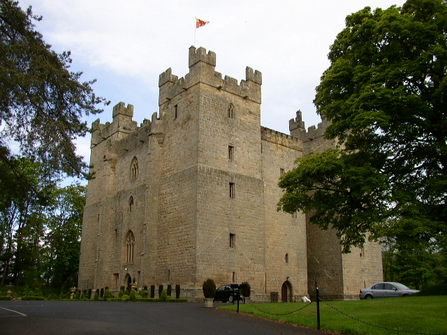
Langley Castle

Langley Castle is a restored medieval tower house, now operated as a hotel, situated in the village of Langley in the valley of the River South Tyne some...

Elrington Halt railway station

Elrington Halt station is a closed stone-built railway station situated on a single-track branch railway line in Northumberland, England, that runs from...

Langley, Northumberland

Langley or Langley-on-Tyne is a small village in Northumberland, England, located to the west of Hexham. The village is on the A686 about 3 miles (5 km...

Langley-on-Tyne railway station

Langley-on-Tyne is a closed stone built railway station situated on a single track branch railway line in Northumberland, England, that ran from Allendale...

Nearby Amenities

Located within 500m of 54.971009,-2.2500458
Haydon Bridge
Created By: Potlatch 0.10f
Place: village
Source: NPE
Wikidata: Q3783796
Lat/Long: 54.9728368/-2.2449558
Crossing
Crossing: zebra
Lat/Long: 54.9724776/-2.2497121
Waterway: weir
Lat/Long: 54.9730721/-2.2461213
Mini Roundabout
Lat/Long: 54.97333/-2.246985
Crossing Barrier: double_half
Crossing Light: yes
Railway: level_crossing
Source: survey
Lat/Long: 54.9749955/-2.2483701
East Lands End
Place: locality
Lat/Long: 54.9688408/-2.2531225
Railway Hotel
Addr City: Haydon Bridge
Addr County: Northumberland
Addr Postcode: NE47 6JG
Addr Street: Church Street
Fhrs Id: 285832
Phone: +44 1434 688417
Tourism: hotel
Lat/Long: 54.9734834/-2.2473671
Pharmacy
Haydon Bridge Pharmacy
Addr City: Haydon Bridge
Addr County: Northumberland
Addr Housenumber: 5
Addr Postcode: NE47 6JG
Addr Street: Church Street
Dispensing: yes
Fhrs Id: 286504
Opening Hours: Mo-Fr 09:00-12:30,13:30-18:00
Phone: +44 1434 684 354
Lat/Long: 54.9736804/-2.2475001
Telephone
Operator: BT
Lat/Long: 54.9750684/-2.2477269
Pub
General Havelock
Addr City: Haydon Bridge
Addr County: Northumberland
Addr Housenumber: 9
Addr Postcode: NE47 6ER
Addr Street: Ratcliffe Road
Fhrs Id: 287468
Phone: +44 1434 684376
Source: survey
Wikidata: Q79683945
Lat/Long: 54.9727277/-2.2479709
Post Office
Haydon Bridge Post Office
Addr City: Hexham
Addr Housenumber: 4
Addr Postcode: NE47 6ET
Addr Street: Ratcliffe Road
Addr Village: Haydon Bridge
Brand: Post Office
Brand Wikidata: Q1783168
Opening Hours: Mo-Su 07:00-22:00
Operator: The Co-operative Food
Ref Pol Id: 15273
Website: https://www.postoffice.co.uk/branch-finder/4573293/haydon-bridge
Lat/Long: 54.9733665/-2.2476194
Noexit: yes
Lat/Long: 54.971326/-2.2537005
Turning Circle
Noexit: yes
Lat/Long: 54.9698964/-2.2483055
Noexit: yes
Lat/Long: 54.9713655/-2.2508439
W.M.H Farm Fresh Meats
Addr City: Haydon Bridge
Addr Housenumber: 4
Addr Postcode: NE47 6JQ
Addr Street: Church Street
Phone: +44 1434 684990
Shop: butcher
Lat/Long: 54.9736102/-2.2470931
Addr City: Haydon Bridge
Addr Housenumber: 6
Addr Street: Church Street
Phone: +44 1434 684248
Shop: pet
Lat/Long: 54.9737035/-2.2471704
Claire's Newsagents
Addr City: Haydon Bridge
Addr County: Northumberland
Addr Housenumber: 11
Addr Postcode: NE47 6JG
Addr Street: Church Street
Fhrs Id: 287158
Phone: +44 1434 684303
Shop: newsagent
Lat/Long: 54.9737935/-2.2475864
Historic: memorial
Lat/Long: 54.9740578/-2.2474522
Bench
Lat/Long: 54.9741255/-2.247505
Bench
Lat/Long: 54.9740111/-2.2474034
Waste Basket
Lat/Long: 54.9740601/-2.247505
Post Box
Ref: NE47 70
Lat/Long: 54.9731386/-2.247464
Post Box
Brand: Royal Mail
Brand Wikidata: Q638098
Operator: Royal Mail
Operator Wikidata: Q638098
Post Box Mounting: stone_wall
Post Box Type: wall
Ref: NE47 46
Survey Date: 2022-03-01
Wikimedia Commons: File:John Martin Street, Haydon Bridge - geograph.org.uk - 3243577.jpg
Lat/Long: 54.9730401/-2.244122
Post Box
Ref: NE47 186
Lat/Long: 54.973378/-2.2526518
Crossing Barrier: double_half
Railway: level_crossing
Source: survey
Lat/Long: 54.9749653/-2.2483367
Haydon Bridge
Public Transport: stop_position
Train: yes
Lat/Long: 54.9751426/-2.2476789
Power: pole
Lat/Long: 54.9695909/-2.2478971
Power: pole
Lat/Long: 54.9691186/-2.2474359
Power: pole
Lat/Long: 54.9684853/-2.2468307
Power: pole
Lat/Long: 54.9678838/-2.2462367
Bench
Backrest: yes
Lat/Long: 54.9752608/-2.2475559
Bench
Backrest: yes
Lat/Long: 54.9752471/-2.2476058
Man Made: chimney
Lat/Long: 54.9741253/-2.2539504
Railway: switch
Lat/Long: 54.9744892/-2.2500961
Railway: switch
Lat/Long: 54.974846/-2.2489331
Generator Method: photovoltaic
Generator Output Electricity: yes
Generator Source: solar
Generator Type: solar_photovoltaic_panel
Location: roof
Power: generator
Lat/Long: 54.9731418/-2.2506589
Generator Method: photovoltaic
Generator Output Electricity: yes
Generator Source: solar
Generator Type: solar_photovoltaic_panel
Location: roof
Power: generator
Lat/Long: 54.9743223/-2.2479899
Generator Method: photovoltaic
Generator Output Electricity: yes
Generator Source: solar
Generator Type: solar_photovoltaic_panel
Location: roof
Power: generator
Lat/Long: 54.971308/-2.2461848
Generator Method: photovoltaic
Generator Output Electricity: yes
Generator Source: solar
Generator Type: solar_photovoltaic_panel
Location: roof
Power: generator
Lat/Long: 54.9699901/-2.2501598
Generator Method: photovoltaic
Generator Output Electricity: yes
Generator Source: solar
Generator Type: solar_photovoltaic_panel
Location: roof
Power: generator
Lat/Long: 54.9699901/-2.250082
Generator Method: photovoltaic
Generator Output Electricity: yes
Generator Source: solar
Generator Type: solar_photovoltaic_panel
Location: roof
Power: generator
Lat/Long: 54.9699901/-2.2499935
Generator Method: photovoltaic
Generator Output Electricity: yes
Generator Source: solar
Generator Type: solar_photovoltaic_panel
Location: roof
Power: generator
Lat/Long: 54.9699901/-2.2498862
Generator Method: photovoltaic
Generator Output Electricity: yes
Generator Source: solar
Generator Type: solar_photovoltaic_panel
Location: roof
Power: generator
Lat/Long: 54.9699932/-2.2497333
Generator Method: photovoltaic
Generator Output Electricity: yes
Generator Source: solar
Generator Type: solar_photovoltaic_panel
Location: roof
Power: generator
Lat/Long: 54.9700255/-2.2496395
Generator Method: photovoltaic
Generator Output Electricity: yes
Generator Source: solar
Generator Type: solar_photovoltaic_panel
Location: roof
Power: generator
Lat/Long: 54.970044/-2.2495617
Generator Method: photovoltaic
Generator Output Electricity: yes
Generator Source: solar
Generator Type: solar_photovoltaic_panel
Location: roof
Power: generator
Lat/Long: 54.9700671/-2.2494705
Generator Method: photovoltaic
Generator Output Electricity: yes
Generator Source: solar
Generator Type: solar_photovoltaic_panel
Location: roof
Power: generator
Lat/Long: 54.9701102/-2.2493793
Generator Method: photovoltaic
Generator Output Electricity: yes
Generator Source: solar
Generator Type: solar_photovoltaic_panel
Location: roof
Power: generator
Lat/Long: 54.9701225/-2.2493122
Generator Method: photovoltaic
Generator Output Electricity: yes
Generator Source: solar
Generator Type: solar_photovoltaic_panel
Location: roof
Power: generator
Lat/Long: 54.9702118/-2.2491889
Generator Method: photovoltaic
Generator Output Electricity: yes
Generator Source: solar
Generator Type: solar_photovoltaic_panel
Location: roof
Power: generator
Lat/Long: 54.9702503/-2.2490628
Generator Method: photovoltaic
Generator Output Electricity: yes
Generator Source: solar
Generator Type: solar_photovoltaic_panel
Location: roof
Power: generator
Lat/Long: 54.9702796/-2.2489475
Generator Method: photovoltaic
Generator Output Electricity: yes
Generator Source: solar
Generator Type: solar_photovoltaic_panel
Location: roof
Power: generator
Lat/Long: 54.9704043/-2.2483976
Generator Method: photovoltaic
Generator Output Electricity: yes
Generator Source: solar
Generator Type: solar_photovoltaic_panel
Location: roof
Power: generator
Lat/Long: 54.9704258/-2.2482984
Generator Method: photovoltaic
Generator Output Electricity: yes
Generator Source: solar
Generator Type: solar_photovoltaic_panel
Location: roof
Power: generator
Lat/Long: 54.970101/-2.248757
Generator Method: photovoltaic
Generator Output Electricity: yes
Generator Source: solar
Generator Type: solar_photovoltaic_panel
Location: roof
Power: generator
Lat/Long: 54.9700471/-2.2487195
Generator Method: photovoltaic
Generator Output Electricity: yes
Generator Source: solar
Generator Type: solar_photovoltaic_panel
Location: roof
Power: generator
Lat/Long: 54.970004/-2.2486766
Generator Method: photovoltaic
Generator Output Electricity: yes
Generator Source: solar
Generator Type: solar_photovoltaic_panel
Location: roof
Power: generator
Lat/Long: 54.9699439/-2.2486524
Generator Method: photovoltaic
Generator Output Electricity: yes
Generator Source: solar
Generator Type: solar_photovoltaic_panel
Location: roof
Power: generator
Lat/Long: 54.9698731/-2.2485773
Generator Method: photovoltaic
Generator Output Electricity: yes
Generator Source: solar
Generator Type: solar_photovoltaic_panel
Location: roof
Power: generator
Lat/Long: 54.9699008/-2.2489421
Generator Method: photovoltaic
Generator Output Electricity: yes
Generator Source: solar
Generator Type: solar_photovoltaic_panel
Location: roof
Power: generator
Lat/Long: 54.9698762/-2.2490413
Generator Method: photovoltaic
Generator Output Electricity: yes
Generator Source: solar
Generator Type: solar_photovoltaic_panel
Location: roof
Power: generator
Lat/Long: 54.9698531/-2.2491111
Generator Method: photovoltaic
Generator Output Electricity: yes
Generator Source: solar
Generator Type: solar_photovoltaic_panel
Location: roof
Power: generator
Lat/Long: 54.96983/-2.2491996
Generator Method: photovoltaic
Generator Output Electricity: yes
Generator Source: solar
Generator Type: solar_photovoltaic_panel
Location: roof
Power: generator
Lat/Long: 54.9698316/-2.2479202
Generator Method: photovoltaic
Generator Output Electricity: yes
Generator Source: solar
Generator Type: solar_photovoltaic_panel
Location: roof
Power: generator
Lat/Long: 54.9698008/-2.2480194
Generator Method: photovoltaic
Generator Output Electricity: yes
Generator Source: solar
Generator Type: solar_photovoltaic_panel
Location: roof
Power: generator
Lat/Long: 54.9697453/-2.2481669
Generator Method: photovoltaic
Generator Output Electricity: yes
Generator Source: solar
Generator Type: solar_photovoltaic_panel
Location: roof
Power: generator
Lat/Long: 54.9697315/-2.2482259
Generator Method: photovoltaic
Generator Output Electricity: yes
Generator Source: solar
Generator Type: solar_photovoltaic_panel
Location: roof
Power: generator
Lat/Long: 54.9697176/-2.2482769
Generator Method: photovoltaic
Generator Output Electricity: yes
Generator Source: solar
Generator Type: solar_photovoltaic_panel
Location: roof
Power: generator
Lat/Long: 54.9696853/-2.2483627
Generator Method: photovoltaic
Generator Output Electricity: yes
Generator Source: solar
Generator Type: solar_photovoltaic_panel
Location: roof
Power: generator
Lat/Long: 54.969653/-2.2484861
Generator Method: photovoltaic
Generator Output Electricity: yes
Generator Source: solar
Generator Type: solar_photovoltaic_panel
Location: roof
Power: generator
Lat/Long: 54.9696345/-2.2485505
Direction: SSE
Generator Method: photovoltaic
Generator Output Electricity: yes
Generator Source: solar
Generator Type: solar_photovoltaic_panel
Power: generator
Source: survey
Lat/Long: 54.9710406/-2.252748
Defibrillator
Emergency: defibrillator
Lat/Long: 54.9727504/-2.2487431
Bus Stop
Haydon Bridge, West End
Bench: yes
Bus: yes
Departures Board: timetable
Public Transport: platform
Shelter: yes
Lat/Long: 54.9725991/-2.2487782
Bus Stop
Bench: no
Bus: yes
Public Transport: platform
Shelter: no
Lat/Long: 54.9714904/-2.2545289
Noexit: yes
Lat/Long: 54.9694313/-2.2508123
Noexit: yes
Lat/Long: 54.9694696/-2.2511065
Noexit: yes
Lat/Long: 54.9690663/-2.2506042
Noexit: yes
Lat/Long: 54.9688485/-2.2502268
Noexit: yes
Lat/Long: 54.969482/-2.2499223
Advertising: board
Lat/Long: 54.9727267/-2.248854
Entrance: main
Lat/Long: 54.9728231/-2.2489459
Charging Station
Authentication App: yes
Motorcar: yes
Network: Charge My Street
Payment App: yes
Ref: EG-07650
Socket Type2: 1
Socket Type2 Current: 32
Socket Type2 Output: 22 kW
Socket Type2 Voltage: 415
Lat/Long: 54.9730631/-2.2491754
Charging Station
Authentication App: yes
Motorcar: yes
Network: Charge My Street
Payment App: yes
Ref: EG-07651
Socket Type2: 1
Socket Type2 Current: 32
Socket Type2 Output: 22 kW
Socket Type2 Voltage: 415
Lat/Long: 54.9730614/-2.2491822
Bus Stop
Bus: yes
Public Transport: platform
Lat/Long: 54.9719631/-2.252394
Bus Stop
Bus: yes
Naptan AtcoCode: 3100Y844643
Naptan NaptanCode: nldgjadg
Public Transport: platform
Lat/Long: 54.9734587/-2.2440984
Noexit: yes
Lat/Long: 54.970921/-2.2529697
Noexit: yes
Lat/Long: 54.9714229/-2.2531991
Reading Rooms
Addr City: Haydon Bridge
Addr Housename: The Reading Rooms
Addr Housenumber: 2
Addr Postcode: NE47 6JQ
Addr Street: Church Street
Guest House: bed_and_breakfast
Tourism: guest_house
Website: http://www.thereadingroomshaydonbridge.co.uk/
Lat/Long: 54.9735346/-2.2470147
Cafe
Oddfellows Coffee
Addr City: Haydon Bridge
Addr Housename: Oddfellows Hall
Addr Postcode: NE47 6BQ
Addr Street: Shaftoe Street
Cuisine: coffee_shop
Internet Access: wlan
Lat/Long: 54.9723138/-2.2453209
The data included in this document is from www.openstreetmap.org. The data is made available under ODbL.

Have you been to Kidd's Hole?

Leave your review of Kidd's Hole below (or comments, questions and feedback).