Backburn

Settlement in Aberdeenshire

Scotland

Backburn

Ploughed Field near Shanquhar Ready for the new crop to be sown.
Ploughed Field near Shanquhar Credit: Anne Burgess

Backburn is a small village located in Aberdeenshire, Scotland. Situated about 25 miles west of Aberdeen, it is nestled amidst the picturesque countryside of the region. The village is home to a close-knit community of around 500 residents.

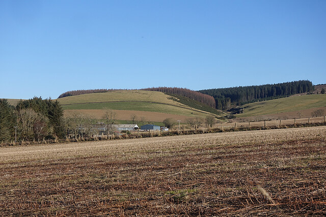
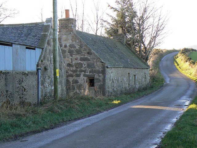
Backburn boasts a tranquil and idyllic setting, with its charming cottages and green fields. The village is surrounded by rolling hills and offers stunning views of the Aberdeenshire landscape. It provides a peaceful escape from the hustle and bustle of city life, making it an ideal place for those seeking a more relaxed lifestyle.

Although small in size, Backburn offers a few amenities for its residents. The village has a local shop where basic necessities can be purchased, ensuring that residents have easy access to essential goods. There is also a community hall that serves as a hub for various social and recreational activities. The hall hosts events such as community gatherings, clubs, and even occasional performances.

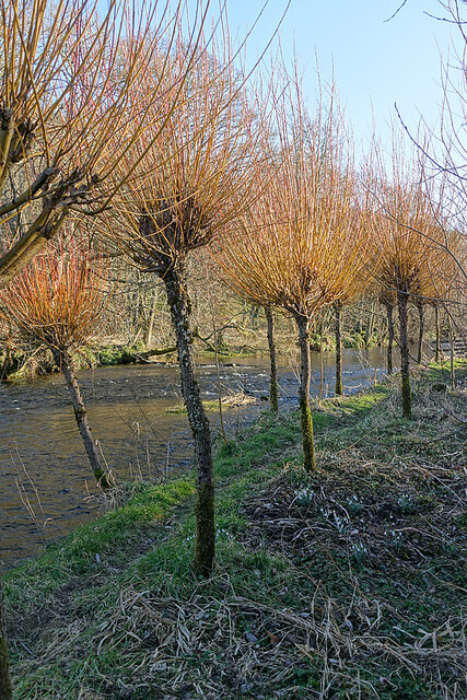
Nature enthusiasts will find plenty to explore in the surrounding area of Backburn. The village is located close to the Cairngorms National Park, which is known for its breathtaking landscapes and outdoor activities. From hiking and mountain biking to wildlife spotting and fishing, there are numerous opportunities to immerse oneself in nature.

In conclusion, Backburn is a charming village that offers a peaceful and scenic environment for its residents. Its close proximity to nature and welcoming community make it an attractive place to call home.

If you have any feedback on the listing, please let us know in the comments section below.

Backburn Images

Images are sourced within 2km of 57.393972/-2.7836067 or Grid Reference NJ5334. Thanks to Geograph Open Source API. All images are credited.

Ploughed Field near Shanquhar Ready for the new crop to be sown.
Ploughed Field near Shanquhar
Ready for the new crop to be sown.
Burn of Cockstown Looking downstream from the bridge at Cadger's Ford.
Burn of Cockstown
Looking downstream from the bridge at Cadger's Ford.
An Empty Field Has it yet to be ploughed, or is it to be left as pasture this year?
An Empty Field
Has it yet to be ploughed, or is it to be left as pasture this year?
Near Kirkhill The whin-covered bank is on the far side of the Burn of Cockstown.
Near Kirkhill
The whin-covered bank is on the far side of the Burn of Cockstown.
Fields near Shanquhar I think the house is Shanquhar Cottage, and Shanquhar itself is mostly hidden by the trees on the left. The wind farm is at Newtongarry.
Fields near Shanquhar
I think the house is Shanquhar Cottage, and Shanquhar itself is mostly hidden by the trees on the left. The wind farm is at Newtongarry.
Backburn The minor road passes close to the houses at Backburn.
Backburn
The minor road passes close to the houses at Backburn.
Field near West Corncatterach The farm buildings at West Corncatterach are actually in the next grid square. To their right is the course of the Glen Burn.
Field near West Corncatterach
The farm buildings at West Corncatterach are actually in the next grid square. To their right is the course of the Glen Burn.
Mains of Gartly Substantial buildings at Mains of Gartly Farm. At a guess they are for rearing chickens but please tell me if I am wrong!
Mains of Gartly
Substantial buildings at Mains of Gartly Farm. At a guess they are for rearing chickens but please tell me if I am wrong!
Risquehouse This is the house at Risquehouse, viewed from the minor public road. It is certain well sheltered by the forest next to it.
Risquehouse
This is the house at Risquehouse, viewed from the minor public road. It is certain well sheltered by the forest next to it.
Tor Hill The gated road gives access to the forestry on Gartly Moor.
Tor Hill
The gated road gives access to the forestry on Gartly Moor.
Tor Hill Sheep grazing in a field below the wooded Tor Hill.
Tor Hill
Sheep grazing in a field below the wooded Tor Hill.
River Bogie Looking downstream from the bridge at Gartly.
River Bogie
Looking downstream from the bridge at Gartly.
Gartly The main street in the small village of Gartly.
Gartly
The main street in the small village of Gartly.
Haugh at Culdrain The flat land is the flood plain or water meadow of the meandering River Bogie, which is on the left of the view.
Haugh at Culdrain
The flat land is the flood plain or water meadow of the meandering River Bogie, which is on the left of the view.
Early Crocus (Crocus tommasinianus) A fine clump of the first species of crocus to flower each year. They are not native, but often naturalise after escaping from gardens.
Early Crocus (Crocus tommasinianus)
A fine clump of the first species of crocus to flower each year. They are not native, but often naturalise after escaping from gardens.
River Bogie Pollarded willows flank an informal path beside the River Bogie.
River Bogie
Pollarded willows flank an informal path beside the River Bogie.
Pollarded Willows In early spring, before the shoots are clipped, these willows look almost like flaming torches in the late afternoon sunshine.
Pollarded Willows
In early spring, before the shoots are clipped, these willows look almost like flaming torches in the late afternoon sunshine.
River Bogie Looking across to the right bank near Culdrain.
River Bogie
Looking across to the right bank near Culdrain.
Show me another place!

Backburn is located at Grid Ref: NJ5334 (Lat: 57.393972, Lng: -2.7836067)

Unitary Authority: Aberdeenshire

Police Authority: North East

What 3 Words

///shipped.masks.promotion. Near Huntly, Aberdeenshire

Nearby Locations

Backburn

Related Wikis

Backburn

Backburn is a rural settlement near Gartly in Aberdeenshire, Scotland. == References ==

Strathbogie, Scotland

Strathbogie (Scottish Gaelic: Srath Bholgaidh or Srath Bhalgaidh) is a district and river valley of northwest Aberdeenshire in Scotland, formerly one of...

Gartly railway station

Gartly railway station served the hamlet of Gartly, Aberdeenshire, Scotland from 1854 to 1968 on the Great North of Scotland Railway. == History == The...

Gartly

Gartly (Scots: Gairtlie, Scottish Gaelic: Gartaidh) is an inland hamlet in Aberdeenshire, Scotland. It is several miles south of the town of Huntly, and...

Gartly Castle

Gartly Castle was a 15th-century castle, about 1 mile (1.6 km) north-east of Gartly, Aberdeenshire, Scotland, and 4 miles (6.4 km) south of Huntly, east...

Leith Hall

Leith Hall is a country house in Kennethmont, Aberdeenshire, Scotland. It was built in 1650, on the site of the medieval Peill Castle, and was the home...

Burn of Tullochbeg

Burn of Tullochbeg is a burn which marks the boundary of the parish of Huntly, Aberdeenshire, Scotland. == References ==

A97 road

The A97 is a major road in Aberdeenshire, Scotland. A very short section of the road is within Moray == Route == It runs south from Banff on the north...

Nearby Amenities

Located within 500m of 57.393972,-2.7836067
Power: pole
Lat/Long: 57.3912812/-2.7776252
Power: pole
Lat/Long: 57.3918616/-2.7778889
Power: pole
Lat/Long: 57.3923151/-2.7759107
Power: pole
Lat/Long: 57.3920629/-2.7769783
Power: pole
Lat/Long: 57.3916501/-2.7787776
Power: pole
Lat/Long: 57.3912439/-2.7805014
Power: pole
Lat/Long: 57.3907972/-2.7824043
Power: pole
Lat/Long: 57.3903691/-2.7842381
Risquehouse
Place: isolated_dwelling
Lat/Long: 57.3899645/-2.7851529
The data included in this document is from www.openstreetmap.org. The data is made available under ODbL.

Have you been to Backburn?

Leave your review of Backburn below (or comments, questions and feedback).