Halleypike Lough

Lake, Pool, Pond, Freshwater Marsh in Northumberland

England

Halleypike Lough

King's Crags
King's Crags Credit: Les Hull

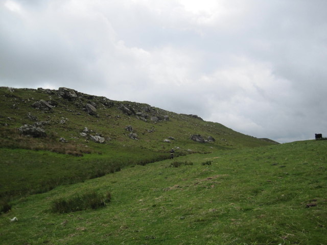
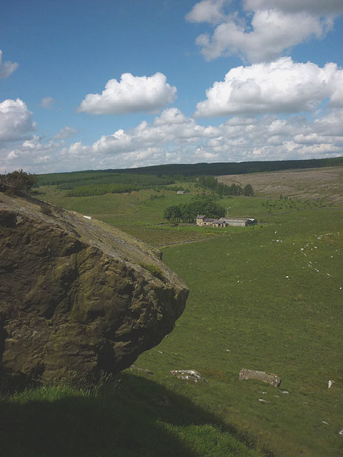
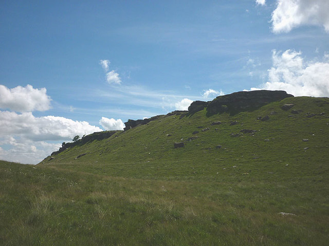
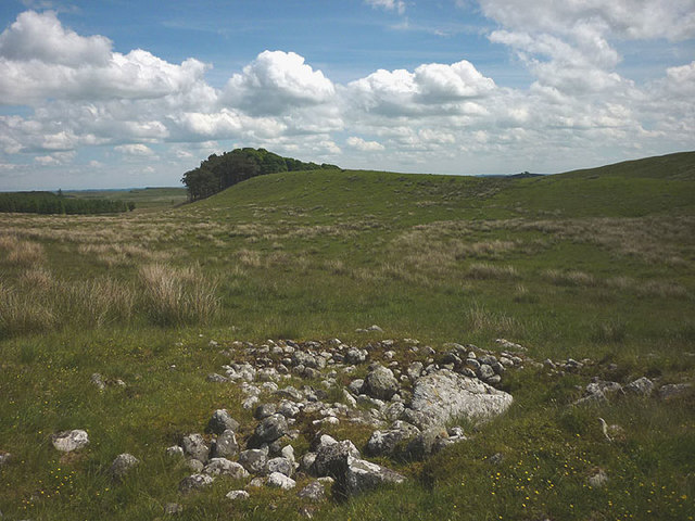
Halleypike Lough, located in Northumberland, is a picturesque freshwater lake nestled amidst the stunning natural beauty of the region. Spanning an area of approximately 10 acres, it is often referred to as a "loch," a term commonly used in Scotland to describe a lake. Surrounded by rolling hills and lush greenery, the lough promises a serene and tranquil atmosphere for visitors seeking a peaceful retreat.

The crystal-clear waters of Halleypike Lough are fed by nearby streams and springs, ensuring a constant flow of freshwater. The lake is relatively shallow, with an average depth of around 6 feet, making it an ideal spot for various water-based activities such as fishing, boating, and kayaking.

The lough is home to a diverse range of aquatic flora and fauna, with several species of fish, including perch, pike, and roach, inhabiting its waters. Additionally, the surrounding marshy areas provide a haven for a variety of bird species, making it a popular destination for birdwatchers.

The area surrounding Halleypike Lough is well-maintained, with designated walking trails that allow visitors to explore and appreciate the natural beauty of the region. A small picnic area nearby provides an opportunity to relax and enjoy a meal amidst the tranquil surroundings.

Overall, Halleypike Lough in Northumberland offers a delightful blend of natural beauty, recreational activities, and abundant wildlife, making it an enchanting destination for nature lovers and outdoor enthusiasts alike.

If you have any feedback on the listing, please let us know in the comments section below.

Halleypike Lough Images

Images are sourced within 2km of 55.041371/-2.2975234 or Grid Reference NY8171. Thanks to Geograph Open Source API. All images are credited.

King's Crags
King's Crags
King's Crags and East Hotbank The crag is a north-facing edge of large boulders and short outcrops of Fell sandstone. It overlooks the remote farmhouse of East Hotbank.
King's Crags and East Hotbank
The crag is a north-facing edge of large boulders and short outcrops of Fell sandstone. It overlooks the remote farmhouse of East Hotbank.
King's Crags A line of north-facing short outcrops and boulders of Fell sandstone.
King's Crags
A line of north-facing short outcrops and boulders of Fell sandstone.
Prehistoric cairn, King's Crags Bronze Age burial cairn in remote country between Queen's and King's Crags.
Prehistoric cairn, King's Crags
Bronze Age burial cairn in remote country between Queen's and King's Crags.
Prehistoric cairn, King's Crags Bronze Age burial cairn in remote country between Queen's and King's Crags. The large slab may once have been the capping stone for a cist or burial chamber.
Prehistoric cairn, King's Crags
Bronze Age burial cairn in remote country between Queen's and King's Crags. The large slab may once have been the capping stone for a cist or burial chamber.
Crow Crags panorama from the south A boundary wall runs across the view crossing the valley of Crook Burn in the centre. Beyond the wall, the moorland of Blue Bog rises to the low ridge of Crow Crags <a href="https://www.geograph.org.uk/photo/3982310">NY7972 : Crow Crags</a>. There is a large sheepfold at its eastern end <a href="https://www.geograph.org.uk/photo/3982123">NY7972 : Sheepfold east of Crow Crags</a> just to the left of the prominent tree on the right which marks another, smaller sheepfold on Harraway Hills <a href="https://www.geograph.org.uk/photo/3982076">NY7972 : Sheepfold north-east of Crow Crags</a>. Beyond Crow Crags (270m) the land rises to 320m at Hawk Side on Haughton Common <a href="https://www.geograph.org.uk/photo/3982347">NY7872 : Hawk Side</a> hiding the extensive forest plantations which now cover the moorland further north.

On the south slope of Crow Crags the low stoney banks of a prehistoric field system are quite visible as white lines running across and downslope in the unusually dry grassland. They make up a series of well-defined rectangular fields. There may originally have been as many as six fields, one of which was probably destroyed by the later sheepfold.
<span class="nowrap"><a title="http://www.keystothepast.info/article/10339/Site-Details?PRN=N12415" rel="nofollow ugc noopener" href="http://www.keystothepast.info/article/10339/Site-Details?PRN=N12415">Link</a><img style="margin-left:2px;" alt="External link" title="External link - shift click to open in new window" src="https://s1.geograph.org.uk/img/external.png" width="10" height="10"/></span>

An area of prehistoric ploughing, known as cord rig, at the south-east end of the field system has been identified on aerial photographs. These also revealed an extensive cairn-field and hollow-way further west.
<span class="nowrap"><a title="http://www.keystothepast.info/article/10339/Site-Details?PRN=N12420" rel="nofollow ugc noopener" href="http://www.keystothepast.info/article/10339/Site-Details?PRN=N12420">Link</a><img style="margin-left:2px;" alt="External link" title="External link - shift click to open in new window" src="https://s1.geograph.org.uk/img/external.png" width="10" height="10"/></span> <span class="nowrap"><a title="http://www.keystothepast.info/article/10339/Site-Details?PRN=N12413" rel="nofollow ugc noopener" href="http://www.keystothepast.info/article/10339/Site-Details?PRN=N12413">Link</a><img style="margin-left:2px;" alt="External link" title="External link - shift click to open in new window" src="https://s1.geograph.org.uk/img/external.png" width="10" height="10"/></span>
Crow Crags panorama from the south
A boundary wall runs across the view crossing the valley of Crook Burn in the centre. Beyond the wall, the moorland of Blue Bog rises to the low ridge of Crow Crags NY7972 : Crow Crags. There is a large sheepfold at its eastern end NY7972 : Sheepfold east of Crow Crags just to the left of the prominent tree on the right which marks another, smaller sheepfold on Harraway Hills NY7972 : Sheepfold north-east of Crow Crags. Beyond Crow Crags (270m) the land rises to 320m at Hawk Side on Haughton Common NY7872 : Hawk Side hiding the extensive forest plantations which now cover the moorland further north. On the south slope of Crow Crags the low stoney banks of a prehistoric field system are quite visible as white lines running across and downslope in the unusually dry grassland. They make up a series of well-defined rectangular fields. There may originally have been as many as six fields, one of which was probably destroyed by the later sheepfold. LinkExternal link An area of prehistoric ploughing, known as cord rig, at the south-east end of the field system has been identified on aerial photographs. These also revealed an extensive cairn-field and hollow-way further west. LinkExternal link LinkExternal link
Milecastle 35 on Hadrian's Wall at Sewingshields Hadrian's wall or 'Vallum Aelium' is the remains of a large Roman fortification. The wall extended west from Segedunum at Wallsend on the River Tyne to the shore of the Solway Firth, ending a short but unknown distance west of the village of Bowness-on-Solway. Construction probably started sometime in AD 122 and was largely completed within six years.

The remains were made a UNESCO World Heritage Site in 1987.
Milecastle 35 on Hadrian's Wall at Sewingshields
Hadrian's wall or 'Vallum Aelium' is the remains of a large Roman fortification. The wall extended west from Segedunum at Wallsend on the River Tyne to the shore of the Solway Firth, ending a short but unknown distance west of the village of Bowness-on-Solway. Construction probably started sometime in AD 122 and was largely completed within six years. The remains were made a UNESCO World Heritage Site in 1987.
Turret 34a at Grindon on Hadrian's Wall
Turret 33b on Hadrian's Wall Hadrian's wall or 'Vallum Aelium' is the remains of a large Roman fortification. The wall extended west from Segedunum at Wallsend on the River Tyne to the shore of the Solway Firth, ending a short but unknown distance west of the village of Bowness-on-Solway. Construction probably started sometime in AD 122 and was largely completed within six years.

The remains were made a UNESCO World Heritage Site in 1987.
Turret 33b on Hadrian's Wall
Hadrian's wall or 'Vallum Aelium' is the remains of a large Roman fortification. The wall extended west from Segedunum at Wallsend on the River Tyne to the shore of the Solway Firth, ending a short but unknown distance west of the village of Bowness-on-Solway. Construction probably started sometime in AD 122 and was largely completed within six years. The remains were made a UNESCO World Heritage Site in 1987.
Excavation of stack stand below Sewingshields Crags Stack stands are common on these upland pastures and often located on aerial photographs. Although they are not too old (post-Medieval), their agricultural function is often unknown. Here, north of the Sewingshields Crags whin-sill, they were probably created for the stacking of peats left out to dry before removal to nearby farm houses as a fuel. Two nearby stands were excavated in June 2022 and there are another nine nearby.
Excavation of stack stand below Sewingshields Crags
Stack stands are common on these upland pastures and often located on aerial photographs. Although they are not too old (post-Medieval), their agricultural function is often unknown. Here, north of the Sewingshields Crags whin-sill, they were probably created for the stacking of peats left out to dry before removal to nearby farm houses as a fuel. Two nearby stands were excavated in June 2022 and there are another nine nearby.
Cranberry (Vaccinium oxycoccos), Sewingshields A very low-growing plant growing in boggy areas alongside sphagnum and other mosses and bog plants.

There are 1 to 5 flowers on a plant each atop their own reddish stem. Flowers have 4 pink petals swept backwards and 8 stamens bundled together around a central style like those of Bittersweet and other Solanum species.

The leaves are hard to spot among the surrounding vegetation but are pointed-oval with a noticeable fold down the centre-line.
<span class="nowrap"><a title="https://wildflowerfinder.org.uk/Flowers/C/Cranberry/Cranberry.htm" rel="nofollow ugc noopener" href="https://wildflowerfinder.org.uk/Flowers/C/Cranberry/Cranberry.htm">Link</a><img style="margin-left:2px;" alt="External link" title="External link - shift click to open in new window" src="https://s1.geograph.org.uk/img/external.png" width="10" height="10"/></span>

Some of its small red and edible berries are shown here <a href="https://www.geograph.org.uk/photo/2073965">NU0918 : Cranberry (Vaccinium oxycoccos), Beanley Moor</a>.
Cranberry (Vaccinium oxycoccos), Sewingshields
A very low-growing plant growing in boggy areas alongside sphagnum and other mosses and bog plants. There are 1 to 5 flowers on a plant each atop their own reddish stem. Flowers have 4 pink petals swept backwards and 8 stamens bundled together around a central style like those of Bittersweet and other Solanum species. The leaves are hard to spot among the surrounding vegetation but are pointed-oval with a noticeable fold down the centre-line. LinkExternal link Some of its small red and edible berries are shown here NU0918 : Cranberry (Vaccinium oxycoccos), Beanley Moor.
Peat bog below Sewingshields Crags
B6318 heading west
B6318 heading west
The top of Sewingshield Crags
King Wanless Green from Queen's Crags
Ridge above Queen's Crags
Eastern approach to Queen's Crags
Show me another place!

Halleypike Lough is located at Grid Ref: NY8171 (Lat: 55.041371, Lng: -2.2975234)

Unitary Authority: Northumberland

Police Authority: Northumbria

What 3 Words

///putts.tingled.windpipe. Near Bardon Mill, Northumberland

Nearby Locations

Halleypike Lough

Related Wikis

Halleypike Lough

Halleypike Lough is an inland lake on Haughton Common at the southern edge of Northumberland National Park, northeast of Bardon Mill, and 1 mile (1.6 km...

Milecastle 34

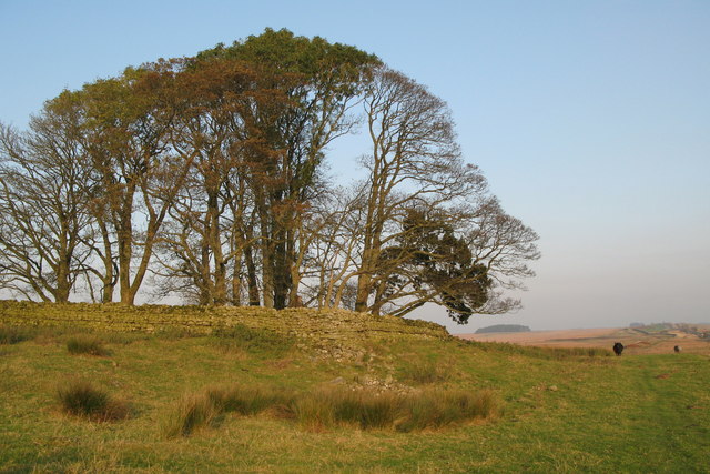
Milecastle 34 (Grindon) was a milecastle of the Roman Hadrian's Wall. There are no visible remains, but the site is within a small, tree-filled, walled...

Milecastle 35

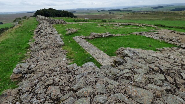
Milecastle 35 (Sewingshields) is one of the milecastles on Hadrian's Wall (grid reference NY80497018). The remains still exist as exposed masonry. ��2...

Milecastle 33

Milecastle 33 (Shield on the Wall) was a milecastle of the Roman Hadrian's Wall, one of a series of small fortlets built at intervals of approximately...

Nearby Amenities

Located within 500m of 55.041371,-2.2975234
Barrier: entrance
Lat/Long: 55.0405128/-2.2914597
The data included in this document is from www.openstreetmap.org. The data is made available under ODbL.

Have you been to Halleypike Lough?

Leave your review of Halleypike Lough below (or comments, questions and feedback).