Crookburn Foot

Lake, Pool, Pond, Freshwater Marsh in Cumberland Eden

England

Crookburn Foot

Moor House in 1991 When still standing, Moor House will have been one of the most remote buildings in England. It was surely built as a shooting lodge but was taken over at some time by the Nature Conservancy - now known as Natural England. Some time after this visit the house was demolished presumably because it was unsafe. The site is now occupied by much simpler structures - <a title="https://www.geograph.org.uk/photo/6791684" href="https://www.geograph.org.uk/photo/6791684">Link</a> .
Moor House in 1991 Credit: Trevor Littlewood

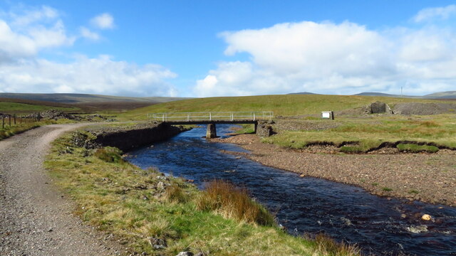
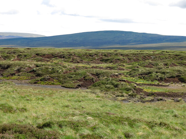
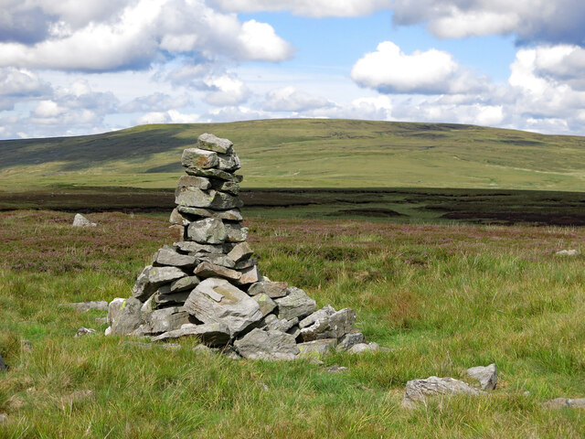
Crookburn Foot is a picturesque freshwater marsh located in Cumberland, England. This serene natural feature is situated in a peaceful and secluded area, making it a popular destination for nature enthusiasts and those seeking tranquility.

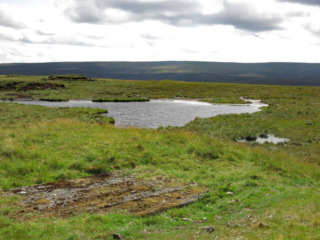
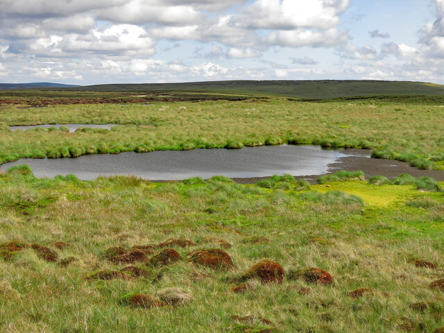
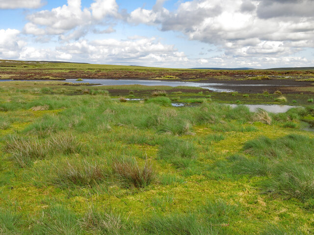
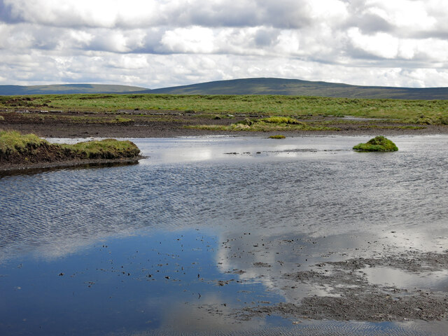
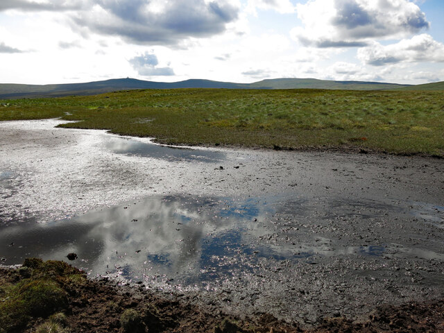
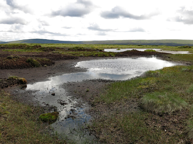
The main attraction of Crookburn Foot is its stunning lake, which boasts crystal-clear waters that reflect the surrounding lush greenery and picturesque landscape. The lake is quite large, providing ample space for various recreational activities such as fishing, boating, and birdwatching.

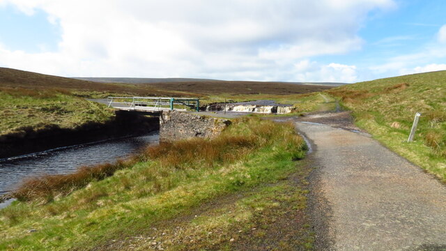
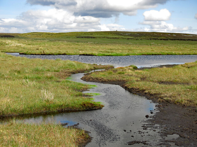
Surrounding the lake are several pools and ponds, each with its own unique ecosystem and array of wildlife. These smaller bodies of water are home to a diverse range of plant and animal species, including water lilies, dragonflies, and numerous species of birds.

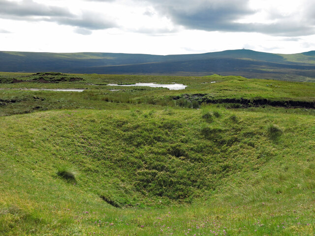
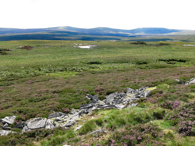
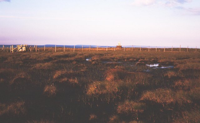
The freshwater marsh at Crookburn Foot is another notable feature. It is a wetland area characterized by its rich biodiversity and abundance of aquatic plants. Here, visitors can observe a variety of unique flora and fauna, including reeds, rushes, and waterfowl.

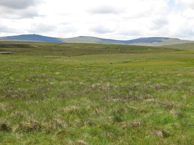
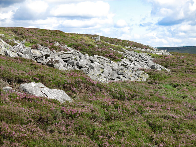
Crookburn Foot provides a peaceful retreat for visitors to connect with nature. The tranquil atmosphere, combined with the stunning natural scenery, makes it an ideal location for relaxation and contemplation. Hiking trails surround the area, offering opportunities for exploration and wildlife spotting.

Overall, Crookburn Foot in Cumberland is a charming and idyllic destination for nature lovers. With its beautiful lake, pools, ponds, and freshwater marsh, it offers a unique and diverse natural experience that is sure to captivate all who visit.

If you have any feedback on the listing, please let us know in the comments section below.

Crookburn Foot Images

Images are sourced within 2km of 54.697378/-2.3555567 or Grid Reference NY7733. Thanks to Geograph Open Source API. All images are credited.

Moor House in 1991 When still standing, Moor House will have been one of the most remote buildings in England. It was surely built as a shooting lodge but was taken over at some time by the Nature Conservancy - now known as Natural England. Some time after this visit the house was demolished presumably because it was unsafe. The site is now occupied by much simpler structures - <a title="https://www.geograph.org.uk/photo/6791684" href="https://www.geograph.org.uk/photo/6791684">Link</a> .
Moor House in 1991
When still standing, Moor House will have been one of the most remote buildings in England. It was surely built as a shooting lodge but was taken over at some time by the Nature Conservancy - now known as Natural England. Some time after this visit the house was demolished presumably because it was unsafe. The site is now occupied by much simpler structures - Link .
Bridge over the R Tees close to Troutbeck Foot
Bridge over Trout Beck leading towards Moor House
Waterfalls on Trout Beck by bridge at Moor House
Moorland around John's Burn Looking WSW towards (left to right) Great Dun Fell, Little Dun Fell and Cross Fell - the western horizon that dominates this area of moorland at the head of the River South Tyne.
Moorland around John's Burn
Looking WSW towards (left to right) Great Dun Fell, Little Dun Fell and Cross Fell - the western horizon that dominates this area of moorland at the head of the River South Tyne.
Old mine shafts on Bellbeaver Rigg (2) Looking south west towards Great Dun Fell (half right).
Old mine shafts on Bellbeaver Rigg (2)
Looking south west towards Great Dun Fell (half right).
Old mine shaft and lochan on Bellbeaver Rigg
Lochan on Bellbeaver Rigg Looking east towards the cairn on the <a href="https://www.geograph.org.uk/photo/3295439">NY7635 : Summit area of Bellbeaver Rigg</a> (photographed by Trevor Littlewood).
Lochan on Bellbeaver Rigg
Looking east towards the cairn on the NY7635 : Summit area of Bellbeaver Rigg (photographed by Trevor Littlewood).
Cairn by an old mine shaft on Bellbeaver Rigg Looking north east with Burnhope Seat in cloud shadow on the horizon (left).
Cairn by an old mine shaft on Bellbeaver Rigg
Looking north east with Burnhope Seat in cloud shadow on the horizon (left).
Lochan on Bellbeaver Rigg
Lochan on Bellbeaver Rigg (2)
Lochan on Bellbeaver Rigg (3) Looking south east towards Herdship Fell.
Lochan on Bellbeaver Rigg (3)
Looking south east towards Herdship Fell.
Lochan on Bellbeaver Rigg (4) Looking WSW towards Great Dun Fell, Little Dun Fell and Cross Fell.
Lochan on Bellbeaver Rigg (4)
Looking WSW towards Great Dun Fell, Little Dun Fell and Cross Fell.
Lochan on Bellbeaver Rigg (5)
Bellbeaver Rigg
Bellbeaver Rigg
Carrs on Bellbeaver Rigg
Carrs on Bellbeaver Rigg (2)
Cairn on the highest point of Bellbeaver Rigg The surrounding area, at over 610 metres (2,000 ft) above sea level, is so flat that this can hardly be called a summit. Looking north east towards Burnhope Seat.
Cairn on the highest point of Bellbeaver Rigg
The surrounding area, at over 610 metres (2,000 ft) above sea level, is so flat that this can hardly be called a summit. Looking north east towards Burnhope Seat.
Show me another place!

Crookburn Foot is located at Grid Ref: NY7733 (Lat: 54.697378, Lng: -2.3555567)

Administrative County: Cumbria

District: Eden

Police Authority: Cumbria

What 3 Words

///ooze.plodding.bulky. Near Alston, Cumbria

Related Wikis

Moorhouse and Cross Fell

Moorhouse and Cross Fell is a Site of Special Scientific Interest covering an extensive area of moorland in the Wear Valley district of west County Durham...

Burnhope Seat

Burnhope Seat is a high moorland fell in the North Pennines Area of Outstanding Natural Beauty (AONB) in northern England. It lies between the heads of...

Cow Green Reservoir

Cow Green Reservoir is a 2-mile (3 km) long water reservoir forming part of the border between the historic counties of Westmorland and County Durham in...

Upper Teesdale

Upper Teesdale is a Site of Special Scientific Interest (SSSI) in the west County Durham, England. It encompasses an extensive upland area that includes...

Nearby Amenities

Located within 500m of 54.697378,-2.3555567
Metalband Hill
Ele: 560.2
Natural: peak
Source: OS Historic
Lat/Long: 54.6999743/-2.3572588
Crookburn Foot
Place: locality
Lat/Long: 54.6971654/-2.3554902
The data included in this document is from www.openstreetmap.org. The data is made available under ODbL.

Have you been to Crookburn Foot?

Leave your review of Crookburn Foot below (or comments, questions and feedback).