Mary's Pot

Lake, Pool, Pond, Freshwater Marsh in Aberdeenshire

Scotland

Mary's Pot

Lakeside Memorial A memorial to an army cadet tragically killed in an accident on the west coast overlooking Fyvie Castle Lake.
Lakeside Memorial Credit: Andrew Wood

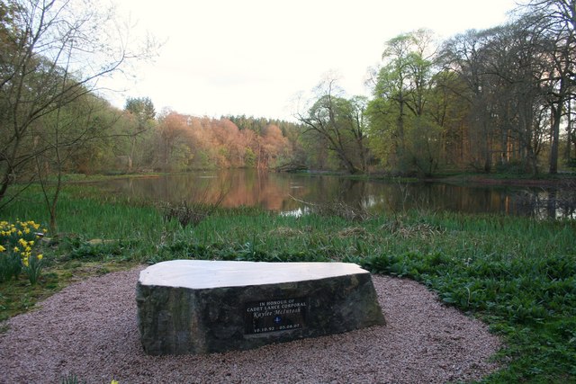
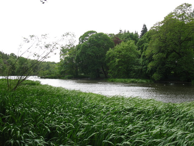
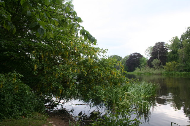
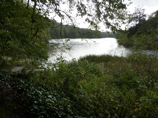
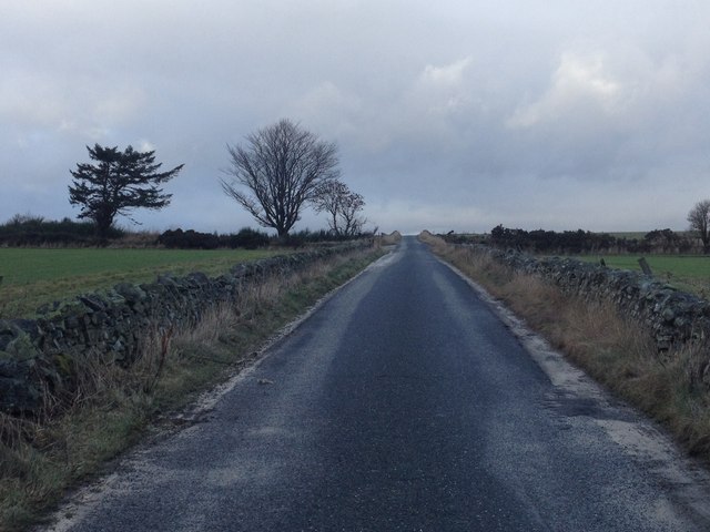
Mary's Pot is a picturesque freshwater pond located in Aberdeenshire, Scotland. Nestled amidst rolling hills and lush greenery, this natural water feature is a popular destination for locals and tourists alike. Spanning an area of approximately 2 acres, Mary's Pot is known for its crystal-clear waters and serene atmosphere.

The pond, also referred to as a lake or pool, is fed by a small stream that flows from the surrounding hills. Its water source is primarily rainwater, which results in a consistently high water level throughout the year. The pond's depth varies, with some areas reaching up to 6 feet deep, providing ample space for aquatic life to thrive.

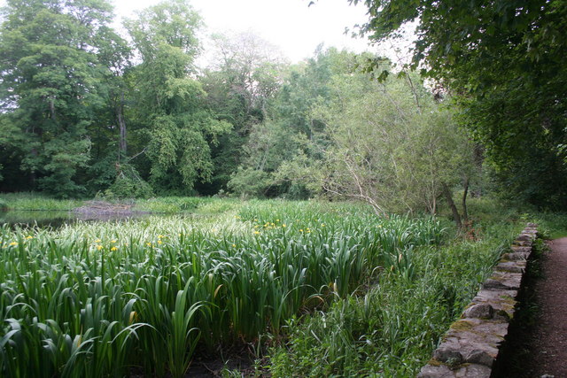
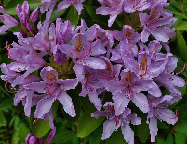
Surrounded by a diverse range of vegetation, including reeds, rushes, and water lilies, Mary's Pot serves as a habitat for various species of plants and animals. The freshwater marshes around the pond are home to rare and protected plant species, making it an important ecological site.

Visitors can enjoy a leisurely stroll along the pond's edge, taking in the stunning views and observing the abundant wildlife. The tranquil setting of Mary's Pot offers a serene escape from the hustle and bustle of daily life, providing a perfect spot for picnics, photography, and birdwatching.

Overall, Mary's Pot in Aberdeenshire is a natural gem, offering a peaceful retreat for nature enthusiasts and a habitat for a diverse range of flora and fauna.

If you have any feedback on the listing, please let us know in the comments section below.
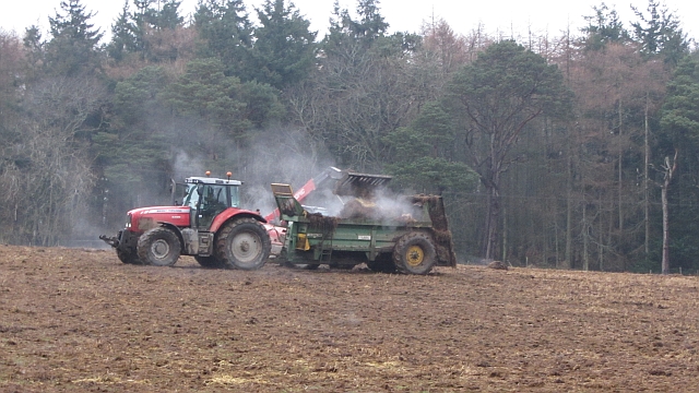
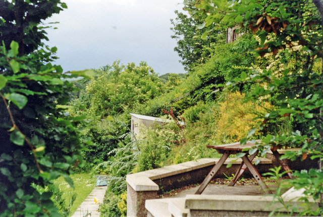
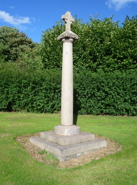
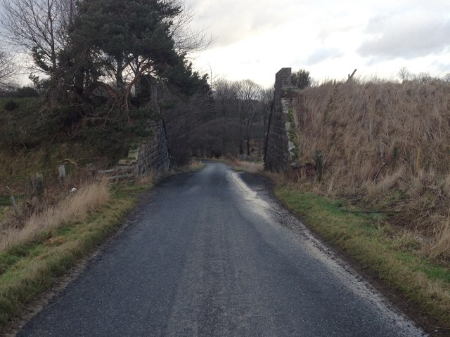
Mary's Pot Images

Images are sourced within 2km of 57.42815/-2.3940055 or Grid Reference NJ7637. Thanks to Geograph Open Source API. All images are credited.

Lakeside Memorial A memorial to an army cadet tragically killed in an accident on the west coast overlooking Fyvie Castle Lake.
Lakeside Memorial
A memorial to an army cadet tragically killed in an accident on the west coast overlooking Fyvie Castle Lake.
View of the Loch of Fyvie The northern end of the loch.
View of the Loch of Fyvie
The northern end of the loch.
The Garden of Scottish Fruits The garden at Fyvie Castle is known as The Garden of Scottish Fruits, however, there appears to be more vegetables and other plants in this area.
The Garden of Scottish Fruits
The garden at Fyvie Castle is known as The Garden of Scottish Fruits, however, there appears to be more vegetables and other plants in this area.
Flag Iris Yellow Flag Iris (Iris pseudacorus) at the edge of the Loch of Fyvie.
Flag Iris
Yellow Flag Iris (Iris pseudacorus) at the edge of the Loch of Fyvie.
Yellow over the lake Laburnum drooping over Fyvie Lake.
Yellow over the lake
Laburnum drooping over Fyvie Lake.
The Garden of Scottish Fruits, Fyvie Castle A National Trust for Scotland property, with its origins in the 13th Century, the 18th C walled garden now is devoted to the cultivation of Scottish vegetables and fruit.
The Garden of Scottish Fruits, Fyvie Castle
A National Trust for Scotland property, with its origins in the 13th Century, the 18th C walled garden now is devoted to the cultivation of Scottish vegetables and fruit.
Fyvie Castle Amazing collection of portraits, and medieval armour.
Fyvie Castle
Amazing collection of portraits, and medieval armour.
Loch of Fyvie
Loch of Fyvie
Muck spreading A field amongst pine woods. It is still cold enough for the muck to "steam".
Muck spreading
A field amongst pine woods. It is still cold enough for the muck to "steam".
Fyvie station (site/remains), 1997 The station was on the ex-GNSR branch from Inveramsay - Macduff off the Aberdeen - Elgin main line. View southward, towards Inveramsay.
The station here and line were closed to passengers from 1/10/51; the line was closed to goods Turriff - Macduff from 1/8/61, Inveramsay - Turriff (through Fyvie) from 3/1/66. (Make out what you can from the photograph!)
Fyvie station (site/remains), 1997
The station was on the ex-GNSR branch from Inveramsay - Macduff off the Aberdeen - Elgin main line. View southward, towards Inveramsay. The station here and line were closed to passengers from 1/10/51; the line was closed to goods Turriff - Macduff from 1/8/61, Inveramsay - Turriff (through Fyvie) from 3/1/66. (Make out what you can from the photograph!)
Fyvie mercat cross, Cuminestown Road
Dismantled railway bridge over a road near Haddo
Minor road near Rothiebrisbane
Fyvie Castle The view of the castle having just crossed the lawn from the car park path
Fyvie Castle
The view of the castle having just crossed the lawn from the car park path
Fyvie Castle Rhododendron
Fyvie Castle
Rhododendron
Fyvie Castle The castle entrance from the south west
Fyvie Castle
The castle entrance from the south west
Fyvie War Memorial The Fyvie War Memorial on the junction of the B9005 and C26S (Aberdeenshire) roads.
Fyvie War Memorial
The Fyvie War Memorial on the junction of the B9005 and C26S (Aberdeenshire) roads.
B9005 east of Fyvie The B9005 heading west just outside the village of Fyvie.
B9005 east of Fyvie
The B9005 heading west just outside the village of Fyvie.
Show me another place!

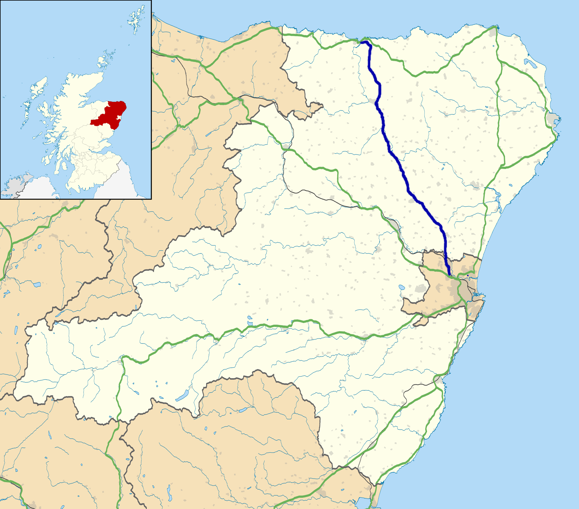
Mary's Pot is located at Grid Ref: NJ7637 (Lat: 57.42815, Lng: -2.3940055)

Unitary Authority: Aberdeenshire

Police Authority: North East

What 3 Words

///reworked.smiling.persuade. Near Rothienorman, Aberdeenshire

Nearby Locations

Fyvie Mary's Pot

Related Wikis

Fyvie

Fyvie is a village in the Formartine area of Aberdeenshire, Scotland. == Geography == Fyvie lies alongside the River Ythan and is on the A947 road. �...

Fyvie railway station

Fyvie railway station was a railway station near Fyvie, Aberdeenshire. It served the rural area and Fyvie Castle, but lay about 1 mile (1.6 km) from the...
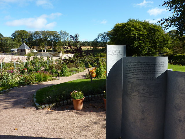
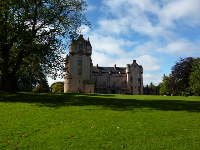
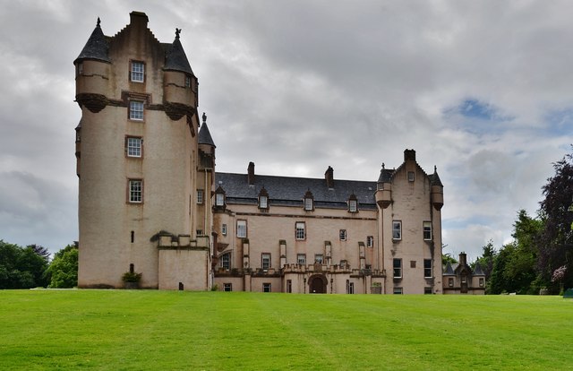
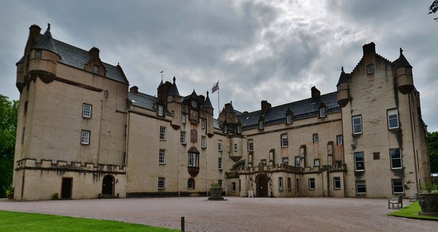
Fyvie Castle

Fyvie Castle is a castle in the village of Fyvie, near Turriff in Aberdeenshire, Scotland. == History == The earliest parts of Fyvie Castle date from the...

A947 road

The A947 is a single-carriageway road in Scotland that links Aberdeen to Banff via several towns in Aberdeenshire, including Newmachar, Oldmeldrum, Fyvie...

Backhill

Backhill is a rural area near Woodhead of Fyvie in Aberdeenshire, Scotland. == References ==

Woodhead, Aberdeenshire

Woodhead of Fyvie, often simply called "Woodhead", is an inland hamlet in Formartine, Aberdeenshire, Scotland, that lies to the east of Fyvie near the...

Tifty, Aberdeenshire

Tifty is near Turriff, Aberdeenshire, Scotland. == References ==

Rothienorman railway station

Rothienorman railway station, Rothie or Rothie Norman was a railway station in Rothienorman, Aberdeenshire on the rural branchline to Macduff. It lay 7...

Nearby Amenities

Located within 500m of 57.42815,-2.3940055
Fyvie
Alt Name Gd: Fiodh Abhainn;Fia Chein
Name Gd: Fiùghaidh
Name Sco: Fyvie
Place: village
Wikidata: Q1011189
Wikipedia: en:Fyvie
Lat/Long: 57.4307456/-2.3924105
Recycling
Fyvie recycling facility
Recycling Batteries: no
Recycling Books: no
Recycling Cans: yes
Recycling Cardboard: yes
Recycling Cartons: no
Recycling Clothes: no
Recycling Electrical Appliances: no
Recycling Glass: yes
Recycling Glass Bottles: yes
Recycling Green Waste: no
Recycling Magazines: yes
Recycling Newspaper: yes
Recycling Paper: yes
Recycling Paper Packaging: yes
Recycling Plastic: no
Recycling Plastic Bottles: yes
Recycling Plastic Packaging: no
Recycling Scrap Metal: no
Recycling Small Appliances: no
Recycling Waste: no
Recycling Wood: no
Recycling Type: container
Lat/Long: 57.4278957/-2.396015
Co-op Food
Brand: Co-op Food
Brand Wikidata: Q3277439
Brand Wikipedia: en:Co-op Food
Operator: The Co-operative Group
Operator Wikidata: Q117202
Shop: supermarket
Website: https://www.coop.co.uk/store-finder/AB53-8PB/main-street
Lat/Long: 57.4293725/-2.3956739
Pub
Vale Hotel
Addr City: Fyvie
Addr Country: GB
Addr Housename: The Lewes
Addr Postcode: AB53 8JP
Fhrs Authority: Aberdeenshire
Fhrs Id: 114228
Fhrs Local Authority Id: 4323
Lat/Long: 57.4282738/-2.3954459
Speed Camera
Ref: 4026
Lat/Long: 57.4301044/-2.4013423
Historic: memorial
Memorial: war_memorial
Wikidata: Q114168463
Lat/Long: 57.4305684/-2.3944935
Bus Stop
Bridge of Lewes
Bus: yes
Naptan AtcoCode: 630022131
Naptan Bearing: N
Naptan CommonName: Bridge of Lewes
Naptan Indicator: N bound
Naptan NaptanCode: 23627923
Naptan Street: Main Street
Naptan Verified: no
Public Transport: platform
Source: naptan;bing;naptan_compare_tool
Lat/Long: 57.4295069/-2.3954422
Bench
Lat/Long: 57.4294795/-2.3951059
Waste Basket
Lat/Long: 57.4294984/-2.3950964
Bus Stop
Bridge of Lewes
Bench: yes
Bin: yes
Bus: yes
Naptan AtcoCode: 630022141
Naptan Bearing: S
Naptan CommonName: Bridge of Lewes
Naptan Indicator: S bound
Naptan NaptanCode: 23627927
Naptan Street: Main Street
Naptan Verified: no
Public Transport: platform
Shelter: yes
Source: naptan;bing;naptan_compare_tool
Lat/Long: 57.4285012/-2.3957315
Leisure: picnic_table
Lat/Long: 57.4285009/-2.396223
Bench
Lat/Long: 57.430722/-2.3946003
Bench
Lat/Long: 57.4323672/-2.391884
Leisure: picnic_table
Lat/Long: 57.4275615/-2.3962904
Give Way
Direction: backward
Lat/Long: 57.429096/-2.3992335
Traffic Sign: yes
Lat/Long: 57.4290446/-2.3988004
Traffic Sign: yes
Lat/Long: 57.428819/-2.3981841
Traffic Sign: yes
Lat/Long: 57.4283049/-2.3974283
Traffic Sign: yes
Lat/Long: 57.428035/-2.396999
Traffic Sign: yes
Lat/Long: 57.4281246/-2.3971962
Traffic Sign: yes
Lat/Long: 57.4279624/-2.3963534
Traffic Sign: yes
Lat/Long: 57.4278293/-2.3961696
Traffic Sign: yes
Lat/Long: 57.4279578/-2.3961794
Traffic Sign: yes
Lat/Long: 57.4280652/-2.3964083
Traffic Sign: yes
Lat/Long: 57.4281587/-2.3960193
Leisure: picnic_table
Lat/Long: 57.4279979/-2.3956596
Power: pole
Lat/Long: 57.4323862/-2.392309
Post Box
Collection Times: Mo-Fr 15:30; Sa 12:15
Operator: Royal Mail
Operator Wikidata: Q638098
Post Box Design: type_l
Post Box Mounting: pole
Post Box Type: lamp
Ref: AB53 290
Royal Cypher: scottish_crown
Lat/Long: 57.427715/-2.3974603
Generator Method: photovoltaic
Generator Output Electricity: yes
Generator Source: solar
Generator Type: solar_photovoltaic_panel
Location: roof
Power: generator
Lat/Long: 57.4310685/-2.3883312
Generator Method: photovoltaic
Generator Output Electricity: yes
Generator Source: solar
Generator Type: solar_photovoltaic_panel
Location: roof
Power: generator
Lat/Long: 57.4315673/-2.3950502
Bus Stop
School Road
Bus: yes
Naptan AtcoCode: 630022152
Naptan Bearing: SW
Naptan CommonName: School Road
Naptan Indicator: at
Naptan NaptanCode: 23627924
Naptan Street: Main Street
Naptan Verified: no
Public Transport: platform
Shelter: yes
Source: naptan;bing;naptan_compare_tool
Lat/Long: 57.432486/-2.3917761
Material: wood
Power: pole
Lat/Long: 57.425168/-2.388808
Material: wood
Power: pole
Lat/Long: 57.425204/-2.3888835
Power: pole
Lat/Long: 57.4279497/-2.392182
Power: pole
Lat/Long: 57.4281924/-2.3946705
Power: pole
Lat/Long: 57.4280856/-2.3935864
Power: pole
Lat/Long: 57.4277859/-2.3909221
Power: pole
Lat/Long: 57.4276233/-2.389645
Power: pole
Lat/Long: 57.427477/-2.3885081
Power: pole
Lat/Long: 57.4269985/-2.3870972
Power: pole
Lat/Long: 57.4266512/-2.3862192
Power: pole
Lat/Long: 57.4268301/-2.4007649
Power: pole
Lat/Long: 57.4273829/-2.3997186
Power: pole
Lat/Long: 57.4279311/-2.3986658
Power: pole
Lat/Long: 57.4277755/-2.4005082
Material: wood
Power: pole
Lat/Long: 57.4290193/-2.3984986
Power: pole
Lat/Long: 57.4294096/-2.3979615
Power: pole
Lat/Long: 57.4301099/-2.3969712
Power: pole
Lat/Long: 57.4304966/-2.3964017
Power: pole
Lat/Long: 57.4309042/-2.3957135
Power: pole
Lat/Long: 57.4313049/-2.3950297
Man Made: surveillance
Surveillance: outdoor
Lat/Long: 57.4293554/-2.3955749
Bus Stop
Priory Cottages
Bus: yes
Naptan AtcoCode: 630022122
Naptan Bearing: SW
Naptan CommonName: Priory Cottages
Naptan Indicator: SW bound
Naptan NaptanCode: 23624972
Naptan Street: Main Street
Naptan Verified: no
Public Transport: platform
Source: naptan;bing;naptan_compare_tool
Lat/Long: 57.4317435/-2.3936754
Bus Stop
Priory Cottages
Bus: yes
Naptan AtcoCode: 630022121
Naptan Bearing: NE
Naptan CommonName: Priory Cottages
Naptan Indicator: NE bound
Naptan NaptanCode: 23624969
Naptan Street: Main Street
Naptan Verified: no
Public Transport: platform
Source: naptan;bing;naptan_compare_tool
Lat/Long: 57.4316509/-2.3940953
Power: pole
Lat/Long: 57.4264096/-2.3889899
Power: pole
Lat/Long: 57.4262016/-2.3893145
Material: wood
Power: pole
Lat/Long: 57.4254464/-2.3893198
Power: pole
Lat/Long: 57.425933/-2.389631
Power: transformer
Lat/Long: 57.4285658/-2.3887155
Power: transformer
Lat/Long: 57.4285445/-2.3885936
Priory Cross
Heritage Operator: Historic Environment Scotland
Heritage Website: https://portal.historicenvironment.scot/designation/LB9612
Historic: memorial
Listed Status: Category C
Material: granite
Memorial: cross
Ref GB Hs: LB9612
Start Date: 1868
Wikidata: Q56617767
Lat/Long: 57.4296441/-2.3931836
Man Made: charge_point
Lat/Long: 57.4279574/-2.3958399
The data included in this document is from www.openstreetmap.org. The data is made available under ODbL.

Have you been to Mary's Pot?

Leave your review of Mary's Pot below (or comments, questions and feedback).