Fyvie

Settlement in Aberdeenshire

Scotland

Fyvie

Lakeside Memorial A memorial to an army cadet tragically killed in an accident on the west coast overlooking Fyvie Castle Lake.
Lakeside Memorial Credit: Andrew Wood

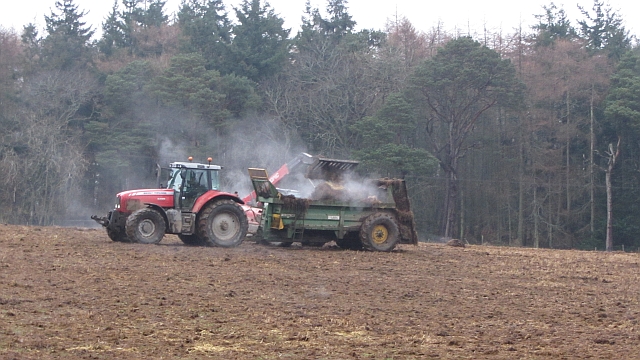
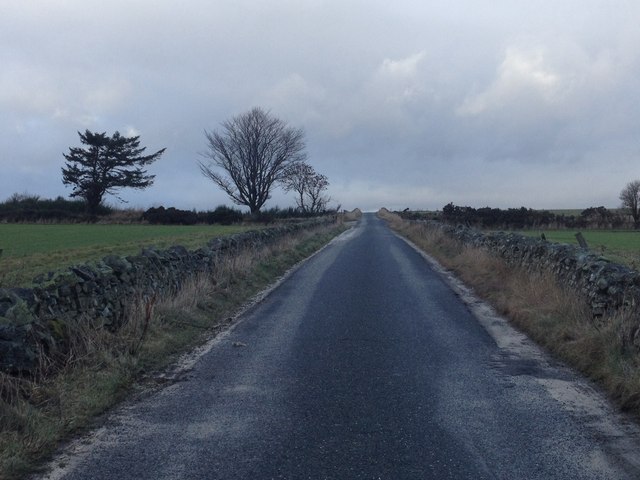
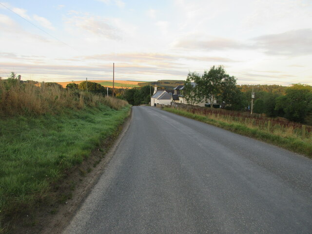
Fyvie is a small village located in the Aberdeenshire region of Scotland. Situated approximately 25 miles northwest of Aberdeen, it is known for its rich historical heritage and picturesque surroundings. The village is situated near the River Ythan, which adds to its natural charm.

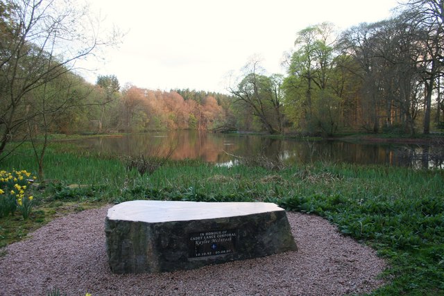
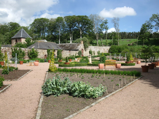
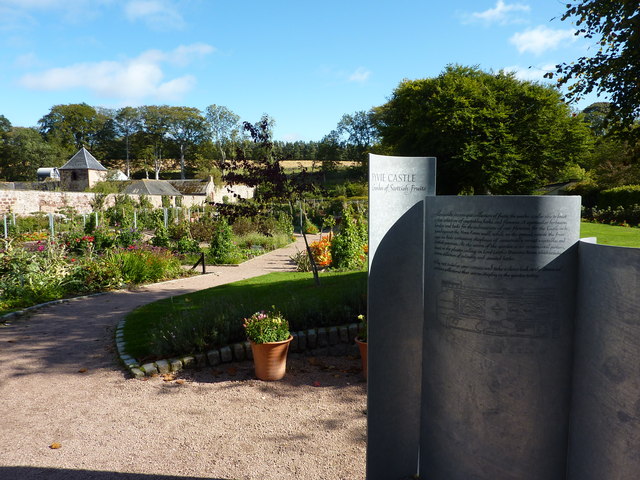
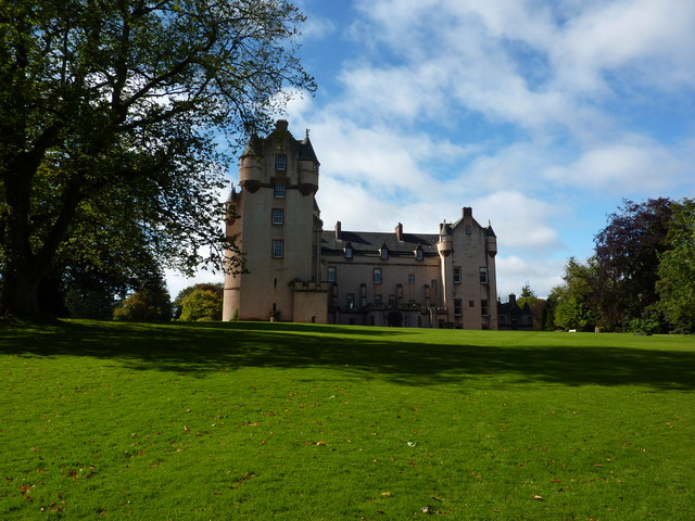
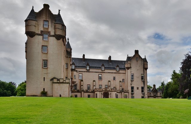
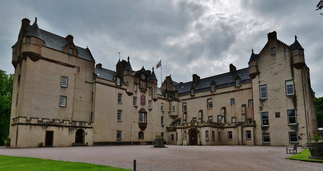
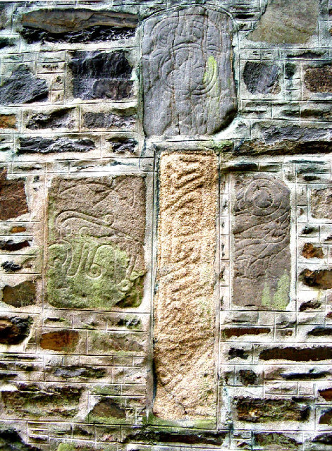
Fyvie is particularly famous for its historic Fyvie Castle. The castle, which dates back to the 13th century, is a major attraction in the area. It boasts a magnificent exterior and is surrounded by beautifully landscaped gardens. The castle has been well-preserved and offers visitors a glimpse into Scottish history through its various period rooms and exhibits.

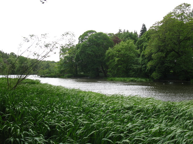
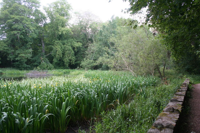
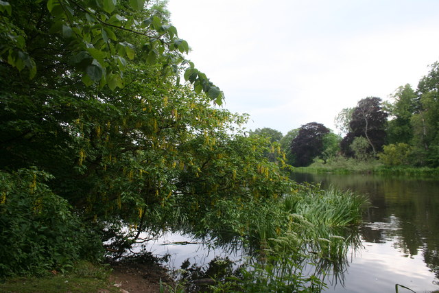
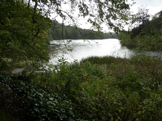
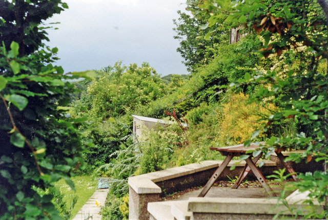
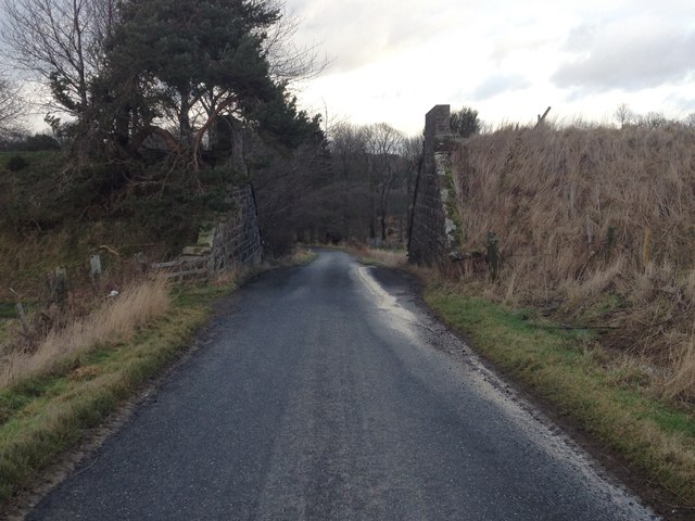
In addition to the castle, Fyvie offers visitors opportunities for outdoor activities, such as walking and cycling. The village is surrounded by stunning countryside, including rolling hills and picturesque farmland. The nearby Fyvie Loch provides a tranquil spot for birdwatching and nature enthusiasts.

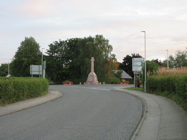
Fyvie is also home to a small but close-knit community. The village has a few local amenities, including a primary school, a post office, and a village hall. The local residents take pride in their community and often organize events and activities for residents and visitors alike.

Overall, Fyvie is a charming village with a rich history, natural beauty, and a strong sense of community. It is an ideal destination for history enthusiasts, nature lovers, and those seeking a peaceful retreat in the Scottish countryside.

If you have any feedback on the listing, please let us know in the comments section below.

Fyvie Images

Images are sourced within 2km of 57.431347/-2.394826 or Grid Reference NJ7637. Thanks to Geograph Open Source API. All images are credited.

Lakeside Memorial A memorial to an army cadet tragically killed in an accident on the west coast overlooking Fyvie Castle Lake.
Lakeside Memorial
A memorial to an army cadet tragically killed in an accident on the west coast overlooking Fyvie Castle Lake.
View of the Loch of Fyvie The northern end of the loch.
View of the Loch of Fyvie
The northern end of the loch.
The Garden of Scottish Fruits The garden at Fyvie Castle is known as The Garden of Scottish Fruits, however, there appears to be more vegetables and other plants in this area.
The Garden of Scottish Fruits
The garden at Fyvie Castle is known as The Garden of Scottish Fruits, however, there appears to be more vegetables and other plants in this area.
Flag Iris Yellow Flag Iris (Iris pseudacorus) at the edge of the Loch of Fyvie.
Flag Iris
Yellow Flag Iris (Iris pseudacorus) at the edge of the Loch of Fyvie.
Yellow over the lake Laburnum drooping over Fyvie Lake.
Yellow over the lake
Laburnum drooping over Fyvie Lake.
The Garden of Scottish Fruits, Fyvie Castle A National Trust for Scotland property, with its origins in the 13th Century, the 18th C walled garden now is devoted to the cultivation of Scottish vegetables and fruit.
The Garden of Scottish Fruits, Fyvie Castle
A National Trust for Scotland property, with its origins in the 13th Century, the 18th C walled garden now is devoted to the cultivation of Scottish vegetables and fruit.
Fyvie Castle Amazing collection of portraits, and medieval armour.
Fyvie Castle
Amazing collection of portraits, and medieval armour.
Loch of Fyvie
Loch of Fyvie
Muck spreading A field amongst pine woods. It is still cold enough for the muck to "steam".
Muck spreading
A field amongst pine woods. It is still cold enough for the muck to "steam".
Fyvie station (site/remains), 1997 The station was on the ex-GNSR branch from Inveramsay - Macduff off the Aberdeen - Elgin main line. View southward, towards Inveramsay.
The station here and line were closed to passengers from 1/10/51; the line was closed to goods Turriff - Macduff from 1/8/61, Inveramsay - Turriff (through Fyvie) from 3/1/66. (Make out what you can from the photograph!)
Fyvie station (site/remains), 1997
The station was on the ex-GNSR branch from Inveramsay - Macduff off the Aberdeen - Elgin main line. View southward, towards Inveramsay. The station here and line were closed to passengers from 1/10/51; the line was closed to goods Turriff - Macduff from 1/8/61, Inveramsay - Turriff (through Fyvie) from 3/1/66. (Make out what you can from the photograph!)
Fyvie mercat cross, Cuminestown Road
Dismantled railway bridge over a road near Haddo
Minor road near Rothiebrisbane
Fyvie Castle The view of the castle having just crossed the lawn from the car park path
Fyvie Castle
The view of the castle having just crossed the lawn from the car park path
Fyvie Castle Rhododendron
Fyvie Castle
Rhododendron
Fyvie Castle The castle entrance from the south west
Fyvie Castle
The castle entrance from the south west
Fyvie War Memorial The Fyvie War Memorial on the junction of the B9005 and C26S (Aberdeenshire) roads.
Fyvie War Memorial
The Fyvie War Memorial on the junction of the B9005 and C26S (Aberdeenshire) roads.
B9005 east of Fyvie The B9005 heading west just outside the village of Fyvie.
B9005 east of Fyvie
The B9005 heading west just outside the village of Fyvie.
Show me another place!

Fyvie is located at Grid Ref: NJ7637 (Lat: 57.431347, Lng: -2.394826)

Unitary Authority: Aberdeenshire

Police Authority: North East

What 3 Words

///refreshed.chickens.corner. Near Rothienorman, Aberdeenshire

Nearby Locations

Mary's Pot Fyvie

Related Wikis

Fyvie

Fyvie is a village in the Formartine area of Aberdeenshire, Scotland. == Geography == Fyvie lies alongside the River Ythan and is on the A947 road. �...

Fyvie railway station

Fyvie railway station was a railway station near Fyvie, Aberdeenshire. It served the rural area and Fyvie Castle, but lay about 1 mile (1.6 km) from the...

Fyvie Castle

Fyvie Castle is a castle in the village of Fyvie, near Turriff in Aberdeenshire, Scotland. == History == The earliest parts of Fyvie Castle date from the...

Backhill

Backhill is a rural area near Woodhead of Fyvie in Aberdeenshire, Scotland. == References ==
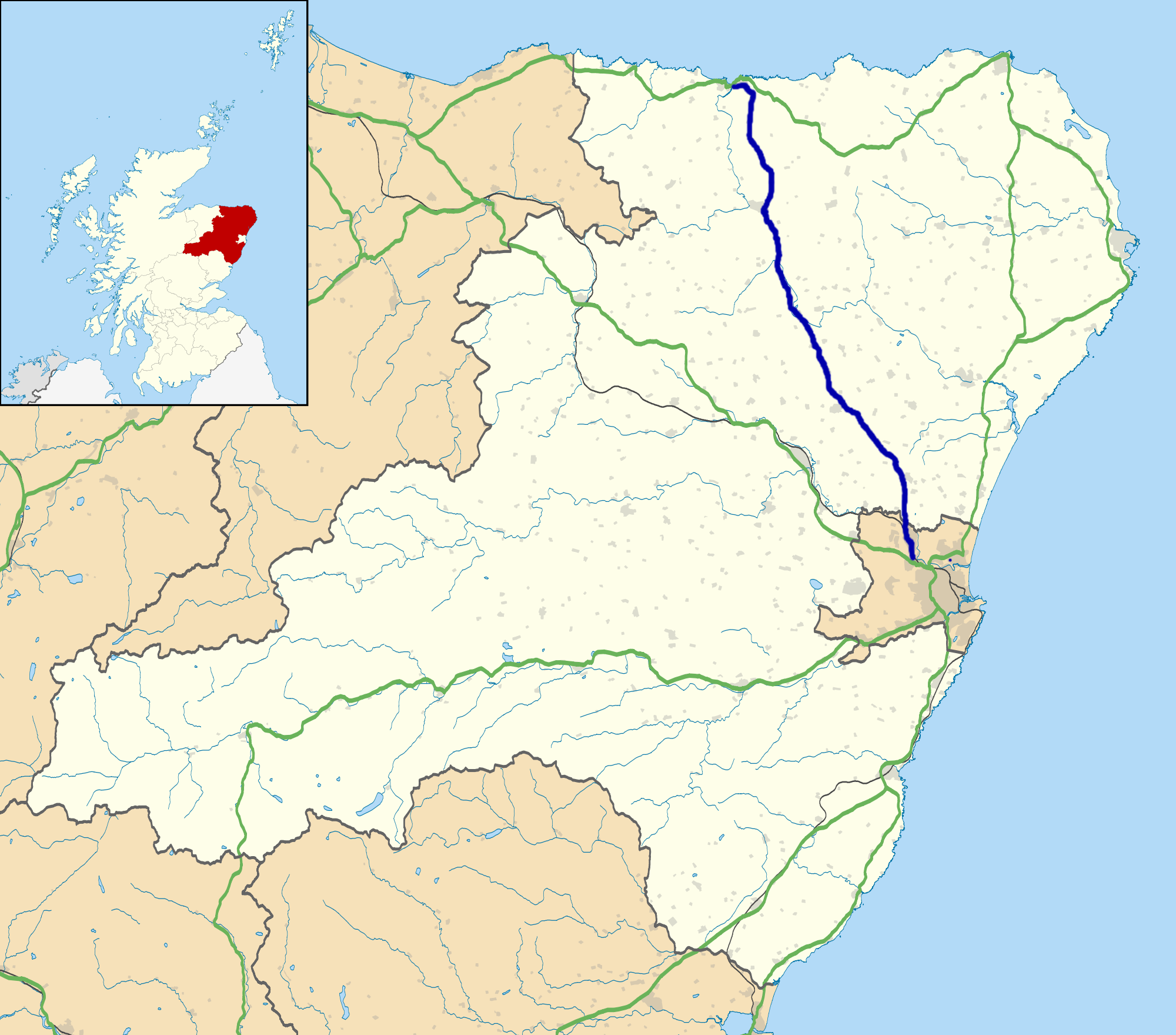
A947 road

The A947 is a single-carriageway road in Scotland that links Aberdeen to Banff via several towns in Aberdeenshire, including Newmachar, Oldmeldrum, Fyvie...

Woodhead, Aberdeenshire

Woodhead of Fyvie, often simply called "Woodhead", is an inland hamlet in Formartine, Aberdeenshire, Scotland, that lies to the east of Fyvie near the...

Tifty, Aberdeenshire

Tifty is near Turriff, Aberdeenshire, Scotland. == References ==

Rothienorman railway station

Rothienorman railway station, Rothie or Rothie Norman was a railway station in Rothienorman, Aberdeenshire on the rural branchline to Macduff. It lay 7...

Nearby Amenities

Located within 500m of 57.431347,-2.394826
Fyvie
Alt Name Gd: Fiodh Abhainn;Fia Chein
Name Gd: Fiùghaidh
Name Sco: Fyvie
Place: village
Wikidata: Q1011189
Wikipedia: en:Fyvie
Lat/Long: 57.4307456/-2.3924105
Recycling
Fyvie recycling facility
Recycling Batteries: no
Recycling Books: no
Recycling Cans: yes
Recycling Cardboard: yes
Recycling Cartons: no
Recycling Clothes: no
Recycling Electrical Appliances: no
Recycling Glass: yes
Recycling Glass Bottles: yes
Recycling Green Waste: no
Recycling Magazines: yes
Recycling Newspaper: yes
Recycling Paper: yes
Recycling Paper Packaging: yes
Recycling Plastic: no
Recycling Plastic Bottles: yes
Recycling Plastic Packaging: no
Recycling Scrap Metal: no
Recycling Small Appliances: no
Recycling Waste: no
Recycling Wood: no
Recycling Type: container
Lat/Long: 57.4278957/-2.396015
Co-op Food
Brand: Co-op Food
Brand Wikidata: Q3277439
Brand Wikipedia: en:Co-op Food
Operator: The Co-operative Group
Operator Wikidata: Q117202
Shop: supermarket
Website: https://www.coop.co.uk/store-finder/AB53-8PB/main-street
Lat/Long: 57.4293725/-2.3956739
Pub
Vale Hotel
Addr City: Fyvie
Addr Country: GB
Addr Housename: The Lewes
Addr Postcode: AB53 8JP
Fhrs Authority: Aberdeenshire
Fhrs Id: 114228
Fhrs Local Authority Id: 4323
Lat/Long: 57.4282738/-2.3954459
Speed Camera
Ref: 4026
Lat/Long: 57.4301044/-2.4013423
Fastern's Een Cross
Heritage Operator: Historic Environment Scotland
Heritage Website: https://portal.historicenvironment.scot/designation/LB9597
Historic: memorial
Listed Status: Category C
Material: stone
Memorial: mercat_cross
Ref GB Hs: LB9597
Start Date: 1902
Wikidata: Q56617758
Lat/Long: 57.4335131/-2.3900958
Historic: memorial
Memorial: war_memorial
Wikidata: Q114168463
Lat/Long: 57.4305684/-2.3944935
Bus Stop
Cuminestown Road
Bench: yes
Bin: yes
Bus: yes
Lit: yes
Naptan AtcoCode: 630022111
Naptan Bearing: NE
Naptan CommonName: Cuminestown Road
Naptan Indicator: NE bound
Naptan NaptanCode: 23624978
Naptan Street: Cuminestown Road
Naptan Verified: no
Passenger Information Display: yes
Public Transport: platform
Shelter: yes
Source: naptan;bing;naptan_compare_tool
Tactile Paving: no
Lat/Long: 57.4333947/-2.3903871
Bench
Lat/Long: 57.4333519/-2.3900984
Bus Stop
Bridge of Lewes
Bus: yes
Naptan AtcoCode: 630022131
Naptan Bearing: N
Naptan CommonName: Bridge of Lewes
Naptan Indicator: N bound
Naptan NaptanCode: 23627923
Naptan Street: Main Street
Naptan Verified: no
Public Transport: platform
Source: naptan;bing;naptan_compare_tool
Lat/Long: 57.4295069/-2.3954422
Bench
Lat/Long: 57.4294795/-2.3951059
Waste Basket
Lat/Long: 57.4294984/-2.3950964
Bus Stop
Bridge of Lewes
Bench: yes
Bin: yes
Bus: yes
Naptan AtcoCode: 630022141
Naptan Bearing: S
Naptan CommonName: Bridge of Lewes
Naptan Indicator: S bound
Naptan NaptanCode: 23627927
Naptan Street: Main Street
Naptan Verified: no
Public Transport: platform
Shelter: yes
Source: naptan;bing;naptan_compare_tool
Lat/Long: 57.4285012/-2.3957315
Leisure: picnic_table
Lat/Long: 57.4285009/-2.396223
Bench
Lat/Long: 57.430722/-2.3946003
Bench
Lat/Long: 57.4323672/-2.391884
Post Box
Operator: Royal Mail
Post Box Design: type_b
Post Box Type: pillar
Ref: AB53 252
Royal Cypher: GR
Lat/Long: 57.4326528/-2.3916915
Leisure: picnic_table
Lat/Long: 57.4275615/-2.3962904
Give Way
Direction: backward
Lat/Long: 57.429096/-2.3992335
Traffic Sign: yes
Lat/Long: 57.4290446/-2.3988004
Traffic Sign: yes
Lat/Long: 57.428819/-2.3981841
Traffic Sign: yes
Lat/Long: 57.4283049/-2.3974283
Traffic Sign: yes
Lat/Long: 57.428035/-2.396999
Traffic Sign: yes
Lat/Long: 57.4281246/-2.3971962
Traffic Sign: yes
Lat/Long: 57.4279624/-2.3963534
Traffic Sign: yes
Lat/Long: 57.4278293/-2.3961696
Traffic Sign: yes
Lat/Long: 57.4279578/-2.3961794
Traffic Sign: yes
Lat/Long: 57.4280652/-2.3964083
Traffic Sign: yes
Lat/Long: 57.4281587/-2.3960193
Leisure: picnic_table
Lat/Long: 57.4279979/-2.3956596
Barrier: bollard
Lat/Long: 57.4332368/-2.3903742
Barrier: bollard
Lat/Long: 57.4332853/-2.3903358
Barrier: bollard
Lat/Long: 57.4333343/-2.3902938
Barrier: bollard
Lat/Long: 57.433385/-2.3902495
Barrier: bollard
Lat/Long: 57.4334105/-2.3901992
Barrier: bollard
Lat/Long: 57.4334229/-2.3901339
Barrier: bollard
Lat/Long: 57.4334173/-2.3900628
Barrier: bollard
Lat/Long: 57.4333973/-2.3900079
Barrier: bollard
Lat/Long: 57.4333567/-2.3899667
Man Made: manhole
Manhole: drain
Lat/Long: 57.4332322/-2.3901713
Leisure: picnic_table
Lat/Long: 57.433414/-2.3904879
Power: pole
Lat/Long: 57.4330822/-2.3906565
Power: pole
Lat/Long: 57.4327471/-2.3914344
Power: pole
Lat/Long: 57.432592/-2.3917992
Power: pole
Lat/Long: 57.4328615/-2.3918082
Power: pole
Lat/Long: 57.4323862/-2.392309
Power: pole
Lat/Long: 57.4333047/-2.390052
Man Made: manhole
Manhole: drain
Lat/Long: 57.4333846/-2.3897969
Power: pole
Lat/Long: 57.433551/-2.3894628
Power: pole
Lat/Long: 57.4337294/-2.3889279
Traffic Sign: yes
Lat/Long: 57.4334333/-2.3894223
Traffic Sign: yes
Lat/Long: 57.4334576/-2.3893792
Post Box
Collection Times: Mo-Fr 15:30; Sa 12:15
Operator: Royal Mail
Operator Wikidata: Q638098
Post Box Design: type_l
Post Box Mounting: pole
Post Box Type: lamp
Ref: AB53 290
Royal Cypher: scottish_crown
Lat/Long: 57.427715/-2.3974603
Generator Method: photovoltaic
Generator Output Electricity: yes
Generator Source: solar
Generator Type: solar_photovoltaic_panel
Location: roof
Power: generator
Lat/Long: 57.43326/-2.3895202
Generator Method: photovoltaic
Generator Output Electricity: yes
Generator Source: solar
Generator Type: solar_photovoltaic_panel
Location: roof
Power: generator
Lat/Long: 57.4310685/-2.3883312
Generator Method: photovoltaic
Generator Output Electricity: yes
Generator Source: solar
Generator Type: solar_photovoltaic_panel
Location: roof
Power: generator
Lat/Long: 57.4315673/-2.3950502
Generator Method: photovoltaic
Generator Output Electricity: yes
Generator Source: solar
Generator Type: solar_photovoltaic_panel
Location: roof
Power: generator
Lat/Long: 57.4343482/-2.3900674
Bus Stop
School Road
Bus: yes
Naptan AtcoCode: 630022152
Naptan Bearing: SW
Naptan CommonName: School Road
Naptan Indicator: at
Naptan NaptanCode: 23627924
Naptan Street: Main Street
Naptan Verified: no
Public Transport: platform
Shelter: yes
Source: naptan;bing;naptan_compare_tool
Lat/Long: 57.432486/-2.3917761
Power: pole
Lat/Long: 57.4279497/-2.392182
Power: pole
Lat/Long: 57.4281924/-2.3946705
Power: pole
Lat/Long: 57.4280856/-2.3935864
Power: pole
Lat/Long: 57.4277859/-2.3909221
Power: pole
Lat/Long: 57.4279311/-2.3986658
Material: wood
Power: pole
Lat/Long: 57.4290193/-2.3984986
Power: pole
Lat/Long: 57.4294096/-2.3979615
Power: pole
Lat/Long: 57.4301099/-2.3969712
Power: pole
Lat/Long: 57.4304966/-2.3964017
Power: pole
Lat/Long: 57.4309042/-2.3957135
Power: pole
Lat/Long: 57.4313049/-2.3950297
Man Made: surveillance
Surveillance: outdoor
Lat/Long: 57.4293554/-2.3955749
Bus Stop
School Road
Bus: yes
Naptan AtcoCode: 630022151
Naptan Bearing: NE
Naptan CommonName: School Road
Naptan Indicator: opp
Naptan NaptanCode: 23627926
Naptan Street: Main Street
Naptan Verified: no
Public Transport: platform
Source: naptan;bing;naptan_compare_tool
Lat/Long: 57.4325585/-2.3920543
Bus Stop
Priory Cottages
Bus: yes
Naptan AtcoCode: 630022122
Naptan Bearing: SW
Naptan CommonName: Priory Cottages
Naptan Indicator: SW bound
Naptan NaptanCode: 23624972
Naptan Street: Main Street
Naptan Verified: no
Public Transport: platform
Source: naptan;bing;naptan_compare_tool
Lat/Long: 57.4317435/-2.3936754
Bus Stop
Priory Cottages
Bus: yes
Naptan AtcoCode: 630022121
Naptan Bearing: NE
Naptan CommonName: Priory Cottages
Naptan Indicator: NE bound
Naptan NaptanCode: 23624969
Naptan Street: Main Street
Naptan Verified: no
Public Transport: platform
Source: naptan;bing;naptan_compare_tool
Lat/Long: 57.4316509/-2.3940953
Power: transformer
Lat/Long: 57.4285658/-2.3887155
Power: transformer
Lat/Long: 57.4285445/-2.3885936
Priory Cross
Heritage Operator: Historic Environment Scotland
Heritage Website: https://portal.historicenvironment.scot/designation/LB9612
Historic: memorial
Listed Status: Category C
Material: granite
Memorial: cross
Ref GB Hs: LB9612
Start Date: 1868
Wikidata: Q56617767
Lat/Long: 57.4296441/-2.3931836
Man Made: charge_point
Lat/Long: 57.4279574/-2.3958399
The data included in this document is from www.openstreetmap.org. The data is made available under ODbL.

Have you been to Fyvie?

Leave your review of Fyvie below (or comments, questions and feedback).