Chantry Pond

Lake, Pool, Pond, Freshwater Marsh in Somerset Mendip

England

Chantry Pond

Nunney Village & Church View of the village and church of Nunney, photographed from outside the castle.
The footbridge in the photograph crosses the Nunney Brook and leads onto Church Street.
Nunney Village & Church Credit: Kevin Pearson

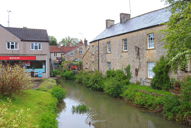
Chantry Pond is a picturesque freshwater body located in the county of Somerset, England. This enchanting water feature is situated within the beautiful Chantry Valley, surrounded by lush greenery and rolling hills, providing a serene and idyllic setting for visitors to enjoy.

Covering an area of approximately 2.5 acres, Chantry Pond is often described as a lake, pool, pond, and freshwater marsh interchangeably due to its unique characteristics. It is fed by a combination of natural springs and small streams, resulting in crystal-clear waters that support a diverse ecosystem.

The pond is home to a wide variety of aquatic life, including various fish species such as carp, roach, and perch. The surrounding marshy areas are teeming with abundant plant life, creating a haven for numerous bird species and small mammals. Birdwatchers can spot an array of waterfowl, including mallards, coots, and swans, as well as the occasional heron or kingfisher.

Chantry Pond offers recreational activities for visitors of all ages. Fishing is a popular pastime, with anglers drawn to the tranquil waters in search of a catch. The calm and peaceful surroundings also make it an ideal spot for picnics, leisurely walks, and nature appreciation.

The pond is easily accessible via a footpath that winds through the Chantry Valley, providing stunning views of the surrounding countryside. Its close proximity to nearby villages and towns makes it a popular destination for both locals and tourists looking to escape the hustle and bustle of everyday life.

Overall, Chantry Pond in Somerset is a hidden gem, offering a peaceful retreat where visitors can immerse themselves in the beauty of nature and enjoy the tranquility of its waters.

If you have any feedback on the listing, please let us know in the comments section below.

Chantry Pond Images

Images are sourced within 2km of 51.217349/-2.4022371 or Grid Reference ST7246. Thanks to Geograph Open Source API. All images are credited.
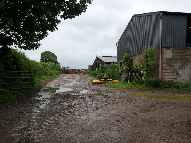
Nunney Village & Church View of the village and church of Nunney, photographed from outside the castle.
The footbridge in the photograph crosses the Nunney Brook and leads onto Church Street.
Nunney Village & Church
View of the village and church of Nunney, photographed from outside the castle. The footbridge in the photograph crosses the Nunney Brook and leads onto Church Street.
Nunney Castle Nunney Castle, viewed from the eastern end of Castle Street.
Nunney Castle
Nunney Castle, viewed from the eastern end of Castle Street.
Church Street in Nunney View of Church Street in Nunney, photographed from outside the church, looking south west towards the George Inn.
Church Street in Nunney
View of Church Street in Nunney, photographed from outside the church, looking south west towards the George Inn.
Church of All Saints, Nunney The Church of All Saints in Nunney, photographed from the gate on Church Street.
Church of All Saints, Nunney
The Church of All Saints in Nunney, photographed from the gate on Church Street.
Nunney Castle <span class="nowrap"><a title="https://historicengland.org.uk/listing/the-list/list-entry/1014716?section=official-listing" rel="nofollow ugc noopener" href="https://historicengland.org.uk/listing/the-list/list-entry/1014716?section=official-listing">Link</a><img style="margin-left:2px;" alt="External link" title="External link - shift click to open in new window" src="https://s1.geograph.org.uk/img/external.png" width="10" height="10"/></span>
Nunney Castle
Whatley Church Church at Whatley.
Whatley Church
Church at Whatley.
Nunney Brook Brook and buildings in Nunney.
Nunney Brook
Brook and buildings in Nunney.
Nunney Castle View from the south
Nunney Castle
View from the south
Old Milestone West of Whatley Crossroads The Milestone is located on grass verge and hedge on the South of the road.  Parish of Whatley (Mendip District). Metal plate attached to stone post, Frome square iron plate design, erected by the Frome turnpike trust in the 18th Century. An earlier photograph can be found here: <a title="https://www.geograph.org.uk/photo/6051504" href="https://www.geograph.org.uk/photo/6051504">Link</a> 

Inscription reads:-  
FROME / 3 / WELLS / 12 

Grade II listed. List Entry Number: 1295398 <span class="nowrap"><a title="https://historicengland.org.uk/listing/the-list/list-entry/1295398" rel="nofollow ugc noopener" href="https://historicengland.org.uk/listing/the-list/list-entry/1295398">Link</a><img style="margin-left:2px;" alt="External link" title="External link - shift click to open in new window" src="https://s1.geograph.org.uk/img/external.png" width="10" height="10"/></span> 

Milestone Society National ID: SO_FRWL03
Old Milestone West of Whatley Crossroads
The Milestone is located on grass verge and hedge on the South of the road.  Parish of Whatley (Mendip District). Metal plate attached to stone post, Frome square iron plate design, erected by the Frome turnpike trust in the 18th Century. An earlier photograph can be found here: Link  Inscription reads:- FROME / 3 / WELLS / 12 Grade II listed. List Entry Number: 1295398 LinkExternal link Milestone Society National ID: SO_FRWL03
Direction Sign – Signpost by the bridge in Nunney Located beside the bridge on the west side of the junction of Castle Hill, Church Street and High Street in Nunney parish. 3 arms and pyramid finial. See also <a title="https://www.geograph.org.uk/photo/6043241" href="https://www.geograph.org.uk/photo/6043241">Link</a>.

Milestone Society National ID: SO_ST7345
Direction Sign – Signpost by the bridge in Nunney
Located beside the bridge on the west side of the junction of Castle Hill, Church Street and High Street in Nunney parish. 3 arms and pyramid finial. See also Link. Milestone Society National ID: SO_ST7345
2011 : Track through Asham Wood Wikipedia has this to say:
"Asham Wood is the largest and most diverse of the ancient semi-natural woods in the Mendips. It has been the subject of controversy and attempts to protect the environment from increased quarrying activity in the area.
The wood occupies 2 deep valleys and the intervening plateau. Most of the underlying rocks are calcareous Carboniferous Limestone and Shales, but Devonian Portishead Beds outcrop along the northern valley. There [is] a range of unusual flora and fauna.
At Asham Wood near Frome coppicing and 50 dormouse boxes have been introduced in order to encourage nesting. The boxes are monitored and dormice numbers are recorded."  <span class="nowrap"><a title="http://en.wikipedia.org/wiki/Asham_Wood" rel="nofollow ugc noopener" href="http://en.wikipedia.org/wiki/Asham_Wood">Link</a><img style="margin-left:2px;" alt="External link" title="External link - shift click to open in new window" src="https://s1.geograph.org.uk/img/external.png" width="10" height="10"/></span>

The only access to Asham Wood from the road is on the north east edge near Dead Womans Bottom, otherwise it is by footpath.
2011 : Track through Asham Wood
Wikipedia has this to say: "Asham Wood is the largest and most diverse of the ancient semi-natural woods in the Mendips. It has been the subject of controversy and attempts to protect the environment from increased quarrying activity in the area. The wood occupies 2 deep valleys and the intervening plateau. Most of the underlying rocks are calcareous Carboniferous Limestone and Shales, but Devonian Portishead Beds outcrop along the northern valley. There [is] a range of unusual flora and fauna. At Asham Wood near Frome coppicing and 50 dormouse boxes have been introduced in order to encourage nesting. The boxes are monitored and dormice numbers are recorded." LinkExternal link The only access to Asham Wood from the road is on the north east edge near Dead Womans Bottom, otherwise it is by footpath.
Nunney Castle and moat
Road at Park Corner
Road at Park Corner
Gate on Limekiln Lane onto guarded property
Finger Farm yard
Finger Farm yard
Road to Mells at Finger Farm
A wet field entrance
Interior, Nunney Castle One of four towers in the moated 14th century castle shown here <a href="https://www.geograph.org.uk/photo/694664">ST7345 : Nunney Castle (2)</a> .
Nunney Castle is cared for by English Heritage <span class="nowrap"><a title="http://www.english-heritage.org.uk/daysout/properties/nunney-castle/" rel="nofollow ugc noopener" href="http://www.english-heritage.org.uk/daysout/properties/nunney-castle/">Link</a><img style="margin-left:2px;" alt="External link" title="External link - shift click to open in new window" src="https://s1.geograph.org.uk/img/external.png" width="10" height="10"/></span> .
Interior, Nunney Castle
One of four towers in the moated 14th century castle shown here ST7345 : Nunney Castle (2) . Nunney Castle is cared for by English Heritage LinkExternal link .
Show me another place!

Chantry Pond is located at Grid Ref: ST7246 (Lat: 51.217349, Lng: -2.4022371)

Administrative County: Somerset

District: Mendip

Police Authority: Avon and Somerset

What 3 Words

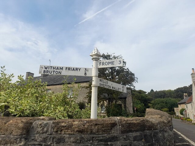
///crouching.stables.blocking. Near Frome, Somerset

Nearby Locations

Chantry Pond

Related Wikis

Colemans Quarry

Colemans Quarry, grid reference ST726452 is a limestone quarry at Holwell, near Nunney on the Mendip Hills, Somerset, England. The Colemans Quarry complex...

Asham Wood

Asham Wood (grid reference ST705460) is a 140.6-hectare (347-acre) biological Site of Special Scientific Interest east of Downhead and south of Leigh-on...

Holwell Quarries

Holwell Quarries (grid reference ST726450) is a 1.3-hectare (3.2-acre) geological Site of Special Scientific Interest at Holwell near Nunney on the Mendip...

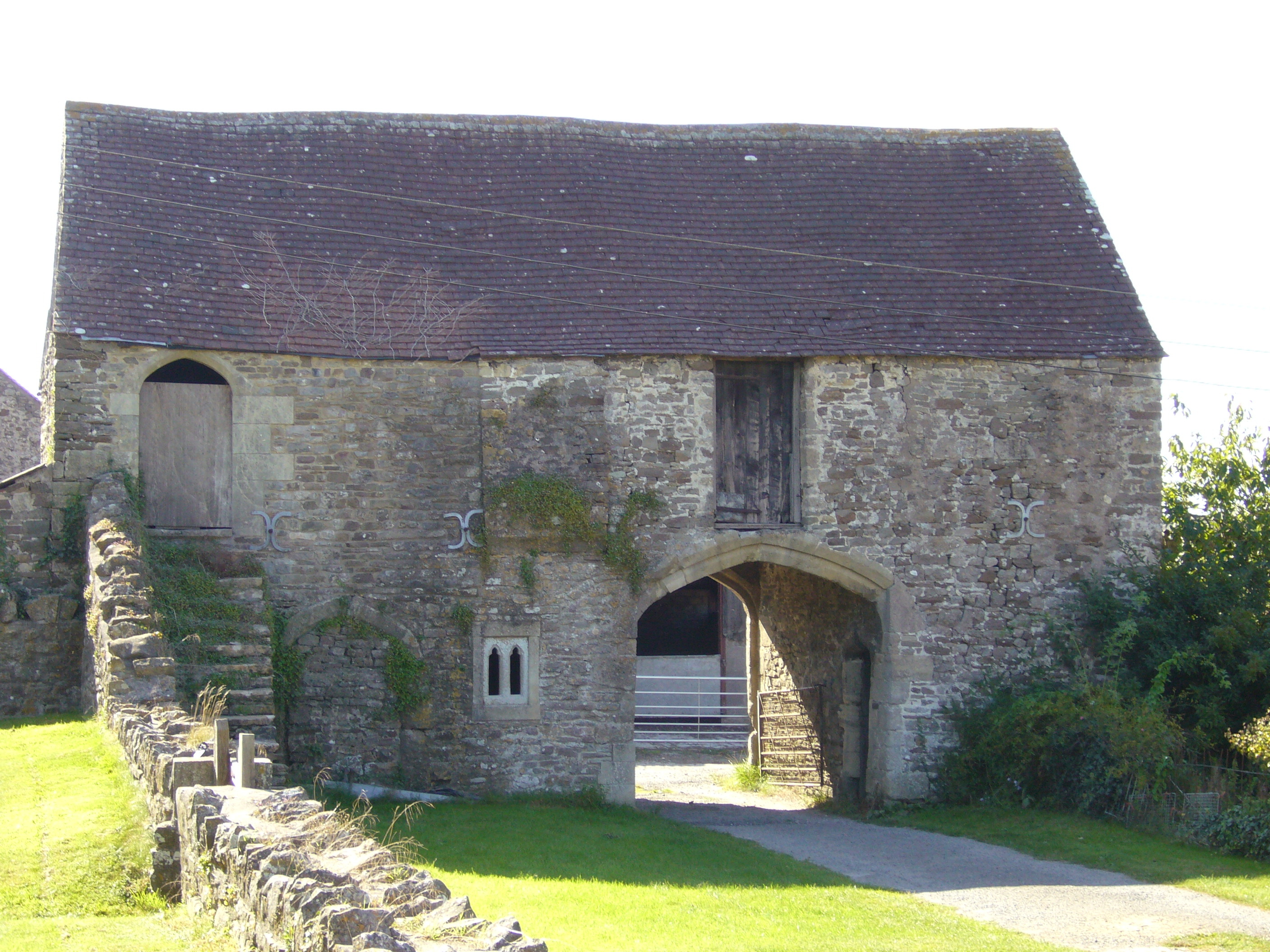
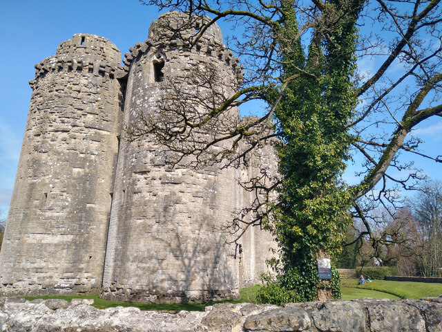
Manor Farmhouse Gatehouse, Whatley

The Manor Farmhouse Gatehouse in Whatley, Somerset, England, was built around 1500 and has been designated as a Grade I listed building.The two-storey...

Nearby Amenities

Located within 500m of 51.217349,-2.4022371
Source: Bing
Lat/Long: 51.221815/-2.4014645
Dead Woman's Bottom
Place: locality
Lat/Long: 51.2148346/-2.4074715
The data included in this document is from www.openstreetmap.org. The data is made available under ODbL.

Have you been to Chantry Pond?

Leave your review of Chantry Pond below (or comments, questions and feedback).