Upper Maisondieu

Lake, Pool, Pond, Freshwater Marsh in Roxburghshire

Scotland

Upper Maisondieu

Summit, Brox Law The maize provides cover and food for pheasants.
Summit, Brox Law Credit: Richard Webb

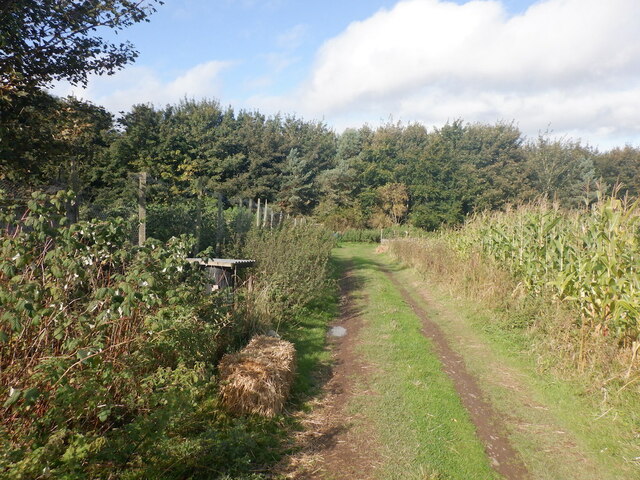
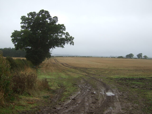
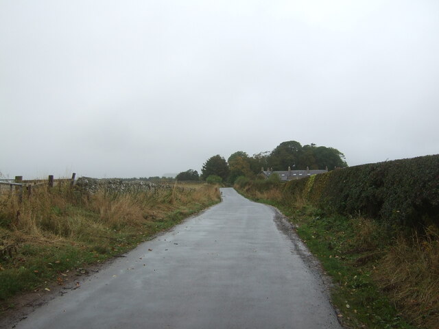
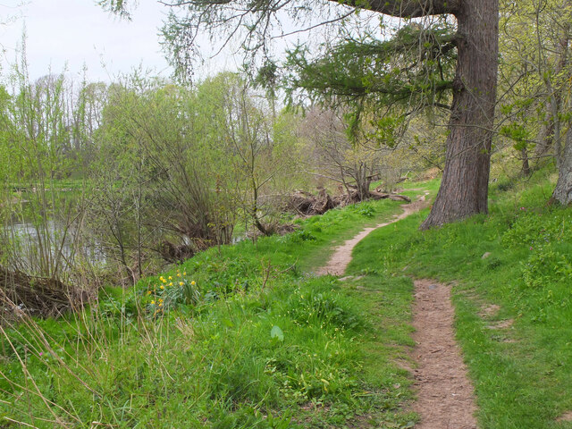
Upper Maisondieu is a freshwater marsh located in the picturesque region of Roxburghshire, Scotland. Situated near the village of Jedburgh, it is a tranquil and serene environment that is home to various bodies of water, including a lake, pool, and pond.

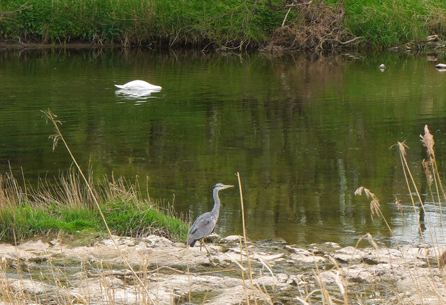
The main feature of Upper Maisondieu is its expansive lake, which spans a considerable area and serves as a focal point for both wildlife and visitors. The lake is surrounded by lush vegetation, including reeds, rushes, and water lilies, creating a stunning natural landscape. Its calm waters provide a habitat for numerous species of fish, amphibians, and waterfowl, making it a popular spot for birdwatching and fishing enthusiasts.

Adjacent to the lake is a smaller pool, providing a more intimate setting for observing the local flora and fauna. This pool is often teeming with various species of water plants and insects, creating a vibrant and ecologically diverse ecosystem.

Furthermore, Upper Maisondieu boasts a smaller pond, which is ideal for observing smaller aquatic creatures such as frogs, newts, and dragonflies. This pond is surrounded by marshy vegetation, adding to the overall aesthetic appeal of the area.

Overall, Upper Maisondieu in Roxburghshire offers a unique and beautiful landscape for nature lovers and outdoor enthusiasts. Its diverse bodies of water, including the expansive lake, smaller pool, and intimate pond, provide a haven for a wide range of wildlife, making it an ideal destination for those seeking a peaceful and immersive natural experience.

If you have any feedback on the listing, please let us know in the comments section below.

Upper Maisondieu Images

Images are sourced within 2km of 55.587186/-2.4617501 or Grid Reference NT7032. Thanks to Geograph Open Source API. All images are credited.

Summit, Brox Law The maize provides cover and food for pheasants.
Summit, Brox Law
The maize provides cover and food for pheasants.
Stubble field and hedgerow, Over Roxburgh
Minor road, Over Roxburgh
Millennium Garden at Floors Castle This lovely formal garden with its French-style parterre was created to commemorate the new millennium and features the intertwining initials of the 10th Duke and Duchess of Roxburghe.
Millennium Garden at Floors Castle
This lovely formal garden with its French-style parterre was created to commemorate the new millennium and features the intertwining initials of the 10th Duke and Duchess of Roxburghe.
The approach to Floors Castle Floors Castle is set in the Roxburghe Estate. It is one of the most excellent stately homes Scotland has to offer. 
<span class="nowrap"><a title="https://www.floorscastle.com/visit-us/floors-castle/" rel="nofollow ugc noopener" href="https://www.floorscastle.com/visit-us/floors-castle/">Link</a><img style="margin-left:2px;" alt="External link" title="External link - shift click to open in new window" src="https://s1.geograph.org.uk/img/external.png" width="10" height="10"/></span>
The approach to Floors Castle
Floors Castle is set in the Roxburghe Estate. It is one of the most excellent stately homes Scotland has to offer. LinkExternal link
Walled garden at Floors Castle With Hermes on his pedestal.
<a title="https://www.geograph.org.uk/photo/6960162" href="https://www.geograph.org.uk/photo/6960162">Link</a>
Walled garden at Floors Castle
With Hermes on his pedestal. Link
Former Head Gardener's House, Floors Castle, Kelso This house stands within the Walled Garden of Floors Castle and has been beautifully restored. It is now available as a holiday let.
Former Head Gardener's House, Floors Castle, Kelso
This house stands within the Walled Garden of Floors Castle and has been beautifully restored. It is now available as a holiday let.
Floors Castle (Main Block), Kelso Standing on the banks of the River Tweed, Floors Castle has the common 18th-century layout of a main block with two symmetrical service wings. The Castle is a Category A Listed Building.
Floors Castle (Main Block), Kelso
Standing on the banks of the River Tweed, Floors Castle has the common 18th-century layout of a main block with two symmetrical service wings. The Castle is a Category A Listed Building.
Weather Station, Walled Garden, Floors Castle, Kelso This box is known as a Stevenson Screen and contains instruments that measure temperature, humidity and rainfall. An official weather station for the Meteorological Office since 1941, records are collected daily by the Head Gardener and are then passed on to the Meteorological Office.
Weather Station, Walled Garden, Floors Castle, Kelso
This box is known as a Stevenson Screen and contains instruments that measure temperature, humidity and rainfall. An official weather station for the Meteorological Office since 1941, records are collected daily by the Head Gardener and are then passed on to the Meteorological Office.
Road, Floors Castle Newly trimmed hedges.
Road, Floors Castle
Newly trimmed hedges.
Farm buildings, Roxburgh
River Teviot near Roxburgh Mill
Minor road near Roxburgh Mill
Bend in the River Teviot near Roxburgh Mill
Salmon angling on the River Tweed at Kelso A boatman and his client are on the famous Junction Pool where the River Teviot and River Tweed meet.
Salmon angling on the River Tweed at Kelso
A boatman and his client are on the famous Junction Pool where the River Teviot and River Tweed meet.
Upstream from the last bridge on the Teviot Looking upstream from the bridge where the A699 crosses the Teviot less than a kilometre from its confluence with the Tweed at Kelso.
Upstream from the last bridge on the Teviot
Looking upstream from the bridge where the A699 crosses the Teviot less than a kilometre from its confluence with the Tweed at Kelso.
Riverside path by the Teviot The Borders Abbeys Way follows this attractive stretch of the Teviot between Kelso and Roxburgh, then on to Jedfoot and Jedburgh.
Riverside path by the Teviot
The Borders Abbeys Way follows this attractive stretch of the Teviot between Kelso and Roxburgh, then on to Jedfoot and Jedburgh.
Heron and swan, River Teviot Grey herons are common on the Borders rivers.
Heron and swan, River Teviot
Grey herons are common on the Borders rivers.
Show me another place!

Upper Maisondieu is located at Grid Ref: NT7032 (Lat: 55.587186, Lng: -2.4617501)

Unitary Authority: The Scottish Borders

Police Authority: The Lothians and Scottish Borders

What 3 Words

///sweetened.trucked.willing. Near Kelso, Scottish Borders

Related Wikis

Capture of Roxburgh (1314)

The Capture of Roxburgh was a siege that took place in 1314, which was a major conflict in the First War of Scottish Independence. This siege was a prelude...

Roxburgh Castle

Roxburgh Castle is a ruined royal castle that overlooks the junction of the rivers Tweed and Teviot, in the Borders region of Scotland. The town and castle...

Roxburgh

Roxburgh () is a civil parish and formerly a royal burgh, in the historic county of Roxburghshire in the Scottish Borders, Scotland. It was an important...

Capture of Roxburgh (1460)

The capture of Roxburgh was a siege that took place during the Anglo-Scottish Wars. James II of Scotland had started a campaign to recapture Roxburgh and...

Nearby Amenities

Located within 500m of 55.587186,-2.4617501
Site of Maison Dieu
Historic: archaeological_site
Lat/Long: 55.5873335/-2.454826
Shelter
Bench: yes
Shelter Type: weather_shelter
Survey Date: 2021-05-08
Lat/Long: 55.5886631/-2.4613611
Power: pole
Lat/Long: 55.591214/-2.4638181
Power: pole
Lat/Long: 55.5907571/-2.4650206
Power: pole
Lat/Long: 55.590306/-2.4662257
Power: pole
Lat/Long: 55.5898549/-2.4674102
Power: pole
Lat/Long: 55.5893733/-2.4664085
Power: pole
Lat/Long: 55.5888945/-2.4654068
Power: pole
Lat/Long: 55.5879952/-2.465327
Power: pole
Lat/Long: 55.5871541/-2.465255
Power: pole
Lat/Long: 55.5863712/-2.465188
Power: pole
Lat/Long: 55.5855984/-2.4651107
Power: pole
Lat/Long: 55.5848227/-2.4650515
Power: pole
Lat/Long: 55.5840426/-2.4649871
Power: pole
Lat/Long: 55.5833775/-2.4655279
Power: pole
Lat/Long: 55.585578/-2.4547568
Power: pole
Lat/Long: 55.5855649/-2.455779
Power: pole
Lat/Long: 55.5858691/-2.457033
Power: pole
Lat/Long: 55.5861936/-2.4583077
Power: pole
Lat/Long: 55.586505/-2.4596029
Power: pole
Lat/Long: 55.586831/-2.4608388
Power: pole
Lat/Long: 55.5869576/-2.4624662
Power: pole
Lat/Long: 55.5870406/-2.4638516
Power: pole
Lat/Long: 55.5873462/-2.4670497
Power: pole
Lat/Long: 55.5875208/-2.4682857
Power: pole
Lat/Long: 55.5876853/-2.4694856
The data included in this document is from www.openstreetmap.org. The data is made available under ODbL.

Have you been to Upper Maisondieu?

Leave your review of Upper Maisondieu below (or comments, questions and feedback).