The Mill Stream

Lake, Pool, Pond, Freshwater Marsh in Dorset

England

The Mill Stream

Woodland, Hollow Hill
Woodland, Hollow Hill Credit: JThomas

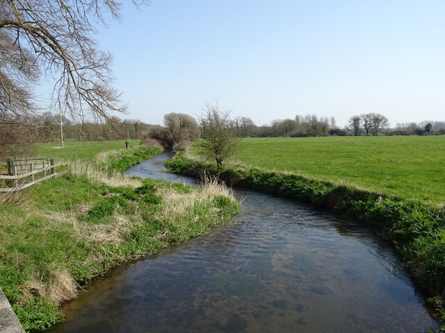
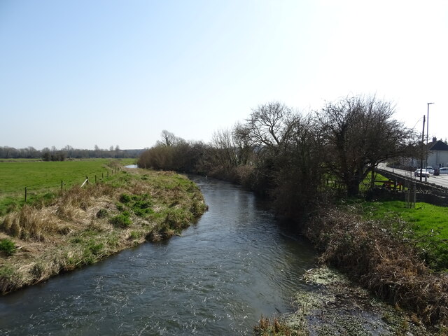
The Mill Stream is a picturesque freshwater feature located in Dorset, England. Often referred to as a lake, pool, pond, or freshwater marsh, it serves as a prominent landmark and a popular destination for both locals and tourists alike.

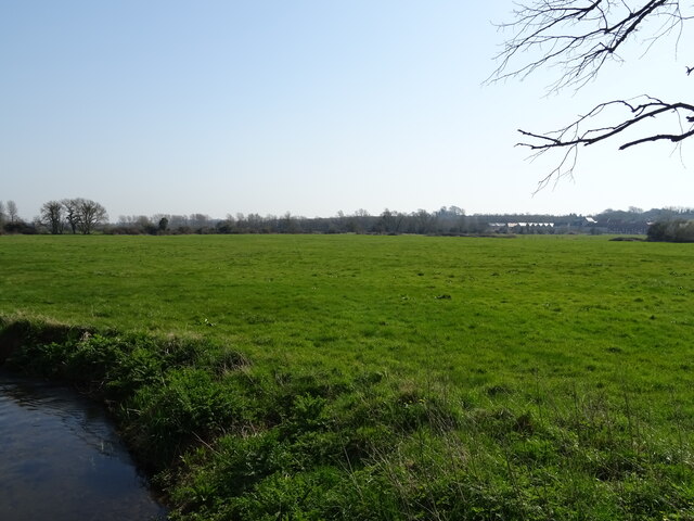
Spanning an area of approximately 10 acres, The Mill Stream is surrounded by lush greenery and tranquil surroundings. It is fed by natural springs and a small stream that flows into it, resulting in clear and pristine water. The water is known for its high quality and is home to a diverse range of flora and fauna.

The Mill Stream offers a tranquil and serene atmosphere, making it an ideal spot for relaxation and leisure activities. Visitors can enjoy picnicking by the water's edge, taking in the breathtaking views of the surrounding countryside, or simply unwinding with a book.

The abundant wildlife within The Mill Stream adds to its appeal. It is home to a variety of fish species, such as brown trout and perch, which attract avid anglers. Birdwatchers can also spot a range of avian species, including swans, ducks, and herons, nesting and foraging around the water's edge.

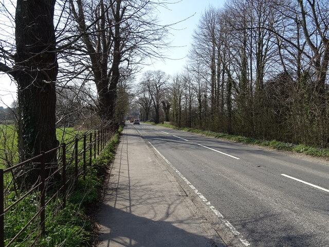
The Mill Stream is easily accessible, with well-maintained footpaths and seating areas provided for visitors. The site is managed and maintained by local authorities to ensure its preservation and protection for future generations to enjoy. Overall, The Mill Stream offers a peaceful retreat in the heart of Dorset's scenic beauty, providing a haven for nature enthusiasts and those seeking solace in the great outdoors.

If you have any feedback on the listing, please let us know in the comments section below.

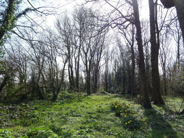
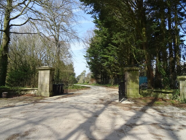
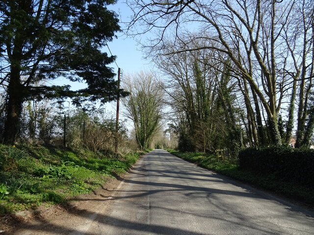
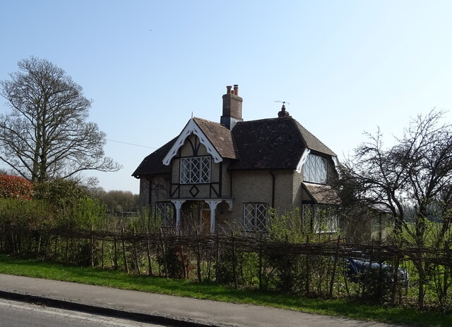
The Mill Stream Images

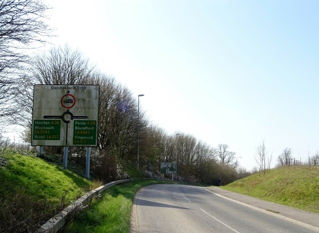
Images are sourced within 2km of 50.713616/-2.4248896 or Grid Reference SY7090. Thanks to Geograph Open Source API. All images are credited.

Woodland, Hollow Hill
Gateway to Birkin House
Minor road towards Ilsington
Eagle Lodge
Eagle Lodge
Hollow Hill approaching A35 roundabout
B3150 towards Dorchester
B3143 towards Piddlehinton
Stream near Dorchester
Grazing near Dorchester
B3150 towards Dorchester
River Frome from Grey's Bridge
Storage area near sewage works
St Michael's Church, Stinsford, Dorset Generally, of 13th-century origins but with many modifications and refurbishments since.
St Michael's Church, Stinsford, Dorset
Generally, of 13th-century origins but with many modifications and refurbishments since.
St Michael's Church, Stinsford, Dorset Generally, of 13th-century origins but with many modifications and refurbishments since.
St Michael's Church, Stinsford, Dorset
Generally, of 13th-century origins but with many modifications and refurbishments since.
St Michael's Church, Stinsford, Dorset A general view from the North aisle across the church. This aisle was incorporated into the church in 1630.
St Michael's Church, Stinsford, Dorset
A general view from the North aisle across the church. This aisle was incorporated into the church in 1630.
St Michael's Church, Stinsford, Dorset The faded Victorian glass of the East window in the North aisle.
St Michael's Church, Stinsford, Dorset
The faded Victorian glass of the East window in the North aisle.
St Michael's Church, Stinsford, Dorset A general view from the South aisle across the church.
St Michael's Church, Stinsford, Dorset
A general view from the South aisle across the church.
St Michael's Church, Stinsford, Dorset The South aisle East window.
St Michael's Church, Stinsford, Dorset
The South aisle East window.
Show me another place!

The Mill Stream is located at Grid Ref: SY7090 (Lat: 50.713616, Lng: -2.4248896)

Unitary Authority: Dorset

Police Authority: Dorset

What 3 Words

///scornful.lime.grant. Near Dorchester, Dorset

Related Wikis

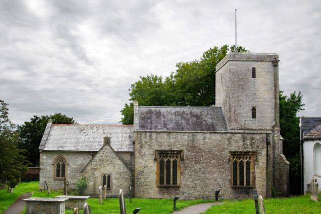
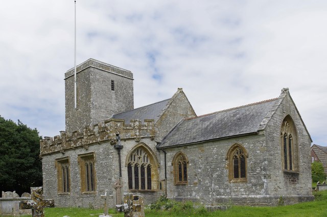
St George's Church, Fordington

St George's Church is a Church of England church in Dorchester, Dorset, England and the parish church of the suburb of Fordington. St George's has been...

Fordington (liberty)

Fordington Liberty was a liberty in the county of Dorset, England, containing the following parishes: Fordington Hermitage Minterne Magna (part) Stockland...

Fordington, Dorset

Fordington is a part of the town of Dorchester, Dorset; originally a separate village, it has now become a suburb. Taking its name from a ford across the...

Dorset Martyrs Memorial

The Dorset Martyrs Memorial is a grade II listed sculpture by Elisabeth Frink in Dorchester, Dorset, England. It was unveiled in 1986 on the site of the...

Nearby Amenities

Located within 500m of 50.713616,-2.4248896
Mini Roundabout
Direction: clockwise
Lat/Long: 50.7123918/-2.4266014
Barrier: bollard
Lat/Long: 50.7119121/-2.4223823
Turning Circle
Lat/Long: 50.7122208/-2.4309941
Material: wood
Power: pole
Source: bing
Lat/Long: 50.7176455/-2.4218741
Dorset Martyrs
Artist Name: Elisabeth Frink
Artwork Type: statue
Tourism: artwork
Wikimedia Commons: Category:Dorset Martyrs by Elisabeth Frink (Dorchester)
Lat/Long: 50.712779/-2.4315126
Post Box
Post Box Mounting: brick_pillar
Post Box Type: wall
Ref: DT1 44
Royal Cypher: EVIIR
Royal Cypher Wikidata: Q33102324
Lat/Long: 50.7116204/-2.4248352
Give Way
Lat/Long: 50.711324/-2.4278912
Traffic Signals
Traffic Signals: signal
Traffic Signals Direction: backward
Lat/Long: 50.7161926/-2.4263327
Traffic Signals
Traffic Signals: signal
Traffic Signals Direction: backward
Lat/Long: 50.7162991/-2.426602
Traffic Signals
Traffic Signals: signal
Traffic Signals Direction: forward
Lat/Long: 50.716418/-2.4256162
Fordington
Place: quarter
Lat/Long: 50.7141096/-2.4288775
Traffic Signals
Crossing: traffic_signals
Crossing Ref: pelican
Traffic Signals: signal
Lat/Long: 50.7098905/-2.4286666
Give Way
Lat/Long: 50.7098945/-2.4288696
Post Box
Operator: Royal Mail
Operator Wikidata: Q638098
Post Box Type: wall
Ref: DT1 1
Ref GB Uprn: 10015410851
Royal Cypher: EIIR
Royal Cypher Wikidata: Q33102113
Lat/Long: 50.7132222/-2.4289682
Telephone
Booth: K6
Covered: booth
Fee: yes
Operator: BT
Operator Wikidata: Q593786
Phone: +44 1305 262619
Lat/Long: 50.7125529/-2.4265715
Board Type: history
Information: board
Tourism: information
Lat/Long: 50.7134993/-2.4287371
Direction: 170
Generator Method: photovoltaic
Generator Output Electricity: yes
Generator Solar Modules: 14
Generator Source: solar
Generator Type: solar_photovoltaic_panel
Location: roof
Power: generator
Lat/Long: 50.7163059/-2.4291174
Direction: 170
Generator Method: photovoltaic
Generator Output Electricity: yes
Generator Solar Modules: 12
Generator Source: solar
Generator Type: solar_photovoltaic_panel
Location: roof
Power: generator
Lat/Long: 50.7160284/-2.4271993
Direction: SSW
Generator Method: photovoltaic
Generator Output Electricity: yes
Generator Solar Modules: 26
Generator Source: solar
Generator Type: solar_photovoltaic_panel
Location: roof
Power: generator
Lat/Long: 50.7148938/-2.4291942
Direction: SSW
Generator Method: photovoltaic
Generator Output Electricity: yes
Generator Solar Modules: 12
Generator Source: solar
Generator Type: solar_photovoltaic_panel
Location: roof
Power: generator
Lat/Long: 50.7131239/-2.4285411
Direction: SSW
Generator Method: photovoltaic
Generator Output Electricity: yes
Generator Solar Modules: 8
Generator Source: solar
Generator Type: solar_photovoltaic_panel
Location: roof
Power: generator
Lat/Long: 50.7105694/-2.4299231
Direction: SSW
Generator Method: photovoltaic
Generator Output Electricity: yes
Generator Solar Modules: 8
Generator Source: solar
Generator Type: solar_photovoltaic_panel
Location: roof
Power: generator
Lat/Long: 50.7105915/-2.4300012
Direction: S
Generator Method: photovoltaic
Generator Output Electricity: yes
Generator Solar Modules: 8
Generator Source: solar
Generator Type: solar_photovoltaic_panel
Location: roof
Power: generator
Lat/Long: 50.7108769/-2.4301504
Direction: W
Generator Method: photovoltaic
Generator Output Electricity: yes
Generator Solar Modules: 8
Generator Source: solar
Generator Type: solar_photovoltaic_panel
Location: roof
Power: generator
Lat/Long: 50.7108934/-2.4302007
Direction: SSW
Generator Method: photovoltaic
Generator Output Electricity: yes
Generator Solar Modules: 16
Generator Source: solar
Generator Type: solar_photovoltaic_panel
Location: roof
Power: generator
Lat/Long: 50.7113153/-2.4302125
Direction: WNW
Generator Method: photovoltaic
Generator Output Electricity: yes
Generator Solar Modules: 16
Generator Source: solar
Generator Type: solar_photovoltaic_panel
Location: roof
Power: generator
Lat/Long: 50.7113724/-2.4282669
Direction: S
Generator Method: photovoltaic
Generator Output Electricity: yes
Generator Solar Modules: 60
Generator Source: solar
Generator Type: solar_photovoltaic_panel
Location: roof
Power: generator
Lat/Long: 50.7097147/-2.4276888
Direction: S
Generator Method: photovoltaic
Generator Output Electricity: yes
Generator Solar Modules: 90
Generator Source: solar
Generator Type: solar_photovoltaic_panel
Location: roof
Power: generator
Lat/Long: 50.7097204/-2.4278739
Direction: S
Generator Method: photovoltaic
Generator Output Electricity: yes
Generator Solar Modules: 120
Generator Source: solar
Generator Type: solar_photovoltaic_panel
Location: roof
Power: generator
Lat/Long: 50.7097244/-2.4281267
Direction: 165
Generator Method: photovoltaic
Generator Output Electricity: yes
Generator Solar Modules: 5
Generator Source: solar
Generator Type: solar_photovoltaic_panel
Location: roof
Power: generator
Lat/Long: 50.7103374/-2.4281264
Direction: 195
Generator Method: photovoltaic
Generator Output Electricity: yes
Generator Solar Modules: 11
Generator Source: solar
Generator Type: solar_photovoltaic_panel
Location: roof
Power: generator
Lat/Long: 50.7105616/-2.4265207
Direction: SSW
Generator Method: photovoltaic
Generator Output Electricity: yes
Generator Solar Modules: 6
Generator Source: solar
Generator Type: solar_photovoltaic_panel
Location: roof
Power: generator
Lat/Long: 50.7116985/-2.425356
Direction: SSW
Generator Method: photovoltaic
Generator Output Electricity: yes
Generator Solar Modules: 100
Generator Source: solar
Generator Type: solar_photovoltaic_panel
Location: roof
Power: generator
Lat/Long: 50.7098896/-2.4262404
Direction: E
Generator Method: photovoltaic
Generator Output Electricity: yes
Generator Solar Modules: 8
Generator Source: solar
Generator Type: solar_photovoltaic_panel
Location: roof
Power: generator
Lat/Long: 50.7103053/-2.4210235
Direction: W
Generator Method: photovoltaic
Generator Output Electricity: yes
Generator Solar Modules: 8
Generator Source: solar
Generator Type: solar_photovoltaic_panel
Location: roof
Power: generator
Lat/Long: 50.7103062/-2.4210873
Direction: SSE
Generator Method: photovoltaic
Generator Output Electricity: yes
Generator Solar Modules: 12
Generator Source: solar
Generator Type: solar_photovoltaic_panel
Location: roof
Power: generator
Lat/Long: 50.7104287/-2.4228528
Direction: SSE
Generator Method: photovoltaic
Generator Output Electricity: yes
Generator Solar Modules: 10
Generator Source: solar
Generator Type: solar_photovoltaic_panel
Location: roof
Power: generator
Lat/Long: 50.7116775/-2.4227546
Direction: 185
Generator Method: photovoltaic
Generator Output Electricity: yes
Generator Solar Modules: 13
Generator Source: solar
Generator Type: solar_photovoltaic_panel
Location: roof
Power: generator
Lat/Long: 50.7116465/-2.4230818
Direction: 185
Generator Method: photovoltaic
Generator Output Electricity: yes
Generator Solar Modules: 12
Generator Source: solar
Generator Type: solar_photovoltaic_panel
Location: roof
Power: generator
Lat/Long: 50.7114993/-2.4218708
Description: OS Benchmark
Man Made: survey_point
Lat/Long: 50.7135436/-2.4308077
Fordington German Prisoners of War Memorial
Description: Memorial to 45 WW1 German Prisoners of War who died in Dorchester.
Historic: memorial
Material: stone
Memorial: war_memorial
Lat/Long: 50.713682/-2.4262451
Red Cow Business Park
Lat/Long: 50.7117925/-2.4191384
Post Box
Collection Times: Mo-Fr 09:00; Sa 07:00
Operator: Royal Mail
Operator Wikidata: Q638098
Post Box Type: lamp
Ref: DT1 103D
Ref GB Uprn: 10015345310
Royal Cypher: EIIR
Royal Cypher Wikidata: Q33102113
Source: survey
Survey Date: 2022-09-10
Lat/Long: 50.7147666/-2.4279289
Bus Stop
Lubbecke Way
Bus: yes
Naptan AtcoCode: 1200DOA90817
Naptan Bearing: S
Naptan CommonName: Lubbecke Way
Naptan Indicator: S-bound
Naptan NaptanCode: dordpjpt
Naptan Street: Kings Road
Naptan Verified: no
Public Transport: platform
Lat/Long: 50.7135582/-2.4259961
The data included in this document is from www.openstreetmap.org. The data is made available under ODbL.

Have you been to The Mill Stream?

Leave your review of The Mill Stream below (or comments, questions and feedback).