Upper Hass Loch

Lake, Pool, Pond, Freshwater Marsh in Roxburghshire

Scotland

Upper Hass Loch

Young trees, Green Knowes A recent plantation amongst more established trees.
Young trees, Green Knowes Credit: Richard Webb

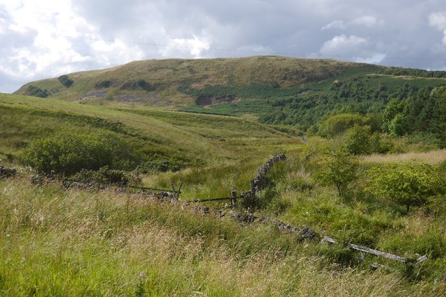
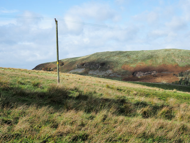
Upper Hass Loch is a picturesque freshwater loch located in Roxburghshire, Scotland. Nestled amidst the rolling hills and verdant landscapes, this tranquil waterbody is a popular destination for nature lovers and outdoor enthusiasts. Spanning an area of approximately 30 hectares, Upper Hass Loch is a haven for various species of flora and fauna.

The loch boasts crystal-clear waters that are teeming with aquatic life. Anglers are drawn to its shores, hoping to catch a glimpse of the abundant fish population, which includes brown trout and perch. The surrounding area is rich in biodiversity, with a diverse range of bird species making the loch their home. Birdwatchers flock to Upper Hass Loch to spot rare species such as the great crested grebe and tufted duck, as well as a variety of waterfowl.

The loch is surrounded by lush vegetation, including reed beds and marshy areas, creating a thriving habitat for wetland plants and wildlife. The marshy areas are particularly important for the survival of several species of amphibians and reptiles, including frogs, newts, and adders.

Upper Hass Loch offers a peaceful retreat for visitors, with stunning views of the surrounding countryside. Its shores provide ample opportunities for leisurely walks, picnics, and wildlife observation. The loch is easily accessible, with a nearby car park and designated walking trails.

Overall, Upper Hass Loch is a hidden gem in Roxburghshire, offering a serene and captivating natural environment for all who visit.

If you have any feedback on the listing, please let us know in the comments section below.

Upper Hass Loch Images

Images are sourced within 2km of 55.384584/-2.5040534 or Grid Reference NT6810. Thanks to Geograph Open Source API. All images are credited.

Young trees, Green Knowes A recent plantation amongst more established trees.
Young trees, Green Knowes
A recent plantation amongst more established trees.
Young trees near Hass One of the more recent plantings around here.
Young trees near Hass
One of the more recent plantings around here.
Pond, Lethem and Hass Forest One of a pair of flight pools.
Pond, Lethem and Hass Forest
One of a pair of flight pools.
Field, Lethem A break from the conifers.  Taken soon after a silage crop had been taken.
Field, Lethem
A break from the conifers. Taken soon after a silage crop had been taken.
Yellow road, Lethem
Yellow road, Lethem
Shaw Burn Looking downstream from the road as the Shaw Burn descends steeply towards the Jed Water. The hill carries a fort.
Shaw Burn
Looking downstream from the road as the Shaw Burn descends steeply towards the Jed Water. The hill carries a fort.
Hareshaw Knowe Pines, much older than the conifer plantations which now surround them.
Hareshaw Knowe
Pines, much older than the conifer plantations which now surround them.
A68 near Huntford
A68 near Huntford
A68 southbound near Green Knowes
Road, Hass Through mainly forested land between the A68 and A6088.
Road, Hass
Through mainly forested land between the A68 and A6088.
Farm close to Lethem Lethem is a small settlement, out of view in the image, hidden by the trees at the left side. The farm is alongside a minor road connecting the A6088 and the A68; the location is just north of the landscape features, Bught Knowe and Crink Law.
Farm close to Lethem
Lethem is a small settlement, out of view in the image, hidden by the trees at the left side. The farm is alongside a minor road connecting the A6088 and the A68; the location is just north of the landscape features, Bught Knowe and Crink Law.
Shaw Craigs Shaw Craigs, the farther ridge, rises to 300 metres; there's a trig point at the summit. The view is from a minor road connecting the A6088 and the A68.
Shaw Craigs
Shaw Craigs, the farther ridge, rises to 300 metres; there's a trig point at the summit. The view is from a minor road connecting the A6088 and the A68.
Edgerston from the air Looking up the A68 road, past Hass towards Edgerston.
Edgerston from the air
Looking up the A68 road, past Hass towards Edgerston.
Rough grazing and woodland near Hass
A68 near Hass Towards Corbridge.
A68 near Hass
Towards Corbridge.
Farm track off the A68 Knock Hills behind.
Farm track off the A68
Knock Hills behind.
Young woodland near Huntford
Track towards Wooplaw Off the A68.
Track towards Wooplaw
Off the A68.
Show me another place!

Upper Hass Loch is located at Grid Ref: NT6810 (Lat: 55.384584, Lng: -2.5040534)

Unitary Authority: The Scottish Borders

Police Authority: The Lothians and Scottish Borders

What 3 Words

///strutting.solutions.landed. Near Jedburgh, Scottish Borders

Nearby Locations

Upper Hass Loch

Related Wikis

Edgerston

Edgerston is a village and an estate about 4 miles (6.4 km) north of the Anglo-Scottish border, and 8 miles (13 km) south of Jedburgh in the Scottish Borders...

Scottish Borders

The Scottish Borders (Scots: the Mairches, lit. 'the Marches'; Scottish Gaelic: Crìochan na h-Alba) is one of 32 council areas of Scotland. It is bordered...

Camptown, Scottish Borders

Camptown is a small settlement on the A68, in the Scottish Borders area of Scotland, 5m (8 km) south of Jedburgh, and the same distance south to Carter...

Raid of the Redeswire

The Raid of the Redeswire, also known as the Redeswire Fray, was a border skirmish between England and Scotland on 7 July 1575 which took place at Carter...

Nearby Amenities

Located within 500m of 55.384584,-2.5040534
Bus Stop
Letham Road End
Bus: yes
Naptan AtcoCode: 69001234
Naptan Bearing: S
Naptan CommonName: Letham Rd End
Naptan Indicator: opp
Naptan Landmark: Road End
Naptan NaptanCode: 72725347
Naptan Street: A68
Operator: Scottish Borders Council
Public Transport: platform
Ref: 69001234
Source: NaPTAN
Lat/Long: 55.3834508/-2.4965841
Bus Stop
Letham Road End
Check Date Shelter: 2021-04-30
Local Ref: AT
Naptan AtcoCode: 6900837
Naptan Bearing: N
Naptan CommonName: Letham Road End
Naptan Indicator: At
Naptan Landmark: Letham Road End
Naptan NaptanCode: 72723237
Naptan Street: A68
Naptan Verified: no
Shelter: no
Source: naptan_import
Lat/Long: 55.3834587/-2.4968368
Hass
Place: hamlet
Lat/Long: 55.3834262/-2.4972015
Natural: peak
Lat/Long: 55.386239/-2.498915
Noexit: yes
Lat/Long: 55.3837074/-2.4977911
Communication Mobile Phone: yes
Man Made: antenna
Lat/Long: 55.386752/-2.5001279
Power: pole
Lat/Long: 55.3862879/-2.4999469
Power: pole
Lat/Long: 55.3854278/-2.4992104
Power: pole
Lat/Long: 55.3852303/-2.4977916
Material: wood
Power: pole
Lat/Long: 55.3850299/-2.4963393
Material: wood
Power: pole
Lat/Long: 55.3815456/-2.4986529
Power: pole
Lat/Long: 55.3814263/-2.4996945
Power: pole
Lat/Long: 55.3813744/-2.5000756
Power: pole
Lat/Long: 55.3812881/-2.5007464
Power: pole
Lat/Long: 55.3806927/-2.501421
The data included in this document is from www.openstreetmap.org. The data is made available under ODbL.

Have you been to Upper Hass Loch?

Leave your review of Upper Hass Loch below (or comments, questions and feedback).