Bitterwell Lake

Lake, Pool, Pond, Freshwater Marsh in Gloucestershire

England

Bitterwell Lake

Field I would have taken a picture of the river flowing behind the trees on the left, but it was not pretty. The water itself looked coloured as if it were the run off from a farmyard. It also contained much debris like tyres and a keep left bollard.
Field Credit: Graham Richards

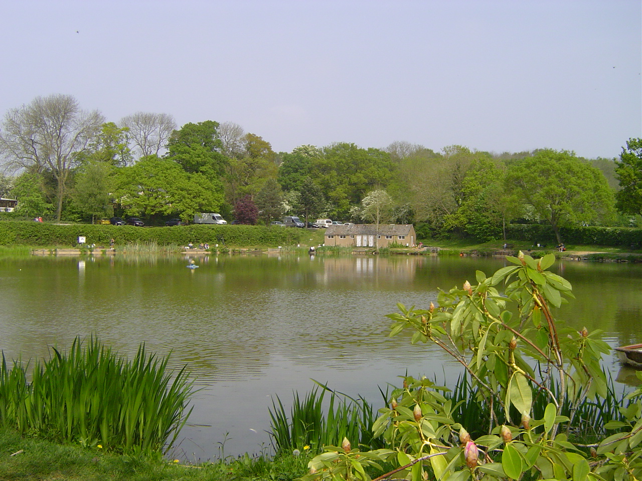
Bitterwell Lake, located in Gloucestershire, is a picturesque body of water that encompasses the characteristics of a lake, pool, pond, and freshwater marsh. Nestled amidst the stunning landscapes of the Cotswolds, this natural attraction offers a serene environment that attracts both locals and tourists alike.

Spanning an area of approximately 30 acres, Bitterwell Lake is known for its crystal-clear waters that reflect the surrounding lush greenery and clear blue skies. The lake is fed by several natural springs, ensuring a constant flow of fresh, clean water. Its depth varies throughout the lake, ranging from shallow areas that resemble a pool or pond to deeper sections that resemble a traditional lake.

One of the defining features of Bitterwell Lake is the presence of a freshwater marsh along its edges. This marshland provides a habitat for a diverse range of plant and animal species, including various aquatic plants like reeds and rushes. The marsh also serves as a haven for numerous bird species, creating an ideal spot for birdwatchers to observe and appreciate nature's beauty.

Visitors to Bitterwell Lake can enjoy a range of activities. Fishing enthusiasts can cast their lines into the lake in search of a variety of fish species, including carp, pike, and perch. The calm waters also make it an excellent spot for boating and kayaking. For those seeking a peaceful retreat, the lake's tranquil surroundings offer the perfect setting for a leisurely walk or a picnic by the water's edge.

Overall, Bitterwell Lake in Gloucestershire is a captivating natural attraction that seamlessly combines the characteristics of a lake, pool, pond, and freshwater marsh. It offers a stunning and diverse environment, making it a must-visit destination for nature lovers and those seeking solace in the beauty of the great outdoors.

If you have any feedback on the listing, please let us know in the comments section below.

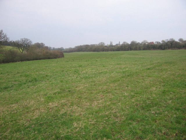
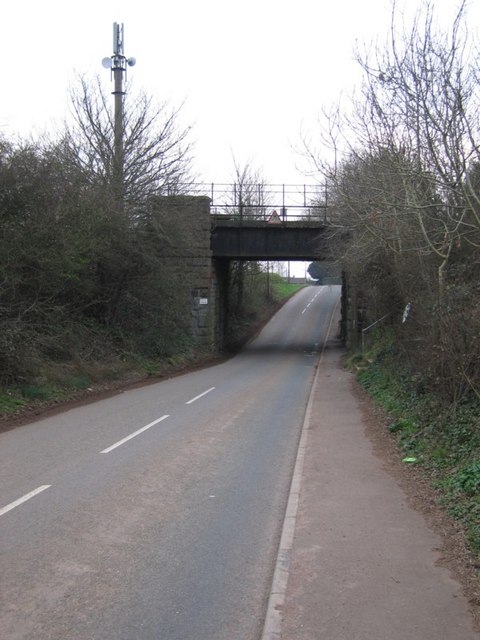
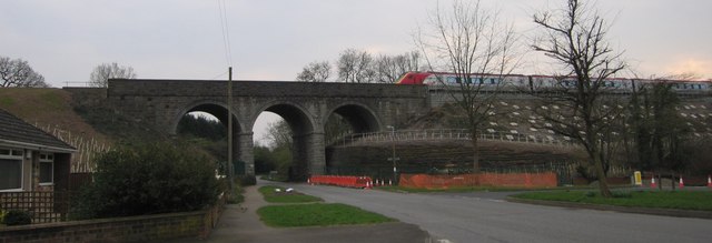
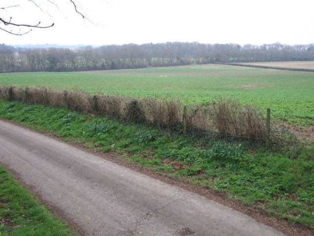
Bitterwell Lake Images

Images are sourced within 2km of 51.513624/-2.4636954 or Grid Reference ST6779. Thanks to Geograph Open Source API. All images are credited.

Field I would have taken a picture of the river flowing behind the trees on the left, but it was not pretty. The water itself looked coloured as if it were the run off from a farmyard. It also contained much debris like tyres and a keep left bollard.
Field
I would have taken a picture of the river flowing behind the trees on the left, but it was not pretty. The water itself looked coloured as if it were the run off from a farmyard. It also contained much debris like tyres and a keep left bollard.
Bridge this bridge carries the London to Wales line with Bristol Parkway not far up the track.
Bridge
this bridge carries the London to Wales line with Bristol Parkway not far up the track.
Not the Church I cannot believe that in March 07 I found a square with no geograph in it that also had a church. So... not falling for the trap I photographed something else.

The train has just left Bristol Parkway 4 km to the east and is heading towards London. The bridge may not be as big as the viaduct just down the line <a href="https://www.geograph.org.uk/gridref/ST6579">ST6579</a> but is interesting none the less.

I leave the church for someone else.
Not the Church
I cannot believe that in March 07 I found a square with no geograph in it that also had a church. So... not falling for the trap I photographed something else. The train has just left Bristol Parkway 4 km to the east and is heading towards London. The bridge may not be as big as the viaduct just down the line ST6579 but is interesting none the less. I leave the church for someone else.
Not Another Field Sorry, yes, another field. The railway line runs along the back of the field behind the far hedge.
Not Another Field
Sorry, yes, another field. The railway line runs along the back of the field behind the far hedge.
Low railway bridge on Park Lane near Winterbourne Down
Park Lane (Frampton Cotterell) phone box
Old telephone box This battered old telephone box contrasts with the brand new housing development on the other side of Park Lane.
Old telephone box
This battered old telephone box contrasts with the brand new housing development on the other side of Park Lane.
Coalpit Heath church The sunlit church in a largely shaded churchyard is quite an imposing sight.
Coalpit Heath church
The sunlit church in a largely shaded churchyard is quite an imposing sight.
Field by Woodside Road A field beside Woodside Road, looking towards Froglane Farm, the two chimneys of which can just be made out under the bare tree on the far skyline.
Field by Woodside Road
A field beside Woodside Road, looking towards Froglane Farm, the two chimneys of which can just be made out under the bare tree on the far skyline.
2012 : A432 Badminton Road at Coalpit Heath A location much improved in appearance since its inception as a mining village in the South Gloucestershire coalfield.
After Coalpit Heath the A432 heads south west to Downend and Bristol.
2012 : A432 Badminton Road at Coalpit Heath
A location much improved in appearance since its inception as a mining village in the South Gloucestershire coalfield. After Coalpit Heath the A432 heads south west to Downend and Bristol.
2012 : Frog Lane Farm at the end of Woodside Road In the middle of the coalfield east of Coalpit Heath.
2012 : Frog Lane Farm at the end of Woodside Road
In the middle of the coalfield east of Coalpit Heath.
2012 : Traffic lights on the A432 at Coalpit Heath Seen from Roundways, Beesmoor Road is straight ahead going to Frampton Cotterell, the A432 Badminton Road crosses.
Coalpit Heath and Frampton Cotterell are already pretty well joined up, Winterbourne is only just detached, Downend and Mangotsfield are only a few fields away to the south. When these are hauled in they will all be part of Bristol. Yate and Chipping Sodbury, look out!
2012 : Traffic lights on the A432 at Coalpit Heath
Seen from Roundways, Beesmoor Road is straight ahead going to Frampton Cotterell, the A432 Badminton Road crosses. Coalpit Heath and Frampton Cotterell are already pretty well joined up, Winterbourne is only just detached, Downend and Mangotsfield are only a few fields away to the south. When these are hauled in they will all be part of Bristol. Yate and Chipping Sodbury, look out!
2012 : Not the viaduct See <a href="https://www.geograph.org.uk/photo/376769">ST6780 : Not the Church</a> it is in fact the A432 Badminton Road passing St.Saviours Church as it goes on its way to Yate and Chipping Sodbury.
Hidden among the trees but it has a lively website (shared) <span class="nowrap"><a title="http://coalpitheath.org.uk" rel="nofollow ugc noopener" href="http://coalpitheath.org.uk">Link</a><img style="margin-left:2px;" alt="External link" title="External link - shift click to open in new window" src="https://s1.geograph.org.uk/img/external.png" width="10" height="10"/></span>
2012 : Not the viaduct
See ST6780 : Not the Church it is in fact the A432 Badminton Road passing St.Saviours Church as it goes on its way to Yate and Chipping Sodbury. Hidden among the trees but it has a lively website (shared) LinkExternal link
2012 : Farmland east of Coalpit Heath Near Froglane Farm.
Mostly wheat in these fields.
2012 : Farmland east of Coalpit Heath
Near Froglane Farm. Mostly wheat in these fields.
2012 : Woodside Road approaching Coalpit Heath
2012 : North from Woodside Road Near Froglane Farm.
The large building right of centre is The New Inn at Mayshill.
Pylons proliferate.
2012 : North from Woodside Road
Near Froglane Farm. The large building right of centre is The New Inn at Mayshill. Pylons proliferate.
Coalpit Heath station (remains), 1987 View eastward, towards Swindon and London, also Cheltenham and Birmingham via Yate: ex-GW Paddington - South Wales and Bristol via Badminton main line, also ex-GW Midlands - Bristol traffic. The lines are visible on the left. The station was closed from 3/4/61.
Coalpit Heath station (remains), 1987
View eastward, towards Swindon and London, also Cheltenham and Birmingham via Yate: ex-GW Paddington - South Wales and Bristol via Badminton main line, also ex-GW Midlands - Bristol traffic. The lines are visible on the left. The station was closed from 3/4/61.
Evening sun on fields at Woodlands Farm
Show me another place!

Bitterwell Lake is located at Grid Ref: ST6779 (Lat: 51.513624, Lng: -2.4636954)

Unitary Authority: South Gloucestershire

Police Authority: Avon and Somerset

What 3 Words

///richer.delusions.eyebrows. Near Winterbourne, Gloucestershire

Related Wikis

Nearby Amenities

Located within 500m of 51.513624,-2.4636954
Bus Stop
Henfield Cross Roads
Naptan AtcoCode: 0170SGZ01493
Naptan Bearing: N
Naptan CommonName: Henfield Cross Roads
Naptan Crossing: Westerleigh Road
Naptan NaptanCode: sglmamt
Naptan Street: Henfield Road
Naptan Verified: no
Shelter: no
Source: naptan_import
Lat/Long: 51.5098098/-2.4623348
Bus Stop
Henfield Cross Roads
Naptan AtcoCode: 0170SGZ01494
Naptan Bearing: S
Naptan CommonName: Henfield Cross Roads
Naptan Crossing: Westerleigh Road
Naptan NaptanCode: sglmamw
Naptan Street: Henfield Road
Naptan Verified: no
Shelter: no
Source: naptan_import
Lat/Long: 51.5098102/-2.462234
Barrier: kissing_gate
Material: metal
Lat/Long: 51.5163013/-2.4688107
Power: pole
Source: Bing
Lat/Long: 51.510278/-2.4637372
Power: pole
Source: Bing
Lat/Long: 51.5103052/-2.4627338
Power: pole
Source: Bing
Lat/Long: 51.5103264/-2.4618493
Power: pole
Source: Bing
Lat/Long: 51.5103612/-2.4605258
Power: pole
Source: Bing
Lat/Long: 51.510396/-2.4592176
Barrier: kissing_gate
Material: metal
Lat/Long: 51.5147589/-2.4674184
Barrier: stile
Lat/Long: 51.5116419/-2.4605571
Barrier: kissing_gate
Lat/Long: 51.5121416/-2.4638498
Barrier: stile
Lat/Long: 51.5143133/-2.4659864
Barrier: stile
Lat/Long: 51.5118017/-2.464883
Post Box
Collection Times: Mo-Fr 16:15, Sa 08:00
Operator: Royal Mail
Post Box Type: wall
Ref: BS36 176
Royal Cypher: EIIR
Royal Cypher Wikidata: Q33102113
Lat/Long: 51.5120201/-2.4654735
Power: pole
Lat/Long: 51.5100896/-2.4650977
Power: pole
Lat/Long: 51.5094683/-2.4661431
Power: pole
Lat/Long: 51.5099605/-2.4656306
Barrier: kissing_gate
Material: wood
Lat/Long: 51.5121039/-2.4657819
Power: pole
Lat/Long: 51.5091958/-2.4634644
Power: pole
Lat/Long: 51.5097183/-2.4639633
Power: pole
Lat/Long: 51.5101807/-2.4644401
Power: pole
Lat/Long: 51.5107511/-2.4647001
Power: pole
Lat/Long: 51.5113824/-2.4650578
Power: pole
Lat/Long: 51.5117191/-2.4648008
Power: pole
Lat/Long: 51.5125404/-2.4643153
Power: pole
Lat/Long: 51.5126967/-2.4642317
Power: pole
Lat/Long: 51.5127419/-2.4640936
Power: pole
Lat/Long: 51.5130216/-2.4643679
Power: pole
Lat/Long: 51.5124306/-2.4650512
Power: pole
Lat/Long: 51.5134236/-2.4645467
Power: pole
Lat/Long: 51.5139147/-2.4647449
Power: pole
Lat/Long: 51.5143112/-2.4649307
Power: pole
Lat/Long: 51.5142793/-2.4637291
Power: pole
Lat/Long: 51.5118813/-2.4655091
Power: pole
Lat/Long: 51.5122444/-2.465003
Power: pole
Lat/Long: 51.5129807/-2.4653872
Power: pole
Lat/Long: 51.5115048/-2.4635118
Power: pole
Lat/Long: 51.5113165/-2.463472
Power: pole
Lat/Long: 51.5109042/-2.4631454
Power: pole
Lat/Long: 51.5104488/-2.4628466
Power: pole
Lat/Long: 51.5103824/-2.4631607
Grit Bin
Colour: green
Lat/Long: 51.5115579/-2.4636747
Power: pole
Lat/Long: 51.5178477/-2.4658619
Power: pole
Lat/Long: 51.5179174/-2.4649559
Power: pole
Lat/Long: 51.5171368/-2.4670747
Power: pole
Lat/Long: 51.5165664/-2.4670447
Ram Hill
Place: hamlet
Wikidata: Q7288476
Wikipedia: en:Ram Hill
Lat/Long: 51.517817/-2.4653371
Henfield
Place: hamlet
Wikidata: Q5714178
Wikipedia: en:Henfield, Gloucestershire
Lat/Long: 51.5117368/-2.4641357
Colour: white
Marker: stile
Operator: GPSS
Utility: oil
Lat/Long: 51.5142245/-2.4648652
Colour: white
Inscription: A/T (W) OIL PIPELINE
Marker: stone
Operator: GPSS
Utility: oil
Lat/Long: 51.5142287/-2.4648664
Colour: white
Marker: stone
Operator: GPSS
Utility: oil
Lat/Long: 51.514251/-2.4646852
Direction: 190
Generator Method: photovoltaic
Generator Output Electricity: yes
Generator Solar Modules: 10
Generator Source: solar
Generator Type: solar_photovoltaic_panel
Location: roof
Power: generator
Lat/Long: 51.5170113/-2.4644405
Direction: 190
Generator Method: photovoltaic
Generator Output Electricity: yes
Generator Solar Modules: 10
Generator Source: solar
Generator Type: solar_photovoltaic_panel
Location: roof
Power: generator
Lat/Long: 51.5170009/-2.4643635
Direction: 190
Generator Method: photovoltaic
Generator Output Electricity: yes
Generator Solar Modules: 12
Generator Source: solar
Generator Type: solar_photovoltaic_panel
Location: roof
Power: generator
Lat/Long: 51.5167258/-2.4649285
Barrier: stile
Stile: stepover
Lat/Long: 51.5120932/-2.4639473
The data included in this document is from www.openstreetmap.org. The data is made available under ODbL.

Have you been to Bitterwell Lake?

Leave your review of Bitterwell Lake below (or comments, questions and feedback).