Apley Pool

Lake, Pool, Pond, Freshwater Marsh in Shropshire

England

Apley Pool

Station Road Wellington
Station Road Wellington Credit: Roy Hughes

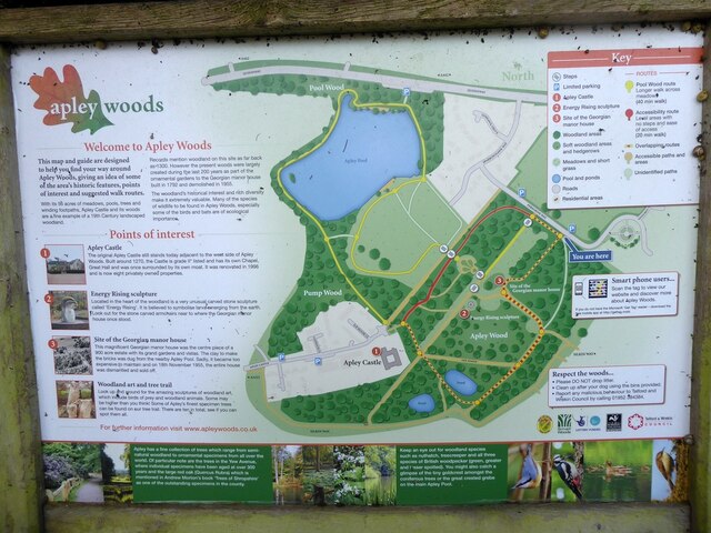
Apley Pool is a freshwater body located in Shropshire, England. It is situated within the Apley Estate, which is renowned for its picturesque landscapes and diverse wildlife. The pool is classified as a lake, pool, pond, and freshwater marsh, as it encompasses various characteristics of these water bodies.

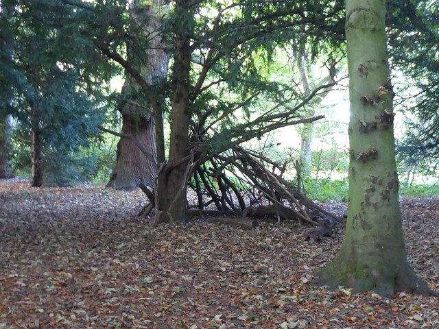
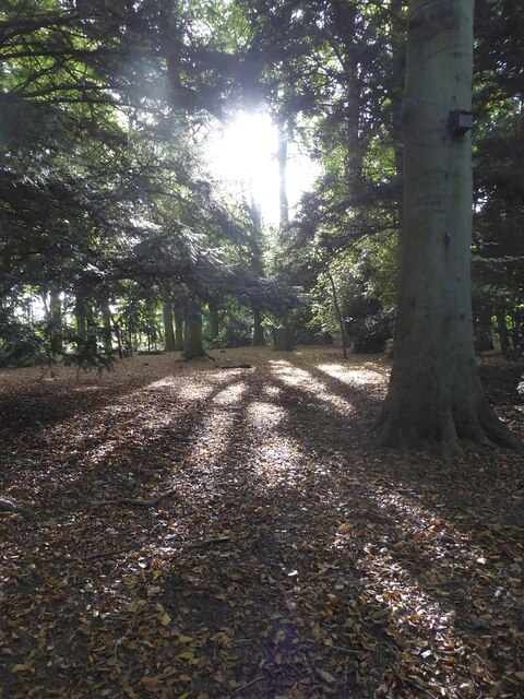
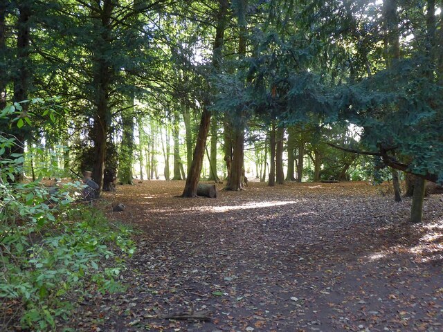
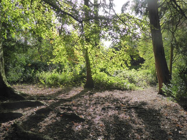
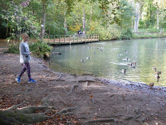
Covering an area of approximately 10 acres, Apley Pool is surrounded by lush vegetation, including reeds, rushes, and water lilies. These plants provide a habitat for a wide range of animal species, making the pool a haven for nature lovers and wildlife enthusiasts.

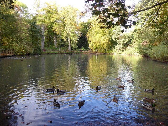
The pool itself is fed by several small streams and natural springs, ensuring a constant flow of freshwater. This, combined with the diverse plant life, creates a thriving ecosystem that supports a variety of aquatic creatures, such as fish, frogs, and water insects. It is not uncommon to spot waterfowl, such as ducks and swans, gracefully gliding across the surface of the pool.

Apley Pool also serves as an important breeding ground for many bird species. During the spring and summer months, the area becomes a hub of activity as birds build nests and raise their young. The tranquil surroundings and abundance of food make it an ideal location for these breeding activities.

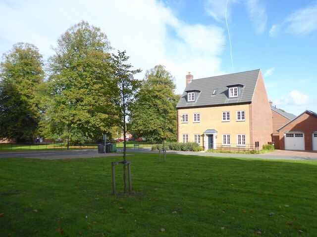
Visitors to Apley Pool can enjoy its natural beauty through various activities, including birdwatching, fishing, and leisurely walks. The pool is easily accessible via footpaths and offers stunning views of the surrounding countryside. Its serene atmosphere and rich biodiversity make it a cherished natural gem in the heart of Shropshire.

If you have any feedback on the listing, please let us know in the comments section below.
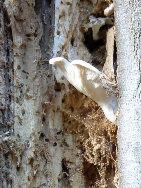
Apley Pool Images

Images are sourced within 2km of 52.718393/-2.5129707 or Grid Reference SJ6513. Thanks to Geograph Open Source API. All images are credited.

Station Road Wellington
The Parish Church of All Saints, Wellington
Wellington station with 6233 The Duchess of Sutherland approaching
6233 The Duchess of Sutherland passing Wellington station
New housing on Peregrine Way Part of a new housing estate opposite Apley Castle Park.
New housing on Peregrine Way
Part of a new housing estate opposite Apley Castle Park.
Visitor map at Apley Woods Marked on the OS map as Apley Castle Park, Apley Woods seems a reasonable name. The top right corner, under the key, marked as meadows here, is actually part of the new housing estate - see <a href="https://www.geograph.org.uk/photo/7078754">SJ6513 : New housing on Peregrine Way</a>.
The map offers two suggested routes, and the paths are colour-coded for accessibility. We had no pushchairs or wheelchairs, so having figured out the less 'accessible' areas just included short flights of shallow steps, we wandered along various paths within the shorter route.
Visitor map at Apley Woods
Marked on the OS map as Apley Castle Park, Apley Woods seems a reasonable name. The top right corner, under the key, marked as meadows here, is actually part of the new housing estate - see SJ6513 : New housing on Peregrine Way. The map offers two suggested routes, and the paths are colour-coded for accessibility. We had no pushchairs or wheelchairs, so having figured out the less 'accessible' areas just included short flights of shallow steps, we wandered along various paths within the shorter route.
Apley Woods It looks like someone has tried to build a shelter around this rather scruffy yew tree.
Apley Woods
It looks like someone has tried to build a shelter around this rather scruffy yew tree.
Apley Woods 1881 map of the area <span class="nowrap"><a title="https://maps.nls.uk/view/101594272#zoom=5&lat=2427&lon=3639&layers=BT" rel="nofollow ugc noopener" href="https://maps.nls.uk/view/101594272#zoom=5&lat=2427&lon=3639&layers=BT">Link</a><img style="margin-left:2px;" alt="External link" title="External link - shift click to open in new window" src="https://s1.geograph.org.uk/img/external.png" width="10" height="10"/></span>
Current Apley Woods website <span class="nowrap"><a title="https://www.apleywoods.co.uk" rel="nofollow ugc noopener" href="https://www.apleywoods.co.uk">Link</a><img style="margin-left:2px;" alt="External link" title="External link - shift click to open in new window" src="https://s1.geograph.org.uk/img/external.png" width="10" height="10"/></span>
Apley Woods
1881 map of the area LinkExternal link Current Apley Woods website LinkExternal link
Apley Woods : Badger sculpture Carved from a tree stump.
For a closer look see <a title="https://www.geograph.org.uk/photo/7079027" href="https://www.geograph.org.uk/photo/7079027">Link</a> and <a title="https://www.geograph.org.uk/photo/7079032" href="https://www.geograph.org.uk/photo/7079032">Link</a>.
Apley Woods : Badger sculpture
Carved from a tree stump. For a closer look see Link and Link.
Apley Woods : Badger sculpture Carved from a tree stump.
For other views see <a title="https://www.geograph.org.uk/photo/7079021" href="https://www.geograph.org.uk/photo/7079021">Link</a> and <a title="https://www.geograph.org.uk/photo/7079032" href="https://www.geograph.org.uk/photo/7079032">Link</a>.
Apley Woods : Badger sculpture
Carved from a tree stump. For other views see Link and Link.
Apley Woods : Badger sculpture Carved from a tree stump.
For other views see <a title="https://www.geograph.org.uk/photo/7079027" href="https://www.geograph.org.uk/photo/7079027">Link</a> and <a title="https://www.geograph.org.uk/photo/7079021" href="https://www.geograph.org.uk/photo/7079021">Link</a>.
Apley Woods : Badger sculpture
Carved from a tree stump. For other views see Link and Link.
Apley Woods : Roots of a fallen tree It must have fallen some years ago, judging by the regrowth seen here <a title="https://www.geograph.org.uk/photo/7079050" href="https://www.geograph.org.uk/photo/7079050">Link</a>.
Apley Woods : Roots of a fallen tree
It must have fallen some years ago, judging by the regrowth seen here Link.
Apley Woods : Regrowth of a fallen tree See <a title="https://www.geograph.org.uk/photo/7079048" href="https://www.geograph.org.uk/photo/7079048">Link</a> for the roots.
Apley Woods : Regrowth of a fallen tree
See Link for the roots.
Apley Woods Much of this mixed woodland is too dark for much of an understory. I guess more light gets in under the deciduous trees.
Apley Woods
Much of this mixed woodland is too dark for much of an understory. I guess more light gets in under the deciduous trees.
Apley Woods One of two ponds in this part of the wood. For another view see <a title="https://www.geograph.org.uk/photo/7079063" href="https://www.geograph.org.uk/photo/7079063">Link</a>.
Apley Woods
One of two ponds in this part of the wood. For another view see Link.
Apley Woods One of two ponds in this part of the wood. For another view see <a title="https://www.geograph.org.uk/photo/7079060" href="https://www.geograph.org.uk/photo/7079060">Link</a>.
Apley Woods
One of two ponds in this part of the wood. For another view see Link.
Apley Woods Fungus in a rotting tree. See also <a title="https://www.geograph.org.uk/photo/7079071" href="https://www.geograph.org.uk/photo/7079071">Link</a>.
Apley Woods
Fungus in a rotting tree. See also Link.
Show me another place!

Apley Pool is located at Grid Ref: SJ6513 (Lat: 52.718393, Lng: -2.5129707)

Unitary Authority: Telford and Wrekin

Police Authority: West Mercia

What 3 Words

///showcase.gobblers.reunion. Near Eyton upon the Weald Moors, Shropshire

Related Wikis

Apley Castle

Apley Castle was a medieval fortified manor in the village of Hadley, Shropshire, England. == History == Apley Castle was a moated, fortified manor house...

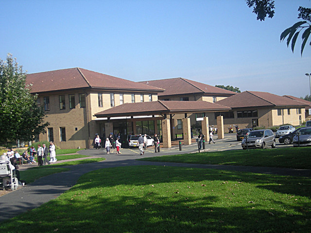
Princess Royal Hospital, Telford

The Princess Royal Hospital is a teaching hospital located in Apley Castle, Telford, England. It forms the Telford site of the Shrewsbury and Telford Hospital...

Charlton School

Charlton School is a coeducational secondary school located in Telford, Shropshire, England. In May 2015 the school was placed in special measures after...

Eyton upon the Weald Moors

Eyton is a village and civil parish in Shropshire, England on the south-west edge of the Weald Moors, north of Wellington. Naturalist Thomas Campbell Eyton...

Nearby Amenities

Located within 500m of 52.718393,-2.5129707
Created By: Merkaartor 0.12
Lat/Long: 52.719107/-2.50574
Created By: Merkaartor 0.12
Lat/Long: 52.7191989/-2.5066129
Apley Castle
Historic: castle
Ruins: yes
Source: NPE+local knowledge
Wikidata: Q4779972
Lat/Long: 52.7163397/-2.5092749
Barrier: bollard
Bicycle: yes
Foot: yes
Lat/Long: 52.7149557/-2.5170723
Turning Circle
Lat/Long: 52.7177116/-2.5105372
Post Box
Operator: Royal Mail
Lat/Long: 52.7192142/-2.5090691
Turning Circle
Lat/Long: 52.7190481/-2.5099249
Barrier: bollard
Bicycle: yes
Foot: yes
Horse: yes
Lat/Long: 52.7156486/-2.5122667
Barrier: cycle_barrier
Bicycle: no
Foot: yes
Horse: no
Lat/Long: 52.717927/-2.5093247
Crossing
Crossing: unmarked
Crossing Markings: no
Lat/Long: 52.7194449/-2.5174694
Noexit: yes
Lat/Long: 52.7187116/-2.5079723
Power: pole
Lat/Long: 52.720282/-2.5186848
Power: pole
Lat/Long: 52.7205634/-2.5150193
Power: pole
Lat/Long: 52.7212239/-2.5137117
Power: pole
Lat/Long: 52.7218872/-2.5124065
Power: pole
Lat/Long: 52.7218589/-2.5125956
Power: pole
Lat/Long: 52.7204438/-2.5164215
Power: pole
Lat/Long: 52.7217869/-2.5111954
Power: pole
Lat/Long: 52.7224027/-2.511418
Noexit: yes
Lat/Long: 52.7192187/-2.5102834
Noexit: yes
Lat/Long: 52.7189637/-2.5101942
Noexit: yes
Lat/Long: 52.7187565/-2.509923
Give Way
Direction: backward
Lat/Long: 52.7192375/-2.5088579
Give Way
Direction: forward
Lat/Long: 52.7197493/-2.5133418
Power: pole
Lat/Long: 52.7219182/-2.5135544
Noexit: yes
Lat/Long: 52.7190377/-2.5070205
Give Way
Direction: forward
Lat/Long: 52.7182388/-2.5098065
The data included in this document is from www.openstreetmap.org. The data is made available under ODbL.

Have you been to Apley Pool?

Leave your review of Apley Pool below (or comments, questions and feedback).