The Canal

Lake, Pool, Pond, Freshwater Marsh in Berwickshire

Scotland

The Canal
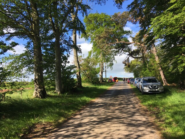
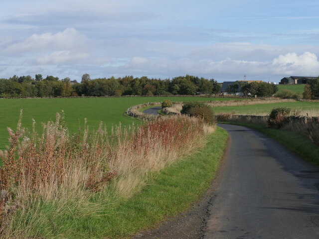
Minor road near Mellerstain Mill
Minor road near Mellerstain Mill Credit: Steven Brown

The requested URL returned error: 429 Too Many Requests

If you have any feedback on the listing, please let us know in the comments section below.

The Canal Images

Images are sourced within 2km of 55.640518/-2.556108 or Grid Reference NT6538. Thanks to Geograph Open Source API. All images are credited.
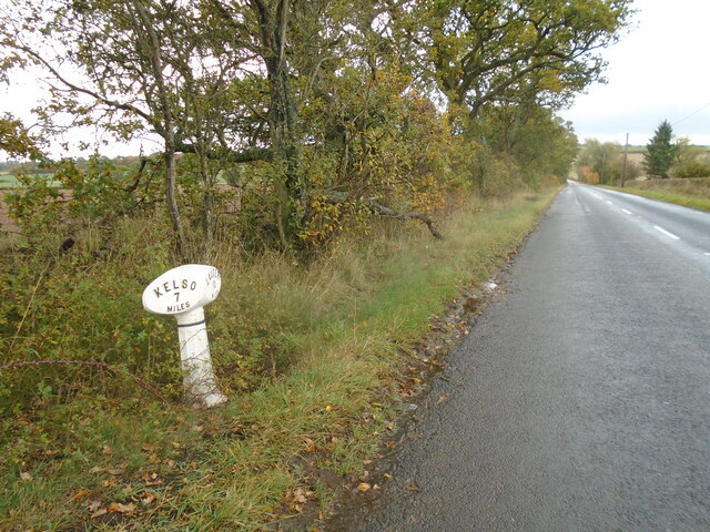
Minor road near Mellerstain Mill
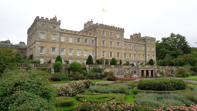
Mellerstain House The south facade
Mellerstain House
The south facade
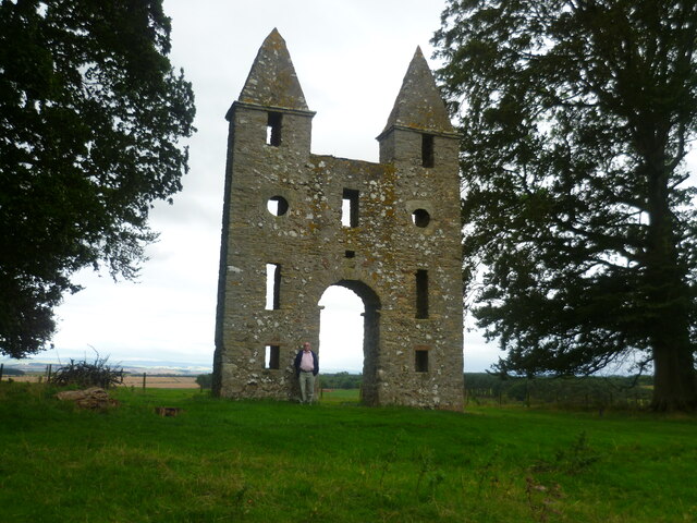
Hundy Mundy The north facade of the eye-catcher for Mellerstain House
Hundy Mundy
The north facade of the eye-catcher for Mellerstain House
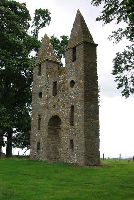
Hundy Mundy The eye-catcher for Mellerstain House
Hundy Mundy
The eye-catcher for Mellerstain House
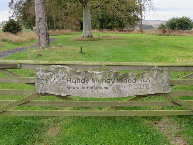
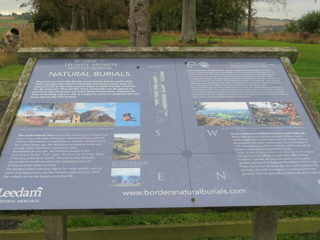
Hundy Mundy Wood The entrance to the natural burial ground near Mellerstain, with an updated information board. For an earlier version see <a href="https://www.geograph.org.uk/photo/2662344">NT6637 : Hundy Mundy Wood information</a>.
Hundy Mundy Wood
The entrance to the natural burial ground near Mellerstain, with an updated information board. For an earlier version see NT6637 : Hundy Mundy Wood information.
Hundy Mundy Wood Burial Ground The entrance to the natural burial site, in a woodland on the Mellerstain Estate.
Hundy Mundy Wood Burial Ground
The entrance to the natural burial site, in a woodland on the Mellerstain Estate.
Road near Mellerstain
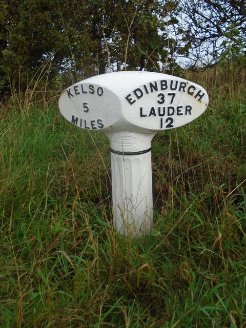
Old milepost Mileposts 3 and 4 miles from Kelso are lost but the 5 mile post is another that was dug out and repainted in 2021.   This area was in Berwickshire prior to the 1970s.  Now Borders.
Old milepost
Mileposts 3 and 4 miles from Kelso are lost but the 5 mile post is another that was dug out and repainted in 2021. This area was in Berwickshire prior to the 1970s. Now Borders.
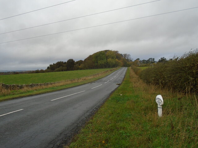
Old milepost Looking northwestwards along the A6089 the milepost can be found underneath the power lines.
Old milepost
Looking northwestwards along the A6089 the milepost can be found underneath the power lines.
Old milepost This milepost on the B6397 just north of but on the opposite side of the road to Girnick has been dug out and painted fairly recently including the band of black near the top of the post.
Old milepost
This milepost on the B6397 just north of but on the opposite side of the road to Girnick has been dug out and painted fairly recently including the band of black near the top of the post.
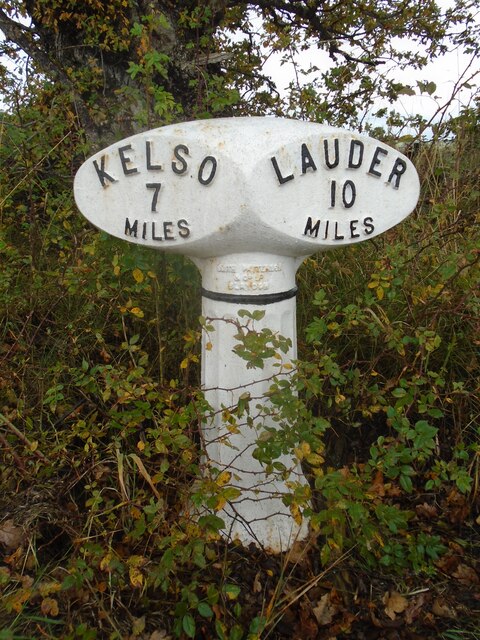
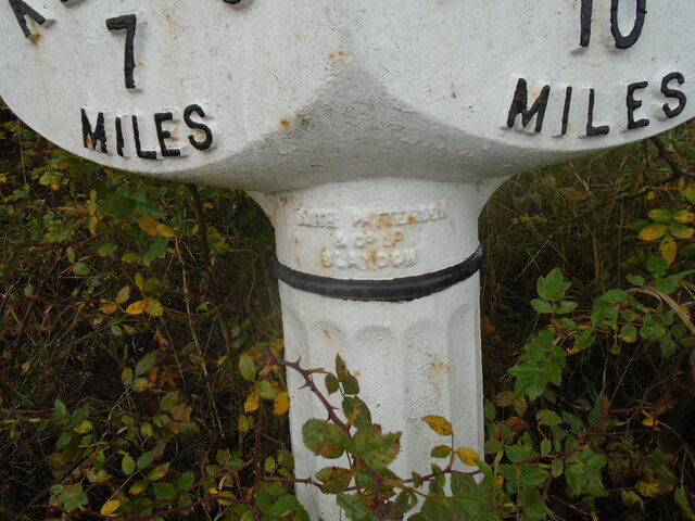
Old milepost This shows the form of the foundry name which is always cast at the top of the post.   A few, like this one, have SMITH PATTERSOON/& CO/BLADEN.   Most posts have SMITH PATTERSON/FOUNDERS/BLADEN.
Old milepost
This shows the form of the foundry name which is always cast at the top of the post. A few, like this one, have SMITH PATTERSOON/& CO/BLADEN. Most posts have SMITH PATTERSON/FOUNDERS/BLADEN.
Old milepost Looking southeastwards towards Smailholm the foot of this post can be seen.   The turning to Girnick is just on the right in the dip.
Old milepost
Looking southeastwards towards Smailholm the foot of this post can be seen. The turning to Girnick is just on the right in the dip.
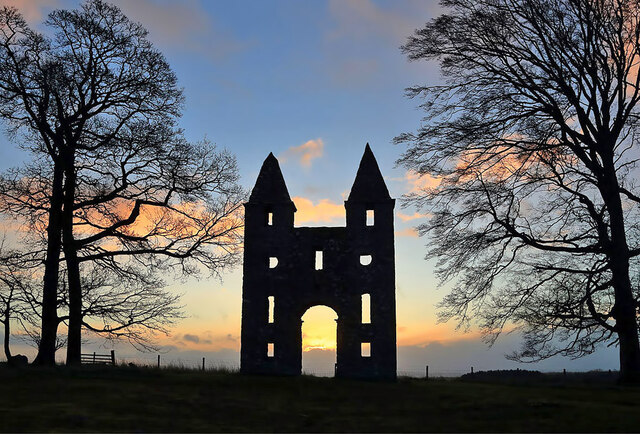
The Gothic folly at Hundy Mundy Wood This 18th century Gothic folly is at the Hundy Mundy woodland burial ground on the Mellerstain Estate.
The Gothic folly at Hundy Mundy Wood
This 18th century Gothic folly is at the Hundy Mundy woodland burial ground on the Mellerstain Estate.
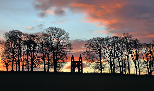
A winter sunrise at Hundy Mundy Wood The 18th century Gothic folly is prominent in this view towards trees at the Hundy Mundy woodland burial ground on the Mellerstain Estate.
A winter sunrise at Hundy Mundy Wood
The 18th century Gothic folly is prominent in this view towards trees at the Hundy Mundy woodland burial ground on the Mellerstain Estate.
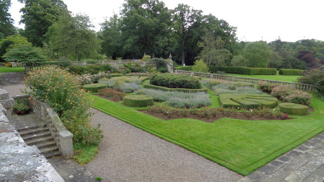
Formal garden On the south front of Mellerstain House
Formal garden
On the south front of Mellerstain House
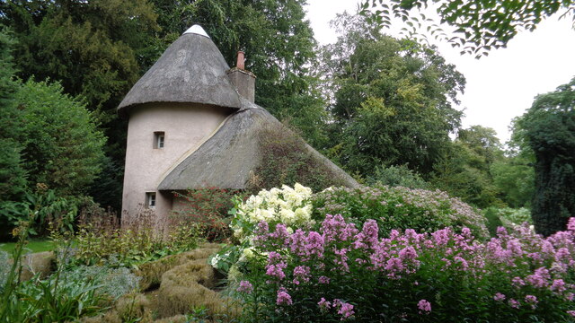
The old cottage On the Mellerstain estate
The old cottage
On the Mellerstain estate
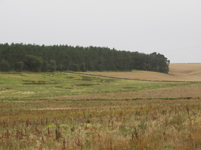
Old pasture fields above free-draining ground ear-marked for pines near Lightfield by Gordon in the Scottish Borders
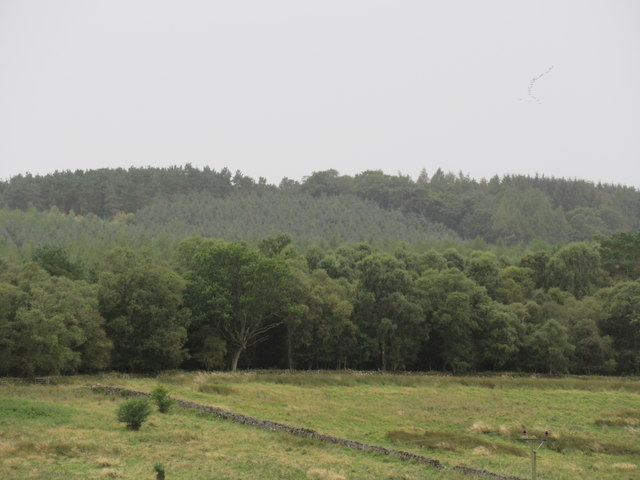
Trees galore near Lightfield in the Scottish Borders
Show me another place!

The Canal is located at Grid Ref: NT6538 (Lat: 55.640518, Lng: -2.556108)

Unitary Authority: The Scottish Borders

Police Authority: The Lothians and Scottish Borders

What 3 Words

///decompose.executive.destroyer. Near Earlston, Scottish Borders

Related Wikis

Mellerstain House

Mellerstain House is a stately home around 8 miles (13 kilometres) north of Kelso in the Borders, Scotland. It is currently the home of George Baillie...

Smailholm

Smailholm (Scots: Smailhowm) is a small village in the historic county of Roxburghshire in south-east Scotland. It is at grid reference NT648364 and straddles...

Nenthorn

Nenthorn is a parish and hamlet in the south of the historic county of Berwickshire in the Scottish Borders area of Scotland. It is included in the Floors...

Gordon Moss

Gordon Moss is a nature reserve near Gordon, in the Scottish Borders area of Scotland, in the former Berwickshire. The moss is situated one mile west of...

Nearby Amenities

Located within 500m of 55.640518,-2.556108
Waterway: weir
Lat/Long: 55.6390161/-2.5555877
Power: pole
Lat/Long: 55.6368513/-2.5521035
Power: pole
Lat/Long: 55.6374338/-2.5513638
Power: pole
Lat/Long: 55.638002/-2.5514324
Power: pole
Lat/Long: 55.6385415/-2.551496
Power: pole
Lat/Long: 55.6391886/-2.5515595
Power: pole
Lat/Long: 55.6397539/-2.5515977
Power: pole
Lat/Long: 55.6404641/-2.5516637
Power: pole
Lat/Long: 55.6411341/-2.5521137
Power: pole
Lat/Long: 55.6417037/-2.5524874
Power: pole
Lat/Long: 55.6416076/-2.5516561
Waterway: weir
Lat/Long: 55.6389693/-2.5541714
Life Ring
Emergency: life_ring
Lat/Long: 55.6419347/-2.5570059
Life Ring
Emergency: life_ring
Lat/Long: 55.6428005/-2.5567748
The data included in this document is from www.openstreetmap.org. The data is made available under ODbL.

Have you been to The Canal?

Leave your review of The Canal below (or comments, questions and feedback).