Kirkback Pool

Lake, Pool, Pond, Freshwater Marsh in Berwickshire

Scotland

Kirkback Pool

"The Street"  on A68
"The Street" on A68 Credit: Douglas Nelson

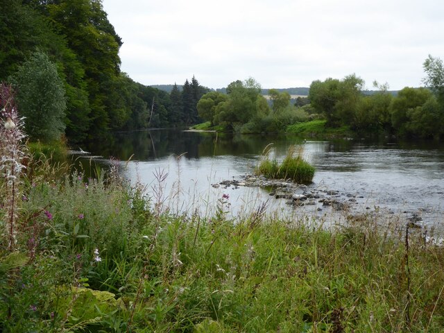
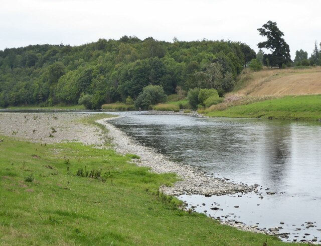
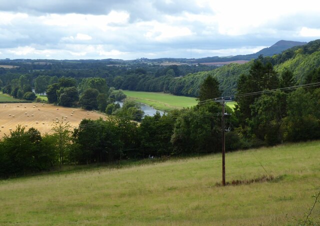
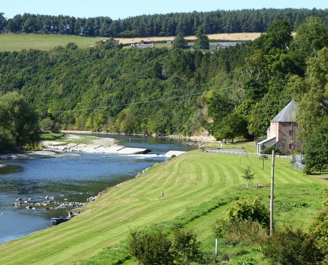
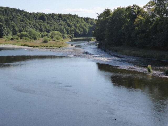
Kirkback Pool, located in Berwickshire, is a picturesque freshwater marsh that offers a serene and tranquil environment for nature enthusiasts. Spanning over a vast area, it is a haven for various aquatic species and an ideal spot for birdwatching.

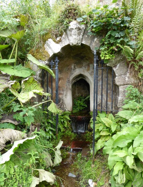
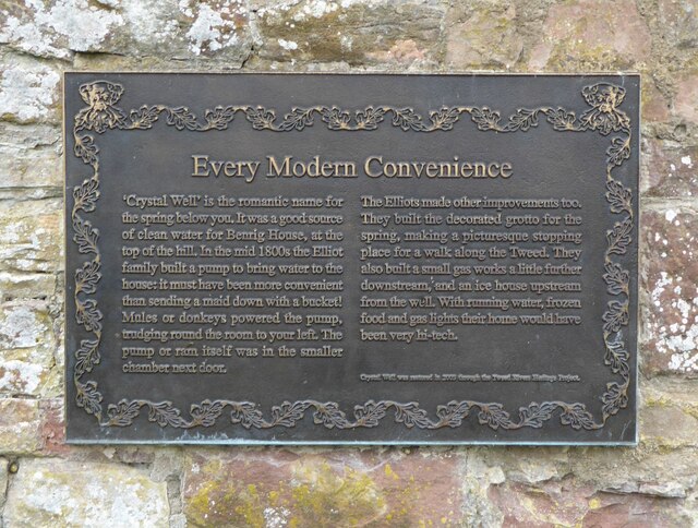
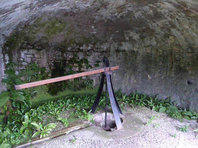
The pool is formed by natural springs and is surrounded by lush greenery, creating a beautiful landscape that attracts visitors all year round. The calm and still waters of Kirkback Pool provide a perfect reflection of the surrounding trees and vegetation, adding to its aesthetic appeal.

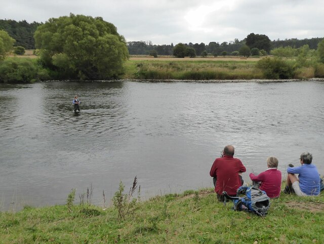
The pool serves as a habitat for a diverse range of wildlife. It is home to various species of fish, including trout and perch, making it a popular destination for anglers. Additionally, the pool attracts numerous species of waterfowl, such as ducks, swans, and herons. Birdwatchers can spot these magnificent creatures in their natural habitat, making it an ideal location for observing and learning about different bird species.

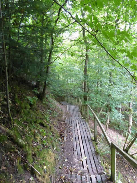
Visitors to Kirkback Pool can explore the area by walking along the designated trails that meander through the marshland. These trails offer glimpses of the various flora and fauna that thrive in this unique ecosystem. The pool also provides opportunities for recreational activities like kayaking and canoeing, allowing visitors to experience the beauty of the surroundings from a different perspective.

Kirkback Pool is a true gem in Berwickshire, offering a serene escape from the hustle and bustle of everyday life. Its natural beauty, diverse wildlife, and recreational opportunities make it a must-visit destination for nature lovers and outdoor enthusiasts alike.

If you have any feedback on the listing, please let us know in the comments section below.

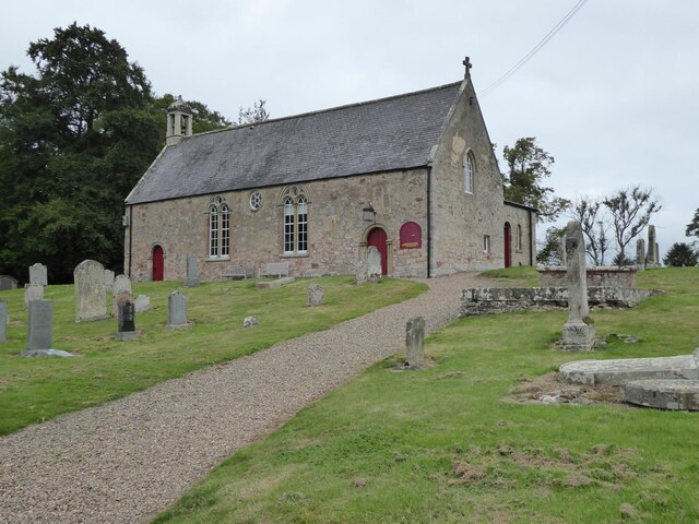
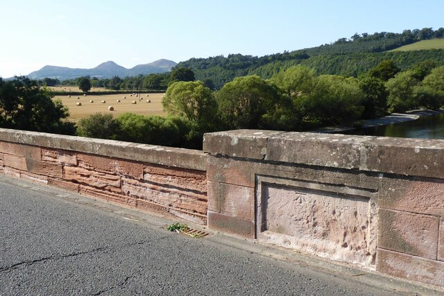
Kirkback Pool Images

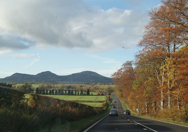
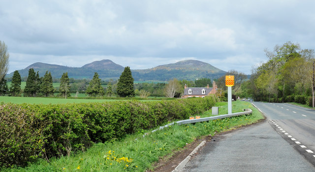
Images are sourced within 2km of 55.566968/-2.6187652 or Grid Reference NT6130. Thanks to Geograph Open Source API. All images are credited.

"The Street"  on A68
"The Street" on A68
Lay-by, road and camera Along a stretch of the A68 approaching St. Boswells where the road is known as The Street.
The Eildon Hills in the distance.
Lay-by, road and camera
Along a stretch of the A68 approaching St. Boswells where the road is known as The Street. The Eildon Hills in the distance.
St Cuthbert's Way The boardwalk avoids the wet woodland further down the bank.
Not the most exciting section of the way with no views through the trees.
St Cuthbert's Way
The boardwalk avoids the wet woodland further down the bank. Not the most exciting section of the way with no views through the trees.
The River Tweed  St Cuthbert's Way passes along the bank, through tall weeds, below Benrig.
The River Tweed
St Cuthbert's Way passes along the bank, through tall weeds, below Benrig.
The Crystal Well A spring originally supplying clean water for Benrig House.
In the mid 1800s the Elliot family built a pump to bring water up to the house, much more convenient than sending a maid down with a bucket!
The Crystal Well
A spring originally supplying clean water for Benrig House. In the mid 1800s the Elliot family built a pump to bring water up to the house, much more convenient than sending a maid down with a bucket!
Every Modern Convenience A plaque on the wall listing the technological progressions involved in getting water up to Benrig House.
Every Modern Convenience
A plaque on the wall listing the technological progressions involved in getting water up to Benrig House.
Donkey or mule power house This chamber, above the Crystal Well, housed the animals that trudged in circles round the room to power the adjacent pump that pumped the water up to Benrig House. See <a title="https://www.geograph.org.uk/photo/6955163" href="https://www.geograph.org.uk/photo/6955163">Link</a>
Donkey or mule power house
This chamber, above the Crystal Well, housed the animals that trudged in circles round the room to power the adjacent pump that pumped the water up to Benrig House. See Link
Gateway to Benrig The house overlooks the River Tweed.
Gateway to Benrig
The house overlooks the River Tweed.
Fisherman in River Tweed Viewed from St Cuthbert's Way.
Fisherman in River Tweed
Viewed from St Cuthbert's Way.
Fishing as a spectator sport! Walkers on St Cuthbert's Way watch a lady fishing in the River Tweed.
Fishing as a spectator sport!
Walkers on St Cuthbert's Way watch a lady fishing in the River Tweed.
River Tweed Near Clintmains.
Pity about the electricity pole!
River Tweed
Near Clintmains. Pity about the electricity pole!
Glebe House By the kirk at Maxton.
Glebe House
By the kirk at Maxton.
Maxton Kirk 'There is reputed to have been a church on or near the present site for close on 1000 years. In 1322 Edward II and his men destroyed Dryburgh Abbey on his retreat from Edinburgh. In revengeful mood, the English army set it on fire. 'One result of this destruction was the gift of Maxton Church, one of the last of such ecclesiastical possessions to become the property of the Abbey.'
<span class="nowrap"><a title="https://www.dryburghdistrictchurches.org/maxton-kirk-history.html" rel="nofollow ugc noopener" href="https://www.dryburghdistrictchurches.org/maxton-kirk-history.html">Link</a><img style="margin-left:2px;" alt="External link" title="External link - shift click to open in new window" src="https://s1.geograph.org.uk/img/external.png" width="10" height="10"/></span>
Maxton Kirk
'There is reputed to have been a church on or near the present site for close on 1000 years. In 1322 Edward II and his men destroyed Dryburgh Abbey on his retreat from Edinburgh. In revengeful mood, the English army set it on fire. 'One result of this destruction was the gift of Maxton Church, one of the last of such ecclesiastical possessions to become the property of the Abbey.' LinkExternal link
Ordnance Survey cut mark On Mertoun Bridge.
With backdrop of River Tweed and the Eildon Hills.
(Better than the usual buried in a hedge location!)
Ordnance Survey cut mark
On Mertoun Bridge. With backdrop of River Tweed and the Eildon Hills. (Better than the usual buried in a hedge location!)
Mill at Clintmains With adjacent weir on the River Tweed.
There is a fisherman in the river above the weir.
Mill at Clintmains
With adjacent weir on the River Tweed. There is a fisherman in the river above the weir.
View downstream from Mertoun Bridge With island in the River Tweed.
View downstream from Mertoun Bridge
With island in the River Tweed.
Entrance and Gate Post for Benrig
Benrig Cemetery
Benrig Cemetery
Show me another place!

Kirkback Pool is located at Grid Ref: NT6130 (Lat: 55.566968, Lng: -2.6187652)

Unitary Authority: The Scottish Borders

Police Authority: The Lothians and Scottish Borders

What 3 Words

///giving.textiles.commit. Near Saint Boswells, Scottish Borders

Related Wikis

Maxton, Roxburghshire

Maxton is a hamlet and civil parish in Roxburghshire, Scotland, and part of the Scottish Borders region. Maxton lies just off the A68, south of St. Boswells...

Maxton railway station

Maxton railway station served the hamlet of Maxton, Roxburghshire, Scotland from 1851 to 1964 on the Kelso Line. == History == The station opened in June...

Greycrook

Greycrook is a village off the A68 and the A699 in the Scottish Borders, approximately 500 m (550 yd) south-east of St Boswells, and close to Dryburgh...

Mertoun

Mertoun is a parish in the south-west of the historic county of Berwickshire in the Scottish Borders area of Scotland. Together with the parish of Maxton...

Nearby Amenities

Located within 500m of 55.566968,-2.6187652
Bus Stop
Church Road End
Local Ref: AT
Naptan AtcoCode: 69001214
Naptan Bearing: E
Naptan BusStopType: CUS
Naptan CommonName: Church Road End
Naptan Indicator: at
Naptan Landmark: Church Road End
Naptan NaptanCode: 72725628
Naptan Street: A699
Naptan Verified: no
Source: naptan_import
Lat/Long: 55.563372/-2.6158516
Bus Stop
Church Road End
Naptan AtcoCode: 6900623
Naptan Bearing: W
Naptan CommonName: Church Road End
Naptan Indicator: opp
Naptan Landmark: Church Road End
Naptan NaptanCode: 72723586
Naptan Street: A699
Naptan Verified: no
Shelter: yes
Source: naptan_import
Lat/Long: 55.5633737/-2.6155186
Maxton
Is In: Scottish Borders
Name Sco: Maxtoun
Place: village
Wikidata: Q6796043
Wikipedia: en:Maxton, Roxburghshire
Lat/Long: 55.5636297/-2.6145335
Post Box
Post Box Type: lamp
Ref: TD6 74
Royal Cypher: scottish_crown
Lat/Long: 55.5638455/-2.6142939
Telephone
Booth: KX100
Check Date: 2021-08-21
Covered: booth
Operator: BT
Operator Wikidata: Q593786
Payment Coins: yes
Lat/Long: 55.5638801/-2.614227
Passing Place
Lat/Long: 55.5643313/-2.6167415
Benrig Manse
Place: isolated_dwelling
Lat/Long: 55.5668078/-2.6263858
Power: pole
Lat/Long: 55.5630376/-2.615059
Power: pole
Lat/Long: 55.5633812/-2.6155225
Power: pole
Lat/Long: 55.5632443/-2.6144513
Power: pole
Lat/Long: 55.5634147/-2.6139337
Power: pole
Lat/Long: 55.5647834/-2.6120952
Power: pole
Lat/Long: 55.564913/-2.61252
Power: pole
Lat/Long: 55.5651329/-2.613223
Power: pole
Lat/Long: 55.5654634/-2.6142762
Power: pole
Lat/Long: 55.5657794/-2.6152521
Power: pole
Lat/Long: 55.5660866/-2.6161379
Power: pole
Lat/Long: 55.5659716/-2.6170932
Power: pole
Lat/Long: 55.565842/-2.6179146
Power: pole
Lat/Long: 55.5656207/-2.6185223
Power: pole
Lat/Long: 55.5658944/-2.6144435
Power: pole
Lat/Long: 55.5673242/-2.6149302
Power: pole
Lat/Long: 55.5679954/-2.6145388
Power: pole
Lat/Long: 55.5686972/-2.614132
Power: pole
Lat/Long: 55.5693888/-2.6137406
Power: pole
Lat/Long: 55.5699959/-2.6133904
Power: pole
Lat/Long: 55.5671015/-2.6266463
The data included in this document is from www.openstreetmap.org. The data is made available under ODbL.

Have you been to Kirkback Pool?

Leave your review of Kirkback Pool below (or comments, questions and feedback).