Lily Mere
Lake, Pool, Pond, Freshwater Marsh in Westmorland South Lakeland
England
Lily Mere

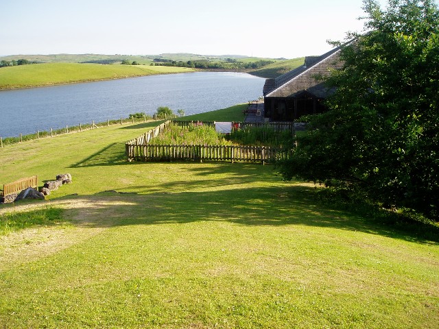
Lily Mere is a picturesque freshwater ecosystem located in Westmorland, a county in the northwest of England. This natural marvel is a combination of a lake, pool, pond, and freshwater marsh, making it a unique and diverse habitat for various species of flora and fauna.
Surrounded by lush greenery and rolling hills, Lily Mere boasts a serene and tranquil atmosphere, attracting both locals and tourists seeking solace in nature. The lake itself is a stunning body of water, characterized by its crystal-clear, shimmering surface. It spans over a considerable area, providing ample space for recreational activities such as kayaking, canoeing, and fishing.
The pool and pond within Lily Mere are smaller bodies of water, nestled within the marshy areas. These water features are home to a wide range of aquatic plants and smaller aquatic creatures, creating a thriving ecosystem. The marsh is a vital component of Lily Mere, acting as a natural filtration system and providing a habitat for numerous waterfowl, amphibians, and insects.
The flora surrounding Lily Mere is equally impressive, with a diverse array of plants thriving in the wetland environment. Tall reeds and grasses dominate the marsh, while lilies and other aquatic plants adorn the edges of the lake, pool, and pond. These flora not only contribute to the beauty of the area but also provide food and shelter for the various wildlife that calls Lily Mere home.
Overall, Lily Mere is a haven of natural beauty, offering visitors an opportunity to immerse themselves in the tranquility of its waters, marvel at its diverse plant life, and observe the numerous species that thrive within its boundaries.
If you have any feedback on the listing, please let us know in the comments section below.
Lily Mere Images
Images are sourced within 2km of 54.31729/-2.6098816 or Grid Reference SD6091. Thanks to Geograph Open Source API. All images are credited.


Lily Mere is located at Grid Ref: SD6091 (Lat: 54.31729, Lng: -2.6098816)
Administrative County: Cumbria
District: South Lakeland
Police Authority: Cumbria
What 3 Words
///cleansed.hammocks.graceful. Near Sedbergh, Cumbria
Nearby Locations
Related Wikis

Killington Lake Services
Killington Lake Services is a motorway service station on the M6 motorway between Junctions 37 and 36 near Killington Lake in Cumbria, England. It was...

Firbank Fell
Firbank Fell is a hill in Cumbria between the towns of Kendal and Sedbergh that is renowned as a place where George Fox, the founder of the Religious Society...

Killington, Cumbria
Killington is a village and civil parish in the South Lakeland district of the county of Cumbria, England. It had a population of 152 in 2001, At the...

St Gregory's Church, Vale of Lune
St Gregory's Church, Vale of Lune, also known as the Vale of Lune Chapel, is a redundant Anglican church situated on the A684 road about 1.5 miles (2 km...

River Rawthey
The River Rawthey is a river in Cumbria in northwest England. The headwaters of the Rawthey are at Rawthey Gill Foot, where Rawthey Gill meets Haskhaw...

Lambrigg Fell
Lambrigg Fell is a hill, the highest point of the area of high ground between Kendal and the M6, in south-eastern Cumbria, England.It lies just outside...

Ingmire Hall
Ingmire Hall is a grade II listed 16th century country house built around the remains of a pele tower some 2 miles west of Sedbergh, Cumbria, England.The...

Firbank
Firbank is a village and civil parish in the South Lakeland district of the English county of Cumbria. It has a population of 97. As Firbank had a population...
Nearby Amenities
Located within 500m of 54.31729,-2.6098816Have you been to Lily Mere?
Leave your review of Lily Mere below (or comments, questions and feedback).