Bosullow, Great

Settlement in Cornwall

England

Bosullow, Great

Former Bible Christian chapel
Former Bible Christian chapel Credit: Paul Barnett

Bosullow is a small hamlet located in the civil parish of Madron, in the county of Cornwall, England. Situated approximately 4 miles northwest of Penzance, Bosullow is nestled within the beautiful countryside of West Cornwall.

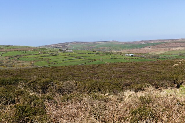
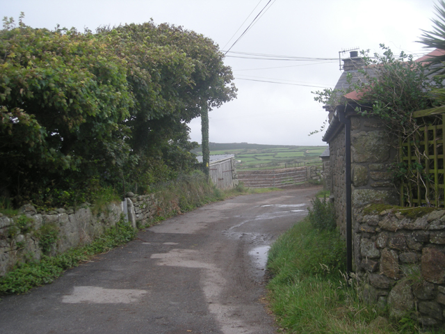
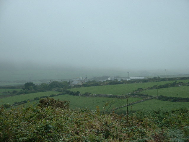
The hamlet is known for its picturesque setting, with rolling hills, lush green fields, and traditional stone cottages dotting the landscape. It is surrounded by rural farmland, offering a tranquil and idyllic atmosphere for residents and visitors alike.

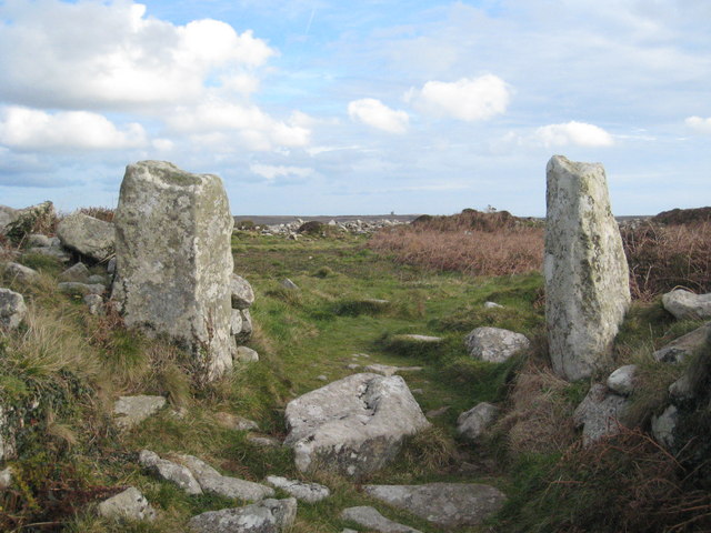
One of the notable features of Bosullow is the ancient stone circle known as Boskednan, located just a short distance from the hamlet. This Neolithic monument is believed to date back to around 2500 BC and consists of 19 granite stones arranged in an oval shape.

Whilst Bosullow itself is a small and quiet community, it benefits from its close proximity to Penzance, which provides a range of amenities and services including shops, schools, and healthcare facilities. The nearby coastal town of St. Ives is also easily accessible, offering a wealth of cultural attractions, art galleries, and stunning beaches.

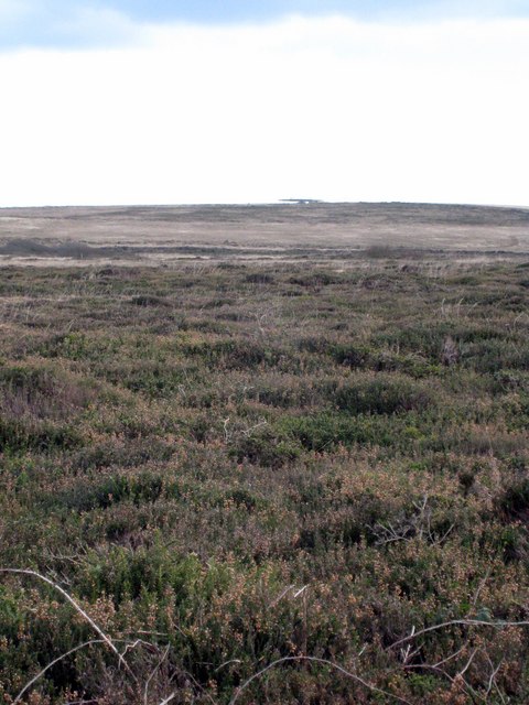
For outdoor enthusiasts, Bosullow is a fantastic base for exploring the surrounding countryside, with numerous footpaths and bridleways crisscrossing the area. Whether it's a leisurely walk through the countryside or a more challenging hike up nearby hills, there are plenty of opportunities to immerse oneself in the natural beauty of Bosullow and its surroundings.

Overall, Bosullow offers a peaceful and scenic retreat for those seeking a rural getaway in the heart of Cornwall.

If you have any feedback on the listing, please let us know in the comments section below.

Bosullow, Great Images

Images are sourced within 2km of 50.146278/-5.622513 or Grid Reference SW4133. Thanks to Geograph Open Source API. All images are credited.

Former Bible Christian chapel
View from Bosvenning Common 2 Another look across the common to distant farms. The far distant rocky outcrop is Carn Galver. See also <a href="https://www.geograph.org.uk/photo/7460419">SW4131 : View from Bosvenning Common 1</a>.
View from Bosvenning Common 2
Another look across the common to distant farms. The far distant rocky outcrop is Carn Galver. See also SW4131 : View from Bosvenning Common 1.
Main road where the footpath emerges Houses on the A3071 opposite the footpath.
Main road where the footpath emerges
Houses on the A3071 opposite the footpath.
Footpath onto the common Footpath over heath and scrub, looking towards Bosvenning Common.
Footpath onto the common
Footpath over heath and scrub, looking towards Bosvenning Common.
Stone Stile, Morvah On the B3306 East of the entrance to a camping field, on Cornwall footpath 106/2/1 looking SE.
The view looking out is <a href="https://www.geograph.org.uk/photo/7557474">SW4035 : Stone Stile, Morvah</a>.
Stone Stile, Morvah
On the B3306 East of the entrance to a camping field, on Cornwall footpath 106/2/1 looking SE. The view looking out is SW4035 : Stone Stile, Morvah.
Stone Stile, Morvah On the B3306 East of the entrance to a camping field, on Cornwall footpath 106/2/1 looking out.
The view SE is <a href="https://www.geograph.org.uk/photo/7557473">SW4035 : Stone Stile, Morvah</a>.
Stone Stile, Morvah
On the B3306 East of the entrance to a camping field, on Cornwall footpath 106/2/1 looking out. The view SE is SW4035 : Stone Stile, Morvah.
Milking time at Keigwin Looking east. Dry Carn in the background.
Milking time at Keigwin
Looking east. Dry Carn in the background.
Flooding on Woon Gumpus Common After several days of heavy rain the peaty ground is saturated and the paths filled with water running like streams.
Flooding on Woon Gumpus Common
After several days of heavy rain the peaty ground is saturated and the paths filled with water running like streams.
Keigwin
Keigwin
The main road to St Ives
Woon Gumpas Common Looking very drab and colourless in late November but in late Summer this heathland is a riot of pink and yellow from the flowers of Cross-leaved Heath (Erica tetralix) and Western Gorse (Ulex gallii).  The strange-shaped building on the horizon is an air traffic control installation <a href="https://www.geograph.org.uk/photo/1489020">SW4032 : NATS navigation aid near Boswens Common</a>.
Woon Gumpas Common
Looking very drab and colourless in late November but in late Summer this heathland is a riot of pink and yellow from the flowers of Cross-leaved Heath (Erica tetralix) and Western Gorse (Ulex gallii). The strange-shaped building on the horizon is an air traffic control installation SW4032 : NATS navigation aid near Boswens Common.
Car Park on Woon Gumpas Common A popular spot for dog walkers and for access to Chun Quoit, which can just be seen on the horizon on the left of the picture.
Car Park on Woon Gumpas Common
A popular spot for dog walkers and for access to Chun Quoit, which can just be seen on the horizon on the left of the picture.
Flooded path on Woon Gumpus Common
Ancient fields on Woon Gumpus Common Looking west towards Carn Kenidjack
Ancient fields on Woon Gumpus Common
Looking west towards Carn Kenidjack
Field boundary This Cornish hedge is probably '000s of years old.
Field boundary
This Cornish hedge is probably '000s of years old.
Access point for the Higher Downs The ancient field boundary has suffered under modern foot traffic, en route to Chun Quoit and Castle.
Access point for the Higher Downs
The ancient field boundary has suffered under modern foot traffic, en route to Chun Quoit and Castle.
The car park for Woon Gumpus common
Access Road to Boslow Farmhouse Rural setting not close to any settlement.
Access Road to Boslow Farmhouse
Rural setting not close to any settlement.
Show me another place!

Bosullow, Great is located at Grid Ref: SW4133 (Lat: 50.146278, Lng: -5.622513)

Unitary Authority: Cornwall

Police Authority: Devon and Cornwall

What 3 Words

///priced.eyepieces.passport. Near St Just, Cornwall

Related Wikis

Great Bosullow

Great Bosullow (Cornish: Bos Chiwolow, meaning dwelling of the house of light) is a hamlet south-east of Morvah in west Cornwall, England, UK. Bosullow...

Little Bosullow

Little Bosullow is a hamlet in the civil parish of Madron, Cornwall, England, UK. Great Bosullow is to the west, Bosullow is on the B3312 Madron to Morvah...

Chûn Castle

Chûn Castle is a large Iron Age hillfort (ringfort) near Penzance in Cornwall, England, United Kingdom. The fort was built about 2,500 years ago, and fell...

West Lanyon Quoit

West Lanyon Quoit, also known as Lower Lanyon Quoit, is the remains of a prehistoric dolmen situated in the parish of Madron in Cornwall grid reference...

Nearby Amenities

Located within 500m of 50.146278,-5.622513
Great Bosullow
Is In: Cornwall, England, UK
Name Kw: Boschiwolow Veur
Place: hamlet
Source: NPE
Wikidata: Q5598795
Wikipedia: en:Great Bosullow
Lat/Long: 50.1459235/-5.6200029
Direction: SE
Generator Method: photovoltaic
Generator Output Electricity: small_installation
Generator Source: solar
Generator Type: solar_photovoltaic_panel
Location: roof
Power: generator
Source: bing
Lat/Long: 50.1465575/-5.6207715
Skreach West Country Cider
Addr City: Penzance
Addr Housename: Barrach Farm
Addr Postcode: TR20 8NP
Addr Street: Great Bosullow
Craft: brewery
Email: skreachcider@gmail.com
Phone: +44 1736 811090
Website: https://www.skreach.co.uk/
Lat/Long: 50.1464946/-5.6202553
Power: pole
Lat/Long: 50.1501678/-5.6246325
Power: pole
Lat/Long: 50.1500956/-5.6236643
Power: pole
Lat/Long: 50.1500148/-5.6225967
Power: pole
Lat/Long: 50.1499117/-5.6209981
Power: pole
Lat/Long: 50.1500234/-5.6199896
Power: pole
Lat/Long: 50.1501437/-5.6191233
Power: pole
Lat/Long: 50.1470122/-5.6238279
Power: pole
Lat/Long: 50.1463229/-5.6229883
Power: pole
Lat/Long: 50.1456886/-5.6222159
Power: pole
Transformer: distribution
Lat/Long: 50.1452821/-5.6217706
Power: pole
Lat/Long: 50.1433561/-5.6268695
Power: pole
Lat/Long: 50.1442577/-5.626608
Power: pole
Lat/Long: 50.1451059/-5.626376
Power: pole
Lat/Long: 50.1457858/-5.6266335
Power: pole
Lat/Long: 50.1463667/-5.6274301
Power: pole
Lat/Long: 50.1466099/-5.6269674
Power: pole
Lat/Long: 50.1470912/-5.6260058
Power: pole
Lat/Long: 50.1477048/-5.6246835
Power: pole
Lat/Long: 50.1484852/-5.6246728
Power: pole
Lat/Long: 50.1492569/-5.6246379
The data included in this document is from www.openstreetmap.org. The data is made available under ODbL.

Have you been to Bosullow, Great?

Leave your review of Bosullow, Great below (or comments, questions and feedback).