Ward Pot

Lake, Pool, Pond, Freshwater Marsh in Aberdeenshire

Scotland

Ward Pot

Access road for Littlewood Park Littlewood Park is a large house <a title="https://www.geograph.org.uk/photo/649151" href="https://www.geograph.org.uk/photo/649151">Link</a> in a minor valley feeding into the River Don. It's approached from the A944 by the long drive seen here; the house is behind the camera, by some way!
Access road for Littlewood Park Credit: Trevor Littlewood

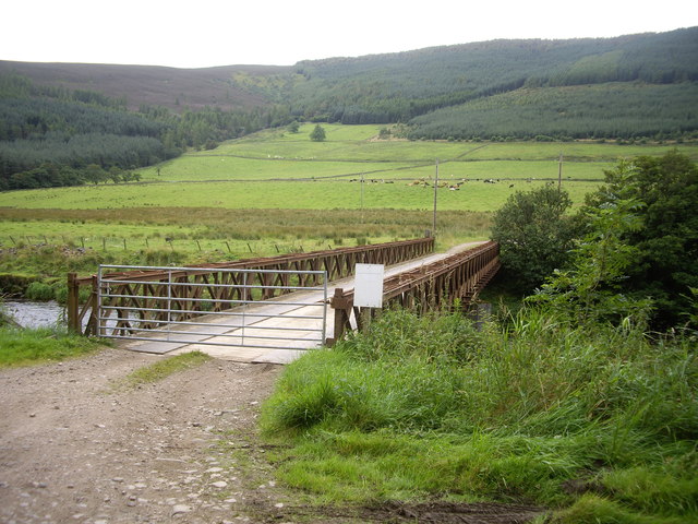
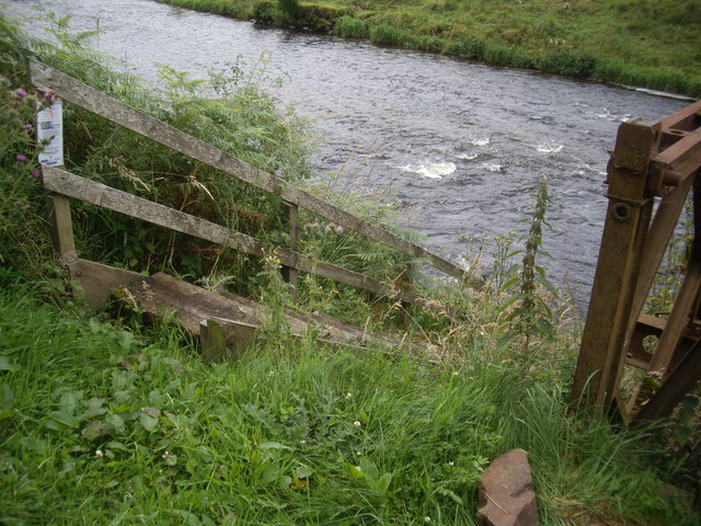
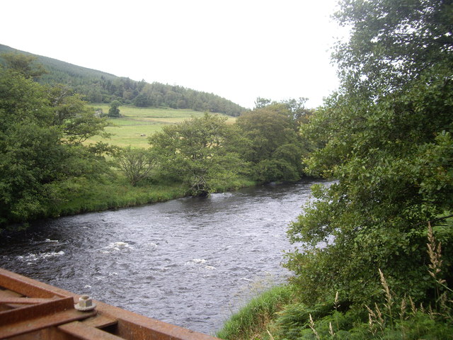
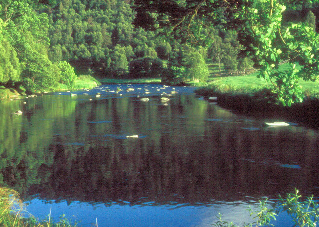
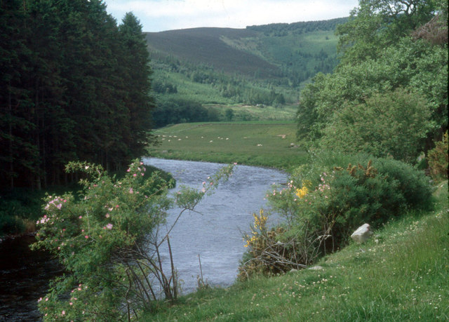
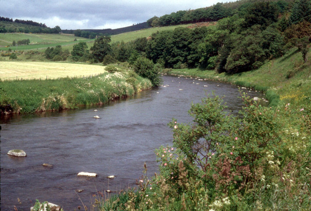
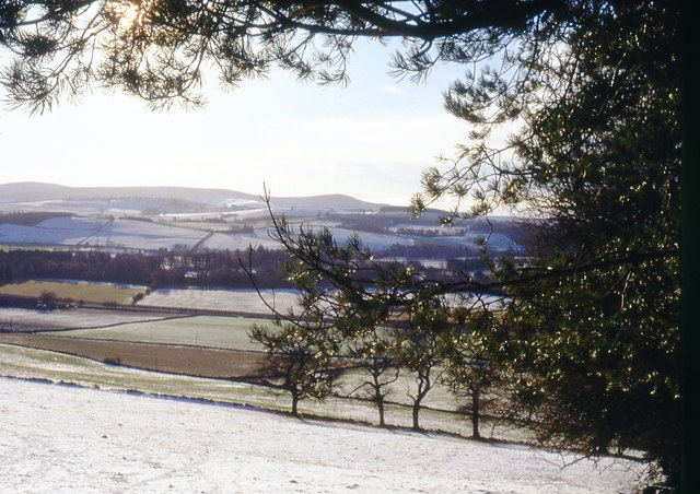
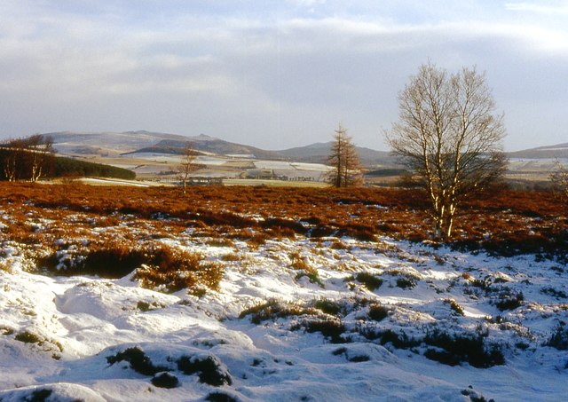
Ward Pot is a small, freshwater lake located in Aberdeenshire, Scotland. It is situated in a tranquil and picturesque setting, surrounded by rolling hills and lush greenery. The lake is known for its crystal-clear waters and is a popular destination for nature enthusiasts and anglers alike.

Covering an area of approximately 5 acres, Ward Pot is a relatively small body of water. However, what it lacks in size, it makes up for in its diverse ecosystem. The lake is home to a variety of aquatic plants, including water lilies and reeds, which provide a habitat for numerous species of fish and birds.

The waters of Ward Pot are teeming with fish, making it a popular spot for anglers seeking trout and pike. The lake is regularly stocked with these species, ensuring a rewarding fishing experience for visitors. Fishing permits are available for purchase, and fishing enthusiasts are advised to bring their own equipment.

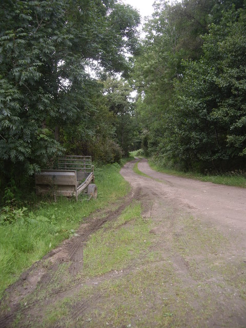
Surrounding the lake, there is a network of walking trails that offer visitors the opportunity to explore the beautiful countryside and observe the local wildlife. Birdwatchers will be delighted by the presence of various waterfowl species, such as swans, ducks, and herons, which can often be spotted gliding across the calm waters or nesting in the nearby reed beds.

Ward Pot is a true haven for nature lovers, offering a peaceful and idyllic setting to enjoy the great outdoors. Its natural beauty, diverse ecosystem, and recreational activities make it a must-visit destination for anyone seeking a tranquil escape in Aberdeenshire.

If you have any feedback on the listing, please let us know in the comments section below.
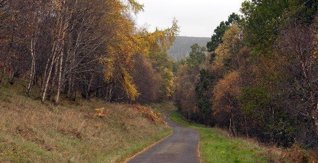
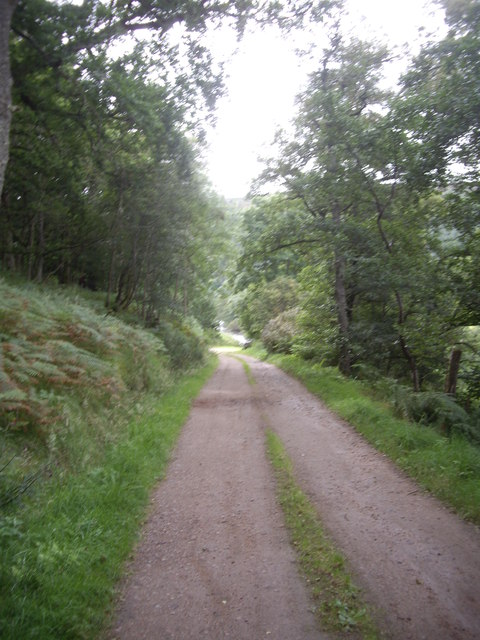
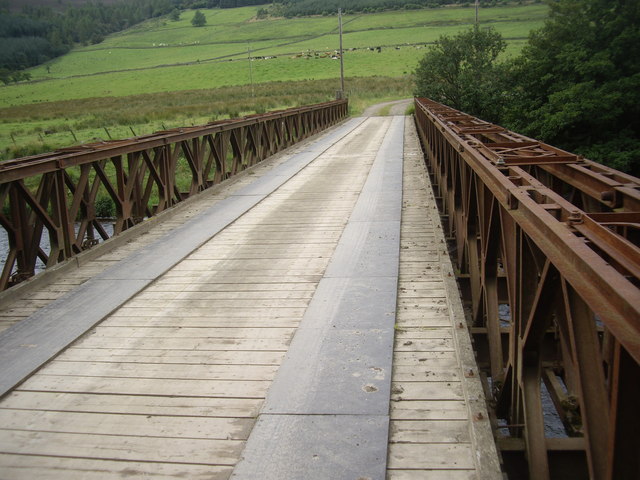
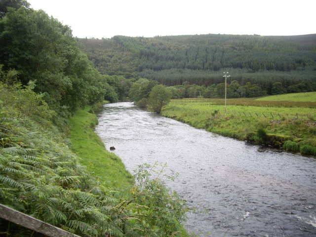
Ward Pot Images

Images are sourced within 2km of 57.23992/-2.7692007 or Grid Reference NJ5316. Thanks to Geograph Open Source API. All images are credited.

Access road for Littlewood Park Littlewood Park is a large house <a title="https://www.geograph.org.uk/photo/649151" href="https://www.geograph.org.uk/photo/649151">Link</a> in a minor valley feeding into the River Don. It's approached from the A944 by the long drive seen here; the house is behind the camera, by some way!
Access road for Littlewood Park
Littlewood Park is a large house Link in a minor valley feeding into the River Don. It's approached from the A944 by the long drive seen here; the house is behind the camera, by some way!
Track from Bithnie Bridge to A97
Bithnie Bridge Over the River Don near Littlewood Park.
Bithnie Bridge
Over the River Don near Littlewood Park.
Downstream River Don From Bithnie Bridge.
Downstream River Don
From Bithnie Bridge.
Gated-track to Bithnie farm Crossing the Don, via a bridge with a lockable gate.
Gated-track to Bithnie farm
Crossing the Don, via a bridge with a lockable gate.
Fishermen's steps to the River Don On the downstream side of Bithnie Bridge.
Fishermen's steps to the River Don
On the downstream side of Bithnie Bridge.
Upstream River Don From Bithnie Bridge.
Upstream River Don
From Bithnie Bridge.
A farm trailer Parked by Bithnie Bridge.
A farm trailer
Parked by Bithnie Bridge.
River Don at Kirkton of Forbes
River Don at Slaskie Pot The Don here winds through pastoral valley bottom and forested hillsides
River Don at Slaskie Pot
The Don here winds through pastoral valley bottom and forested hillsides
A bend in the River Don Several pairs of Sedge Warblers are selecting their territories this month
A bend in the River Don
Several pairs of Sedge Warblers are selecting their territories this month
Alford West Kirk and manse With a walled area containing six horizontal gravestones, each with an identical key motif. No further information/explanation to hand - help please.
Alford West Kirk and manse
With a walled area containing six horizontal gravestones, each with an identical key motif. No further information/explanation to hand - help please.
One of several Murray family graves in Alford West Kirkyard Relatives of Charles Murray ('Doric' poet) whose ashes were spread close by. See <span class="nowrap"><a title="http://humphrysfamilytree.com/Murray/poet.html" rel="nofollow ugc noopener" href="http://humphrysfamilytree.com/Murray/poet.html">Link</a><img style="margin-left:2px;" alt="External link" title="External link - shift click to open in new window" src="https://s1.geograph.org.uk/img/external.png" width="10" height="10"/></span> for a family tree.
One of several Murray family graves in Alford West Kirkyard
Relatives of Charles Murray ('Doric' poet) whose ashes were spread close by. See LinkExternal link for a family tree.
Quiet morning on the River Don
West Parish Church, Alford The church is by the A980 on the west side of Alford. A church was on this site in the 12th century but the present building was erected in the early 19th century. The church is closed and in private ownership. (Source: Places of worship in Scotland website)
West Parish Church, Alford
The church is by the A980 on the west side of Alford. A church was on this site in the 12th century but the present building was erected in the early 19th century. The church is closed and in private ownership. (Source: Places of worship in Scotland website)
A wall memorial at West Parish Church, Alford This magnificent symbolic memorial with an impressive skeleton is on the west gable of the church. Unfortunately the inscription panel has weathered badly over the years. A small slate-roofed open porch protects the memorial from the weather.
A wall memorial at West Parish Church, Alford
This magnificent symbolic memorial with an impressive skeleton is on the west gable of the church. Unfortunately the inscription panel has weathered badly over the years. A small slate-roofed open porch protects the memorial from the weather.
Farmland at Balfour in the Howe of Alford
Strathlunach Wood Only scattered trees remain on the hilltop. Looking to Bennachie and Millstone Hill.
Strathlunach Wood
Only scattered trees remain on the hilltop. Looking to Bennachie and Millstone Hill.
Show me another place!

Ward Pot is located at Grid Ref: NJ5316 (Lat: 57.23992, Lng: -2.7692007)

Unitary Authority: Aberdeenshire

Police Authority: North East

What 3 Words

///bells.hydration.tricks. Near Alford, Aberdeenshire

Nearby Locations

Ward Pot

Related Wikis

Marr, Scotland

Marr (Scottish Gaelic: Màrr) is one of six committee areas in Aberdeenshire, Scotland. It has a population of 34,038 (2001 Census). Someone from Marr...

Asloun Castle

Asloun Castle is a castle, formerly Z-plan, dating from the 16th century, 2 miles (3.2 km) south-west of Alford, in Aberdeenshire, Scotland, of which only...

Bridge of Alford

Bridge of Alford is a village in Aberdeenshire, Scotland.Bridge of Alford is situated near Alford beside the bridge over the River Don. It is on the road...

Battle of Alford

The Battle of Alford was an engagement of the Scottish Civil War. It took place near the village of Alford, Aberdeenshire, on 2 July 1645. During the battle...

Nearby Amenities

Located within 500m of 57.23992,-2.7692007
Power: pole
Lat/Long: 57.237521/-2.7622737
Power: pole
Lat/Long: 57.2383502/-2.7623473
Power: pole
Lat/Long: 57.2391113/-2.7624462
Power: pole
Lat/Long: 57.2399981/-2.7617309
Power: pole
Lat/Long: 57.2408711/-2.7610993
Power: pole
Lat/Long: 57.2410687/-2.7612058
Power: pole
Lat/Long: 57.2416521/-2.7616523
Power: pole
Lat/Long: 57.2422107/-2.7620708
Power: pole
Lat/Long: 57.2429093/-2.7637932
Power: pole
Lat/Long: 57.2430782/-2.7651097
Power: pole
Lat/Long: 57.243118/-2.7653304
Power: pole
Lat/Long: 57.2433376/-2.766926
Power: pole
Lat/Long: 57.2435558/-2.7685368
Power: pole
Lat/Long: 57.2437246/-2.7698558
Power: pole
Lat/Long: 57.2438948/-2.771109
Power: pole
Lat/Long: 57.2441007/-2.771974
Power: pole
Lat/Long: 57.2374867/-2.7635903
Power: pole
Lat/Long: 57.2374414/-2.7649829
Power: pole
Lat/Long: 57.2373989/-2.7665353
Power: pole
Lat/Long: 57.2373522/-2.7679736
Power: pole
Lat/Long: 57.2373206/-2.7694373
Power: pole
Lat/Long: 57.2436327/-2.7654826
The data included in this document is from www.openstreetmap.org. The data is made available under ODbL.

Have you been to Ward Pot?

Leave your review of Ward Pot below (or comments, questions and feedback).