Black Pool
Lake, Pool, Pond, Freshwater Marsh in Cumberland Carlisle
England
Black Pool

Black Pool, Cumberland is a picturesque freshwater marsh located in the county of Cumberland, England. It is nestled within the serene landscape of the Lake District National Park, renowned for its natural beauty and diverse ecosystems.
This enchanting pool is a product of glacial activity from the last Ice Age, characterized by its dark, almost black water, hence the name "Black Pool." The pool stretches over an area of approximately 10 acres, providing a haven for a wide array of flora and fauna.
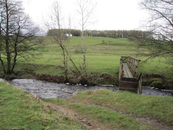
Surrounded by lush vegetation and bordered by reed beds, the pool supports a rich and diverse ecosystem. It is home to an assortment of aquatic plants such as water lilies, pondweeds, and reed mace. These plants provide important habitat and food sources for numerous species of birds, insects, and amphibians.
Birdwatchers flock to Black Pool, Cumberland to catch a glimpse of its impressive avian population. The pool attracts various waterfowl, including mallards, tufted ducks, and Canada geese. Visitors may also spot common moorhens, coots, and the occasional kingfisher darting across the water's surface.
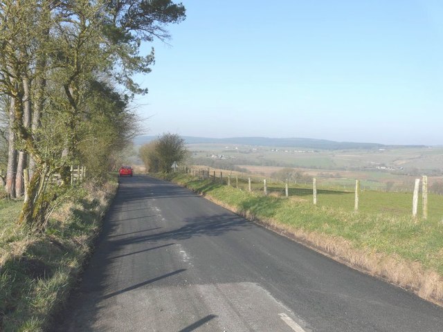
The pool is surrounded by a network of walking trails, allowing visitors to explore the surrounding marshland and enjoy the tranquility of the area. The serene atmosphere and the breathtaking views make Black Pool, Cumberland a popular destination for nature enthusiasts, photographers, and those seeking a peaceful retreat in the heart of the Lake District.
If you have any feedback on the listing, please let us know in the comments section below.
Black Pool Images
Images are sourced within 2km of 55.091718/-2.7363097 or Grid Reference NY5377. Thanks to Geograph Open Source API. All images are credited.


Black Pool is located at Grid Ref: NY5377 (Lat: 55.091718, Lng: -2.7363097)
Administrative County: Cumbria
District: Carlisle
Police Authority: Cumbria
What 3 Words
///radiated.raven.wacky. Near Brampton, Cumbria
Nearby Locations
Related Wikis

Blackpool Gate
Blackpool Gate is a settlement in the civil parish of Bewcastle, which is in the district of the City of Carlisle in the county of Cumbria, England. It...

Alston Formation
The Alston Formation is a geologic formation in England. It preserves fossils dating back to the Viséan to Serpukhovian (Asbian, Brigantian and Pendleian...

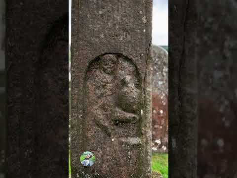
Bewcastle Roman Fort
Bewcastle Roman Fort was built to the north of Hadrian's Wall as an outpost fort possibly intended for scouting and intelligence. The remains of the fort...

Bewcastle Castle
Bewcastle Castle is a ruined castle in the parish of Bewcastle in the English county of Cumbria, a few miles from the Scottish border. == History == The...
Related Videos

NORTHUMBRIAN HIGH CROSS: BEWCASTLE IN A HISTORIC COUNTY OF CUMBERLAND, THE AREA OF CUMBRIA, ENGLAND.
At Bewcastle in North Cumbria, there's a parish church dedicated to Saint Cuthbert, and the shaft of an early medieval ...
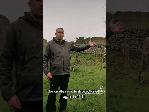
The History of Bewcastle
A brief history of Bewcastle, enjoy. #cumbria #borders #history #armstrong #tours #roman #fort #medieval #castle #reivers.

Bewcastle: A Celtic Shrine & An Anglo-Saxon Cross
A trip to Bewcastle in the wild borderlands of Cumbria. My thoughts on the Celtic shrine, the Anglo-Saxon Cross and just a general ...
Nearby Amenities
Located within 500m of 55.091718,-2.7363097Have you been to Black Pool?
Leave your review of Black Pool below (or comments, questions and feedback).