Horse Pot
Lake, Pool, Pond, Freshwater Marsh in Aberdeenshire
Scotland
Horse Pot

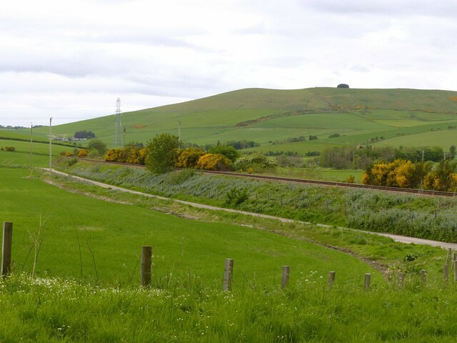
Horse Pot is a picturesque freshwater marsh located in Aberdeenshire, Scotland. With its tranquil surroundings and diverse ecosystem, it is a popular destination for nature enthusiasts and wildlife lovers. Spanning over a vast area, Horse Pot features a combination of a lake, pool, pond, and a freshwater marsh.
The centerpiece of Horse Pot is its pristine lake, which stretches across a considerable portion of the marsh. The lake is known for its crystal-clear waters, providing a habitat for various aquatic plants and animals. It serves as a crucial water source for the numerous species that inhabit the area.
Surrounding the lake, there are smaller bodies of water such as pools and ponds. These smaller water bodies contribute to the overall biodiversity of Horse Pot, attracting different species of birds, amphibians, and insects. The pools and ponds offer a safe haven for many aquatic plants and wildlife, creating a vibrant and thriving ecosystem.
The freshwater marsh at Horse Pot is an essential part of the landscape. It is characterized by its rich soil, which supports the growth of a variety of vegetation. The marshland is home to an array of plant species, including reeds, sedges, and grasses, providing food and shelter for numerous insects and small animals.
Visitors to Horse Pot can enjoy a peaceful stroll along the marshland, observing the diverse flora and fauna that call this place home. The marsh provides an excellent opportunity for birdwatching, with several species of waterfowl and wading birds often spotted in the area.
Overall, Horse Pot in Aberdeenshire offers a serene and captivating environment, with its combination of a lake, pool, pond, and freshwater marsh providing a haven for wildlife and a delightful experience for nature enthusiasts.
If you have any feedback on the listing, please let us know in the comments section below.
Horse Pot Images
Images are sourced within 2km of 57.45592/-2.7847485 or Grid Reference NJ5340. Thanks to Geograph Open Source API. All images are credited.


Horse Pot is located at Grid Ref: NJ5340 (Lat: 57.45592, Lng: -2.7847485)
Unitary Authority: Aberdeenshire
Police Authority: North East
What 3 Words
///woven.innocence.childcare. Near Huntly, Aberdeenshire
Nearby Locations
Related Wikis
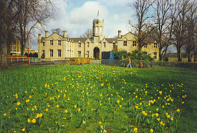
The Gordon Schools
The Gordon Schools is a six-year, non denominational comprehensive co-educational secondary school located in Huntly, Aberdeenshire, Scotland. It takes...
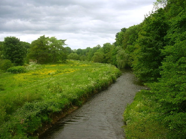
River Bogie
The River Bogie (Scottish Gaelic: Balgaidh), also known as the Water of Bogie, is a river in north-west Aberdeenshire in the north east of Scotland. It...

Deveron Projects
Deveron Projects, formerly Deveron Arts, is a United Kingdom arts organisation based in Huntly, Aberdeenshire, Scotland that hosts international artists...

Stewart's Hall
Stewart's Hall, formerly Huntly Town Hall, is a municipal structure in Gordon Street, Huntly, Aberdeenshire, Scotland. The structure, which is used as...
Nearby Amenities
Located within 500m of 57.45592,-2.7847485Have you been to Horse Pot?
Leave your review of Horse Pot below (or comments, questions and feedback).