Big Pool

Lake, Pool, Pond, Freshwater Marsh in Cheshire

England

Big Pool

Runcorn station
Runcorn station Credit: Roy Hughes

Big Pool, located in Cheshire, is a prominent freshwater body that serves as a lake, pool, pond, and freshwater marsh all in one. This stunning natural feature covers an area of approximately 20 acres, making it an important site for both local wildlife and recreational activities. The pool is nestled within a picturesque landscape, surrounded by lush vegetation and rolling hills.

Renowned for its crystal-clear waters, Big Pool offers a diverse range of habitats, attracting a wide variety of plant and animal species. The pool itself is characterized by its calm and tranquil nature, providing a serene environment for both visitors and resident wildlife. The surrounding marshland is home to an array of aquatic plants, such as reeds and water lilies, which provide a haven for numerous bird species and other wetland creatures.

The pool's deep waters are known for hosting a thriving population of fish, including pike, perch, and roach. This makes it a popular spot for fishing enthusiasts who enjoy the challenge of catching these species. Additionally, the pool attracts migratory birds during certain seasons, making it a sought-after destination for birdwatchers.

Big Pool offers various recreational opportunities, such as boating and kayaking, allowing visitors to explore its scenic beauty from the water. Moreover, the pool's tranquil ambiance makes it a perfect spot for picnicking and relaxation, providing an escape from the hustle and bustle of everyday life.

In conclusion, Big Pool in Cheshire is an enchanting freshwater feature that encompasses a lake, pool, pond, and freshwater marsh. With its diverse flora and fauna, it offers a haven for wildlife and a range of recreational activities for visitors to enjoy.

If you have any feedback on the listing, please let us know in the comments section below.

Big Pool Images

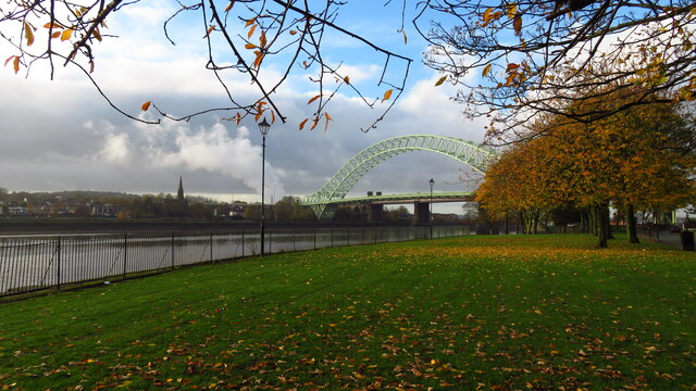
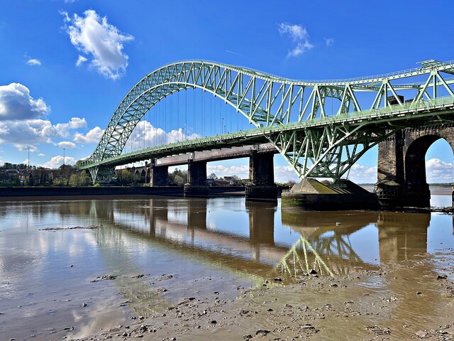
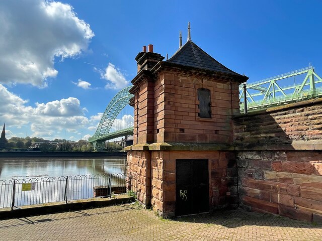
Images are sourced within 2km of 53.338395/-2.7263151 or Grid Reference SJ5182. Thanks to Geograph Open Source API. All images are credited.

Runcorn station
Runcorn station
Duke Close, Runcorn
Duke Close, Runcorn
The Manchester Ship Canal, Runcorn
The River Mersey from the Runcorn Bridge
Tesco Distribution Depot, Widnes
Runcorn-Widnes road bridge The original road bridge at Runcorn is notoriously hard to photograph, due to the adjacent railway bridge.  This shot is from a passing northbound train.
Runcorn-Widnes road bridge
The original road bridge at Runcorn is notoriously hard to photograph, due to the adjacent railway bridge. This shot is from a passing northbound train.
Old Quay Bridge ** Old Quay Bridge is a swing bridge across the Manchester Ship Canal from Runcorn to Wigg Island. The bridge was built circa 1894. It took its name from the Old Quay Canal, which is more commonly known as the Runcorn to Latchford Canal.
** Courtesy Wikipedia
Old Quay Bridge
** Old Quay Bridge is a swing bridge across the Manchester Ship Canal from Runcorn to Wigg Island. The bridge was built circa 1894. It took its name from the Old Quay Canal, which is more commonly known as the Runcorn to Latchford Canal. ** Courtesy Wikipedia
Dock on Manchester Ship Canal Dock on Manchester Ship Canal with Silver Jubilee Bridge in background
Dock on Manchester Ship Canal
Dock on Manchester Ship Canal with Silver Jubilee Bridge in background
The Ferry Boat Wetherspoons PH, Runcorn
Silver Jubilee Bridge - view N from Queensway, Runcorn
View N along Silver Jubilee Bridge, Runcorn
West Bank & Victoria Promenade from Silver Jubilee Bridge
Silver Jubilee Bridge from Victoria Promenade, West Bank
Silver Jubilee Bridge The bridge carries the A557 over the River Mersey and the Manchester Ship Canal. It was built as a replacement for the Runcorn Transporter Bridge and opened in 1961. It is grade II listed.
Silver Jubilee Bridge
The bridge carries the A557 over the River Mersey and the Manchester Ship Canal. It was built as a replacement for the Runcorn Transporter Bridge and opened in 1961. It is grade II listed.
Former power house for the Runcorn Transporter Bridge At the foot of the slipway to the former bridge. The replacement Silver Jubilee Bridge can be seen beyond the building.
Former power house for the Runcorn Transporter Bridge
At the foot of the slipway to the former bridge. The replacement Silver Jubilee Bridge can be seen beyond the building.
Astmoor Road Approaching Mersey Gateway (A533) bridge.
Astmoor Road
Approaching Mersey Gateway (A533) bridge.
Innovation Leisure, Runcorn
Astmoor Road towards the A558
Show me another place!

Big Pool is located at Grid Ref: SJ5182 (Lat: 53.338395, Lng: -2.7263151)

Unitary Authority: Halton

Police Authority: Cheshire

What 3 Words

///shell.bolt.dollar. Near Runcorn, Cheshire

Related Wikis

Runcorn Urban District

Runcorn Urban District was an urban district centred around the town of Runcorn in Cheshire, England from 1894 until 1974.The district was abolished in...

Runcorn Rural District

Runcorn was a rural district in Cheshire, England from 1894 until 1974. It was named after but did not include Runcorn, a town on the River Mersey to the...

The Brindley

The Brindley is a theatre in the town of Runcorn, Cheshire, England. Located by the Bridgewater Canal, the centre is named after the canal's engineer,...

Holy Trinity Church, Runcorn

Holy Trinity Church is in Runcorn, Cheshire, England. It is an active Anglican parish church in the diocese of Chester, the archdeaconry of Chester and...

Nearby Amenities

Located within 500m of 53.338395,-2.7263151
Traffic Signals
Traffic Signals: signal
Lat/Long: 53.3386657/-2.7283615
Traffic Signals
Traffic Signals: signal
Lat/Long: 53.3389619/-2.7271177
Traffic Signals
Traffic Signals: bus_priority
Traffic Signals Direction: forward
Lat/Long: 53.3415263/-2.7264837
Mini Roundabout
Direction: clockwise
Lat/Long: 53.3402007/-2.7284404
Source: Yahoo
Lat/Long: 53.3420763/-2.7301297
Traffic Signals
Traffic Signals: signal
Lat/Long: 53.3385662/-2.7285346
Barrier: bollard
Lat/Long: 53.3373659/-2.7334589
Crossing
Crossing: unmarked
Crossing Island: no
Tactile Paving: yes
Lat/Long: 53.3418365/-2.7281848
Traffic Signals
Traffic Signals: bus_priority
Traffic Signals Direction: forward
Lat/Long: 53.342334/-2.7247498
Traffic Calming: table
Lat/Long: 53.3419089/-2.7234282
Traffic Signals
Traffic Signals: signal
Lat/Long: 53.3386957/-2.7268461
Motorway Junction
Lat/Long: 53.3401868/-2.7231087
Turning Circle
Lat/Long: 53.3370276/-2.7238544
Turning Circle
Lat/Long: 53.3366166/-2.7221184
Mini Roundabout
Direction: clockwise
Lat/Long: 53.3388552/-2.7312658
Bus Stop
Picton Avenue
Bus: yes
Public Transport: platform
Lat/Long: 53.3409368/-2.7230325
Bus Stop
Picton Avenue
Bus: yes
Public Transport: platform
Lat/Long: 53.3407675/-2.7226412
Bus Stop
Saxon Road
Bus: yes
Public Transport: platform
Lat/Long: 53.3383743/-2.722331
Power: substation
Lat/Long: 53.3379215/-2.7201957
Barrier: bollard
Bicycle: yes
Cyclestreets Id: 88332
Foot: yes
Motor Vehicle: no
Url: https://www.cyclestreets.net/location/88332/
Lat/Long: 53.3410809/-2.7216649
Crossing
Crossing: uncontrolled
Cyclestreets Id: 90769
Kerb: flush
Tactile Paving: no
Url: https://www.cyclestreets.net/location/90769/
Lat/Long: 53.3347439/-2.7224196
Barrier: bollard
Bicycle: yes
Cyclestreets Id: 88425
Foot: yes
Motor Vehicle: no
Url: https://www.cyclestreets.net/location/88425/
Lat/Long: 53.3386003/-2.7276371
Crossing
Crossing: unmarked
Crossing Island: yes
Kerb: lowered
Tactile Paving: yes
Lat/Long: 53.3392204/-2.7298918
Traffic Signals
Traffic Signals: bus_priority
Traffic Signals Direction: backward
Lat/Long: 53.3421219/-2.7248746
Crossing
Crossing: unmarked
Crossing Island: yes
Cyclestreets Id: 88423
Kerb: lowered
Tactile Paving: yes
Url: https://www.cyclestreets.net/location/88423/
Lat/Long: 53.3386052/-2.7257451
Bus Stop
Union Street
Bus: yes
Departures Board: timetable
Naptan AtcoCode: 068000000529
Naptan NaptanCode: halagpjp
Public Transport: platform
Shelter: yes
Lat/Long: 53.338022/-2.7257804
Bus Stop
Union Street
Bus: yes
Departures Board: timetable
Naptan AtcoCode: 068000000528
Naptan NaptanCode: halagpjm
Public Transport: platform
Shelter: yes
Lat/Long: 53.3377295/-2.7256127
Post Box
Ref: WA7 6
Lat/Long: 53.3373144/-2.7334219
Crossing
Button Operated: yes
Crossing: uncontrolled
Crossing Island: no
Crossing Markings: dots
Tactile Paving: yes
Lat/Long: 53.3415998/-2.7264048
Barrier: bollard
Bicycle: yes
Cyclestreets Id: 88324
Foot: yes
Motor Vehicle: no
Url: https://www.cyclestreets.net/location/88324/
Lat/Long: 53.3401191/-2.7291077
Barrier: bollard
Bicycle: yes
Foot: yes
Motor Vehicle: no
Lat/Long: 53.3405231/-2.7290889
Crossing
Crossing: uncontrolled
Crossing Island: yes
Crossing Markings: dots
Tactile Paving: yes
Lat/Long: 53.3389457/-2.7302091
Telephone
Booth: KX100
Covered: booth
Lat/Long: 53.3417591/-2.7310195
Crossing
Crossing: unmarked
Crossing Island: no
Crossing Markings: no
Tactile Paving: yes
Lat/Long: 53.3422059/-2.7301913
Crossing
Crossing: unmarked
Crossing Island: yes
Kerb: lowered
Tactile Paving: yes
Lat/Long: 53.336063/-2.7258024
Bus Stop
Bus: yes
Naptan AtcoCode: 068000000012
Naptan NaptanCode: haladadg
Public Transport: platform
Shelter: yes
Lat/Long: 53.3418729/-2.7262506
Bus Stop
Bus: yes
Public Transport: platform
Lat/Long: 53.3415729/-2.7263287
Traffic Calming: table
Lat/Long: 53.34183/-2.7245699
Addr Housenumber: 66
Addr Street: Victoria Road
Lat/Long: 53.3393985/-2.7261688
Addr Housenumber: 68
Addr Street: Victoria Road
Lat/Long: 53.3394491/-2.7261829
Addr Housenumber: 70
Addr Street: Victoria Road
Lat/Long: 53.3395165/-2.7261914
Barrier: bollard
Foot: yes
Lat/Long: 53.3394569/-2.7227783
Atm
Lat/Long: 53.3389825/-2.7310252
Traffic Signals
Traffic Signals: signal
Traffic Signals Direction: forward
Lat/Long: 53.3391524/-2.7303582
Traffic Signals
Traffic Signals: signal
Traffic Signals Direction: forward
Lat/Long: 53.3392086/-2.7303071
Traffic Signals
Traffic Signals: signal
Traffic Signals Direction: forward
Lat/Long: 53.3388678/-2.7299118
Traffic Signals
Traffic Signals: signal
Traffic Signals Direction: forward
Lat/Long: 53.3389287/-2.7299033
Crossing
Crossing: unmarked
Crossing Island: no
Tactile Paving: yes
Lat/Long: 53.3415855/-2.7283002
Post Box
Ref: WA7 29
Lat/Long: 53.3377302/-2.7226146
Fast Food
Subway
Addr City: Runcorn
Addr Postcode: WA7 5AQ
Addr Street: Thomas Jones Way
Brand: Subway
Brand Wikidata: Q244457
Brand Wikipedia: en:Subway (restaurant)
Contact Website: https://restaurants.subway.com/united-kingdom/en/runcorn/bridge-retail-park-thomas-jones-way
Cuisine: sandwich
Fhrs Id: 141430
Source Addr: FHRS Open Data
Takeaway: yes
Lat/Long: 53.3389689/-2.73068
Traffic Signals
Traffic Signals: signal
Lat/Long: 53.3387882/-2.7275975
Give Way
Direction: forward
Lat/Long: 53.3365478/-2.7261356
Crossing
Crossing: uncontrolled
Crossing Island: yes
Crossing Markings: dots
Tactile Paving: yes
Lat/Long: 53.33893/-2.7300785
Crossing
Button Operated: yes
Crossing: traffic_signals
Crossing Island: yes
Crossing Ref: pelican
Tactile Paving: yes
Lat/Long: 53.3416246/-2.7312287
Crossing
Button Operated: yes
Crossing: traffic_signals
Crossing Island: yes
Crossing Markings: dots
Crossing Ref: puffin
Tactile Paving: yes
Lat/Long: 53.3388731/-2.7299825
Addr City: Runcorn
Addr Housenumber: 8
Addr Postcode: WA7 1AU
Addr Street: High Street
Lat/Long: 53.3419399/-2.7308632
Fast Food
Marios Pizza
Addr City: Runcorn
Addr Housenumber: 6
Addr Postcode: WA7 1AU
Addr Street: High Street
Cuisine: pizza
Lat/Long: 53.341996/-2.7307712
Entrance: yes
Lat/Long: 53.3419891/-2.7307128
Crossing
Button Operated: yes
Crossing: traffic_signals
Crossing Island: no
Crossing Ref: pelican
Tactile Paving: yes
Lat/Long: 53.3417911/-2.7311017
Crossing
Crossing: unmarked
Crossing Island: no
Tactile Paving: yes
Lat/Long: 53.3417122/-2.7280092
Barrier: bollard
Lat/Long: 53.3423125/-2.7289856
Barrier: bollard
Lat/Long: 53.3423251/-2.7290169
Barrier: bollard
Lat/Long: 53.3423964/-2.7291676
Traffic Signals
Traffic Signals: signal
Traffic Signals Direction: forward
Lat/Long: 53.3389045/-2.7302614
Give Way
Direction: backward
Lat/Long: 53.3389792/-2.7201627
Barrier: bollard
Bicycle: yes
Cyclestreets Id: 88429
Foot: yes
Motor Vehicle: no
Url: https://www.cyclestreets.net/location/88429/
Lat/Long: 53.3401349/-2.7324094
Man Made: water_well
Lat/Long: 53.3363597/-2.7311842
Crossing
Crossing: unmarked
Kerb: lowered
Tactile Paving: yes
Lat/Long: 53.3364179/-2.7260693
Crossing
Crossing: unmarked
Crossing Island: yes
Kerb: lowered
Tactile Paving: yes
Lat/Long: 53.3372679/-2.7258346
Crossing
Crossing: unmarked
Kerb: lowered
Tactile Paving: yes
Lat/Long: 53.3356485/-2.7261878
Crossing
Crossing: unmarked
Crossing Island: yes
Kerb: lowered
Tactile Paving: yes
Lat/Long: 53.3352314/-2.7256557
Barrier: bollard
Bicycle: yes
Foot: yes
Horse: yes
Motor Vehicle: no
Lat/Long: 53.3392339/-2.7259489
Barrier: cycle_barrier
Bicycle: yes
Foot: yes
Horse: yes
Motor Vehicle: no
Lat/Long: 53.3393891/-2.7265821
Cafe
Bridge Deli
Addr Housename: 3 St. Paul's Mews
Addr Street: High Street
Lat/Long: 53.3414955/-2.7317396
Give Way
Lat/Long: 53.3401313/-2.7322267
Crossing
Crossing: unmarked
Crossing Island: no
Tactile Paving: yes
Lat/Long: 53.339373/-2.7297691
Crossing
Crossing: unmarked
Crossing Island: no
Tactile Paving: yes
Lat/Long: 53.3398251/-2.7305599
Crossing
Bicycle: no
Crossing: unmarked
Crossing Island: no
Tactile Paving: yes
Lat/Long: 53.3397872/-2.7303904
Motorway Junction
Lat/Long: 53.3394837/-2.7246385
Traffic Signals
Traffic Signals: signal
Traffic Signals Direction: forward
Lat/Long: 53.3389967/-2.7298592
Traffic Signals
Traffic Signals: signal
Traffic Signals Direction: forward
Lat/Long: 53.3392447/-2.729871
Turning Loop
Lat/Long: 53.3372908/-2.7278216
Crossing
Crossing: unmarked
Crossing Island: no
Crossing Markings: no
Tactile Paving: yes
Lat/Long: 53.3424861/-2.7232673
Give Way
Direction: forward
Lat/Long: 53.3378758/-2.727729
Traffic Signals
Traffic Signals: signal
Lat/Long: 53.3387608/-2.7268644
Give Way
Direction: backward
Lat/Long: 53.3386328/-2.7222485
Give Way
Direction: backward
Lat/Long: 53.3386578/-2.722356
Give Way
Direction: forward
Lat/Long: 53.3388645/-2.7201413
Traffic Signals
Traffic Signals: signal
Traffic Signals Direction: backward
Lat/Long: 53.3417988/-2.7310743
Traffic Signals
Traffic Signals: signal
Traffic Signals Direction: forward
Lat/Long: 53.3416023/-2.7312129
Traffic Signals
Traffic Signals: bus_priority
Traffic Signals Direction: backward
Lat/Long: 53.3417429/-2.7262497
Traffic Signals
Traffic Signals: bus_priority
Traffic Signals Direction: backward
Lat/Long: 53.3416351/-2.7260999
Traffic Signals
Traffic Signals: bus_priority
Traffic Signals Direction: forward
Lat/Long: 53.3416338/-2.7265213
Traffic Signals
Traffic Signals: bus_priority
Traffic Signals Direction: forward
Lat/Long: 53.3421811/-2.725042
Traffic Signals
Traffic Signals: bus_priority
Traffic Signals Direction: backward
Lat/Long: 53.342249/-2.7246484
Give Way
Direction: backward
Lat/Long: 53.3412305/-2.7244154
Crossing
Bicycle: yes
Button Operated: yes
Crossing: traffic_signals
Crossing Island: no
Crossing Markings: dots
Crossing Ref: toucan
Tactile Paving: yes
Lat/Long: 53.3422965/-2.7247562
Crossing
Crossing: unmarked
Crossing Island: no
Crossing Markings: dots
Tactile Paving: yes
Lat/Long: 53.3421433/-2.724853
Crossing
Crossing: unmarked
Crossing Island: no
Crossing Markings: dots
Tactile Paving: yes
Lat/Long: 53.3422002/-2.7249292
Crossing
Crossing: unmarked
Crossing Island: no
Crossing Markings: dots
Tactile Paving: yes
Lat/Long: 53.3422404/-2.7246963
Crossing
Crossing: unmarked
Crossing Island: no
Tactile Paving: yes
Lat/Long: 53.3402223/-2.73251
Crossing
Crossing: unmarked
Crossing Island: no
Tactile Paving: yes
Lat/Long: 53.340223/-2.7329708
Information: guidepost
Tourism: information
Lat/Long: 53.3415772/-2.725523
Information: guidepost
Tourism: information
Lat/Long: 53.3414072/-2.7243003
Information: guidepost
Tourism: information
Lat/Long: 53.3421713/-2.7295672
Barrier: cycle_barrier
Cycle Barrier: double
Lat/Long: 53.3415135/-2.7283513
Information: guidepost
Tourism: information
Lat/Long: 53.3400651/-2.728533
Crossing
Crossing: unmarked
Crossing Island: no
Tactile Paving: yes
Lat/Long: 53.3387555/-2.7255716
Crossing
Button Operated: yes
Crossing: traffic_signals
Crossing Island: yes
Crossing Markings: dots
Crossing Ref: puffin
Tactile Paving: yes
Lat/Long: 53.3390597/-2.7297768
Crossing
Button Operated: yes
Crossing: traffic_signals
Crossing Island: yes
Crossing Markings: dots
Crossing Ref: puffin
Tactile Paving: yes
Lat/Long: 53.3390128/-2.7299193
Crossing
Button Operated: yes
Crossing: traffic_signals
Crossing Island: yes
Crossing Markings: dots
Crossing Ref: puffin
Tactile Paving: yes
Lat/Long: 53.3389467/-2.7299653
Give Way
Lat/Long: 53.3394861/-2.7301795
Bicycle Parking
Bicycle Parking: stands
Capacity: 6
Covered: no
Fee: no
Lat/Long: 53.339573/-2.7301133
Information: guidepost
Tourism: information
Lat/Long: 53.339879/-2.7305724
Crossing
Crossing: uncontrolled
Crossing Island: no
Crossing Markings: zebra
Tactile Paving: yes
Lat/Long: 53.3396577/-2.7300816
Crossing
Crossing: uncontrolled
Crossing Island: no
Crossing Markings: zebra
Tactile Paving: yes
Lat/Long: 53.3395358/-2.7301948
Information: guidepost
Tourism: information
Lat/Long: 53.3402964/-2.7326557
Bench
Backrest: yes
Material: wood
Lat/Long: 53.3398816/-2.7307046
Bench
Backrest: yes
Material: wood
Lat/Long: 53.3398663/-2.7306521
Bench
Backrest: yes
Material: wood
Lat/Long: 53.3400625/-2.7315996
Bench
Backrest: yes
Material: wood
Lat/Long: 53.3400522/-2.7315579
Waste Basket
Material: metal
Lat/Long: 53.3402517/-2.7323549
Information: guidepost
Tourism: information
Lat/Long: 53.3401458/-2.7323686
Crossing
Button Operated: yes
Crossing: uncontrolled
Crossing Island: no
Crossing Markings: dots
Tactile Paving: yes
Lat/Long: 53.3416809/-2.7263151
Crossing
Button Operated: yes
Crossing: traffic_signals
Crossing Island: no
Crossing Markings: dots
Crossing Ref: puffin
Tactile Paving: yes
Lat/Long: 53.3416351/-2.7262016
Car Wash
Automated: no
Self Service: no
Lat/Long: 53.3414411/-2.7273497
The data included in this document is from www.openstreetmap.org. The data is made available under ODbL.

Have you been to Big Pool?

Leave your review of Big Pool below (or comments, questions and feedback).