High Taggleshaw

Lake, Pool, Pond, Freshwater Marsh in Westmorland South Lakeland

England

High Taggleshaw

Old Boundary Marker near Dale End Parish Boundary Marker on the west side of the road between Garnett Bridge and Sadgill, just south of Dale End. On the boundary between Longsleddale parish and Whitwell and Selside parish. Both were townships in Kendal parish until 1866.

Milestone Society National ID: WE_LONWHI01pb
Old Boundary Marker near Dale End Credit: Colin Smith

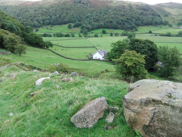
High Taggleshaw is a picturesque region located in the Westmorland district of Cumbria, England. Nestled amidst the stunning Lake District National Park, this area is renowned for its natural beauty and abundance of aquatic ecosystems. High Taggleshaw is home to a diverse range of water bodies, including lakes, pools, ponds, and freshwater marshes.

One of the prominent features of High Taggleshaw is its tranquil lake, which is surrounded by rolling hills and lush greenery. The lake's crystal-clear waters provide a haven for various species of fish, making it a popular spot for anglers and fishing enthusiasts. Its calm and serene ambiance also attracts visitors seeking relaxation and tranquility.

In addition to the lake, High Taggleshaw boasts several smaller pools and ponds scattered throughout the region. These bodies of water serve as vital habitats for a variety of aquatic plants and animals, contributing to the overall biodiversity of the area. The pools and ponds often offer a haven for migratory birds, and birdwatchers can often be seen observing the numerous species that visit these habitats throughout the year.

Notably, High Taggleshaw is also home to a freshwater marsh, which adds to the region's ecological significance. This marshland is characterized by its wet and marshy terrain, providing a unique habitat for a range of water-loving plants and creatures. The marsh serves as a breeding ground for various amphibians and supports a rich array of plant life, such as reeds and water lilies.

Overall, High Taggleshaw in Westmorland is a nature lover's paradise, offering a harmonious blend of lakes, pools, ponds, and freshwater marshes. Its stunning landscapes and diverse ecosystems make it an ideal destination for those seeking to immerse themselves in the beauty of the English countryside.

If you have any feedback on the listing, please let us know in the comments section below.

High Taggleshaw Images

Images are sourced within 2km of 54.387625/-2.7631277 or Grid Reference SD5099. Thanks to Geograph Open Source API. All images are credited.

Old Boundary Marker near Dale End Parish Boundary Marker on the west side of the road between Garnett Bridge and Sadgill, just south of Dale End. On the boundary between Longsleddale parish and Whitwell and Selside parish. Both were townships in Kendal parish until 1866.

Milestone Society National ID: WE_LONWHI01pb
Old Boundary Marker near Dale End
Parish Boundary Marker on the west side of the road between Garnett Bridge and Sadgill, just south of Dale End. On the boundary between Longsleddale parish and Whitwell and Selside parish. Both were townships in Kendal parish until 1866. Milestone Society National ID: WE_LONWHI01pb
Gate below Side House This gate indicates the route of the Thirlmere Aqueduct. The aqueduct used to be inspected by foot, so gates were provided where the route crosses walls and fences.
Gate below Side House
This gate indicates the route of the Thirlmere Aqueduct. The aqueduct used to be inspected by foot, so gates were provided where the route crosses walls and fences.
Dockernook Farm
Dockernook Farm
Farmhouse at Murthwaite Murthwaite is in Longsleddale, the valley extending into the distance.
The stone of the building is unusual for the Lake District, being apparently of a honey-coloured sandstone rather than the more common a greenish or grey slate.
Farmhouse at Murthwaite
Murthwaite is in Longsleddale, the valley extending into the distance. The stone of the building is unusual for the Lake District, being apparently of a honey-coloured sandstone rather than the more common a greenish or grey slate.
Last light on a dead tree, upper Longsleddale The late afternoon light is just catching the tree and the fells at the head of the dale casting the valley pastures into shadow. Docker Nook farm can just be seen below. It will be frosty tonight.
Last light on a dead tree, upper Longsleddale
The late afternoon light is just catching the tree and the fells at the head of the dale casting the valley pastures into shadow. Docker Nook farm can just be seen below. It will be frosty tonight.
The ruins of Tenter Howe, Longsleddale A ruined farmhouse and outbuildings in the middle dale. Whiteside Pike catches the last of the setting sun.
The ruins of Tenter Howe, Longsleddale
A ruined farmhouse and outbuildings in the middle dale. Whiteside Pike catches the last of the setting sun.
On Point 367m looking north One of several un-named summits in this area of Potter Fell above Longsleddale. On the left skyline are the dark conical peaks of Ill Bell and Froswick above Kentmere. Fresh, new snow covers the slightly higher fells around High Street.
On Point 367m looking north
One of several un-named summits in this area of Potter Fell above Longsleddale. On the left skyline are the dark conical peaks of Ill Bell and Froswick above Kentmere. Fresh, new snow covers the slightly higher fells around High Street.
Ex-tarn above Longsleddale The tarn shown on the maps within a walled enclosure is now an extensive marsh surrounded by a tumbled down wall with next to no open water. There would appear to be the remains of a dam or embankment at the western end and 'Where'the path?' seems to suggest a definite depression that was once a fairly extensive body of water. There don't appear to be any mine or quarry workings nearby so an industrial use doesn't seem likely. My guess would be a flighting pond for wildfowling but not for some considerable time judging by the state of things.
Ex-tarn above Longsleddale
The tarn shown on the maps within a walled enclosure is now an extensive marsh surrounded by a tumbled down wall with next to no open water. There would appear to be the remains of a dam or embankment at the western end and 'Where'the path?' seems to suggest a definite depression that was once a fairly extensive body of water. There don't appear to be any mine or quarry workings nearby so an industrial use doesn't seem likely. My guess would be a flighting pond for wildfowling but not for some considerable time judging by the state of things.
A dead tree in the enclosure above Longsleddale Within the ruined enclosure that seems to have once surrounded a pond, there is a scatter of trees several of them dead.
A dead tree in the enclosure above Longsleddale
Within the ruined enclosure that seems to have once surrounded a pond, there is a scatter of trees several of them dead.
Sunken track above Docker Nook, Longsleddale As the bridleway climbs the slope above the farm it splits into several strands some of which are sunken or excavated into the hillside. The track is one of those oddities that appear to go nowhere - this one ends shortly 400m up in the moorland wastes of Sleddale Forest. Obviously, it was used by horses but the purpose is not clear since there are no mine workings, quarries or pastures up there. Perhaps they were digging and carrying peat down?
Sunken track above Docker Nook, Longsleddale
As the bridleway climbs the slope above the farm it splits into several strands some of which are sunken or excavated into the hillside. The track is one of those oddities that appear to go nowhere - this one ends shortly 400m up in the moorland wastes of Sleddale Forest. Obviously, it was used by horses but the purpose is not clear since there are no mine workings, quarries or pastures up there. Perhaps they were digging and carrying peat down?
Wall gap above Docker Nook The 'bridleway to nowhere' passes through a gap in the wall. Across Longsleddale is the graceful Whiteside Pike with a glimpse of the Howgill Fells further right.
Wall gap above Docker Nook
The 'bridleway to nowhere' passes through a gap in the wall. Across Longsleddale is the graceful Whiteside Pike with a glimpse of the Howgill Fells further right.
Dale End, a collection of houses in Longsleddale
Murthwaite Knott
Murthwaite Knott
Ruined Sheepfold above Longsleddale Passed by on a path that connects the Kent Valley to Longsleddale - the valley of the River Sprint.
Ruined Sheepfold above Longsleddale
Passed by on a path that connects the Kent Valley to Longsleddale - the valley of the River Sprint.
Descending towards Nether House Farm Descending a good track towards Nether House Farm in Longsleddale
Descending towards Nether House Farm
Descending a good track towards Nether House Farm in Longsleddale
Murthwaite Knott from Nether House Farm Small hill, topped by a plantation seen across Longsleddale from Nether House Farm.
Murthwaite Knott from Nether House Farm
Small hill, topped by a plantation seen across Longsleddale from Nether House Farm.
Bridleway leading to Nether House Farm Bridleway in Longsleddale - the name given to the upper reaches of the Sprint Valley.
Bridleway leading to Nether House Farm
Bridleway in Longsleddale - the name given to the upper reaches of the Sprint Valley.
The Road to Low House Low House can just be seen in the trees to the left of centre
The Road to Low House
Low House can just be seen in the trees to the left of centre
Show me another place!

High Taggleshaw is located at Grid Ref: SD5099 (Lat: 54.387625, Lng: -2.7631277)

Administrative County: Cumbria

District: South Lakeland

Police Authority: Cumbria

What 3 Words

///unfilled.guess.priced. Near Staveley, Cumbria

Related Wikis

Strickland Roger

Strickland Roger is a civil parish in South Lakeland, Cumbria, England. In the 2001 census the parish had a population of 544, decreasing at the 2011 census...

Garnett Bridge

Garnett Bridge is a hamlet in Cumbria, England, on the River Sprint. It is located three miles by foot southeast of Long Sleddale. It consists mainly of...

River Sprint

The River Sprint is a river in Cumbria, England with its source high up on the south-facing side of Harter Fell. It flows into the River Kent just to...

Potter Fell

Potter Fell is a fell near the villages of Burneside and Staveley, Cumbria, England, reaching a maximum height of 1,400 feet (430 m) at Brunt Knott. Alfred...

Cowan Head

Cowan Head is a hamlet in Cumbria, England. It is on the River Kent upstream from Burneside. == See also == Burneside Paper Mills Tramway == References ==

Whitwell and Selside

Whitwell and Selside is a former civil parish, now part of the parish of Selside and Fawcett Forest, in the Westmorland and Furness district, in the ceremonial...

South Westmorland Rural District

South Westmorland was a rural district in Westmorland, England from 1894 to 1974. It saw various boundary changes during its existence, particularly in...
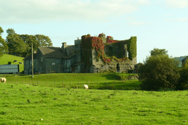
Burneside Hall

Burneside Hall is a converted medieval pele tower in Burneside, Cumbria, England. == History == Documentary records for Burneside Hall extend to 1290,...

Nearby Amenities

Located within 500m of 54.387625,-2.7631277
Ford: yes
Lat/Long: 54.3866129/-2.7684833
Tuggleshaw
Natural: peak
Source: OS 1:25k
Lat/Long: 54.3881127/-2.7592999
Potter Fell
Place: locality
Lat/Long: 54.3862263/-2.7591134
Barrier: stile
Lat/Long: 54.3857063/-2.7636885
The data included in this document is from www.openstreetmap.org. The data is made available under ODbL.

Have you been to High Taggleshaw?

Leave your review of High Taggleshaw below (or comments, questions and feedback).