Harthill Pool

Lake, Pool, Pond, Freshwater Marsh in Cheshire

England

Harthill Pool

Bolesworth Hill Farm
Bolesworth Hill Farm Credit: Peter McDermott

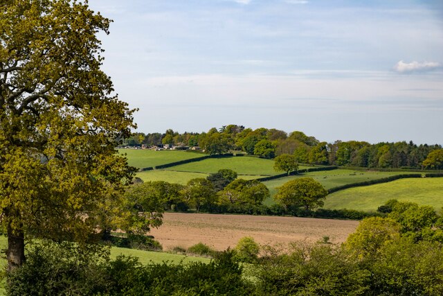
Harthill Pool, located in Cheshire, England, is a stunning freshwater lake that serves as a popular recreational spot for both locals and tourists alike. Spanning an area of approximately 15 acres, the pool is surrounded by picturesque landscapes, making it an ideal destination for nature enthusiasts.

The pool itself is a haven for various aquatic species, offering a diverse ecosystem for both flora and fauna. It is home to a wide variety of fish species, including pike, roach, and perch, attracting fishing enthusiasts throughout the year. The crystal-clear water of Harthill Pool is also a habitat for numerous waterfowl such as mallards, coots, and tufted ducks, providing a serene atmosphere for birdwatchers.

The surrounding area of the pool features lush greenery and vibrant vegetation. The banks of the lake are adorned with beautiful reeds, creating a natural boundary between the water and the land. This freshwater marsh, with its wetland plants, offers a sheltered environment for many amphibians and insects, contributing to the biodiversity of the region.

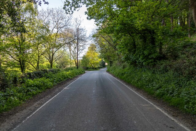
Harthill Pool provides various amenities to enhance visitors' experiences. It offers fishing platforms and pegs for anglers, ensuring a comfortable and safe fishing experience. Additionally, there are walking trails around the lake, enabling visitors to explore the scenic beauty of the area and enjoy leisurely strolls.

Overall, Harthill Pool, with its tranquil surroundings and abundant wildlife, is a remarkable destination for individuals seeking a peaceful escape in the heart of Cheshire. Whether you are an angler, a birdwatcher, or simply a nature lover, this freshwater lake offers a delightful experience for all.

If you have any feedback on the listing, please let us know in the comments section below.

Harthill Pool Images

Images are sourced within 2km of 53.091909/-2.7548734 or Grid Reference SJ4955. Thanks to Geograph Open Source API. All images are credited.

Bolesworth Hill Farm
Fingerpost, A534 Junction with Harthill Lane. One missing finger, with "CCC" shield but no manufacturer's marking.


Milestone Society National ID: CH_SJ5053B
Fingerpost, A534
Junction with Harthill Lane. One missing finger, with "CCC" shield but no manufacturer's marking. Milestone Society National ID: CH_SJ5053B
Bolesworth Road Bolesworth Road near Oakbank Farm.
Bolesworth Road
Bolesworth Road near Oakbank Farm.
All Saints' Church All Saints' Church at Harthill.
All Saints' Church
All Saints' Church at Harthill.
Harthill Horses at pond near Harthill.
Harthill
Horses at pond near Harthill.
Sandhollow Farm Road near Sandhollow Farm.
Sandhollow Farm
Road near Sandhollow Farm.
Hill View
Hill View
All Saints' Church (disused), Harthill, Cheshire A chapel on this site is first mentioned in 1280. It is likely that this earlier church was timber-framed. The present church was built in 1609. Restoration was carried out in 1862–63.

<span class="nowrap"><a title="https://en.wikipedia.org/wiki/All_Saints_Church,_Harthill" rel="nofollow ugc noopener" href="https://en.wikipedia.org/wiki/All_Saints_Church,_Harthill">Link</a><img style="margin-left:2px;" alt="External link" title="External link - shift click to open in new window" src="https://s1.geograph.org.uk/img/external.png" width="10" height="10"/></span>
All Saints' Church (disused), Harthill, Cheshire
A chapel on this site is first mentioned in 1280. It is likely that this earlier church was timber-framed. The present church was built in 1609. Restoration was carried out in 1862–63. LinkExternal link
Old Inscription, Rondvll Pricket Church Warden 1606-1611, All Saints' Church RONDVLL PRICKET
CHVRCH WARDEN:EVERSINCE 1606
VNTILL 1611

Above the church door at All Saints' Church
Old Inscription, Rondvll Pricket Church Warden 1606-1611, All Saints' Church
RONDVLL PRICKET CHVRCH WARDEN:EVERSINCE 1606 VNTILL 1611 Above the church door at All Saints' Church
Trig Point on Raw Head The trig point on the highest part of Bickerton Hill, Raw Head.

Wikipedia Bickerton Hill <span class="nowrap"><a title="https://en.wikipedia.org/wiki/Bickerton_Hill" rel="nofollow ugc noopener" href="https://en.wikipedia.org/wiki/Bickerton_Hill">Link</a><img style="margin-left:2px;" alt="External link" title="External link - shift click to open in new window" src="https://s1.geograph.org.uk/img/external.png" width="10" height="10"/></span>
Trig Point on Raw Head
The trig point on the highest part of Bickerton Hill, Raw Head. Wikipedia Bickerton Hill LinkExternal link
View from Bickerton Hill on a Murky Day Looking west from the Sandstone Trail near Raw Head on Bickerton Hill on a murky winter's day.

Wikipedia Bickerton Hill <span class="nowrap"><a title="https://en.wikipedia.org/wiki/Bickerton_Hill" rel="nofollow ugc noopener" href="https://en.wikipedia.org/wiki/Bickerton_Hill">Link</a><img style="margin-left:2px;" alt="External link" title="External link - shift click to open in new window" src="https://s1.geograph.org.uk/img/external.png" width="10" height="10"/></span>
View from Bickerton Hill on a Murky Day
Looking west from the Sandstone Trail near Raw Head on Bickerton Hill on a murky winter's day. Wikipedia Bickerton Hill LinkExternal link
View off Maiden Castle towards Brown Knowl
View down to Brown Knowl from the Sandstone Trail To the right of centre, the tower of Brown Knowl Methodist Church.
View down to Brown Knowl from the Sandstone Trail
To the right of centre, the tower of Brown Knowl Methodist Church.
Bolesworth International Horse Show 2016: car park
Bolesworth International Horse Show 2016: bus bar
Bolesworth International Horse Show 2016: international arena
Bolesworth International Horse Show 2016: car park Bolesworth Castle is in the background.
Bolesworth International Horse Show 2016: car park
Bolesworth Castle is in the background.
Show me another place!

Harthill Pool is located at Grid Ref: SJ4955 (Lat: 53.091909, Lng: -2.7548734)

Unitary Authority: Cheshire West and Chester

Police Authority: Cheshire

What 3 Words

///estimates.potential.acclaim. Near Harthill, Cheshire

Related Wikis

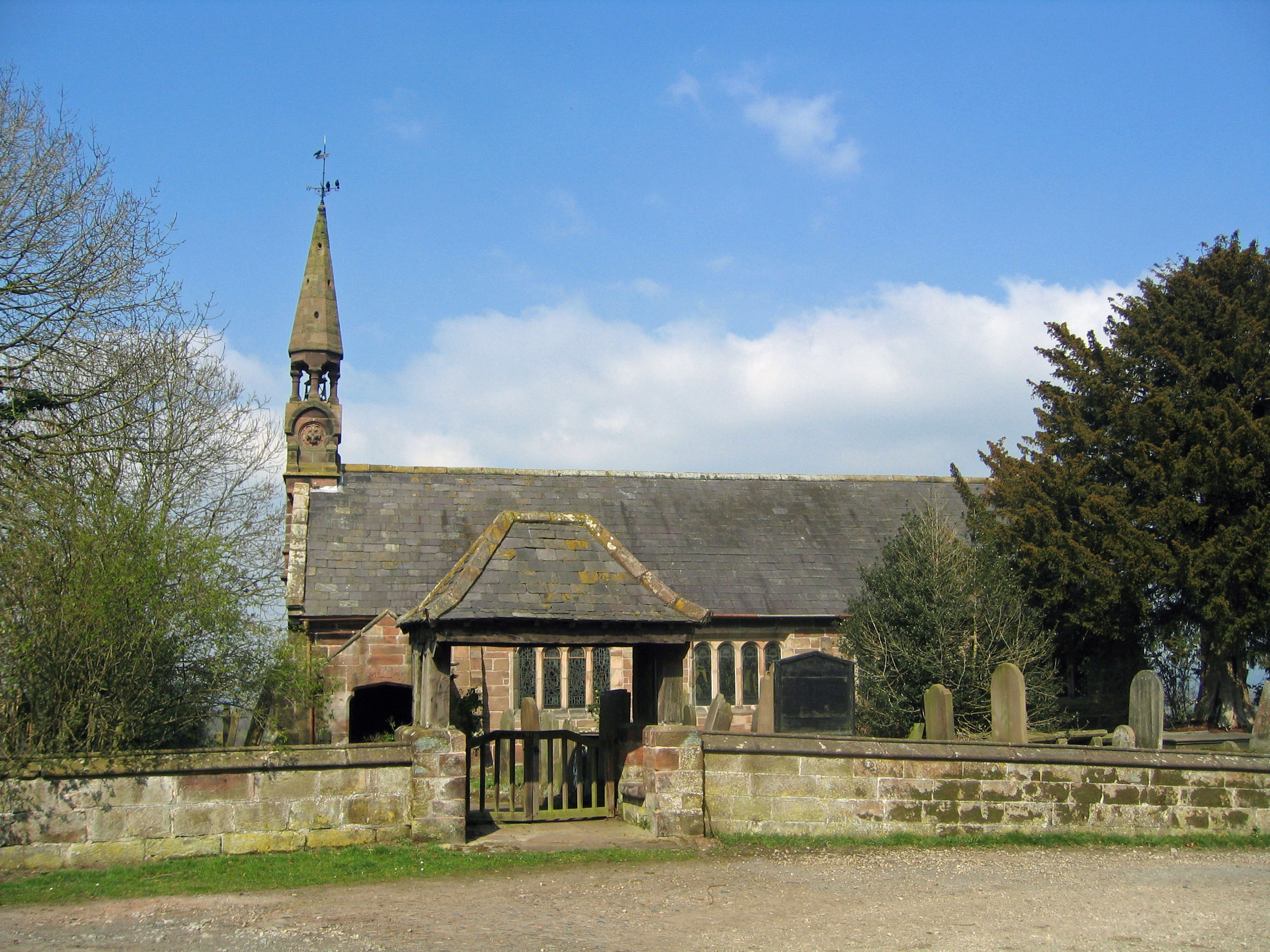
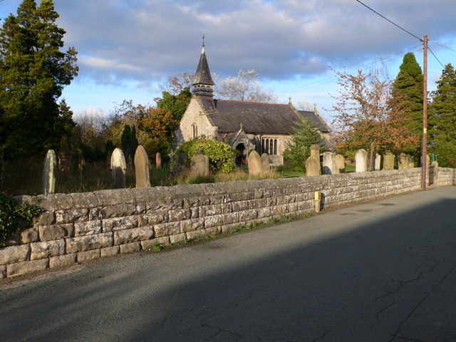
All Saints Church, Harthill

All Saints Church is a redundant Anglican church in the village of Harthill, Cheshire, England. It is recorded in the National Heritage List for England...

Harthill, Cheshire

Harthill is a village and civil parish in the unitary authority of Cheshire West and Chester and the ceremonial county of Cheshire, England. All Saints...

Bickerton, Cheshire

Bickerton is a village and civil parish in the unitary authority of Cheshire East and the ceremonial county of Cheshire, England, about 8 miles (13 km...

Brown Knowl Methodist Church

Brown Knowl Methodist Church is in Sherrington's Lane in the settlement of Brown Knowl in the civil parish of Broxton, Cheshire, England. The church,...

Burwardsley

Burwardsley is a village and civil parish the unitary authority of Cheshire West and Chester and the ceremonial county of Cheshire, England. The parish...

Broxton railway station

Broxton railway station was a railway station near the village of Broxton, Cheshire on the Whitchurch and Tattenhall Railway. == History == Broxton opened...

Broxton, Cheshire

Broxton is a village and civil parish in the unitary authority of Cheshire West and Chester and the ceremonial county of Cheshire, England. The village...

Whitchurch and Tattenhall Railway

The Whitchurch and Tattenhall Railway was a line in Cheshire built by the London and North Western Railway in the 19th century. The branch, which was 14...

Nearby Amenities

Located within 500m of 53.091909,-2.7548734
Harthill Fiisheries
Leisure: fishing
Lat/Long: 53.0917218/-2.7551071
Barrier: stile
Foot: yes
Source: GPS survey
Lat/Long: 53.0899136/-2.749844
Barrier: stile
Foot: yes
Source: GPS survey
Lat/Long: 53.0905563/-2.7490375
Barrier: stile
Foot: yes
Source: GPS survey
Lat/Long: 53.0915231/-2.7481212
The data included in this document is from www.openstreetmap.org. The data is made available under ODbL.

Have you been to Harthill Pool?

Leave your review of Harthill Pool below (or comments, questions and feedback).