Haweswater Reservoir

Lake, Pool, Pond, Freshwater Marsh in Westmorland Eden

England

Haweswater Reservoir

Old quarry building A useful lunch spot
Old quarry building Credit: David Brown

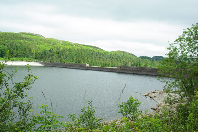
Haweswater Reservoir is a man-made freshwater reservoir located in the county of Westmorland in the North West of England. Situated in the Lake District National Park, it covers an area of approximately 2.9 square kilometers and lies at an elevation of 154 meters above sea level.

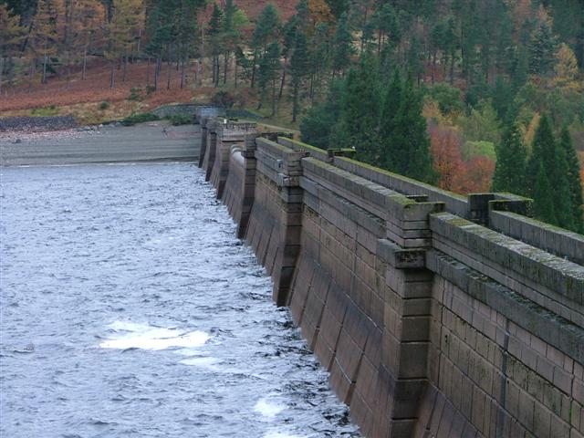
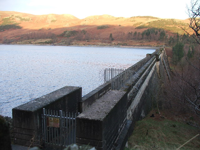
The reservoir was constructed in the early 1930s by the Manchester Corporation to supply water to the growing population of Manchester and surrounding areas. The construction involved flooding the valley of Mardale and submerging the village of Mardale Green, which now lies beneath the reservoir's waters.

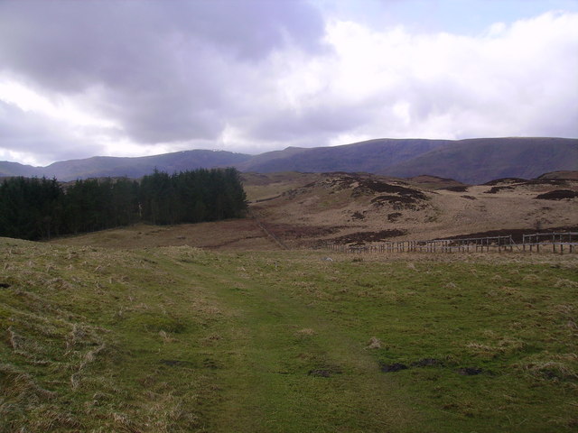
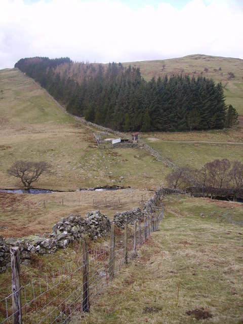
Haweswater Reservoir is fed by the River Lowther, which flows into the reservoir from the east. It is surrounded by picturesque rolling hills and mountains, including Harter Fell and High Street. The surrounding area offers stunning views and is a popular destination for hikers, nature enthusiasts, and photographers.

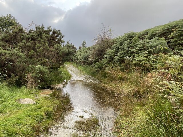
The reservoir is a haven for wildlife, with several species of birds, including golden eagles and peregrine falcons, being spotted in the area. It is also home to a variety of fish, including brown trout and Arctic char. The surrounding vegetation includes grasslands, heather moorlands, and woodlands, providing habitats for a diverse range of flora and fauna.

Haweswater Reservoir not only serves as a source of drinking water but also provides recreational opportunities such as fishing, boating, and walking. It is managed by United Utilities and plays a vital role in both the natural and human landscape of the Lake District.

If you have any feedback on the listing, please let us know in the comments section below.

Haweswater Reservoir Images

Images are sourced within 2km of 54.526122/-2.7959008 or Grid Reference NY4814. Thanks to Geograph Open Source API. All images are credited.

Old quarry building A useful lunch spot
Old quarry building
A useful lunch spot
Haweswater Dam Wall
Haweswater Dam Wall
Burnbanks Ford This ford is found on the track on the north bank of Haweswater Reservoir.
Burnbanks Ford
This ford is found on the track on the north bank of Haweswater Reservoir.
Haweswater Dam Built by Manchester Corporation between 1929 and 1941. It raised the surface of Haweswater by 96 feet increasing its capacity to 18,660 million gallons. The dam is of hollow concrete buttress construction which was quite innovative in its day. The method was cheaper and lower maintenance. Any movement of the dam is monitored inside by a giant plumb bob which has only deflected one twentieth of an inch since the dam's construction.
Haweswater Dam
Built by Manchester Corporation between 1929 and 1941. It raised the surface of Haweswater by 96 feet increasing its capacity to 18,660 million gallons. The dam is of hollow concrete buttress construction which was quite innovative in its day. The method was cheaper and lower maintenance. Any movement of the dam is monitored inside by a giant plumb bob which has only deflected one twentieth of an inch since the dam's construction.
Haweswater Dam.
Haweswater Dam.
Haweswater Dam Looking along the first two kilometres of Haweswater.
Haweswater Dam
Looking along the first two kilometres of Haweswater.
Haweswater Dam (2) About one kilometre to the dam from here.
Haweswater Dam (2)
About one kilometre to the dam from here.
Haweswater Dam (3) Completed in 1935 Haweswater Dam was considered to be an engineering feat in its time.  It measures 470 m long and 27.5 m high, and is built from 44 separate buttressed units, joined together with flexible joints.  There is also a 56 inch walkway along the top of the dam.  At its maximum capacity the Haweswater reservoir can hold 18.6 billion gallons of water.
Haweswater Dam (3)
Completed in 1935 Haweswater Dam was considered to be an engineering feat in its time. It measures 470 m long and 27.5 m high, and is built from 44 separate buttressed units, joined together with flexible joints. There is also a 56 inch walkway along the top of the dam. At its maximum capacity the Haweswater reservoir can hold 18.6 billion gallons of water.
Haweswater Dam (4) Completed in 1935 Haweswater Dam was considered to be an engineering feat in its time.  It measures 470 m long and 27.5 m high, and is built from 44 separate buttressed units, joined together with flexible joints.  There is also a 56 inch walkway along the top of the dam.  At its maximum capacity the Haweswater reservoir can hold 18.6 billion gallons of water.
Haweswater Dam (4)
Completed in 1935 Haweswater Dam was considered to be an engineering feat in its time. It measures 470 m long and 27.5 m high, and is built from 44 separate buttressed units, joined together with flexible joints. There is also a 56 inch walkway along the top of the dam. At its maximum capacity the Haweswater reservoir can hold 18.6 billion gallons of water.
Chimney In the woods between High and Low Goat Gills
Chimney
In the woods between High and Low Goat Gills
Haweswater From the approach to Hugh's Laithes Pike. Dam in shot
Haweswater
From the approach to Hugh's Laithes Pike. Dam in shot
Cairn, Hugh's Laithes Pike Unless you are prepared to climb the six foot high deer fence you cannot indulge your obsession fully and make contact with the cairn
Cairn, Hugh's Laithes Pike
Unless you are prepared to climb the six foot high deer fence you cannot indulge your obsession fully and make contact with the cairn
Naddle Low Forest At 426m.Looking towards Hugh's Laithes Pike
Naddle Low Forest
At 426m.Looking towards Hugh's Laithes Pike
Plantation, Naddle Forest High Street and Kidsty Pike on the skyline
Plantation, Naddle Forest
High Street and Kidsty Pike on the skyline
Naddle Beck High up the beck between Harper Hills and Highfield Crag
Naddle Beck
High up the beck between Harper Hills and Highfield Crag
Sheep Pens, Naddle Beck On the return to Harper Hills
Sheep Pens, Naddle Beck
On the return to Harper Hills
Naddle Forest Looking up the upper valley formed by Naddle Beck. Snow shower on High Street
Naddle Forest
Looking up the upper valley formed by Naddle Beck. Snow shower on High Street
Dam and Inflow, Haweswater
Show me another place!

Haweswater Reservoir is located at Grid Ref: NY4814 (Lat: 54.526122, Lng: -2.7959008)

Administrative County: Cumbria

District: Eden

Police Authority: Cumbria

What 3 Words

///safely.unstated.plus. Near Shap, Cumbria

Related Wikis

Haweswater Reservoir

Haweswater is a reservoir in the valley of Mardale, Cumbria in the Lake District, England. Work to raise the height of the original natural lake was started...

Mardale

Mardale is a glacial valley in the Lake District, in northern England. The valley used to have a hamlet at its head, called Mardale Green, but this village...

Naddle Horseshoe

The Naddle Horseshoe is a group of summits in the English Lake District, south of Mardale valley, Cumbria. It is the subject of a chapter of Wainwright...

Wether Hill (Lake District)

Wether Hill is a fell in the English Lake District, between Martindale and Haweswater. It lies on the main north-south ridge of the Far Eastern Fells between...

Nearby Amenities

Located within 500m of 54.526122,-2.7959008
Man Made: water_well
Lat/Long: 54.5297774/-2.7977298
The data included in this document is from www.openstreetmap.org. The data is made available under ODbL.

Have you been to Haweswater Reservoir?

Leave your review of Haweswater Reservoir below (or comments, questions and feedback).