The Gullet

Lake, Pool, Pond, Freshwater Marsh in Roxburghshire

Scotland

The Gullet

Forestry road near Newcastleton
Forestry road near Newcastleton Credit: Steven Brown

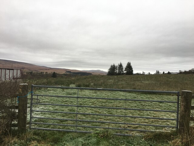
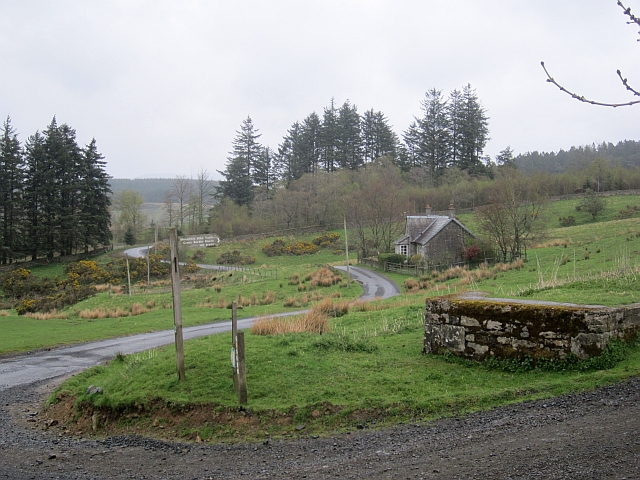
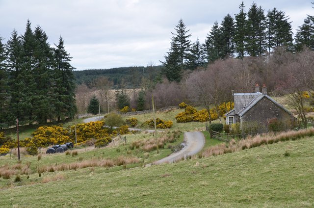
The Gullet is a picturesque freshwater marsh located in Roxburghshire, Scotland. Nestled amidst the scenic landscape, it is renowned for its tranquil ambiance and stunning natural beauty. The Gullet is a small but significant body of water, often referred to as a lake, pool, or pond due to its size and characteristics.

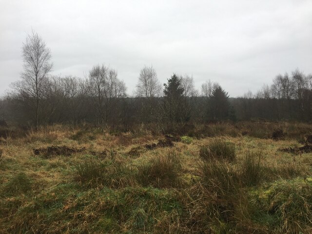
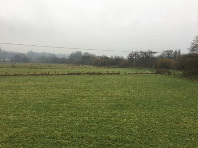
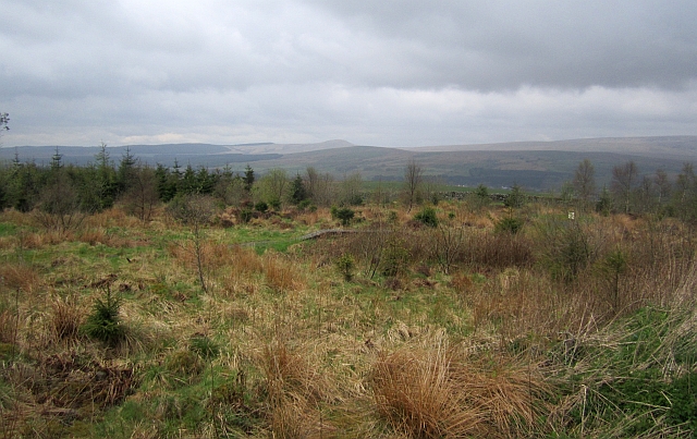
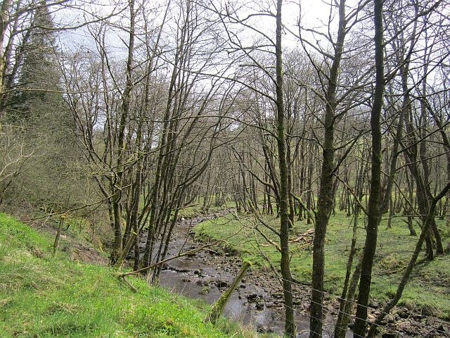
Covering an area of approximately 10 acres, The Gullet is surrounded by lush greenery and vibrant flora, creating a haven for numerous species of wildlife. The marsh is home to a diverse range of plants, including water lilies, reeds, and rushes, which provide a vibrant burst of color throughout the year. This rich vegetation also serves as a sanctuary for a variety of birds, insects, and small mammals.

The water in The Gullet is crystal clear and teems with life. It supports various fish species, such as trout and perch, making it a popular spot for anglers. The calm and serene atmosphere of the marsh also attracts birdwatchers and nature enthusiasts who come to observe the numerous bird species that inhabit the area, including herons, swans, and ducks.

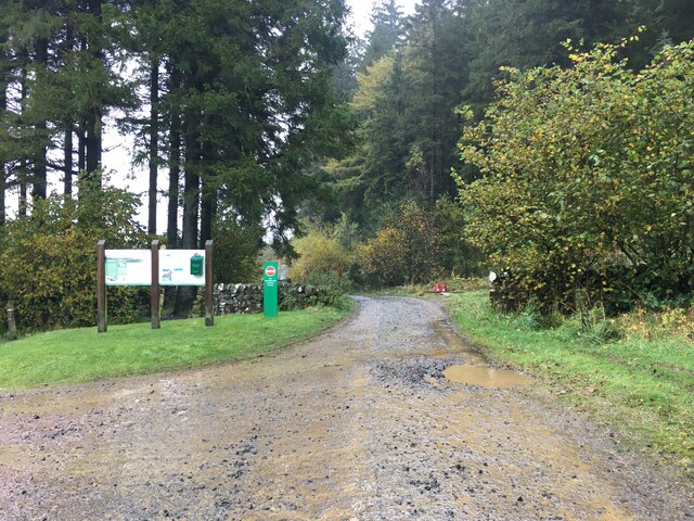
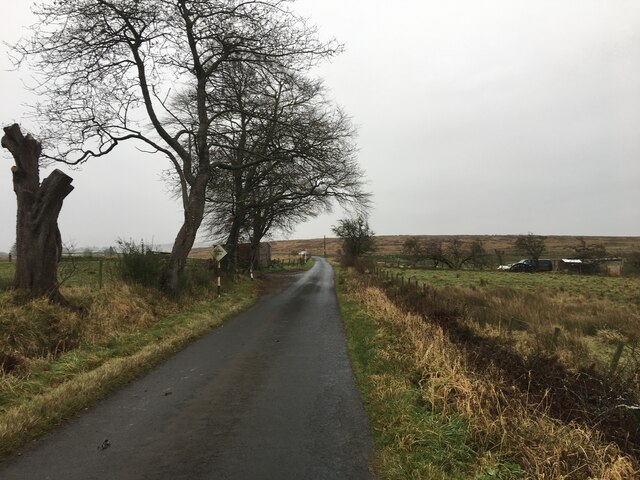
The Gullet is easily accessible to the public, with well-maintained walking paths and observation points around its perimeter. Visitors can enjoy leisurely walks, relax on benches while taking in the stunning views, or indulge in photography to capture the natural beauty of the marsh.

In conclusion, The Gullet in Roxburghshire is a small yet captivating freshwater marsh, offering a tranquil retreat for nature lovers. Its abundant wildlife, scenic surroundings, and recreational opportunities make it a must-visit destination for those seeking a peaceful and immersive experience in the heart of Scotland's natural splendor.

If you have any feedback on the listing, please let us know in the comments section below.

The Gullet Images

Images are sourced within 2km of 55.177999/-2.8105861 or Grid Reference NY4887. Thanks to Geograph Open Source API. All images are credited.

Forestry road near Newcastleton
Newcastleton Forest
Newcastleton Forest
A poignant gravestone at Ettleton Cemetery The main inscription reads:

SACRED
TO THE
MEMORY
OF
JANET SCOTT
DAUGHTER OF
HELEN SCOTT
WHO DIED AT
NEWCASTLETON
14TH MARCH
1863
AGED 2 YEARS
AND 
8 MONTHS.

The inscription above with a hand holding open the Holy Bible reads:

Suffer little
Children,
and forbid
them not,
to come
unto me;
for of 
such 
is the
kingdom 
of Heaven.
A poignant gravestone at Ettleton Cemetery
The main inscription reads: SACRED TO THE MEMORY OF JANET SCOTT DAUGHTER OF HELEN SCOTT WHO DIED AT NEWCASTLETON 14TH MARCH 1863 AGED 2 YEARS AND 8 MONTHS. The inscription above with a hand holding open the Holy Bible reads: Suffer little Children, and forbid them not, to come unto me; for of such is the kingdom of Heaven.
B6357 approaching Newcastleton
Gated field near Newcastleton
Fields beside the Liddel Water
Minor road near Newcastleton
Might need it! Winter arrives in the Borders - and some good advice is to hand.
Might need it!
Winter arrives in the Borders - and some good advice is to hand.
Road junction, Dykecrofts The usual way into Newcastleton Forest with the road into the picture being used for some of the walking routes at the Priest Hill car park. The mountain bike trails and other waymarked walking routes climb a gentle hill to the right.
Road junction, Dykecrofts
The usual way into Newcastleton Forest with the road into the picture being used for some of the walking routes at the Priest Hill car park. The mountain bike trails and other waymarked walking routes climb a gentle hill to the right.
Skills area, Newcastleton Forest A selection of problems that may turn up on a trail centre route.
Skills area, Newcastleton Forest
A selection of problems that may turn up on a trail centre route.
Tweeden Burn At the foot of Hillhouse Wood, Newcastleton Forest.
Tweeden Burn
At the foot of Hillhouse Wood, Newcastleton Forest.
Logs leaving Newcastleton Forest Timber lorry passing the car park at Dykecrofts.
Logs leaving Newcastleton Forest
Timber lorry passing the car park at Dykecrofts.
Edge of Hillhouse Wood A line of beeches where there was once a boundary between the long established Hillhouse Wood and open country. Since c.1950, Newcastleton Forest has been planted on the open hillside and the boundary fell out of use. 

The path is the 7stanes red route at Newcastleton.
Edge of Hillhouse Wood
A line of beeches where there was once a boundary between the long established Hillhouse Wood and open country. Since c.1950, Newcastleton Forest has been planted on the open hillside and the boundary fell out of use. The path is the 7stanes red route at Newcastleton.
Hillhouse Wood Hillhouse Wood is one of the small woodlands that existed long before the moorland and rough grazing above Newcastleton was planted by the Forestry Commission in the post war years.
Hillhouse Wood
Hillhouse Wood is one of the small woodlands that existed long before the moorland and rough grazing above Newcastleton was planted by the Forestry Commission in the post war years.
Hills behind Newcastleton Looking over Newcastleton to the hills behind, from above Dykecrofts, formerly the Trail Head for the Seven Stanes.
Hills behind Newcastleton
Looking over Newcastleton to the hills behind, from above Dykecrofts, formerly the Trail Head for the Seven Stanes.
Dykecrofts One of the cottages at Dykecrofts.
Dykecrofts
One of the cottages at Dykecrofts.
Road to Priesthill car park Looking from the track up to Newcastleton Forest.
Road to Priesthill car park
Looking from the track up to Newcastleton Forest.
Entrance to Newcastleton Forest The forest road above Dykecrofts Cottage with the Cross-Border Trail heading off to the right (white post waymark).
Entrance to Newcastleton Forest
The forest road above Dykecrofts Cottage with the Cross-Border Trail heading off to the right (white post waymark).
Show me another place!

The Gullet is located at Grid Ref: NY4887 (Lat: 55.177999, Lng: -2.8105861)

Unitary Authority: The Scottish Borders

Police Authority: The Lothians and Scottish Borders

What 3 Words

///inherits.misfits.curl. Near Langholm, Dumfries & Galloway

Related Wikis

Castleton, Scottish Borders

Castleton (Scottish Gaelic: Baile Chaisteil) is a civil parish in the Scottish Borders area of Scotland, in the former Roxburghshire, in the extreme south...

Newcastleton railway station

Newcastleton railway station served the village of Newcastleton, Scottish Borders, Scotland from 1862 to 1969 on the Border Union Railway. == History... ==

Newcastleton

Newcastleton, also called Copshaw Holm, is a village in Liddesdale, the Scottish Borders, a few miles from the border with England, on the Liddel Water...

Ettleton

Ettleton is a village near Castleton, in the Scottish Borders area of Scotland, in the former Roxburghshire. == Etymology and history == Ettleton Parish...

Related Videos

Fish with Feet? #shorts #shortvideo #Newcastleton #walking #walkandtalk #countryside #riverside

You sometimes see really strange things when you're out walking, but fish with feet? This #shorts #short clip is from our recent ...

A Short Walk Around Newcastleton - Raltonside & Blackburn

Refreshing walk #3 is a 4 to 5 mile (depends on your navigation) short walk around Newcatleton in the Scottish Borders. The walk ...

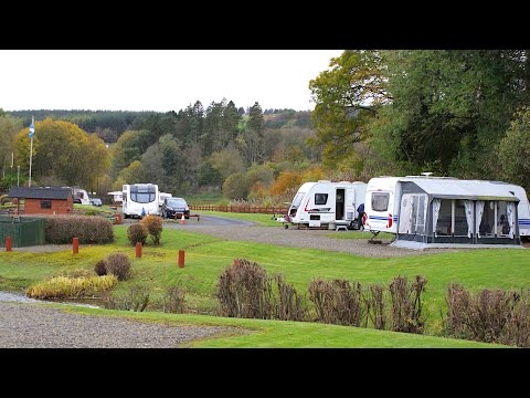
Lidalia Caravan Park

Nestled in a beautifully landscaped setting and within walking distance of the quaint village of Newcastleton, a Scottish Borders ...

A short walk from Newcastleton - Mangerton Tower Walk

This Refreshing walk is a 4.5 mile short walk from Newcatleton in the Scottish Borders taking in the ruins of Mangerton Tower.

Nearby Amenities

Located within 500m of 55.177999,-2.8105861
Newcastleton
Alt Name: Copshaw Holm
Name En: Newcastleton
Name Gd: Baile a' Chaisteil Nuadh
Name Sco: Cowpshawholme
Place: village
Population: 768
Wikidata: Q1011720
Wikipedia: en:Newcastleton
Lat/Long: 55.1796383/-2.8127011
Bus Stop
Douglas Square
Bus: yes
Naptan AtcoCode: 69001059
Naptan Bearing: S
Naptan CommonName: Douglas Square
Naptan Indicator: opp
Naptan Landmark: Bus Shelter
Naptan NaptanCode: 72725858
Naptan Street: Douglas Square
Operator: Scottish Borders Council
Public Transport: platform
Ref: 69001059
Source: NaPTAN
Lat/Long: 55.1796651/-2.8127294
Bus Stop
Douglas Square
Bus: yes
Naptan AtcoCode: 6900663
Naptan Bearing: N
Naptan CommonName: Douglas Square
Naptan Indicator: at
Naptan Landmark: Bus Shelter
Naptan NaptanCode: 72723232
Naptan Street: Douglas Square
Operator: Scottish Borders Council
Public Transport: platform
Ref: 6900663
Shelter: yes
Source: NaPTAN
Lat/Long: 55.1796807/-2.8129965
Newcastleton
Historic Railway: station
Railway: site
Source: npe
Wikidata: Q30587998
Wikipedia: en:Newcastleton railway station
Lat/Long: 55.1808198/-2.8158847
Fuel
Border Auto Services
Lat/Long: 55.1806143/-2.8121757
T. Elliot & Sons
Addr Housenumber: 46
Addr Postcode: TD9 0RA
Addr Street: North Hermitage Street
Fhrs Id: 56050
Shop: butcher
Lat/Long: 55.1803723/-2.8124117
Border Autoservices
Addr Housenumber: 44
Addr Postcode: TD9 0RA
Addr Street: North Hermitage Street
Shop: car_repair
Lat/Long: 55.180648/-2.812299
Holm Hardware
Addr Housenumber: 1
Addr Postcode: TD9 0QR
Addr Street: South Hermitage Street
Shop: doityourself
Lat/Long: 55.1791655/-2.8131305
Bank
Bank of Scotland
Addr Country: GB
Addr Postcode: TD9 0QD
Addr Street: Douglas Square
Brand: Bank of Scotland
Brand Wikidata: Q627381
Brand Wikipedia: en:Bank of Scotland
Contact Website: https://branches.bankofscotland.co.uk/newcastleton/douglas-square
Lat/Long: 55.1792719/-2.813455
Cafe
The Olive Tree
Addr Housenumber: 38-39
Addr Postcode: TD9 0QE
Addr Street: South Hermitage Street
Fhrs Id: 9647
Opening Hours: Mo-Fr 07:30-16:00; Su 10:00-16:00; Sa 08:00-16:00
Source Addr: FHRS Open Data
Lat/Long: 55.1781179/-2.8144765
Cafe
Copshaw Kitchen
Addr Housenumber: 4
Addr Postcode: TD9 0RB
Addr Street: North Hermitage Street
Fhrs Id: 633054
Source Addr: FHRS Open Data
Lat/Long: 55.1803601/-2.812018
Lumsden's Newsagents
Addr Housenumber: 3
Addr Postcode: TD9 0QR
Addr Street: South Hermitage Street
Shop: newsagent
Lat/Long: 55.1789143/-2.8133558
Recycling
Lat/Long: 55.1795821/-2.8131345
Post Box
Brand: Royal Mail
Brand Wikidata: Q638098
Mapillary: 287548163266587
Operator: Royal Mail
Operator Wikidata: Q638098
Post Box Mounting: pier
Post Box Type: lamp
Survey Date: 2021-11-11
Lat/Long: 55.1794779/-2.8139245
Post Box
Post Box Mounting: wall
Post Box Type: lamp
Ref: TD9 61
Royal Cypher: scottish_crown
Source: survey
Lat/Long: 55.1774397/-2.8148194
Post Box
Ref: TD9 40
Source: survey
Lat/Long: 55.1817966/-2.8108088
Telephone
Booth: KX100
Covered: booth
Source: survey
Lat/Long: 55.1796805/-2.8130447
Material: wood
Power: pole
Lat/Long: 55.1814383/-2.8075848
Power: pole
Lat/Long: 55.1739472/-2.8139618
Power: pole
Lat/Long: 55.1740391/-2.8133972
Power: pole
Lat/Long: 55.1751802/-2.8157294
Power: pole
Lat/Long: 55.1750071/-2.8144607
Power: pole
Lat/Long: 55.1747728/-2.8130204
Power: pole
Lat/Long: 55.1741248/-2.8127213
Power: pole
Lat/Long: 55.1746533/-2.8122948
Power: pole
Lat/Long: 55.1758159/-2.8113641
Power: pole
Lat/Long: 55.1764347/-2.8108437
Power: pole
Lat/Long: 55.1771592/-2.8102778
Power: pole
Lat/Long: 55.1781486/-2.8096555
Power: pole
Lat/Long: 55.1795117/-2.8090681
Power: pole
Lat/Long: 55.1803081/-2.8084351
Power: pole
Lat/Long: 55.1807262/-2.8081079
Power: pole
Lat/Long: 55.1787222/-2.8092921
Power: pole
Lat/Long: 55.1787023/-2.8088737
Power: pole
Lat/Long: 55.1785629/-2.8075379
Power: pole
Lat/Long: 55.1783745/-2.8062424
Power: pole
Lat/Long: 55.1782367/-2.8048369
War Memorial Liddesdale
Historic: memorial
Lat/Long: 55.1795527/-2.8126143
Entrance: yes
Lat/Long: 55.1791938/-2.813457
Entrance: yes
Lat/Long: 55.1792942/-2.8133855
Costcutter
Brand: Costcutter
Brand Wikidata: Q5175072
Brand Wikipedia: en:Costcutter
Contact Website: https://store-locator.costcutter.co.uk/costcutter-78501fd9c904
Shop: convenience
Lat/Long: 55.1797262/-2.8120324
Historic: monument
Lat/Long: 55.179767/-2.8133274
Post Office
Newcastleton Post Office
Addr Postcode: TD9 0RB
Brand: Post Office
Brand Wikidata: Q1783168
Operator: Spar
Ref Pol Id: 131100
Lat/Long: 55.1802909/-2.8120907
Spar
Brand: Spar
Brand Wikidata: Q610492
Brand Wikipedia: en:SPAR (retailer)
Shop: convenience
Website: https://www.spar.co.uk/store-locator/lan19080-spar-newcastleton/
Lat/Long: 55.1802649/-2.8121229
Information: guidepost
Tourism: information
Lat/Long: 55.1816932/-2.8073374
Police
Lat/Long: 55.1795488/-2.8146234
Pub
The Trap
Addr City: Newcastleton
Addr Housenumber: 6
Addr Postcode: TD9 0QR
Addr Street: South Hermitage Street
Lat/Long: 55.1785816/-2.8136832
Community Centre
Buccleuch Centre
Website: https://www.visitnewcastleton.com
Lat/Long: 55.1788298/-2.813443
Dalkeith House
Addr City: Newcastleton
Addr Housenumber: 13
Addr Postcode: TD9 0QD
Addr Street: Douglas Square
Guest House: self_catering
Tourism: guest_house
Website: https://www.dalkeith-house.com
Lat/Long: 55.1795944/-2.8137239
Dinmont Cottage
Addr City: Newcastleton
Addr Street: North Hermitage Street
Guest House: house
Tourism: guest_house
Website: http://dinmontcottageholidaylet.co.uk/
Lat/Long: 55.181741/-2.8107908
Clinic
Newcastleton Health Centre
Addr City: Newcastleton
Addr Postcode: TD9 0RU
Addr Street: Moss Road
Healthcare: clinic
Website: https://www.newcastletonhc.co.uk
Lat/Long: 55.1815536/-2.812347
Power: pole
Lat/Long: 55.1804371/-2.8171444
Man Made: tower
Lat/Long: 55.1794217/-2.8149205
Defibrillator
Access: yes
Defibrillator Location: outside Newcastleton Community Fire Station
Emergency: defibrillator
Indoor: no
Lat/Long: 55.179546/-2.8145847
The data included in this document is from www.openstreetmap.org. The data is made available under ODbL.

Have you been to The Gullet?

Leave your review of The Gullet below (or comments, questions and feedback).