Burrington Pool

Lake, Pool, Pond, Freshwater Marsh in Herefordshire

England

Burrington Pool

Track heading to Burrington
Track heading to Burrington Credit: N Chadwick

Burrington Pool is a picturesque freshwater lake located in Herefordshire, England. Nestled amidst the rolling countryside, it covers an area of approximately 5 acres. The pool, also known as a pond or lake, is a popular destination for nature enthusiasts, birdwatchers, and those seeking a tranquil escape.

Surrounded by lush vegetation and bordered by reed beds, Burrington Pool provides a diverse habitat for various flora and fauna. It is home to a wide range of waterfowl, including ducks, geese, and swans, which can be observed gracefully gliding across its calm waters. The lake's reed beds provide a vital breeding ground for many bird species, such as reed warblers and herons.

The pool itself is fed by natural springs, ensuring a constant flow of freshwater. This creates an ideal environment for aquatic plants to thrive, offering a vibrant display of colors throughout the year. The clear waters of Burrington Pool also support a healthy population of fish, making it a popular spot for anglers.

Visitors to Burrington Pool can enjoy the serenity of the surroundings by taking leisurely walks along its banks or simply sitting on one of the benches dotted around the area. The tranquil atmosphere is further enhanced by the gentle rustling of reeds and the melodious songs of the birds that call this place home.

Overall, Burrington Pool offers a delightful escape into nature, providing a haven for wildlife and a peaceful retreat for those seeking solace in the beauty of the Herefordshire countryside.

If you have any feedback on the listing, please let us know in the comments section below.

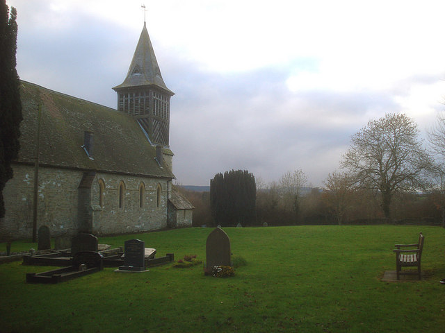
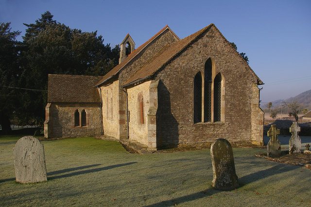
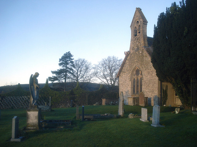
Burrington Pool Images

Images are sourced within 2km of 52.343589/-2.8143685 or Grid Reference SO4472. Thanks to Geograph Open Source API. All images are credited.

Track heading to Burrington
Coppiced tree and fence
Track heading downhill towards Burrington
Coppiced trees on the edge of Bringewood Forest An ancient hunting forest on the Ludlow Anticlyne. Traditionally an oak forest, coppiced for charcoal it is now a commercial conifer wood. It is managed, but not entirely owned by the Forestry Commission.
The charcoal used to supply the iron smelters at Bringewood Forge.
Since the late 1970s the forest has been opened up to recreational use and is now quite busy, with a dense path network. 
The forest carries a large herd of fallow deer including the long haired variety supposedly unique to Haye Park.
Coppiced trees on the edge of Bringewood Forest
An ancient hunting forest on the Ludlow Anticlyne. Traditionally an oak forest, coppiced for charcoal it is now a commercial conifer wood. It is managed, but not entirely owned by the Forestry Commission. The charcoal used to supply the iron smelters at Bringewood Forge. Since the late 1970s the forest has been opened up to recreational use and is now quite busy, with a dense path network. The forest carries a large herd of fallow deer including the long haired variety supposedly unique to Haye Park.
Coppiced fencing near Monstay
Track footpath junction near Monstay The path goes down to Monstay Farm.
Track footpath junction near Monstay
The path goes down to Monstay Farm.
The edge of Bringewood (Mortimer) Forest The Mortimer Forest is the name given to the remnant of a Saxon Hunting forest on the Shropshire / Herefordshire border near Ludlow (Bringewood Forest). It is owned and managed by the Forestry Commission, who invented the name. The forest has car parks, information boards and trails.  The underlying rocks are Upper Silurian and the forest is the type site for these rocks (the Ludlovian).
The edge of Bringewood (Mortimer) Forest
The Mortimer Forest is the name given to the remnant of a Saxon Hunting forest on the Shropshire / Herefordshire border near Ludlow (Bringewood Forest). It is owned and managed by the Forestry Commission, who invented the name. The forest has car parks, information boards and trails. The underlying rocks are Upper Silurian and the forest is the type site for these rocks (the Ludlovian).
Open gate to New House
Bringewood (Mortimer) Forest The Mortimer Forest is the name given to the remnant of a Saxon Hunting forest on the Shropshire / Herefordshire border near Ludlow (Bringewood Forest). It is owned and managed by the Forestry Commission, who invented the name. The forest has car parks, information boards and trails.  The underlying rocks are Upper Silurian and the forest is the type site for these rocks (the Ludlovian).
Bringewood (Mortimer) Forest
The Mortimer Forest is the name given to the remnant of a Saxon Hunting forest on the Shropshire / Herefordshire border near Ludlow (Bringewood Forest). It is owned and managed by the Forestry Commission, who invented the name. The forest has car parks, information boards and trails. The underlying rocks are Upper Silurian and the forest is the type site for these rocks (the Ludlovian).
Track to new House
Track to new House
Mortimer (Bringewood) Forest The Mortimer Forest is the name given to the remnant of a Saxon Hunting forest on the Shropshire / Herefordshire border near Ludlow (Bringewood Forest). It is owned and managed by the Forestry Commission, who invented the name. The forest has car parks, information boards and trails.  The underlying rocks are Upper Silurian and the forest is the type site for these rocks (the Ludlovian).
Mortimer (Bringewood) Forest
The Mortimer Forest is the name given to the remnant of a Saxon Hunting forest on the Shropshire / Herefordshire border near Ludlow (Bringewood Forest). It is owned and managed by the Forestry Commission, who invented the name. The forest has car parks, information boards and trails. The underlying rocks are Upper Silurian and the forest is the type site for these rocks (the Ludlovian).
Track to New House
Track to New House
Heading to New House
A field of Maize on the edge of Bringewood Maize is a cereal crop, indigenous to the Americas. In Britain it is usually called corn. <span class="nowrap"><a title="http://en.wikipedia.org/wiki/Maize" rel="nofollow ugc noopener" href="http://en.wikipedia.org/wiki/Maize">Link</a><img style="margin-left:2px;" alt="External link" title="External link - shift click to open in new window" src="https://s1.geograph.org.uk/img/external.png" width="10" height="10"/></span>
A field of Maize on the edge of Bringewood
Maize is a cereal crop, indigenous to the Americas. In Britain it is usually called corn. LinkExternal link
Maize near New House
Track heading to New House
Barn near New House
Barn near New House
New House
New House
Show me another place!

Burrington Pool is located at Grid Ref: SO4472 (Lat: 52.343589, Lng: -2.8143685)

Unitary Authority: County of Herefordshire

Police Authority: West Mercia

What 3 Words

///superbly.pony.nourished. Near Burrington, Herefordshire

Related Wikis

Burrington, Herefordshire

Burrington is a small village and civil parish in the far north of Herefordshire, England. It is part of the Leintwardine group of parishes and shares...

Pipe Aston

Pipe Aston is a small village and civil parish in the far north of Herefordshire, close to the border with Shropshire. It has a population of about 24...

Elton, Herefordshire

Elton is a hamlet and civil parish in the far north of Herefordshire. It is situated on the Wigmore to Ludlow road. The village is northeast of Leinthall...

Downton, Herefordshire

Downton is a civil parish in Herefordshire, located in the north of the county and containing the village of Downton-on-the-Rock. It is part of the Leintwardine...

Nearby Amenities

Located within 500m of 52.343589,-2.8143685
Burrington
Place: village
Wikidata: Q3784129
Lat/Long: 52.3443063/-2.8187977
Entrance: yes
Lat/Long: 52.3440915/-2.8201784
Post Box
Post Box Type: wall
Ref: SY8 7
Royal Cypher: VR
Royal Cypher Wikidata: Q33102356
Lat/Long: 52.3466146/-2.8185185
Barrier: stile
Source: survey
Lat/Long: 52.3394018/-2.8161559
Barrier: stile
Source: survey
Lat/Long: 52.3393412/-2.8161934
Cast Iron Grave Slabs
Historic: memorial
Source: survey
Lat/Long: 52.3441172/-2.8198667
Bench
Source: survey
Lat/Long: 52.3443359/-2.8197674
Grit Bin
Source: survey
Lat/Long: 52.3460711/-2.8186624
Grit Bin
Source: survey
Lat/Long: 52.3446677/-2.8188515
Information: board
Source: survey
Tourism: information
Lat/Long: 52.3436305/-2.8193839
Grit Bin
Source: survey
Lat/Long: 52.3436223/-2.8193879
Amenity Disused: phone
Source: survey
Lat/Long: 52.3436395/-2.8193758
Grit Bin
Source: survey
Lat/Long: 52.3430709/-2.8198707
Barrier: stile
Source: survey
Lat/Long: 52.3440555/-2.8207638
Barrier: stile
Lat/Long: 52.3419285/-2.8135
Barrier: stile
Lat/Long: 52.3421703/-2.8142975
The data included in this document is from www.openstreetmap.org. The data is made available under ODbL.

Have you been to Burrington Pool?

Leave your review of Burrington Pool below (or comments, questions and feedback).