Overlook Loch

Lake, Pool, Pond, Freshwater Marsh in Aberdeenshire

Scotland

Overlook Loch

Baderonach Hill Summit A "formal" cairn at the summit of Baderonach Hill 475m (Trump)
Baderonach Hill Summit Credit: Ralph Greig

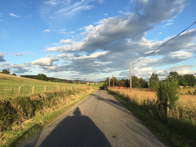
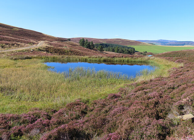
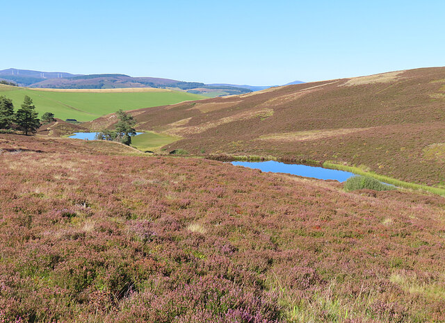
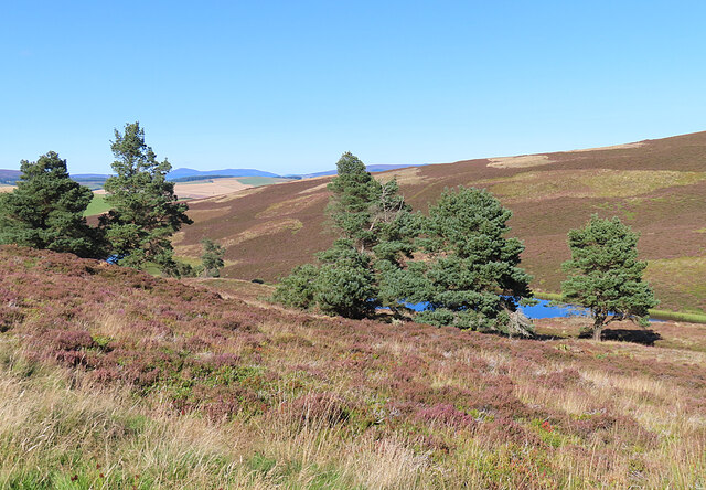
Overlook Loch is a picturesque freshwater lake located in Aberdeenshire, Scotland. Nestled amidst the stunning Scottish Highlands, this tranquil waterbody offers a serene escape for nature lovers and outdoor enthusiasts alike. Spanning an area of approximately 20 acres, Overlook Loch is a perfect blend of natural beauty and rich biodiversity.

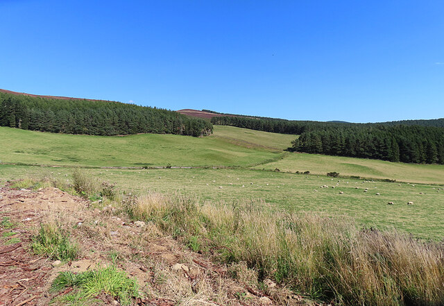
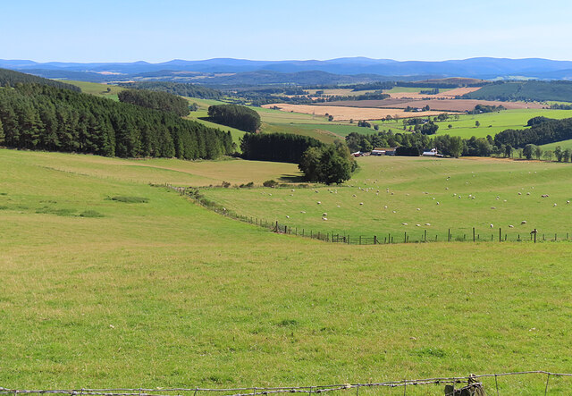
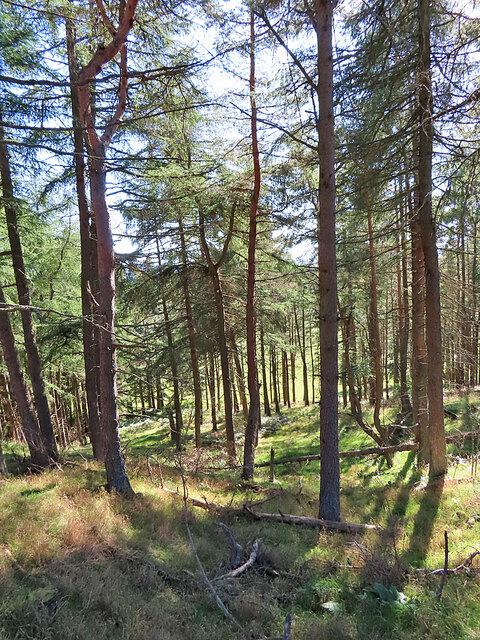
Surrounded by rolling hills and lush greenery, the lake boasts crystal-clear waters that reflect the breathtaking landscape around it. The shoreline is adorned with a variety of vegetation, including reeds, shrubs, and grasses, creating a vibrant and diverse ecosystem. The area surrounding the lake is home to numerous species of birds, making it a popular spot for birdwatching enthusiasts.

The lake itself provides a habitat for various aquatic creatures, such as fish, amphibians, and invertebrates. Anglers often frequent Overlook Loch to try their luck at catching trout, salmon, and other freshwater fish species that inhabit the lake. The calm and undisturbed nature of the lake also makes it an ideal location for kayaking, canoeing, and leisurely boat rides.

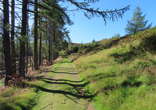
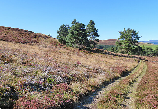
A walking trail encircles Overlook Loch, allowing visitors to enjoy a leisurely stroll while taking in the breathtaking scenery. The trail offers numerous viewpoints, each providing a unique perspective of the lake and its surroundings. Additionally, there are several picnic areas and benches scattered along the trail, providing visitors with the opportunity to relax and immerse themselves in the peaceful ambiance.

Overlook Loch, with its stunning beauty and diverse wildlife, is a true gem within Aberdeenshire. Whether it's for a scenic walk, birdwatching, or simply enjoying the tranquility of nature, this freshwater lake offers an unforgettable experience for all who visit.

If you have any feedback on the listing, please let us know in the comments section below.

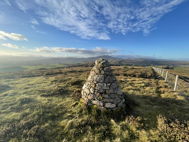
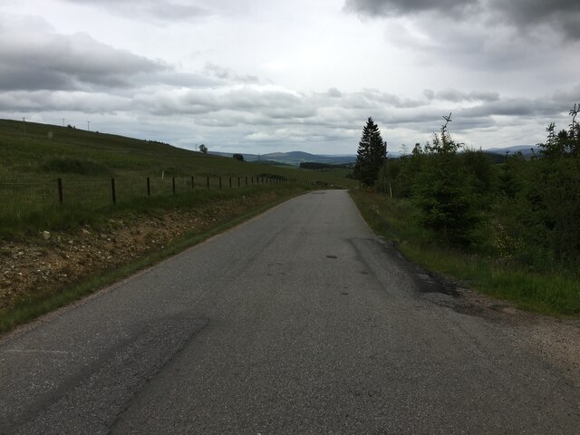
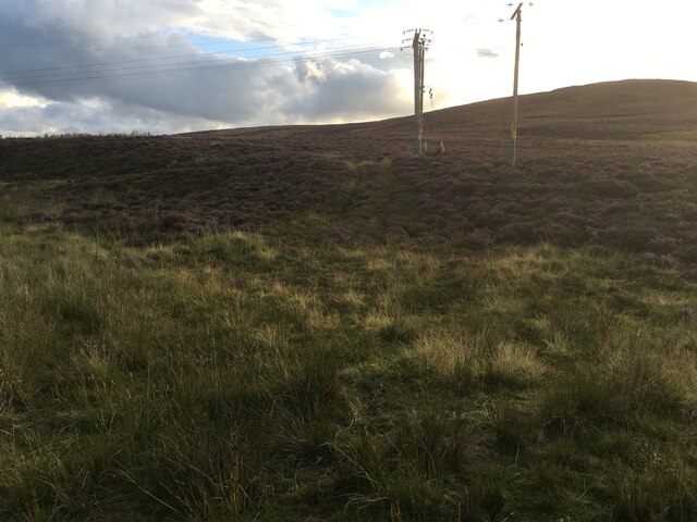
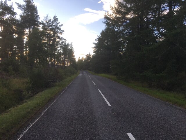
Overlook Loch Images

Images are sourced within 2km of 57.16358/-2.9405474 or Grid Reference NJ4308. Thanks to Geograph Open Source API. All images are credited.

Baderonach Hill Summit A "formal" cairn at the summit of Baderonach Hill 475m (Trump)
Baderonach Hill Summit
A "formal" cairn at the summit of Baderonach Hill 475m (Trump)
Minor road towards Migvie
Rough track on Craig Glas
A97 near Witchock Loch
Minor road near Migvie
Fields near Reinacharn Hill farming on the slopes of Molly Watt's Hill.
Fields near Reinacharn
Hill farming on the slopes of Molly Watt's Hill.
Fields at Reinacharn Looking downhill from the track north-east of Keeper's Cottage towards the flatter ground closer to the River Dee.
Fields at Reinacharn
Looking downhill from the track north-east of Keeper's Cottage towards the flatter ground closer to the River Dee.
Tillyreach Hillock According to the map Tillyreach Hillock is the small hill at the foot of this field.
Tillyreach Hillock
According to the map Tillyreach Hillock is the small hill at the foot of this field.
Molly Watt's Hill A rather featureless view towards the modest summit of Molly Watt's Hill. The Ordnance Survey Name Book says that the name is derived from a person named Mary Watt (hardly surprising) but does not relate who she was or why the hill was named after her.
Molly Watt's Hill
A rather featureless view towards the modest summit of Molly Watt's Hill. The Ordnance Survey Name Book says that the name is derived from a person named Mary Watt (hardly surprising) but does not relate who she was or why the hill was named after her.
Drummy Hillock A track runs along outside the forestry plantation on Drummy Hillock.
Drummy Hillock
A track runs along outside the forestry plantation on Drummy Hillock.
Sheep near Drummy Hillock Sheep in a sloping field with an open view towards Morven on the skyline.
Sheep near Drummy Hillock
Sheep in a sloping field with an open view towards Morven on the skyline.
Forest Belt This apparently unnamed strip of woodland is between two tracks east of Reinacharn Lodge.
Forest Belt
This apparently unnamed strip of woodland is between two tracks east of Reinacharn Lodge.
Forest Track This is the upper of two tracks that enclose a block of forest above Reinacharn Lodge.
Forest Track
This is the upper of two tracks that enclose a block of forest above Reinacharn Lodge.
Remains of a Fishing Hut The demise of the hut has been chronicled by Geograph contributors. See <a href="https://www.geograph.org.uk/photo/680832">NJ4408 : Fishing hut at Lazy Well</a>, taken in 2008 and <a href="https://www.geograph.org.uk/photo/2024069">NJ4408 : Weatherproof wooden bothy</a>, taken in 2010.
Remains of a Fishing Hut
The demise of the hut has been chronicled by Geograph contributors. See NJ4408 : Fishing hut at Lazy Well, taken in 2008 and NJ4408 : Weatherproof wooden bothy, taken in 2010.
Lazy Well Lazy Well is the name given to this artificial pool, created by a dam to the north.
Lazy Well
Lazy Well is the name given to this artificial pool, created by a dam to the north.
Track to the Lochans This track descends from Lazy Well to three more artificial ponds created for shooting.
Track to the Lochans
This track descends from Lazy Well to three more artificial ponds created for shooting.
Lazy Well Lochs This is the uppermost of three small artificial lochans created for shooting. There's a glimpse of the second one further down.
Lazy Well Lochs
This is the uppermost of three small artificial lochans created for shooting. There's a glimpse of the second one further down.
Scots Pines (Pinus sylvestris) A small row of native pines between tracks on the hill above the Lazy Well Lochans, one of which can be seen through the trees.
Scots Pines (Pinus sylvestris)
A small row of native pines between tracks on the hill above the Lazy Well Lochans, one of which can be seen through the trees.
Show me another place!

Overlook Loch is located at Grid Ref: NJ4308 (Lat: 57.16358, Lng: -2.9405474)

Unitary Authority: Aberdeenshire

Police Authority: North East

What 3 Words

///paces.buckets.indicated. Near Aboyne, Aberdeenshire

Related Wikis

Migvie Castle

Migvie Castle was a 13th-century castle to the west of Migvie, Aberdeenshire, Scotland. Its remains were listed as a scheduled monument in 2007. ��2�...

Blue cairn circle

Blue cairn circle is a 21 metres (69 ft) diameter stone circle in Aberdeenshire, Scotland. In the center is a large stone cairn with several pits in it...

Towie, Aberdeenshire

Towie is a small hamlet and civil parish in Aberdeenshire, Scotland, close to Alford and Lumsden, on the River Don.One of the most notable features of...

Logie Coldstone

Logie Coldstone (Scottish Gaelic: Lògaidh) is a village in Aberdeenshire, Scotland. The village lies north of the River Dee, near Tarland in the Cromar...

Towie Castle

Towie Castle was a 17th-century tower house, about 3.5 miles (5.6 km) southwest of Kildrummy in Aberdeenshire, Scotland, on the right bank of the Don....

Blelack

Blelack (, Scottish Gaelic: Blàth Bholg) is a place in Aberdeenshire, Scotland, the location of Blelack House, a Scottish mansion house with origins in...

Glenkindie Castle

Glenkindie Castle was a 16th-century castle, about 3 miles (4.8 km) south-west of Kildrummy, Aberdeenshire, Scotland, at Glenkindie, north of the River...

Tarland

Tarland (Gaelic: Turlann) is a village in Aberdeenshire, Scotland and is located 5 miles (8 km) northwest of Aboyne, and 30 miles (50 km) west of Aberdeen...

Nearby Amenities

Located within 500m of 57.16358,-2.9405474
Artwork Type: sculpture
Tourism: artwork
Lat/Long: 57.163777/-2.9394867
Power: pole
Lat/Long: 57.160777/-2.9346841
Power: pole
Lat/Long: 57.160639/-2.9355487
Power: pole
Lat/Long: 57.1604593/-2.9366523
Power: pole
Lat/Long: 57.1605185/-2.9377739
Power: pole
Lat/Long: 57.1605777/-2.9387439
Power: pole
Lat/Long: 57.1606265/-2.9397615
Power: pole
Lat/Long: 57.1606976/-2.9408484
Power: pole
Lat/Long: 57.160444/-2.9418659
Power: pole
Lat/Long: 57.1602377/-2.9426856
Power: pole
Lat/Long: 57.1596246/-2.9434359
The data included in this document is from www.openstreetmap.org. The data is made available under ODbL.

Have you been to Overlook Loch?

Leave your review of Overlook Loch below (or comments, questions and feedback).