Muckle Water

Lake, Pool, Pond, Freshwater Marsh in Orkney

Scotland

Muckle Water

Coastline below Skea Hill, Westray, Orkney Looking towards Rousay (left) and Orkney Mainland.
Coastline below Skea Hill, Westray, Orkney Credit: Claire Pegrum

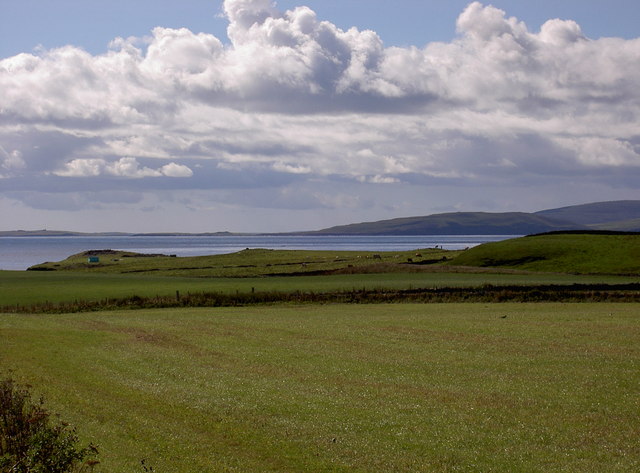
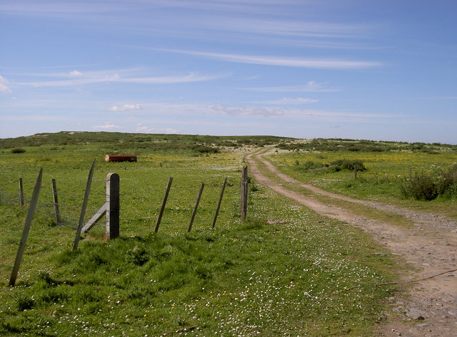
Muckle Water is a freshwater loch located in the Orkney Islands, Scotland. It is situated in the parish of Harray, approximately 10 miles west of Kirkwall, the main town of Orkney. The loch covers an area of around 3 square miles, making it one of the largest freshwater bodies on the islands.

Muckle Water is renowned for its natural beauty and tranquility. Surrounded by rolling hills and picturesque landscapes, it provides a stunning backdrop for outdoor activities and wildlife observation. The loch is fed by several small streams and has a relatively shallow depth, with an average of 10-15 feet. Its waters are clear and unpolluted, supporting a diverse range of aquatic flora and fauna.

The loch is a popular destination for anglers, offering excellent fishing opportunities. It is home to various species of fish, including brown trout, pike, and perch. Fishing permits can be obtained locally, allowing visitors to enjoy a day of peaceful angling on the loch.

Muckle Water is also a haven for birdwatchers, attracting a wide variety of avian species. The surrounding wetlands and marshes provide an ideal habitat for waterfowl, wading birds, and migratory species. Visitors may spot species such as herons, swans, ducks, and geese, making it a paradise for bird enthusiasts.

In summary, Muckle Water is a beautiful and ecologically diverse freshwater loch, offering recreational activities such as fishing and birdwatching. Its serene surroundings and abundant wildlife make it a must-visit destination for nature lovers and those seeking a peaceful retreat in the Orkney Islands.

If you have any feedback on the listing, please let us know in the comments section below.
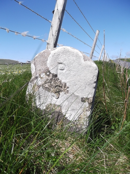
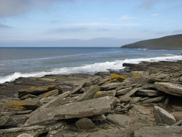
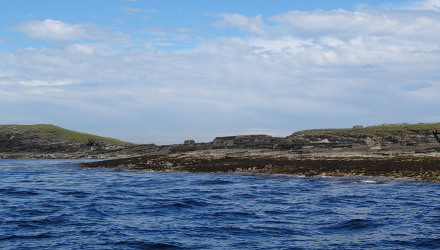
Muckle Water Images

Images are sourced within 2km of 59.270321/-3.0022144 or Grid Reference HY4243. Thanks to Geograph Open Source API. All images are credited.

Coastline below Skea Hill, Westray, Orkney Looking towards Rousay (left) and Orkney Mainland.
Coastline below Skea Hill, Westray, Orkney
Looking towards Rousay (left) and Orkney Mainland.
Old Milestone by the B6097, Midbea, Westray By the B6097, in parish of Westray (District), 100m North of crossroads corner, on verge.

Inscription reads:- : P / 3 : : T / ½ :  (To Pierowall and Tuquoy)

Surveyed

Milestone Society National ID: OR_WYPWTQ03.
Old Milestone by the B6097, Midbea, Westray
By the B6097, in parish of Westray (District), 100m North of crossroads corner, on verge. Inscription reads:- : P / 3 : : T / ½ : (To Pierowall and Tuquoy) Surveyed Milestone Society National ID: OR_WYPWTQ03.
Rocky foreshore This is near to Muckle Water, with a view of Skea Hill in the background.
Rocky foreshore
This is near to Muckle Water, with a view of Skea Hill in the background.
Fitty Hill Used the footpath via Lengemire which is now a ruin with Jim Bloomer and Tricky Speirs.
Name: Fitty Hill
Hill number: 1557
Height: 169m / 554ft
Area: 23: Orkney Islands
Class: Ma,1
Grid ref: HY 42976 44856
Summit feature: trig point
Drop: 169m
Col: Sea
Fitty Hill
Used the footpath via Lengemire which is now a ruin with Jim Bloomer and Tricky Speirs. Name: Fitty Hill Hill number: 1557 Height: 169m / 554ft Area: 23: Orkney Islands Class: Ma,1 Grid ref: HY 42976 44856 Summit feature: trig point Drop: 169m Col: Sea
Heading For Fitty Hill
West side of Bakie Skerry, Berst Ness, Westray Bedrock slabs of sandstone form Bakie Skerry on Berst Ness, Westray.
West side of Bakie Skerry, Berst Ness, Westray
Bedrock slabs of sandstone form Bakie Skerry on Berst Ness, Westray.
Summit, Fitty Hill A triangulation pillar at the highest point of Westray.
Summit, Fitty Hill
A triangulation pillar at the highest point of Westray.
Slopes of Fitty Hill View towards the Ness of Tuquoy at the southern tip of Westray.
Slopes of Fitty Hill
View towards the Ness of Tuquoy at the southern tip of Westray.
Fitty Hill The highest hill on Westray.
Fitty Hill
The highest hill on Westray.
Fields and beach near Kirbest, Westside View toward beach near Kirbest, Westside district of Westray
Fields and beach near Kirbest, Westside
View toward beach near Kirbest, Westside district of Westray
Old shed on shore near Kirbest, Westside, Westray Old store by the shore with island of Egilday on horizon above it - you can just make out the tower of St Magnus Church on Egilsay.
Old shed on shore near Kirbest, Westside, Westray
Old store by the shore with island of Egilday on horizon above it - you can just make out the tower of St Magnus Church on Egilsay.
Knowe o Skea, near Langskaill View over farmland at Langskaill towards Knowe o Skea (the 'bump' with green tent on it).  Island of Rousay in background to right.
Knowe o Skea, near Langskaill
View over farmland at Langskaill towards Knowe o Skea (the 'bump' with green tent on it). Island of Rousay in background to right.
Tirlot, Westside, Westray Cottage on farm of Tirlot.  Fitty hill just visible on RH side.
Tirlot, Westside, Westray
Cottage on farm of Tirlot. Fitty hill just visible on RH side.
Cottage below Fitty Hill, Westside, Westray
Farm of Hammers, Westside Westray
'Patience' - farm cottage
Sandy Links of Gairy, Westside, Westray Like all sandy areas in Westray, this is over-run with rabbits.  Is used occasionally for Motocross races.
Sandy Links of Gairy, Westside, Westray
Like all sandy areas in Westray, this is over-run with rabbits. Is used occasionally for Motocross races.
House of Powdykes, Westside, Westray Shed used to be part of croft of Cottahowan.
House of Powdykes, Westside, Westray
Shed used to be part of croft of Cottahowan.
Show me another place!

Muckle Water is located at Grid Ref: HY4243 (Lat: 59.270321, Lng: -3.0022144)

Unitary Authority: Orkney Islands

Police Authority: Highlands and Islands

What 3 Words

///managed.validated.barmaid. Near Pierowall, Orkney Islands

Related Wikis

Westside Church

Westside Church, (also known as Cross Kirk), is a ruined 12th century church located on the island of Westray in Orkney, Scotland. Archaeological excavations...

Westray

Westray (, Scots: Westree) is one of the Orkney Islands in Scotland, with a usual resident population of just under 600 people. Its main village is Pierowall...

Pierowall

Pierowall is a village of Westray in the Orkney Islands, off the coast of the northern Scottish mainland. The village is the island's largest settlement...

Noltland Castle

Noltland Castle is located near Pierowall on the island of Westray in the Orkney Islands of Scotland. It dates mainly to the later 16th century, although...

Related Videos

Westray Vlog 2021

I hope you enjoyed the video, if you did consider Subscribing it means a lot. Chalmersquoy Website ...

Orkney Ferries, ferry MV Earl Sigurd, Outer North Isles services

MV Earl Sigurd is a Ro-Ro vehicle ferry operated by Orkney Ferries. It was built in 1989 by McTay Marine in Bromborough.

Orkney Tour 2022-08-20 Westray (South)

On this ride I cycled around the southern part of Westray. With this island I took the car and stayed a couple of days. There was ...

Nearby Amenities

Located within 500m of 59.270321,-3.0022144
Knowe o'Burristae (Broch)
Historic: archaeological_site
Lat/Long: 59.2689803/-2.998568
The data included in this document is from www.openstreetmap.org. The data is made available under ODbL.

Have you been to Muckle Water?

Leave your review of Muckle Water below (or comments, questions and feedback).