Long Pond

Lake, Pool, Pond, Freshwater Marsh in Lancashire

England

Long Pond

Entrance to the Brookside development Situated off Deysbrook Lane in what was once the Croxteth Hall Estate and featuring Brookside Close, the filming location for the iconic Channel 4 soap opera which was transmitted from 1982 until 2001.  This painted sign has clearly seen better days.
Entrance to the Brookside development Credit: James T M Towill

Long Pond, located in Lancashire, England, is a picturesque body of water that serves as a natural freshwater marsh and has characteristics of both a lake and a pool. Spanning a surface area of approximately 10 acres, the pond is surrounded by lush vegetation, adding to its scenic beauty.

The water in Long Pond is sourced from various springs and rainfall, ensuring a constant flow of fresh and clean water. The pond is known for its calm and tranquil atmosphere, making it a popular spot for nature enthusiasts and those seeking a peaceful retreat. The surrounding area is teeming with wildlife, including ducks, swans, and various species of fish, making it an ideal location for bird watching and fishing.

Long Pond offers recreational activities for visitors, such as boating and kayaking. The calm and still nature of the water makes it suitable for leisurely paddling or exploring the marshy areas surrounding the pond. The gentle slopes and grassy banks provide ample space for picnicking or simply enjoying the beautiful scenery.

The pond is easily accessible via a well-maintained footpath that runs along its edge, providing a pleasant walk for visitors. Additionally, there are designated parking areas nearby for those arriving by car.

Long Pond, with its combination of a freshwater marsh, lake-like characteristics, and serene ambiance, offers a unique and refreshing experience for anyone seeking to connect with nature in the Lancashire region.

If you have any feedback on the listing, please let us know in the comments section below.
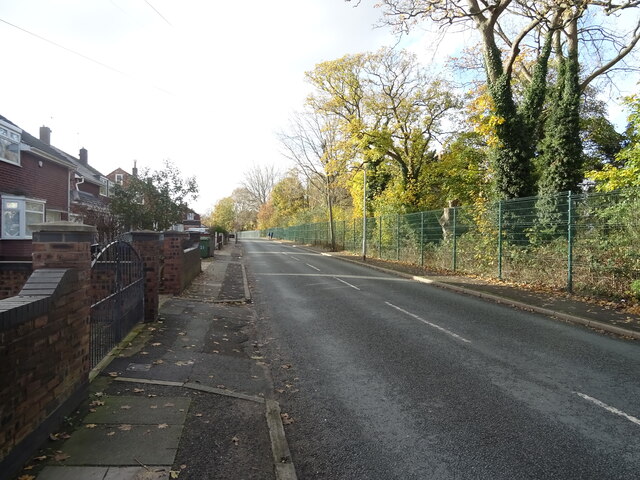
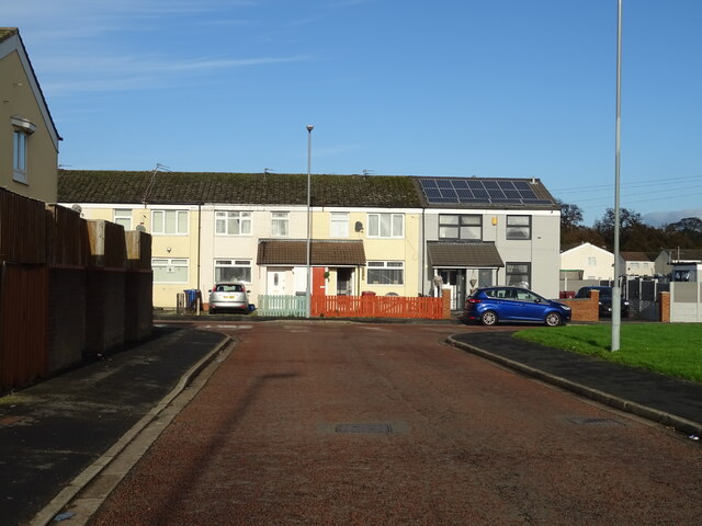
Long Pond Images

Images are sourced within 2km of 53.444157/-2.8932954 or Grid Reference SJ4094. Thanks to Geograph Open Source API. All images are credited.

Entrance to the Brookside development Situated off Deysbrook Lane in what was once the Croxteth Hall Estate and featuring Brookside Close, the filming location for the iconic Channel 4 soap opera which was transmitted from 1982 until 2001.  This painted sign has clearly seen better days.
Entrance to the Brookside development
Situated off Deysbrook Lane in what was once the Croxteth Hall Estate and featuring Brookside Close, the filming location for the iconic Channel 4 soap opera which was transmitted from 1982 until 2001. This painted sign has clearly seen better days.
Brookside Close: scene of many a scene! Brookside Close as featured in the iconic Channel 4 soap opera from 1982 until 2001.  After the cessation of the series, the cul-de-sac fell into disrepair but was later regenerated providing private housing as seen today.  The Brookside development is located off Deysbrook Lane in the West Derby suburb of Liverpool.
Brookside Close: scene of many a scene!
Brookside Close as featured in the iconic Channel 4 soap opera from 1982 until 2001. After the cessation of the series, the cul-de-sac fell into disrepair but was later regenerated providing private housing as seen today. The Brookside development is located off Deysbrook Lane in the West Derby suburb of Liverpool.
Brookside: former security gate remains The remains of the security gate at the former entrance to the Channel 4 soap opera 'Brookside' set can be noted to the left next to the gable end of the house.
Brookside: former security gate remains
The remains of the security gate at the former entrance to the Channel 4 soap opera 'Brookside' set can be noted to the left next to the gable end of the house.
Flats on Melwood Drive, Liverpool, L12
Bus stop and shelter on Melwood Drive, Liverpool, L12
The Deysbrook in West Derby
Sign for the Deysbrook in West Derby
Bookmakers on Deysbrook Lane, West Derby
Bus stop on Deysbrook Lane, West Derby
Houses on Deysbrook Lane
Houses on Yew Tree Lane, West Derby, Liverpool
Yew Tree Lane, West Derby, Liverpool
Hollow Croft, L28
Hollow Croft, L28
Path towards Knowsley Brook
National Cycle Network Route 862
Path towards Croxteth
Houses on Midhurst Road, L12
Fir Tree Drive South, L12
Show me another place!

Long Pond is located at Grid Ref: SJ4094 (Lat: 53.444157, Lng: -2.8932954)

Unitary Authority: Liverpool

Police Authority: Merseyside

What 3 Words

///bumpy.mass.speak. Near Knowsley, Merseyside

Nearby Locations

Long Pond Statue Pond

Related Wikis

Croxteth Hall

Croxteth Hall is a country estate and Grade II* listed building in the West Derby suburb of Liverpool, England. It is the former country estate and ancestral...

Liverpool West Derby (UK Parliament constituency)

Liverpool, West Derby is a constituency represented in the House of Commons of the UK Parliament since 2019 by Ian Byrne of the Labour Party. == Boundaries... ==

Croxteth

Croxteth is a suburb of Liverpool, Merseyside, England, and a Liverpool City Council Ward. Although housing in the area is predominantly modern, the suburb...

Murder of Rhys Jones

On 22 August 2007, Rhys Milford Jones, an eleven-year-old English boy, was murdered in Liverpool while walking home from football practice. Sean Mercer...

Deysbrook Barracks

Deysbrook Barracks was a regular army barracks in West Derby in Liverpool. The barracks was used by 59th (Volunteers) Signal Squadron of the Royal Signals...

Dixons Croxteth Academy

Dixons Croxteth Academy (formally The De La Salle Academy) is a co-educational secondary school in the Croxteth area of Liverpool, England, with no formal...

Croxteth (Liverpool ward)

Croxteth ward is an electoral division of Liverpool City Council. Ward in the Liverpool West Derby Parliamentary constituency. == Background == The ward...

Melwood

AXA Melwood Training Centre, in West Derby, Liverpool is the training ground and academy for Liverpool Football Club's Women's first team, youth teams...

Nearby Amenities

Located within 500m of 53.444157,-2.8932954
Traffic Signals
Traffic Signals: signal
Lat/Long: 53.4460617/-2.8997106
CROXTETH2
Disused: yes
Man Made: petroleum_well
Ref GB Decc: LJ/16-2
Source: DECC
Lat/Long: 53.4448611/-2.8966944
CROXTETH1
Disused: yes
Man Made: petroleum_well
Ref GB Decc: LJ/16-1
Source: DECC
Lat/Long: 53.4426944/-2.8986111
Traffic Signals
Traffic Signals: signal
Traffic Signals Direction: forward
Lat/Long: 53.4460545/-2.8991757
Turning Circle
Lat/Long: 53.4486218/-2.8929309
Bus Stop
OAK LANE/CROXTETH HALL LANE
Bus: yes
Naptan AtcoCode: 2800S46086A
Naptan Bearing: SW
Naptan CommonName: OAK LANE/CROXTETH HALL LANE
Naptan Indicator: OAK LANE/CROXTETH HALL LANE
Naptan Landmark: NR FIR TREE DRIVE SOUTH
Naptan NaptanCode: merdpjdj
Naptan Notes: No Notes
Naptan PlusbusZoneRef: LVRPLCH
Naptan ShortCommonName: Oak Lane
Naptan Street: OAK LANE
Naptan Verified: no
Public Transport: platform
Source: naptan_import
Lat/Long: 53.4481193/-2.895355
Bus Stop
OAK LANE/CROXTETH HALL LANE
Bus: yes
Naptan AtcoCode: 2800S46086B
Naptan Bearing: NE
Naptan CommonName: OAK LANE/CROXTETH HALL LANE
Naptan Indicator: OAK LANE/CROXTETH HALL LANE
Naptan Landmark: NR CORNER FIR TREE DRIVE RTH
Naptan NaptanCode: merdpjdm
Naptan Notes: No Notes
Naptan PlusbusZoneRef: LVRPLCH
Naptan ShortCommonName: Oak Lane
Naptan Street: OAK LANE
Naptan Verified: no
Public Transport: platform
Source: naptan_import
Lat/Long: 53.4482431/-2.8956287
Bus Stop
OAK LANE/STONEBRIDGE LANE
Bus: yes
Naptan AtcoCode: 2800S46095A
Naptan Bearing: NE
Naptan CommonName: OAK LANE/STONEBRIDGE LANE
Naptan Indicator: OAK LANE NORTH/CROXTETH HALL LANE
Naptan Landmark: PLAYING FIELD TO REAR
Naptan NaptanCode: merdpjmp
Naptan Notes: No Notes
Naptan PlusbusZoneRef: LVRPLCH
Naptan ShortCommonName: Oak Ln/Stonebr Ln
Naptan Street: OAK LANE NORTH
Naptan Verified: no
Public Transport: platform
Source: naptan_import
Lat/Long: 53.4467101/-2.8986681
Bus Stop
OAK LANE NORTH/CROXTETH COUNTRY PARK
Bus: yes
Naptan AtcoCode: 2800S46095B
Naptan Bearing: SW
Naptan CommonName: OAK LANE NORTH/CROXTETH COUNTRY PARK
Naptan Indicator: OAK LANE NORTH/CROXTETH HALL LANE
Naptan Landmark: OAK LANE NORTH/CROXTETH COUNTRY PARK
Naptan NaptanCode: merdpjmt
Naptan Notes: No Notes
Naptan PlusbusZoneRef: LVRPLCH
Naptan ShortCommonName: Oak Ln N/Crox Park
Naptan Street: OAK LANE NORTH
Naptan Verified: no
Public Transport: platform
Source: naptan_import
Lat/Long: 53.4465686/-2.898364
Generator Method: photovoltaic
Generator Output Electricity: yes
Generator Source: solar
Generator Type: solar_photovoltaic_panel
Location: roof
Power: generator
Lat/Long: 53.447553/-2.897983
Generator Method: photovoltaic
Generator Output Electricity: yes
Generator Source: solar
Generator Type: solar_photovoltaic_panel
Location: roof
Power: generator
Lat/Long: 53.4474891/-2.8978891
Generator Method: photovoltaic
Generator Output Electricity: yes
Generator Source: solar
Generator Type: solar_photovoltaic_panel
Location: roof
Power: generator
Lat/Long: 53.4444709/-2.898975
Generator Method: photovoltaic
Generator Output Electricity: yes
Generator Source: solar
Generator Type: solar_photovoltaic_panel
Location: roof
Power: generator
Lat/Long: 53.444431/-2.9000425
Generator Method: photovoltaic
Generator Output Electricity: yes
Generator Source: solar
Generator Type: solar_photovoltaic_panel
Location: roof
Power: generator
Lat/Long: 53.4445109/-2.9006782
Generator Method: photovoltaic
Generator Output Electricity: yes
Generator Source: solar
Generator Type: solar_photovoltaic_panel
Location: roof
Power: generator
Lat/Long: 53.4437504/-2.9001472
Generator Method: photovoltaic
Generator Output Electricity: yes
Generator Source: solar
Generator Type: solar_photovoltaic_panel
Location: roof
Power: generator
Lat/Long: 53.4430938/-2.900402
Generator Method: photovoltaic
Generator Output Electricity: yes
Generator Source: solar
Generator Type: solar_photovoltaic_panel
Location: roof
Power: generator
Lat/Long: 53.4441728/-2.8988262
Generator Method: photovoltaic
Generator Output Electricity: yes
Generator Source: solar
Generator Type: solar_photovoltaic_panel
Location: roof
Power: generator
Lat/Long: 53.4441633/-2.8989335
Traffic Signals
Traffic Signals: signal
Lat/Long: 53.4463481/-2.8991397
Traffic Signals
Traffic Signals: signal
Lat/Long: 53.4463065/-2.8990867
Cycleway: asl
Lat/Long: 53.44611/-2.8996634
Traffic Signals
Traffic Signals: signal
Lat/Long: 53.4464188/-2.8996091
Traffic Calming: table
Lat/Long: 53.4479814/-2.8964811
Natural: shrub
Lat/Long: 53.4431528/-2.8927556
Natural: shrub
Lat/Long: 53.4430507/-2.8924224
Natural: shrub
Lat/Long: 53.4429571/-2.8929989
The data included in this document is from www.openstreetmap.org. The data is made available under ODbL.

Have you been to Long Pond?

Leave your review of Long Pond below (or comments, questions and feedback).