Loch of Vastray

Lake, Pool, Pond, Freshwater Marsh in Orkney

Scotland

Loch of Vastray

Broch at Craig of Ritten Mainland Orkney coastline with the green hump of the broch in the centre of the shot. If the Eynhallow ferry boat was on the course shown on the OS map, this shot would be from outside the grid square, but the true course is well to the west of the reefs of Wyre Skerries and hugs the coast on the way in to Tingwall.
Broch at Craig of Ritten Credit: Gordon Hatton

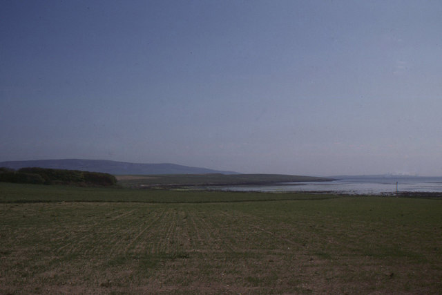
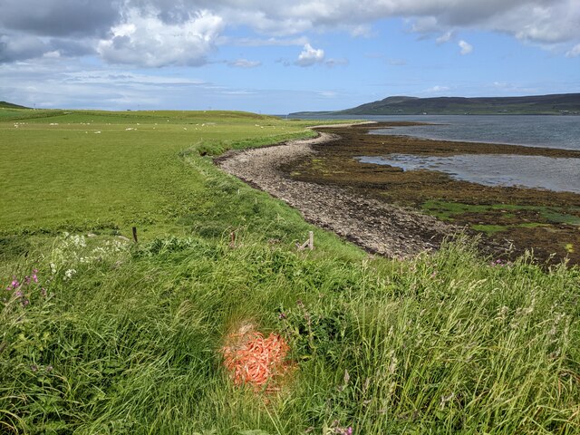
Loch of Vastray is a picturesque freshwater loch located in the Orkney Islands, Scotland. Spanning an area of approximately 100 acres, it is situated on the island of Mainland, near the village of Marwick. The loch is surrounded by rolling hills and offers stunning panoramic views of the Orkney landscape.

The Loch of Vastray is known for its diverse ecosystem and abundant wildlife. It is home to a variety of waterfowl, including greylag geese, tufted ducks, and teal. The loch's marshy shores provide a suitable habitat for wading birds such as lapwings and curlews. Birdwatchers and nature enthusiasts frequent the area to observe and study the numerous species that inhabit the region.

The loch is also a popular spot for fishing, particularly for brown trout. Anglers visit Loch of Vastray to enjoy a peaceful day of fishing, surrounded by the serene beauty of the Orkney countryside. Fishing permits can be obtained from local authorities or nearby fishing associations.

The surrounding area offers ample opportunities for outdoor activities and exploration. Visitors can take leisurely walks along the loch's shores, enjoying the tranquility and the stunning scenery. Additionally, there are several walking trails nearby, including the renowned Marwick Head coastal trail, which offers breathtaking views of the rugged coastline and the Atlantic Ocean.

Overall, Loch of Vastray is a haven of natural beauty and biodiversity. Its idyllic setting, abundant wildlife, and recreational opportunities make it a must-visit destination for nature lovers and outdoor enthusiasts visiting the Orkney Islands.

If you have any feedback on the listing, please let us know in the comments section below.

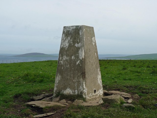
Loch of Vastray Images

Images are sourced within 2km of 59.110632/-3.052328 or Grid Reference HY3925. Thanks to Geograph Open Source API. All images are credited.

Broch at Craig of Ritten Mainland Orkney coastline with the green hump of the broch in the centre of the shot. If the Eynhallow ferry boat was on the course shown on the OS map, this shot would be from outside the grid square, but the true course is well to the west of the reefs of Wyre Skerries and hugs the coast on the way in to Tingwall.
Broch at Craig of Ritten
Mainland Orkney coastline with the green hump of the broch in the centre of the shot. If the Eynhallow ferry boat was on the course shown on the OS map, this shot would be from outside the grid square, but the true course is well to the west of the reefs of Wyre Skerries and hugs the coast on the way in to Tingwall.
Scara Taing Small headland at the point where the coast turns into the bay of Wood Wick. A view from the Eynhallow on course for Tingwall pier.
Scara Taing
Small headland at the point where the coast turns into the bay of Wood Wick. A view from the Eynhallow on course for Tingwall pier.
Wood Wick, Evie, Mainland Patches of woodland like that seen to the left are rare in Orkney; rare enough for this, apparently, to give its name to the bay.
On the horizon, the hills of Rousay across Eynhallow Sound, the latter hidden behind the low hills beyond the wood.
Wood Wick, Evie, Mainland
Patches of woodland like that seen to the left are rare in Orkney; rare enough for this, apparently, to give its name to the bay. On the horizon, the hills of Rousay across Eynhallow Sound, the latter hidden behind the low hills beyond the wood.
Bluebells by the Burn of Woodwick
Track to Arwick The weather beaten building left of the newish storage shed demonstrates the nature of living on Orkney and the winds that hit the island.
Track to Arwick
The weather beaten building left of the newish storage shed demonstrates the nature of living on Orkney and the winds that hit the island.
Herding sheep with a Toyota near Aikerness
Vishall Hill Walked up from the SE to the trig and then the TuMP summit with Jim Bloomer and Tricky Speirs on a sunny afternoon.
Name: Vishall Hill
Hill number: 12218
Height: 91m / 299ft
Parent (Ma/M): 1555  Milldoe - Mid Tooin
Area 23: Orkney Islands
Class: 0
Grid ref: HY386250 (est)
Drop: 61m
Col: 30m  HY380248
Vishall Hill
Walked up from the SE to the trig and then the TuMP summit with Jim Bloomer and Tricky Speirs on a sunny afternoon. Name: Vishall Hill Hill number: 12218 Height: 91m / 299ft Parent (Ma/M): 1555 Milldoe - Mid Tooin Area 23: Orkney Islands Class: 0 Grid ref: HY386250 (est) Drop: 61m Col: 30m HY380248
Disused Quarry At Vishall Hill
Triangulation pillar, Vishall Hill, Orkney The island on the left is Gairsay.
Triangulation pillar, Vishall Hill, Orkney
The island on the left is Gairsay.
Wyre skerries Seals basking on the Wyre skerries, a scrap of land at the west end of Wyre.
Wyre skerries
Seals basking on the Wyre skerries, a scrap of land at the west end of Wyre.
Broch at the Craig of Ritten This one, as is often the case, has a beautiful situation. It is one of several nearby, the largest by far being that at Gurness, 3 km to the NE. They are of course, a Pictish construction.
Broch at the Craig of Ritten
This one, as is often the case, has a beautiful situation. It is one of several nearby, the largest by far being that at Gurness, 3 km to the NE. They are of course, a Pictish construction.
Wave-cut platform Orcadian wave-cut platforms provide a fascinating chance to see evidence of the processes which formed these islands. The sandstone, from which most of the islands are made, was deposited in an inland sea surrounded by a desert. Water levels fluctuated and the land dried and cracked as levels fell. These cracks then filled up with dust and sand. Today, these desiccation cracks have been preserved in the stone. Intriguingly, ripple marks left on that same shore, 350 million years ago, have also been preserved and are a common sight. Having said that, neither are evident in this photo!
Wave-cut platform
Orcadian wave-cut platforms provide a fascinating chance to see evidence of the processes which formed these islands. The sandstone, from which most of the islands are made, was deposited in an inland sea surrounded by a desert. Water levels fluctuated and the land dried and cracked as levels fell. These cracks then filled up with dust and sand. Today, these desiccation cracks have been preserved in the stone. Intriguingly, ripple marks left on that same shore, 350 million years ago, have also been preserved and are a common sight. Having said that, neither are evident in this photo!
The shoreline looking north Seen from the top of the ruined broch.
The shoreline looking north
Seen from the top of the ruined broch.
Plenty of building material The grass mound is a ruined broch, no doubt constructed with good flat stones from this beach.
Plenty of building material
The grass mound is a ruined broch, no doubt constructed with good flat stones from this beach.
The remains of the broch Most ruined brochs are still piles of stones - why is this one covered in soil and vegetation?  Parts of the original stone are visible in the gaps.
The remains of the broch
Most ruined brochs are still piles of stones - why is this one covered in soil and vegetation? Parts of the original stone are visible in the gaps.
The shoreline looking south-east Seen from the top of the ruined broch.
The shoreline looking south-east
Seen from the top of the ruined broch.
Masses of seaweed This stuff is very difficult to walk on! Looking over Eynhallow Sound to Rousay.
Masses of seaweed
This stuff is very difficult to walk on! Looking over Eynhallow Sound to Rousay.
Looking towards the ruined broch from the seaweed bed
Show me another place!

Loch of Vastray is located at Grid Ref: HY3925 (Lat: 59.110632, Lng: -3.052328)

Unitary Authority: Orkney Islands

Police Authority: Highlands and Islands

What 3 Words

///arch.maddening.starch. Near Evie, Orkney Islands

Related Wikis

Broch of Gurness

The Broch of Gurness is an Iron Age broch village on the northeast coast of Mainland Orkney in Scotland overlooking Eynhallow Sound, about 15 miles north...

Sands of Evie

The Sands of Evie is a sandy beach landform near the village of Evie on Mainland Orkney, Scotland, protected by the Point of Hellia headland. This beach...

Point of Hellia

The Point of Hellia is a headland on the northwest coast of the Orkney Mainland, Scotland. This landform extends into the southern part of Eynhallow Sound...

Eynhallow Sound

Eynhallow Sound is a seaway lying between Mainland Orkney and the island of Rousay in the Orkney Islands, Scotland. The tidal indraught is "scarcely felt...

Nearby Amenities

Located within 500m of 59.110632,-3.052328
Power: pole
Lat/Long: 59.1107305/-3.0538452
Power: pole
Lat/Long: 59.1099745/-3.0539632
Power: pole
Lat/Long: 59.1091373/-3.054108
Power: pole
Lat/Long: 59.1083248/-3.0542046
Power: pole
Lat/Long: 59.1072259/-3.0552292
Power: pole
Lat/Long: 59.1066833/-3.0557013
Grunshall
Place: locality
Lat/Long: 59.1102338/-3.0606018
The data included in this document is from www.openstreetmap.org. The data is made available under ODbL.

Have you been to Loch of Vastray?

Leave your review of Loch of Vastray below (or comments, questions and feedback).