Shrawardine Pool

Lake, Pool, Pond, Freshwater Marsh in Shropshire

England

Shrawardine Pool

View to the Breidden Hills Looking across fields to the west of Shrawardine Castle.
View to the Breidden Hills Credit: Jonathan Billinger

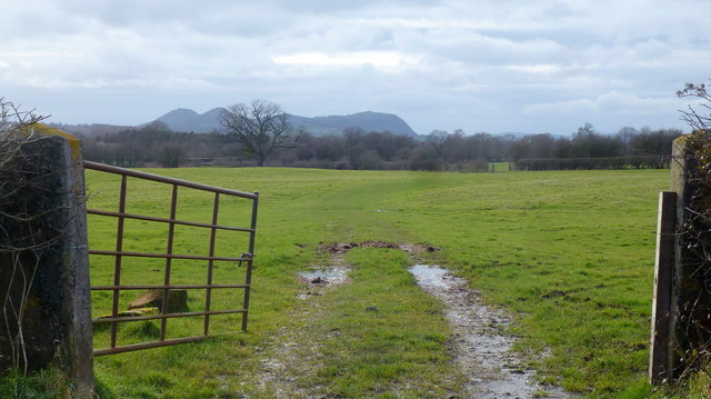
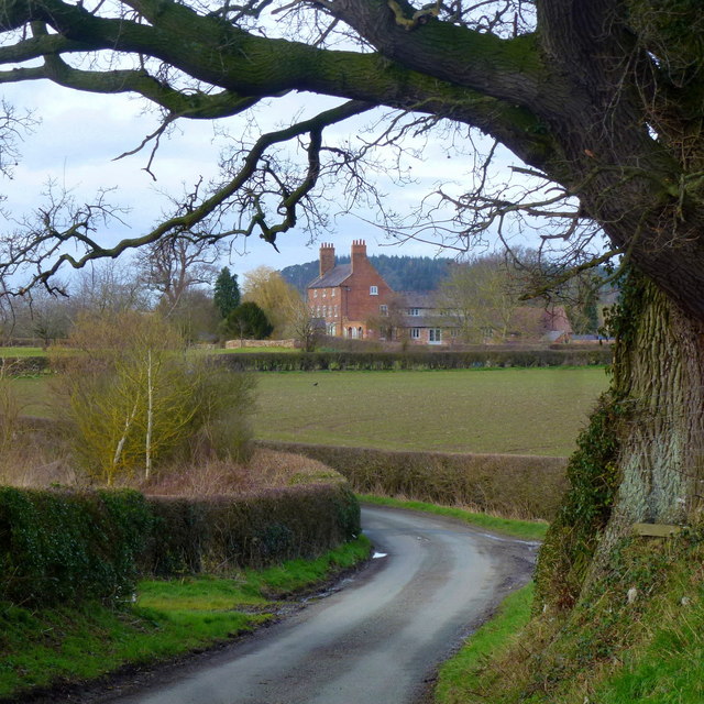
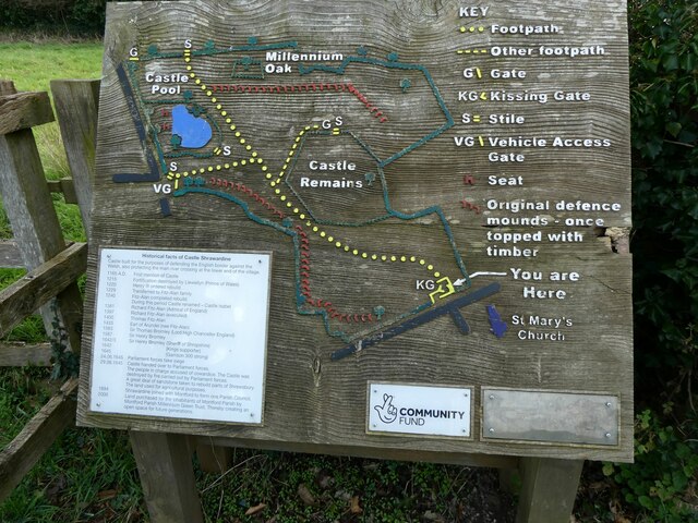
Shrawardine Pool is a picturesque freshwater marsh located in Shrewsbury, Shropshire, England. Situated within the grounds of Shrawardine Castle, the pool covers an area of approximately five acres and is surrounded by lush greenery and mature trees, providing a serene and tranquil setting.

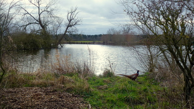
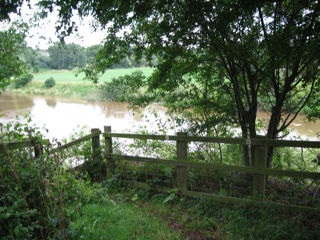
The pool itself is a natural water body, likely formed during the last Ice Age. It is fed by several small streams and springs that originate from the nearby hills. The water is clear and pristine, providing a habitat for a diverse range of aquatic flora and fauna.

The pool is home to a variety of plant species, including water lilies, reeds, and rushes, which thrive in its shallow margins. These plants not only enhance the pool's aesthetic appeal but also create a vital habitat for insects, amphibians, and birds.

The marshy areas surrounding the pool are teeming with wildlife. Visitors can spot a wide range of water birds, such as herons, ducks, and moorhens, as well as dragonflies and damselflies gliding over the water's surface. The pool also supports a population of fish, including carp and tench, attracting fishing enthusiasts throughout the year.

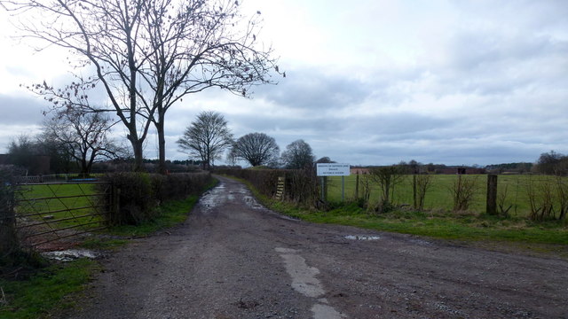
Shrawardine Pool offers a peaceful retreat for nature lovers, providing an opportunity to observe and appreciate the beauty of the natural world. Visitors can explore the pool's surroundings via a network of walking trails, which offer panoramic views of the pool and its surrounding landscape.

Overall, Shrawardine Pool is a haven for both wildlife and visitors, offering a diverse range of flora and fauna in a tranquil and picturesque setting.

If you have any feedback on the listing, please let us know in the comments section below.

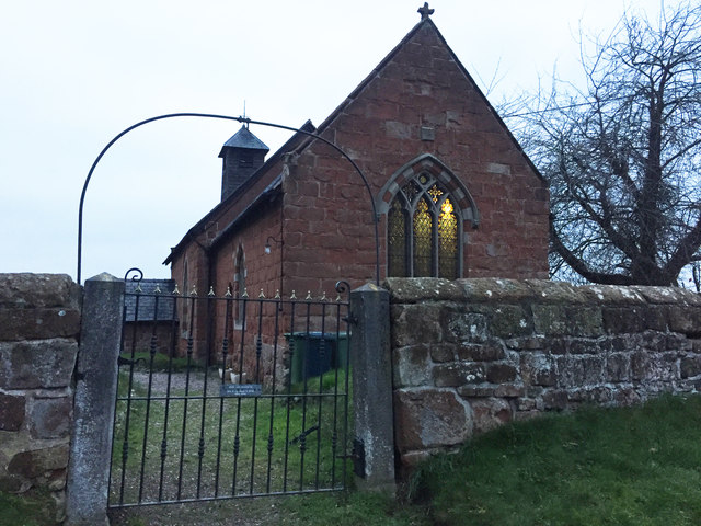
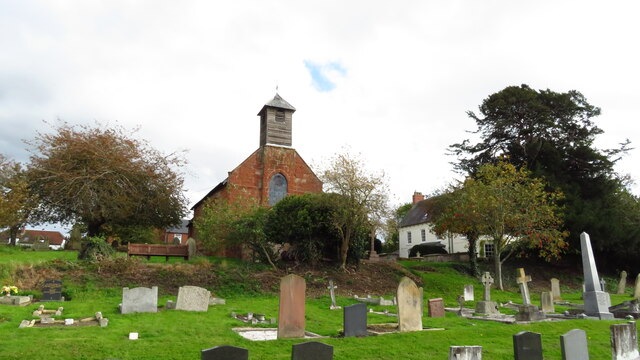
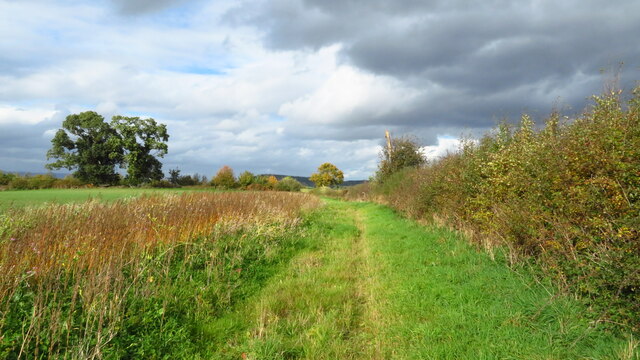
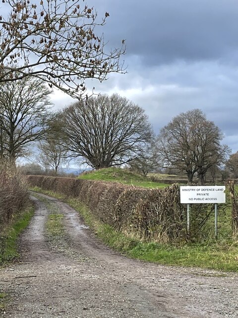
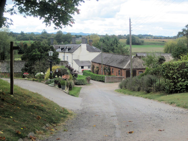
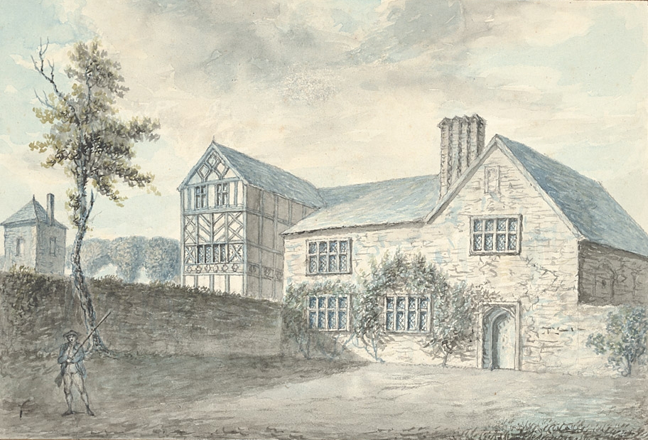
Shrawardine Pool Images

Images are sourced within 2km of 52.738553/-2.8927934 or Grid Reference SJ3916. Thanks to Geograph Open Source API. All images are credited.

View to the Breidden Hills Looking across fields to the west of Shrawardine Castle.
View to the Breidden Hills
Looking across fields to the west of Shrawardine Castle.
A glimpse of Folly Farm Framed by the shape of a fine old oak tree by the lane next to Folly Pool.
A glimpse of Folly Farm
Framed by the shape of a fine old oak tree by the lane next to Folly Pool.
Folly Pool Late afternoon and a pheasant surveys his territory.
Folly Pool
Late afternoon and a pheasant surveys his territory.
Nesscliffe Training Area Photo taken from the end of the public road by what used to be Shrawardine Station on the dismantled Shropshire and Montgomeryshire Railway which closed in 1960.
The training area is used for helicopter work as was evidenced by my ears but not my eyes at this point.
Nesscliffe Training Area
Photo taken from the end of the public road by what used to be Shrawardine Station on the dismantled Shropshire and Montgomeryshire Railway which closed in 1960. The training area is used for helicopter work as was evidenced by my ears but not my eyes at this point.
The Church of St Mary the Virgin, Shrawardine
Ordnance Survey Cut Mark This can be found on the roadside boundary wall of St Mary's Church in Shrawardine.
For more detail see : <span class="nowrap"><a title="http://www.bench-marks.org.uk/bm81104" rel="nofollow ugc noopener" href="http://www.bench-marks.org.uk/bm81104">Link</a><img style="margin-left:2px;" alt="External link" title="External link - shift click to open in new window" src="https://s1.geograph.org.uk/img/external.png" width="10" height="10"/></span>
Ordnance Survey Cut Mark
This can be found on the roadside boundary wall of St Mary's Church in Shrawardine. For more detail see : LinkExternal link
The Church of St Mary at Shrawardine Viewed from the north.
The Church of St Mary at Shrawardine
Viewed from the north.
OS Cut Mark: Shrawardine, St Mary's Church CUT MARK: WALL 0.9M S PRODN S FACE CH SW SIDE RD (ODN 87.7865m, AGL 0.5m).
OS Cut Mark: Shrawardine, St Mary's Church
CUT MARK: WALL 0.9M S PRODN S FACE CH SW SIDE RD (ODN 87.7865m, AGL 0.5m).
Shrawardine, St Mary's Church Cut mark also showing on roadside wall
Shrawardine, St Mary's Church
Cut mark also showing on roadside wall
Shrawardine - St Mary the Virgin Church
On the Shropshire Way heading towards Felton Butler from Shrawardine
Barred entrance to military training area near Shrawardine This was a well used training area by American forces in the Second World War. The OS map still has “America” printed to describe the area. It still is used periodically by UK territorial units.
Barred entrance to military training area near Shrawardine
This was a well used training area by American forces in the Second World War. The OS map still has “America” printed to describe the area. It still is used periodically by UK territorial units.
Information board at Shrawardine castle The castle was attacked by the Welsh under Llywelyn in 1215.  It was also a site of conflict in the English Civil War in 1645. 

Nice board. Great work. Lovely use of texture.
Information board at Shrawardine castle
The castle was attacked by the Welsh under Llywelyn in 1215. It was also a site of conflict in the English Civil War in 1645. Nice board. Great work. Lovely use of texture.
Plaque on the churchyard gate at Shrawardine church In 1956 this village won the Best Kept Village award for that year. It is still a very well kept village. Nice to imagine 1956 here. Few cars, no wifi, stronger accents, rationing ending, the war years fading just a tad maybe, optimism, progress, but Suez, Eden and the advent of Elvis?
Plaque on the churchyard gate at Shrawardine church
In 1956 this village won the Best Kept Village award for that year. It is still a very well kept village. Nice to imagine 1956 here. Few cars, no wifi, stronger accents, rationing ending, the war years fading just a tad maybe, optimism, progress, but Suez, Eden and the advent of Elvis?
The church and churchyard in Shrawardine Lots of grand tombs here. 

Vanitas vanitatum....
The church and churchyard in Shrawardine
Lots of grand tombs here. Vanitas vanitatum....
A5 approaching Felton Butler Roundabout The A5 is a major trunk road which runs for about 181 miles from London, in England, to Holyhead, in Wales. For part of its route, it follows a section of the Roman route which later took the Anglo-Saxon name Watling Street.  At Oswestry, the A5 joins the A483 and becomes the bypass to the east of the town. It continues to multiplex with the A483 until it reaches Halton, where it diverges towards Llangollen and Holyhead.
A5 approaching Felton Butler Roundabout
The A5 is a major trunk road which runs for about 181 miles from London, in England, to Holyhead, in Wales. For part of its route, it follows a section of the Roman route which later took the Anglo-Saxon name Watling Street. At Oswestry, the A5 joins the A483 and becomes the bypass to the east of the town. It continues to multiplex with the A483 until it reaches Halton, where it diverges towards Llangollen and Holyhead.
A5 approaching White Hall Roundabout The A5 is a major trunk road that runs 260 miles from London to Holyhead. It follows the course of an old Roman Road (Watling Street).
Wikipedia: <span class="nowrap"><a title="http://en.wikipedia.org/wiki/A5_road_(Great_Britain)" rel="nofollow ugc noopener" href="http://en.wikipedia.org/wiki/A5_road_(Great_Britain)">Link</a><img style="margin-left:2px;" alt="External link" title="External link - shift click to open in new window" src="https://s1.geograph.org.uk/img/external.png" width="10" height="10"/></span>
A5 approaching White Hall Roundabout
The A5 is a major trunk road that runs 260 miles from London to Holyhead. It follows the course of an old Roman Road (Watling Street). Wikipedia: LinkExternal link
Severn viewpoint 1 - Shrawardine, Shropshire A public footpath from Shrawardine - 'Shraden' to the locals - ends here at the site of a now-vanished railway bridge of the Shropshire & Montgomeryshire Railway. A bench here gives a pleasant spot for a break. Taken at 11.26 am BST (British Summer Time).

<a href="https://www.geograph.org.uk/photo/3606817">SJ3915 : Severn viewpoint 2 - Shrawardine, Shropshire</a> <a href="https://www.geograph.org.uk/photo/3606822">SJ3915 : Severn viewpoint 3 - Shrawardine, Shropshire</a> <a href="https://www.geograph.org.uk/photo/3606838">SJ3915 : Severn viewpoint 4 - Shrawardine, Shropshire</a>
Severn viewpoint 1 - Shrawardine, Shropshire
A public footpath from Shrawardine - 'Shraden' to the locals - ends here at the site of a now-vanished railway bridge of the Shropshire & Montgomeryshire Railway. A bench here gives a pleasant spot for a break. Taken at 11.26 am BST (British Summer Time). SJ3915 : Severn viewpoint 2 - Shrawardine, Shropshire SJ3915 : Severn viewpoint 3 - Shrawardine, Shropshire SJ3915 : Severn viewpoint 4 - Shrawardine, Shropshire
Show me another place!

Shrawardine Pool is located at Grid Ref: SJ3916 (Lat: 52.738553, Lng: -2.8927934)

Unitary Authority: Shropshire

Police Authority: West Mercia

What 3 Words

///gathers.musical.scratches. Near Great Ness, Shropshire

Nearby Locations

Shrawardine Pool

Related Wikis

Shrawardine

Shrawardine is a small village and former civil parish, now in the parish of Montford, in the Shropshire district, in the ceremonial county of Shropshire...

Shrawardine railway station

Shrawardine railway station was a station in Shrawardine, Shropshire, England. The station was opened in 1866 and closed in 1933. == References == ��2...

Montford, Shropshire

Montford is a small village and parish in Shropshire, England. The village lies near the A5 road, on the north bank of the River Severn and is 3 miles...

Alberbury Priory

Alberbury Priory was a medieval monastic house in Alberbury, Shropshire, England, established c.1230. It was one of three houses in England belonging...

Nearby Amenities

Located within 500m of 52.738553,-2.8927934
The data included in this document is from www.openstreetmap.org. The data is made available under ODbL.

Have you been to Shrawardine Pool?

Leave your review of Shrawardine Pool below (or comments, questions and feedback).