Babylon

Settlement in Flintshire

Wales

Babylon

Burton Lodge Farm Farm on Stringer's Lane near Honkley
Burton Lodge Farm Credit: Eirian Evans

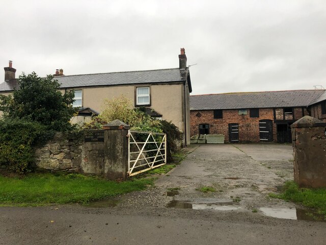
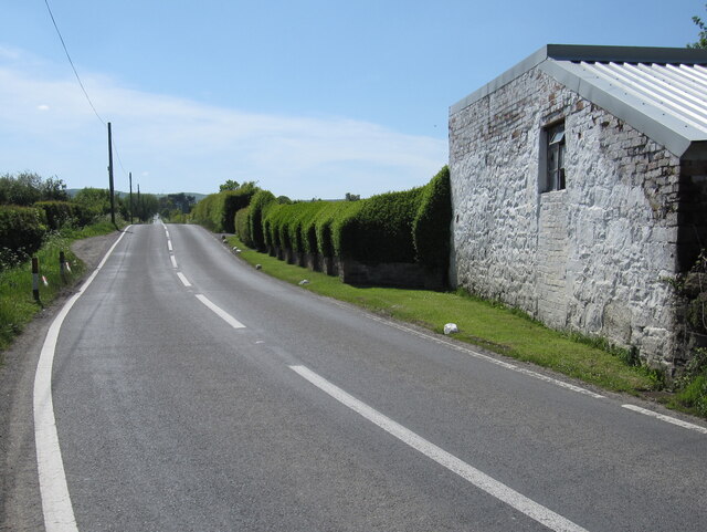
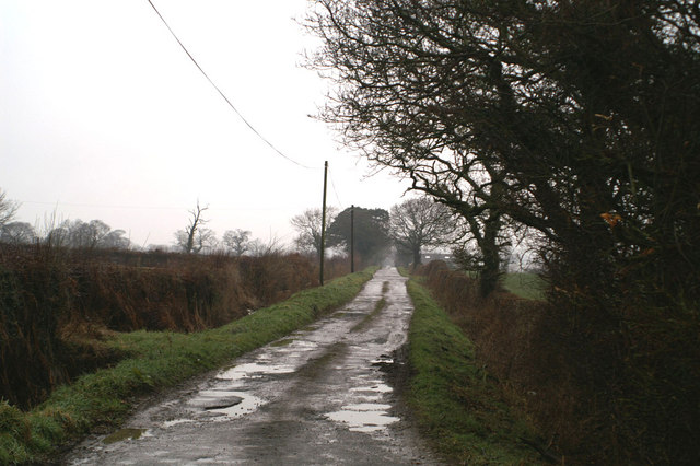
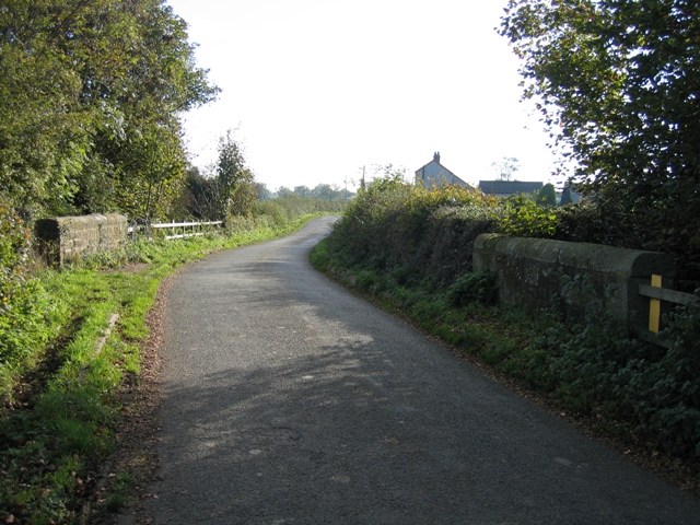
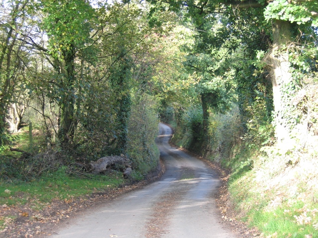
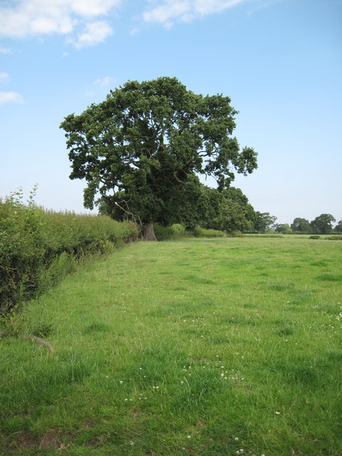
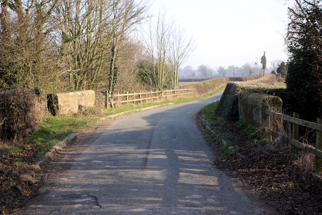
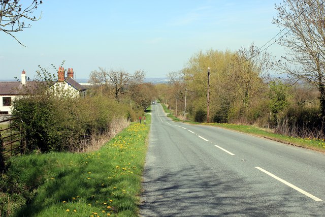
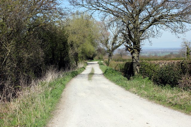
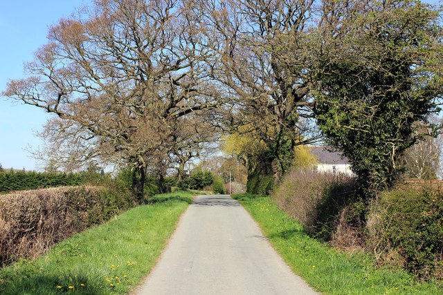
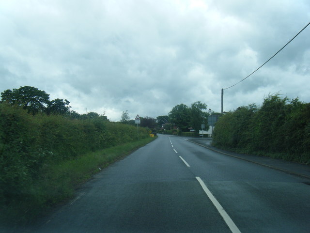
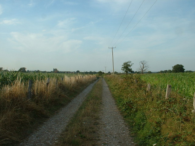
Babylon is a small village located in the county of Flintshire, Wales. Situated in the northern part of the country, it lies approximately 5 miles southwest of the town of Holywell. The village is nestled amidst picturesque rolling hills and offers stunning views of the surrounding countryside.

Babylon is a quaint and peaceful village with a close-knit community. It is predominantly a residential area, consisting of traditional stone-built houses and cottages. The village is known for its charming and well-maintained gardens, which add to its overall aesthetic appeal.

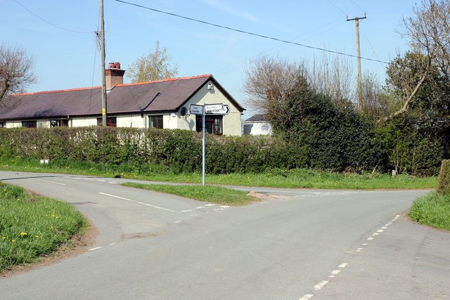
Despite its small size, Babylon has a few amenities to offer its residents. There is a local pub, providing a cozy and friendly atmosphere for locals and visitors alike. Additionally, the village has a small convenience store where basic necessities can be purchased.

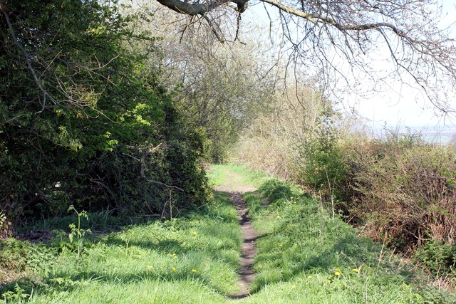
The surrounding area of Babylon is rich in natural beauty, making it an ideal location for outdoor enthusiasts. There are several walking and hiking trails nearby, allowing visitors to explore the stunning countryside. Additionally, the village is located not far from the coast, providing easy access to beautiful beaches and seaside towns.

Overall, Babylon is a serene and scenic village that offers a peaceful retreat from the hustle and bustle of city life. Its natural beauty, friendly community, and proximity to both rural and coastal attractions make it an appealing place to live or visit.

If you have any feedback on the listing, please let us know in the comments section below.
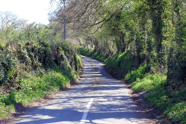
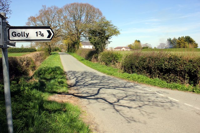
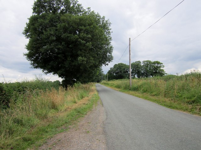
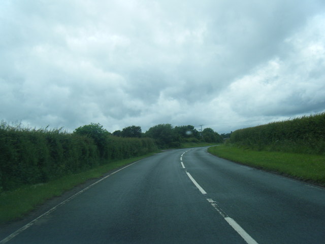
Babylon Images

Images are sourced within 2km of 53.141501/-3.008184 or Grid Reference SJ3260. Thanks to Geograph Open Source API. All images are credited.

Burton Lodge Farm Farm on Stringer's Lane near Honkley
Burton Lodge Farm
Farm on Stringer's Lane near Honkley
Benchmark at Bradbrook Farm, Kinnerton Ordnance Survey benchmark on a roadside barn at Bradbrook Farm, Kinnerton Road, Kinnerton. The mark was levelled at 62.045m above Newlyn Datum, verified in 1959. 
See also <a href="https://www.geograph.org.uk/photo/7454009">SJ3260 : Kinnerton Road by Bradbrook Farm</a> 
<span class="nowrap"><a title="https://www.bench-marks.org.uk/bm189931" rel="nofollow ugc noopener" href="https://www.bench-marks.org.uk/bm189931">Link</a><img style="margin-left:2px;" alt="External link" title="External link - shift click to open in new window" src="https://s1.geograph.org.uk/img/external.png" width="10" height="10"/></span>
Benchmark at Bradbrook Farm, Kinnerton
Ordnance Survey benchmark on a roadside barn at Bradbrook Farm, Kinnerton Road, Kinnerton. The mark was levelled at 62.045m above Newlyn Datum, verified in 1959. See also SJ3260 : Kinnerton Road by Bradbrook Farm LinkExternal link
Kinnerton Road by Bradbrook Farm Looking along the very straight Kinnerton Road, the barn on the right at Bradbrook Farm has an Ordnance Survey benchmark on the nearest corner <a href="https://www.geograph.org.uk/photo/7454001">SJ3260 : Benchmark at Bradbrook Farm, Kinnerton</a>
Kinnerton Road by Bradbrook Farm
Looking along the very straight Kinnerton Road, the barn on the right at Bradbrook Farm has an Ordnance Survey benchmark on the nearest corner SJ3260 : Benchmark at Bradbrook Farm, Kinnerton
Middle Lane, Kinnerton
Stone Bridge over Stringer's Brook The brook passes under the road at a sharp angle, hence the offset parapets.
Stone Bridge over Stringer's Brook
The brook passes under the road at a sharp angle, hence the offset parapets.
Sunken Lane Lane running from Town Ditch to Sandy Lane.  At the bottom of the hill, according to the map, it crosses the beginnings of a tributary of Stringer's Brook.
Sunken Lane
Lane running from Town Ditch to Sandy Lane. At the bottom of the hill, according to the map, it crosses the beginnings of a tributary of Stringer's Brook.
Farmland near Honkley Looking north taken from the footpath.
Farmland near Honkley
Looking north taken from the footpath.
Stringer's Brook Bridge on Stringer's Lane Stringer's Lane passing over Stringer's Brook as it heads towards Honkley.
Stringer's Brook Bridge on Stringer's Lane
Stringer's Lane passing over Stringer's Brook as it heads towards Honkley.
Kinnerton Road Kinnerton Road heading north east towards Higher Kinnerton.
Kinnerton Road
Kinnerton Road heading north east towards Higher Kinnerton.
Bridleway off Middle Lane
Bridleway off Middle Lane The bridleway gets a bit more overgrown here.
Bridleway off Middle Lane
The bridleway gets a bit more overgrown here.
Crossroads at Shordley Manor The junction of Middle Lane, Sandy Lane and Shordley Road.
Crossroads at Shordley Manor
The junction of Middle Lane, Sandy Lane and Shordley Road.
Sandy Lane Sandy Lane heading north east towards Higher Kinnerton.
Sandy Lane
Sandy Lane heading north east towards Higher Kinnerton.
Stringers Lane Stringers Lane from the junction with Sandy Lane.
Stringers Lane
Stringers Lane from the junction with Sandy Lane.
This way to Golly Signpost to Golly on Sandy Lane.
This way to Golly
Signpost to Golly on Sandy Lane.
Sandy Lane
Sandy Lane
Main Road west of Lower Kinnerton
Main Road approaching Kinnerton Lane junction
Show me another place!

Babylon is located at Grid Ref: SJ3260 (Lat: 53.141501, Lng: -3.008184)

Unitary Authority: Flintshire

Police Authority: North Wales

What 3 Words

///examples.trickles.bravery. Near Penyffordd, Flintshire

Nearby Locations

Babylon

Related Wikis

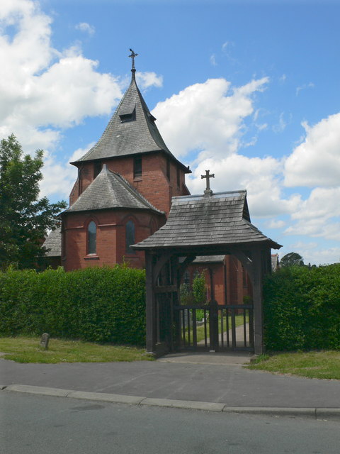
All Saints Church, Higher Kinnerton

All Saints Church is in Main Road, Higher Kinnerton, Flintshire, Wales. It is an active Anglican parish church in the Diocese of Chester, the archdeaconry...

Higher Kinnerton

Higher Kinnerton is a village and community within rural Flintshire, Wales, close to the Wales-England border. Its sister village, Lower Kinnerton, is...

Mold Railway

The Mold Railway was a railway company that built a line in north-east Wales. The line linked Mold to Chester and it opened on 14 August 1849. The company...

Kinnerton railway station

Kinnerton railway station was a station in Higher Kinnerton, Flintshire, Wales. The station was opened on 2 February 1891 and closed on 30 April 1962....

Nearby Amenities

Located within 500m of 53.141501,-3.008184
Higher Kinnerton
Name Cy: Kinnerton Uchaf
Name En: Higher Kinnerton
Place: village
Wikidata: Q5758202
Lat/Long: 53.1439618/-3.0034398
Post Office
Higher Kinnerton Post Office
Name Cy: Swyddfa'r Post Higher Kinnerton
Lat/Long: 53.1435357/-3.0035806
Grit Bin
Lat/Long: 53.1422851/-3.001601
Villagestore
Addr Housename: Villagestore
Addr Postcode: CH4 9AJ
Addr Street: Main Road
Shop: convenience
Lat/Long: 53.1432955/-3.004425
Bus Stop
Higher Kinnerton, Main Road / Higher Kinnerton Church
Bus: yes
Naptan AtcoCode: 5120AWD71287
Naptan Bearing: NE
Naptan CommonName: Higher Kinnerton Church
Naptan Crossing: Bennett`s Lane
Naptan Indicator: o/s
Naptan Landmark: All Saints` Church
Naptan LocalityName: Higher Kinnerton
Naptan NaptanCode: fliawpa
Naptan ShortCommonName: Higher Kinnerton Church
Naptan Street: Main Road
Public Transport: platform
Shelter: yes
Source: naptan_import
Lat/Long: 53.1436833/-3.0043043
Turning Circle
Turning Circle: knuckle
Lat/Long: 53.1425615/-3.004128
Direction: 195
Generator Method: photovoltaic
Generator Output Electricity: yes
Generator Solar Modules: 16
Generator Source: solar
Generator Type: solar_photovoltaic_panel
Location: roof
Power: generator
Lat/Long: 53.1434856/-3.0016483
Direction: SSW
Generator Method: photovoltaic
Generator Output Electricity: yes
Generator Solar Modules: 14
Generator Source: solar
Generator Type: solar_photovoltaic_panel
Location: roof
Power: generator
Lat/Long: 53.1437539/-3.007236
Direction: SSW
Generator Method: photovoltaic
Generator Output Electricity: yes
Generator Solar Modules: 11
Generator Source: solar
Generator Type: solar_photovoltaic_panel
Location: roof
Power: generator
Lat/Long: 53.1427654/-3.005919
Direction: SSW
Generator Method: photovoltaic
Generator Output Electricity: yes
Generator Solar Modules: 12
Generator Source: solar
Generator Type: solar_photovoltaic_panel
Location: roof
Power: generator
Lat/Long: 53.1430735/-3.0056119
Direction: 215
Generator Method: photovoltaic
Generator Output Electricity: yes
Generator Solar Modules: 16
Generator Source: solar
Generator Type: solar_photovoltaic_panel
Location: roof
Power: generator
Lat/Long: 53.1429174/-3.004539
Direction: 215
Generator Method: photovoltaic
Generator Output Electricity: yes
Generator Solar Modules: 16
Generator Source: solar
Generator Type: solar_photovoltaic_panel
Location: roof
Power: generator
Lat/Long: 53.1430923/-3.003907
Direction: 215
Generator Method: photovoltaic
Generator Output Electricity: yes
Generator Solar Modules: 16
Generator Source: solar
Generator Type: solar_photovoltaic_panel
Location: roof
Power: generator
Lat/Long: 53.1432957/-3.0042097
Direction: 125
Generator Method: photovoltaic
Generator Output Electricity: yes
Generator Solar Modules: 16
Generator Source: solar
Generator Type: solar_photovoltaic_panel
Location: roof
Power: generator
Lat/Long: 53.142007/-3.0042406
Direction: 215
Generator Method: photovoltaic
Generator Output Electricity: yes
Generator Solar Modules: 10
Generator Source: solar
Generator Type: solar_photovoltaic_panel
Location: roof
Power: generator
Lat/Long: 53.1422294/-3.0041715
Direction: 215
Generator Method: photovoltaic
Generator Output Electricity: yes
Generator Solar Modules: 12
Generator Source: solar
Generator Type: solar_photovoltaic_panel
Location: roof
Power: generator
Lat/Long: 53.1413305/-3.0068705
Post Box
Brand: Royal Mail
Brand Wikidata: Q638098
Brand Wikipedia: en:Royal Mail
Collection Times: Mo-Fr 16:00; Sa 11:15; Su off
Drive Through: no
Note: Priority Post Box
Operator: Royal Mail
Operator Wikidata: Q638098
Post Box Type: wall
Ref: CH4 220
Royal Cypher: GVIR
Royal Cypher Wikidata: Q33102169
Lat/Long: 53.1434942/-3.0035815
Defibrillator
Defibrillator Location: outside Kinnerton Village Hall
Emergency: defibrillator
Indoor: no
Lat/Long: 53.1437086/-3.0036499
Bus Stop
Higher Kinnerton, Main Road / Higher Kinnerton Church
Bus: yes
Naptan AtcoCode: 5120WDB22290
Naptan Bearing: SW
Naptan CommonName: Higher Kinnerton Church
Naptan Crossing: Bennett`s Lane
Naptan Indicator: opp
Naptan Landmark: All Saints` Church
Naptan LocalityName: Higher Kinnerton
Naptan NaptanCode: flimdwm
Naptan ShortCommonName: Higher Kinnerton Church
Naptan Street: Main Road
Public Transport: platform
Source: naptan_import
Lat/Long: 53.1433133/-3.0044751
Bus Stop
Higher Kinnerton, Bennett`s Lane / Higher Kinnerton Church
Bus: yes
Naptan AtcoCode: 5120FLX17072
Naptan Bearing: NW
Naptan BusStopType: CUS
Naptan CommonName: Higher Kinnerton Church
Naptan Crossing: Burton Drive
Naptan Indicator: after Post Office
Naptan Landmark: Higher Kinnerton Post Office
Naptan LocalityName: Higher Kinnerton
Naptan NaptanCode: fliawpd
Naptan ShortCommonName: Higher Kinnerton Post Office
Naptan Street: Bennett`s Lane
Public Transport: platform
Source: naptan_import
Lat/Long: 53.1434934/-3.0037802
Cafe
Walters
Cuisine: coffee_shop
Fixme: This building has three seperate parts - on the South side on Main Road is a private house, on the corner is Walters cafe and on Park Avenue is a residential building. The map needs editing to show this corrrectly.
Outdoor Seating: yes
Lat/Long: 53.1439456/-3.0042985
The data included in this document is from www.openstreetmap.org. The data is made available under ODbL.

Have you been to Babylon?

Leave your review of Babylon below (or comments, questions and feedback).