Purdom's Crook

Lake, Pool, Pond, Freshwater Marsh in Cumberland Carlisle

England

Purdom's Crook

Gate guardian of Norman's timberyard A nice piece of chain-saw art that catches the eye on the A8071 near Longtown; there is a partner on the opposite side of the entrance <a href="https://www.geograph.org.uk/photo/7158659">NY4066 : Gate guardian of Norman's timberyard</a>.
Gate guardian of Norman's timberyard Credit: M J Richardson

Purdom's Crook is a picturesque freshwater marsh located in Cumberland, a historic county in the northwest of England. It is known for its serene ambiance and abundant natural beauty. The crook is situated in close proximity to several other bodies of water, including a lake, a pool, and a pond, creating a diverse aquatic ecosystem.

The main attraction of Purdom's Crook is its freshwater marsh, which is a type of wetland characterized by the presence of constantly saturated or seasonally flooded soil. This unique habitat supports a wide variety of plant and animal species, making it a haven for nature enthusiasts and birdwatchers. The marsh is home to numerous water-loving plants such as reeds, rushes, and water lilies, which create a vibrant and verdant landscape.

The marsh also serves as an important breeding ground and feeding area for a myriad of bird species, including herons, ducks, swans, and geese. Visitors can observe these graceful creatures in their natural habitat, providing a unique opportunity for birdwatching and photography.

In addition to the freshwater marsh, Purdom's Crook boasts a lake, pool, and pond. These bodies of water provide further opportunities for outdoor activities such as fishing, boating, and even swimming during the warmer months.

Overall, Purdom's Crook in Cumberland offers a tranquil escape into nature, with its freshwater marsh, lake, pool, and pond providing a diverse range of recreational and ecological experiences for visitors to enjoy.

If you have any feedback on the listing, please let us know in the comments section below.

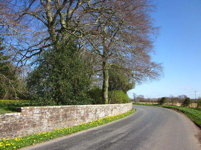
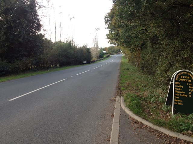
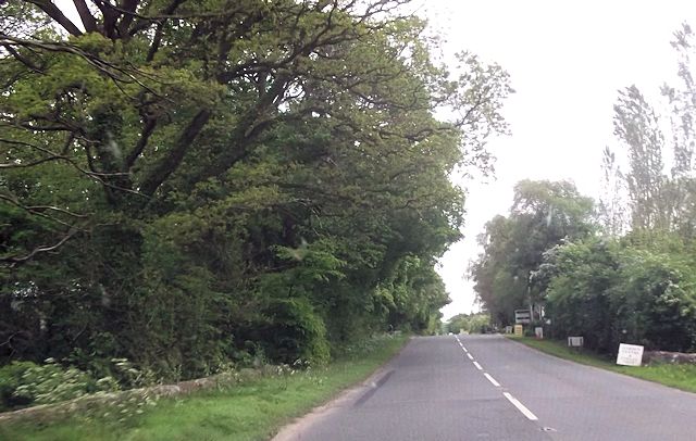
Purdom's Crook Images

Images are sourced within 2km of 54.980533/-2.9519793 or Grid Reference NY3965. Thanks to Geograph Open Source API. All images are credited.

Gate guardian of Norman's timberyard A nice piece of chain-saw art that catches the eye on the A8071 near Longtown; there is a partner on the opposite side of the entrance <a href="https://www.geograph.org.uk/photo/7158659">NY4066 : Gate guardian of Norman's timberyard</a>.
Gate guardian of Norman's timberyard
A nice piece of chain-saw art that catches the eye on the A8071 near Longtown; there is a partner on the opposite side of the entrance NY4066 : Gate guardian of Norman's timberyard.
Gate guardian of Norman's timberyard A nice piece of chain-saw art that catches the eye on the A8071 near Longtown; there is a partner on the opposite side of the entrance <a href="https://www.geograph.org.uk/photo/7158657">NY4066 : Gate guardian of Norman's timberyard</a>.
Gate guardian of Norman's timberyard
A nice piece of chain-saw art that catches the eye on the A8071 near Longtown; there is a partner on the opposite side of the entrance NY4066 : Gate guardian of Norman's timberyard.
Polythene landscape near Longtown The polythene warms the soil, in which maize has been sown. When harvested it will go to an anaerobic digester to produce methane <span class="nowrap"><a title="https://en.wikipedia.org/wiki/Anaerobic_digestion?msclkid=adb03555c6f511ecbf8c925041f224d" rel="nofollow ugc noopener" href="https://en.wikipedia.org/wiki/Anaerobic_digestion?msclkid=adb03555c6f511ecbf8c925041f224d">Link</a><img style="margin-left:2px;" alt="External link" title="External link - shift click to open in new window" src="https://s1.geograph.org.uk/img/external.png" width="10" height="10"/></span> , which can be used as a fuel.
Polythene landscape near Longtown
The polythene warms the soil, in which maize has been sown. When harvested it will go to an anaerobic digester to produce methane LinkExternal link , which can be used as a fuel.
Polythene landscape near Longtown The polythene warms the soil, in which maize has been sown. When harvested it will go to an anaerobic digester to produce methane  <span class="nowrap"><a title="https://en.wikipedia.org/wiki/Anaerobic_digestion?msclkid=adb03555c6f511ecbf8c925041f224d" rel="nofollow ugc noopener" href="https://en.wikipedia.org/wiki/Anaerobic_digestion?msclkid=adb03555c6f511ecbf8c925041f224d">Link</a><img style="margin-left:2px;" alt="External link" title="External link - shift click to open in new window" src="https://s1.geograph.org.uk/img/external.png" width="10" height="10"/></span> , which can be used as a fuel.
Polythene landscape near Longtown
The polythene warms the soil, in which maize has been sown. When harvested it will go to an anaerobic digester to produce methane LinkExternal link , which can be used as a fuel.
Polythene landscape near Longtown The polythene warms the soil, in which maize has been sown. When harvested it will go to an anaerobic digester to produce methane <span class="nowrap"><a title="https://en.wikipedia.org/wiki/Anaerobic_digestion?msclkid=adb03555c6f511ecbf8c925041f224d" rel="nofollow ugc noopener" href="https://en.wikipedia.org/wiki/Anaerobic_digestion?msclkid=adb03555c6f511ecbf8c925041f224d">Link</a><img style="margin-left:2px;" alt="External link" title="External link - shift click to open in new window" src="https://s1.geograph.org.uk/img/external.png" width="10" height="10"/></span> , which can be used as a fuel. Beyond are poultry houses at Lynemoor.
Polythene landscape near Longtown
The polythene warms the soil, in which maize has been sown. When harvested it will go to an anaerobic digester to produce methane LinkExternal link , which can be used as a fuel. Beyond are poultry houses at Lynemoor.
Road beside Alstonby Hall
A6071 near Longtown
A6071 near Longtown
Garden Centre entrance from A6071
Grassland and Down by Rigg Farm
Grassland by Down by Rigg Farm
Road, Alstonbury
Road, Alstonbury
Alstonby Villa
Alstonby Villa
Field of plastic strips By Alstonby Bridge.
Field of plastic strips
By Alstonby Bridge.
Alstonby Hall Farm
Alstonby Hall Farm
Alstonby Hall Lodge 19th century former shooting lodge attached to Alstonby Hall, now let as a holiday cottage.
Alstonby Hall Lodge
19th century former shooting lodge attached to Alstonby Hall, now let as a holiday cottage.
Chainsaw maiden Standing outside a timber yard on the A6071 at Lynemoor.
Chainsaw maiden
Standing outside a timber yard on the A6071 at Lynemoor.
Whitesike Garden Centre Garden centre and cafe beside the A6071.
Whitesike Garden Centre
Garden centre and cafe beside the A6071.
Junction of minor roads at Rigg
Show me another place!

Purdom's Crook is located at Grid Ref: NY3965 (Lat: 54.980533, Lng: -2.9519793)

Administrative County: Cumbria

District: Carlisle

Police Authority: Cumbria

What 3 Words

///wrist.educates.stalemate. Near Longtown, Cumbria

Nearby Locations

Purdom's Crook

Related Wikis

Westlinton

Westlinton (or West Linton) is a small village and civil parish in Cumbria, England. It is in the City of Carlisle district, and is located north of Carlisle...

Lyneside railway station

Lyneside railway station served the hamlet of West Linton, Cumbria, England, from 1861 to 1964 on the Waverley Line. == History == The station opened sometime...

River Esk, Dumfries and Galloway

The River Esk (Scottish Gaelic: Easg), also known as the Border Esk, is a river in Dumfries and Galloway, Scotland, that enters the English county of Cumbria...

River Lyne

The River Lyne is a river of Cumbria in England. The river is formed near the hamlet of Stapleton, five miles west of Bewcastle, by the confluence of the...

Longtown, Cumbria

Longtown is a market town in Cumbria, England, just south of the Scottish Border. It has a sheep market which was at the centre of the 2001 United Kingdom...

RAF Longtown

Royal Air Force Longtown or more simply RAF Longtown is a former Royal Air Force satellite station located 2 miles (3.2 km) east of Longtown, Cumbria and...

Todhills, Cumbria

Todhills is a small village on the outskirts of Carlisle, Cumbria, England. The village's name is from Old English tota-hyll "look-out hill". Located north...

Blackford, Cumbria

Blackford is a village in Cumbria, England, close to Gretna, Scotland. == Etymology == Blackford means what it says, a black ford or river-crossing. However...

Related Videos

Adventure on the River Esk, Longtown. Big Herons filmed, may catch Salmon and Trout before YOU do!

We are using Subtitles to relay information about this area. In your YouTube settings please set up your Subtitles and Select your ...

Westerby Mister Stardust

Legyield E57 Blackdyke.

Nearby Amenities

Located within 500m of 54.980533,-2.9519793
Barrier: yes
Lat/Long: 54.984804/-2.9508593
Created By: Merkaartor 0.12
Lat/Long: 54.981294/-2.9515809
Created By: Merkaartor 0.12
Lat/Long: 54.98202/-2.9507319
Created By: Merkaartor 0.12
Lat/Long: 54.9825399/-2.9502889
Created By: Merkaartor 0.12
Lat/Long: 54.9829454/-2.950108
Telephone
Booth: KX100
Covered: booth
Source: survey
Lat/Long: 54.9841044/-2.9504735
Bus Stop
Sandysike
Bus: yes
Naptan AtcoCode: 090033011788
Naptan Bearing: S
Naptan CommonName: Sandysike
Naptan Indicator: near
Naptan Landmark: Sandysike Junction
Naptan NaptanCode: cumamjda
Naptan Street: A7(T)
Public Transport: platform
Ref: 90033011788
Shelter: yes
Source: NaPTAN
Lat/Long: 54.9835291/-2.9519514
Post Box
Post Box Mounting: telegraph_pole
Post Box Type: lamp
Ref: CA6 316
Lat/Long: 54.9842848/-2.9505644
Sandysike
Place: hamlet
Lat/Long: 54.9839007/-2.9499961
Power: tower
Lat/Long: 54.9785113/-2.9450331
Power: tower
Lat/Long: 54.9804101/-2.9458612
Power: tower
Lat/Long: 54.9826797/-2.9468511
Power: pole
Lat/Long: 54.9771647/-2.9569759
Power: pole
Lat/Long: 54.9776157/-2.9462248
Power: pole
Lat/Long: 54.978424/-2.9461889
Power: pole
Lat/Long: 54.9789629/-2.9461721
Power: pole
Lat/Long: 54.9795747/-2.946129
Power: pole
Lat/Long: 54.9802662/-2.9460978
Power: pole
Lat/Long: 54.9810717/-2.946438
Power: pole
Lat/Long: 54.9816505/-2.9467063
Power: pole
Lat/Long: 54.9825234/-2.9470776
Power: pole
Lat/Long: 54.982867/-2.9472357
Power: pole
Lat/Long: 54.9837248/-2.9476238
Power: pole
Lat/Long: 54.9800036/-2.9462392
Power: pole
Lat/Long: 54.9797768/-2.9475256
Power: pole
Lat/Long: 54.9846045/-2.948879
Power: pole
Lat/Long: 54.9835866/-2.94989
Power: pole
Lat/Long: 54.9806751/-2.9446845
The data included in this document is from www.openstreetmap.org. The data is made available under ODbL.

Have you been to Purdom's Crook?

Leave your review of Purdom's Crook below (or comments, questions and feedback).