Boat Pool

Lake, Pool, Pond, Freshwater Marsh in Dumfriesshire

Scotland

Boat Pool

The Tarras Water Looking upstream from the B6318 bridge over, with about 800 m to go before it joins the River Esk.
The Tarras Water Credit: M J Richardson

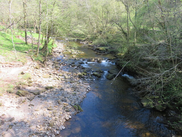
Boat Pool is a picturesque freshwater marsh located in Dumfriesshire, Scotland. Nestled amidst rolling hills and surrounded by lush greenery, this stunning body of water offers a serene and tranquil setting for nature enthusiasts and visitors alike.

Covering an area of approximately 10 acres, Boat Pool is a haven for a diverse range of flora and fauna. The pool itself is fed by several small streams and natural springs, ensuring a constant flow of fresh water. The water is crystal clear and teeming with life, making it ideal for fishing and wildlife observation.

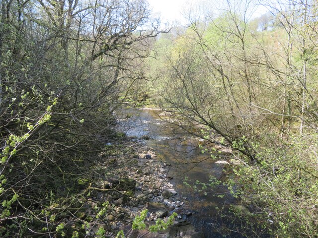
Boat Pool is home to a wide variety of aquatic plants, such as water lilies, reeds, and rushes, which provide vital shelter and breeding grounds for many species of birds, insects, and amphibians. Visitors can witness the vibrant colors of dragonflies darting over the water's surface or catch a glimpse of a rare bird species as it gracefully glides through the air.

The surrounding area boasts well-maintained walking trails, allowing visitors to explore the marshland and enjoy the breathtaking views. There are several designated fishing spots along the pool, attracting both seasoned anglers and beginners looking to cast their lines.

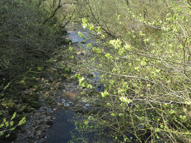
For those seeking a peaceful retreat, Boat Pool offers a tranquil escape from the hustle and bustle of everyday life. With its natural beauty and abundant wildlife, this freshwater marsh provides a serene environment for relaxation, exploration, and appreciation of the wonders of nature.

If you have any feedback on the listing, please let us know in the comments section below.
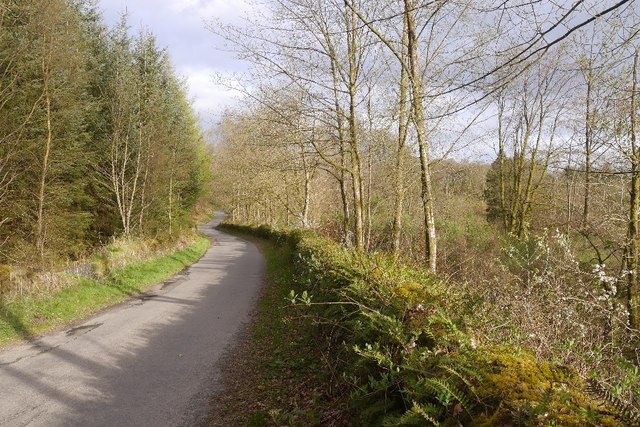
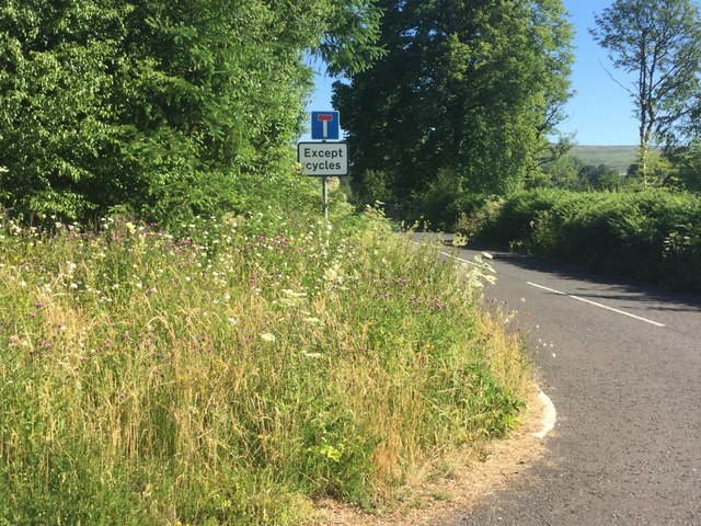
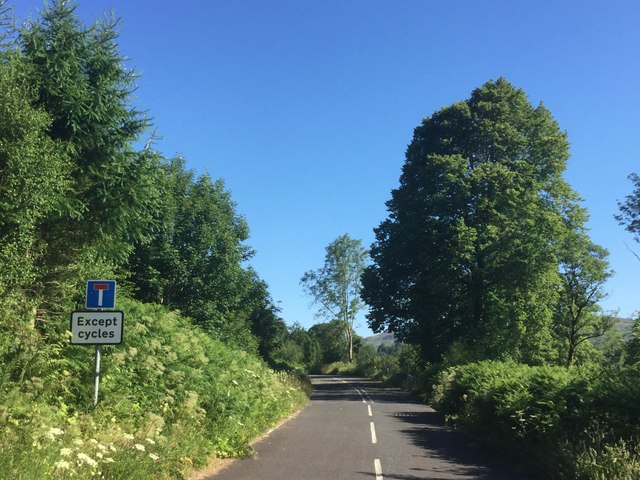
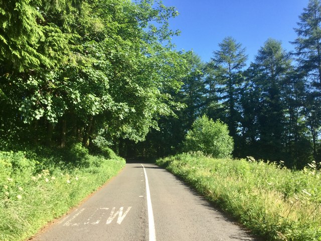
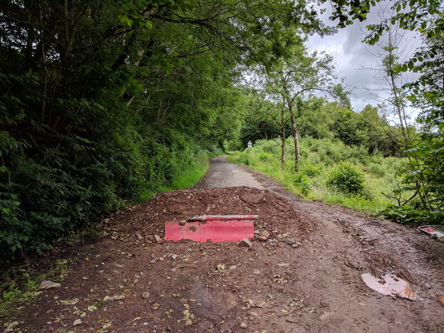
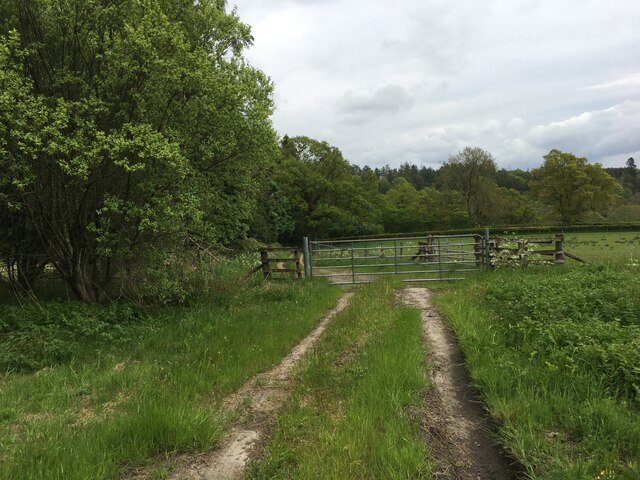
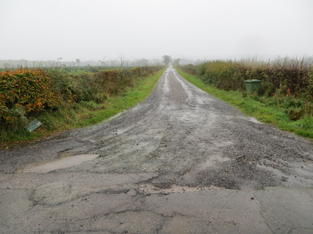
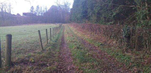
Boat Pool Images

Images are sourced within 2km of 55.115711/-2.9799166 or Grid Reference NY3780. Thanks to Geograph Open Source API. All images are credited.

The Tarras Water Looking upstream from the B6318 bridge over, with about 800 m to go before it joins the River Esk.
The Tarras Water
Looking upstream from the B6318 bridge over, with about 800 m to go before it joins the River Esk.
The Tarras Water Looking downstream from the B6318 bridge over, with about 800 m to go before it joins the River Esk.
The Tarras Water
Looking downstream from the B6318 bridge over, with about 800 m to go before it joins the River Esk.
The Tarras Water Looking downstream from the B6318 bridge over, with about 800 m to go before it joins the River Esk. The light green on the nearby twigs are fruits of an overhanging Elm.
The Tarras Water
Looking downstream from the B6318 bridge over, with about 800 m to go before it joins the River Esk. The light green on the nearby twigs are fruits of an overhanging Elm.
A7 towards Langholm
A7 towards Langholm
B6318 The B6318 has been closed for a long time, but this bit was accessible from Langholm.  We have family connections here so were having a quick look around during a long journey home.
B6318
The B6318 has been closed for a long time, but this bit was accessible from Langholm. We have family connections here so were having a quick look around during a long journey home.
The old A7 Now replaced by a wide and straight route above, this is the former alignment near the Esk, downstream of Langholm. Some of the old road is accessible as a through loop, this bit narrows to a path at the north end.
The old A7
Now replaced by a wide and straight route above, this is the former alignment near the Esk, downstream of Langholm. Some of the old road is accessible as a through loop, this bit narrows to a path at the north end.
Old A7 Now a loop road below the modern alignment south of Langholm.
Old A7
Now a loop road below the modern alignment south of Langholm.
Road closed because of subsidence
Road (B6318) at Upper Mumbie Looking north-westward.
Road (B6318) at Upper Mumbie
Looking north-westward.
Ordnance Survey Cut Mark This mark can be found on the wall of a roadside building at Upper Mumbie Farm. The benchmark height is recorded as being 102.927 metres above sea level.
For more detail see : <span class="nowrap"><a title="https://www.bench-marks.org.uk/bm43287" rel="nofollow ugc noopener" href="https://www.bench-marks.org.uk/bm43287">Link</a><img style="margin-left:2px;" alt="External link" title="External link - shift click to open in new window" src="https://s1.geograph.org.uk/img/external.png" width="10" height="10"/></span>
Ordnance Survey Cut Mark
This mark can be found on the wall of a roadside building at Upper Mumbie Farm. The benchmark height is recorded as being 102.927 metres above sea level. For more detail see : LinkExternal link
Upper Mumbie, Farm Building Farm building at Upper Mumbie Farm, named as Upper Mumbiehirst on maps prior to the mid-1950's. There is an OS cut benchmark on this building - <span class="nowrap"><a title="https://www.bench-marks.org.uk/bm43287" rel="nofollow ugc noopener" href="https://www.bench-marks.org.uk/bm43287">Link</a><img style="margin-left:2px;" alt="External link" title="External link - shift click to open in new window" src="https://s1.geograph.org.uk/img/external.png" width="10" height="10"/></span>
Upper Mumbie, Farm Building
Farm building at Upper Mumbie Farm, named as Upper Mumbiehirst on maps prior to the mid-1950's. There is an OS cut benchmark on this building - LinkExternal link
Benchmark at Upper Mumbie Ordnance Survey benchmark on a farm building at Upper Mumbie Farm - <span class="nowrap"><a title="https://www.bench-marks.org.uk/bm43287" rel="nofollow ugc noopener" href="https://www.bench-marks.org.uk/bm43287">Link</a><img style="margin-left:2px;" alt="External link" title="External link - shift click to open in new window" src="https://s1.geograph.org.uk/img/external.png" width="10" height="10"/></span>
Benchmark at Upper Mumbie
Ordnance Survey benchmark on a farm building at Upper Mumbie Farm - LinkExternal link
Gated farm track near Enthorn
Flowers by the A7 Spare ground between the new and old A7.
Flowers by the A7
Spare ground between the new and old A7.
Between old and new Partly wooded land between the new A7 and the older alignment by Haggs.
Between old and new
Partly wooded land between the new A7 and the older alignment by Haggs.
Track from road (B6318) leading to Glencartholm Looking south-westward.
Track from road (B6318) leading to Glencartholm
Looking south-westward.
Track near Enthorn Rough track near Enthorn.
Track near Enthorn
Rough track near Enthorn.
Show me another place!

Boat Pool is located at Grid Ref: NY3780 (Lat: 55.115711, Lng: -2.9799166)

Unitary Authority: Dumfries and Galloway

Police Authority: Dumfries and Galloway

What 3 Words

///nasal.detonated.holds. Near Langholm, Dumfries & Galloway
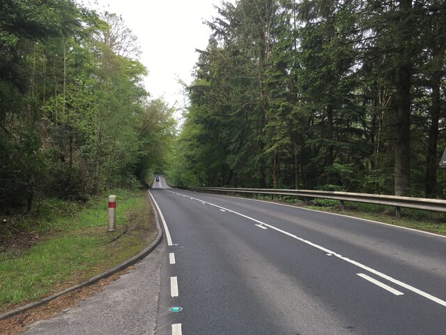
Related Wikis

Glencartholm

Glencartholm is a location in Dumfries and Galloway, southern Scotland, along the River Esk.The Glencartholm Volcanic Beds contain a Palaeozoic (specifically...
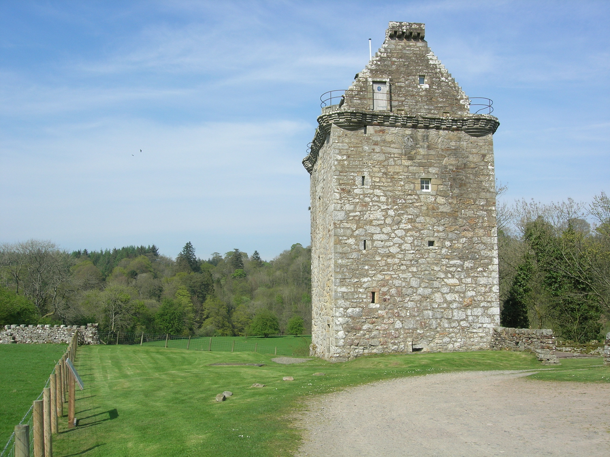
Gilnockie Tower

Gilnockie Tower is a 16th-century tower house, located at the hamlet of Hollows, 2.3 km north of Canonbie, in Dumfriesshire, south-west Scotland. The tower...

Gilnockie railway station

Gilnockie railway station served the hamlet of Hollows, Dumfries and Galloway, Scotland from 1864 to 1967 on the Border Union Railway. == History == The...

Fairy Loup

Fairy Loup is a waterfall located on Byre Burn, a tributary of River Esk, in Dumfries and Galloway, Scotland.The waterfall's name originates in a local...

Langholm railway station

Langholm railway station served the burgh of Langholm, Dumfries and Galloway, Scotland from 1864 to 1967 on the Border Union Railway. == History == The...

Wauchope Castle

Wauchope Castle was a castle located at Wauchope, in Dumfries and Galloway, Scotland. The castle was a stronghold of the Lindsay family. It was the caput...

Battle of Arkinholm

The Battle of Arkinholm was fought on 1 May 1455, at Arkinholm near Langholm in Scotland, during the reign of King James II of Scotland. Although a small...

Langholm Town Hall

Langholm Town Hall is a municipal building in the High Street in Langholm, Dumfries and Galloway, Scotland. The structure, which is used as a community...

Nearby Amenities

Located within 500m of 55.115711,-2.9799166
Auchenrivock
Naptan AtcoCode: 680000639111
Naptan Bearing: NW
Naptan BusStopType: CUS
Naptan CommonName: Auchenrivock
Naptan Indicator: Road End
Naptan Landmark: Auchenrivock
Naptan NaptanCode: 34237543
Naptan Notes: none
Naptan Street: A7
Naptan Verified: no
Source: naptan_import
Lat/Long: 55.1157691/-2.9847732
Auchenrivock
Naptan AtcoCode: 680000639222
Naptan Bearing: SE
Naptan BusStopType: CUS
Naptan CommonName: Auchenrivock
Naptan Indicator: opp Road End
Naptan Landmark: Auchenrivock
Naptan NaptanCode: 34237545
Naptan Notes: none
Naptan Street: A7
Naptan Verified: no
Source: naptan_import
Lat/Long: 55.1157886/-2.9845855
Irvine House
Rapids: 3
Waterway: rapids
Lat/Long: 55.1147392/-2.981156
Power: pole
Lat/Long: 55.1123334/-2.976216
Power: pole
Lat/Long: 55.1140101/-2.9770448
Power: pole
Lat/Long: 55.1138897/-2.9778213
Power: pole
Lat/Long: 55.1183168/-2.974836
Power: pole
Lat/Long: 55.1145655/-2.9773425
Power: pole
Lat/Long: 55.1153724/-2.976747
Power: pole
Lat/Long: 55.1159952/-2.9762857
Power: pole
Lat/Long: 55.1169095/-2.9765217
Power: pole
Lat/Long: 55.1178544/-2.9767256
Power: pole
Lat/Long: 55.1189526/-2.9769777
Power: pole
Lat/Long: 55.1197073/-2.9771708
Power: pole
Lat/Long: 55.1188144/-2.9773843
Power: pole
Lat/Long: 55.1180222/-2.9794958
Power: pole
Lat/Long: 55.1175377/-2.9801781
Power: pole
Lat/Long: 55.1170576/-2.9808219
Power: pole
Lat/Long: 55.1167881/-2.9819574
Power: pole
Lat/Long: 55.1171033/-2.9830878
Power: pole
Lat/Long: 55.1174405/-2.9841281
Power: pole
Lat/Long: 55.1177659/-2.9852199
Power: pole
Lat/Long: 55.1177674/-2.9859486
Power: pole
Lat/Long: 55.1166644/-2.984074
Power: pole
Lat/Long: 55.1163434/-2.9848053
Power: pole
Lat/Long: 55.116012/-2.9853538
The data included in this document is from www.openstreetmap.org. The data is made available under ODbL.

Have you been to Boat Pool?

Leave your review of Boat Pool below (or comments, questions and feedback).