Listerheugh Stream

Lake, Pool, Pond, Freshwater Marsh in Peeblesshire

Scotland

Listerheugh Stream

Caberston Coffee Shop, Walkerburn This coffee shop is located on the north side of the A72 in the village centre.
Caberston Coffee Shop, Walkerburn Credit: Walter Baxter

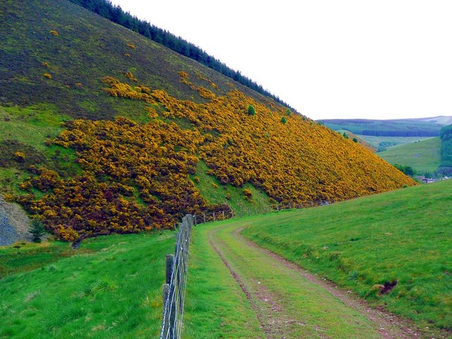
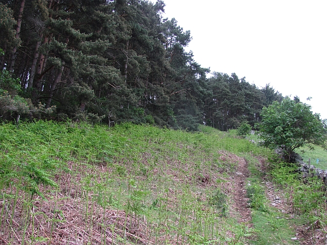
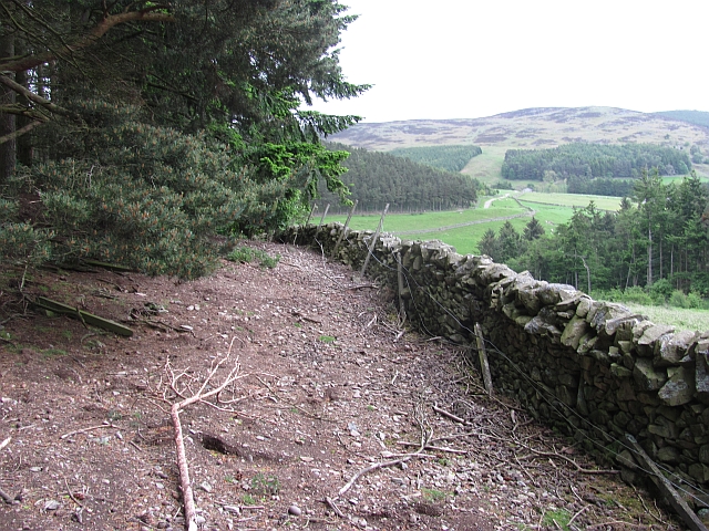
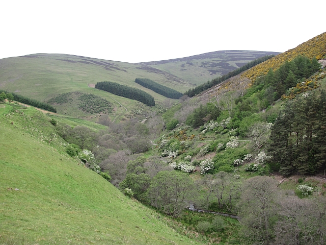
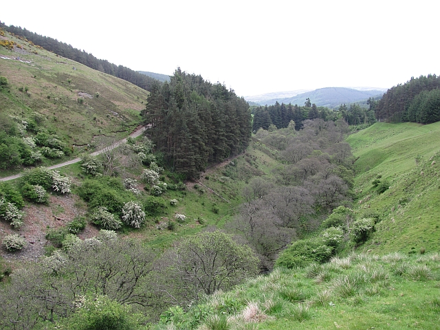
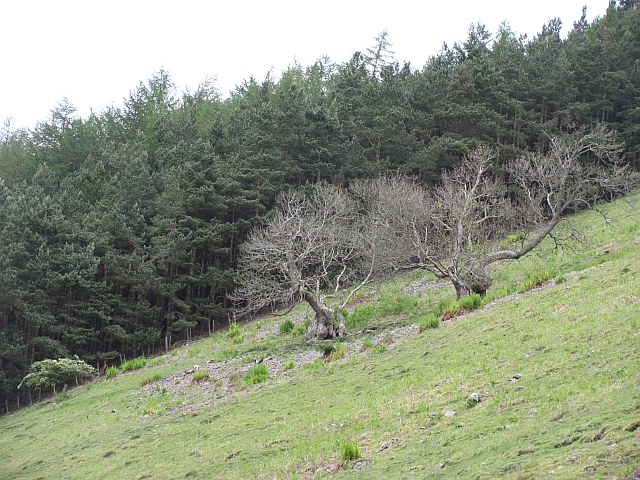
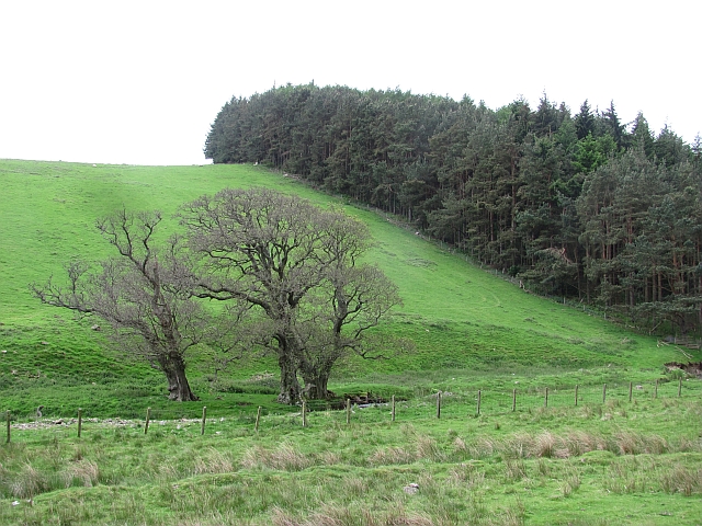
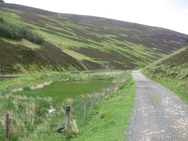
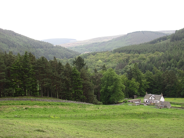
Listerheugh Stream is a freshwater stream located in Peeblesshire, a historic county in the southern part of Scotland. The stream is situated in the scenic and picturesque countryside, surrounded by lush greenery and rolling hills.

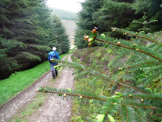
Spanning approximately 5 miles in length, Listerheugh Stream is a vital tributary of the River Tweed, which is one of the most renowned salmon fishing rivers in Scotland. The stream originates from the hills near Glentress Forest and flows through a mixture of farmland and woodland before joining the River Tweed near the town of Peebles.

Listerheugh Stream is characterized by its crystal-clear, unpolluted water, which supports a diverse and thriving ecosystem. It serves as a habitat for a wide variety of aquatic creatures, including salmon, trout, and various species of freshwater invertebrates. The stream's clean waters also attract a range of bird species, making it an excellent spot for birdwatching.

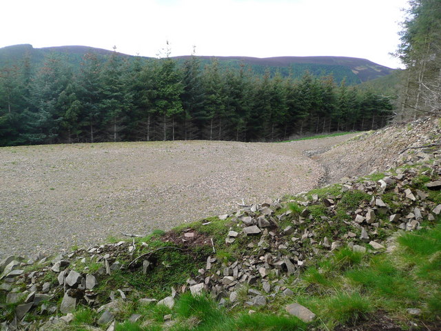
Along the banks of Listerheugh Stream, there are occasional pools, ponds, and freshwater marshes, which provide additional habitats for a variety of flora and fauna. These wetland areas support a rich diversity of plant species, such as reeds, sedges, and water lilies, which in turn attract dragonflies, frogs, and other wetland creatures.

Listerheugh Stream is a popular destination for nature enthusiasts, anglers, and those seeking a tranquil environment to unwind and enjoy the beauty of the Scottish countryside. Its idyllic setting, coupled with its importance as a tributary of the River Tweed, makes it a valuable and cherished natural asset within the region.

If you have any feedback on the listing, please let us know in the comments section below.

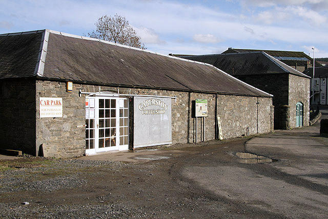
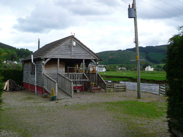
Listerheugh Stream Images

Images are sourced within 2km of 55.625062/-2.999672 or Grid Reference NT3737. Thanks to Geograph Open Source API. All images are credited.

Caberston Coffee Shop, Walkerburn This coffee shop is located on the north side of the A72 in the village centre.
Caberston Coffee Shop, Walkerburn
This coffee shop is located on the north side of the A72 in the village centre.
Superior fishing hut on the Tweed Fishing the Tweed for salmon can be expensive, and clients expect decent facilities.  This hut provides shelter and a seat when break time comes.  Note the rod support outside between the two sets of steps.
Superior fishing hut on the Tweed
Fishing the Tweed for salmon can be expensive, and clients expect decent facilities. This hut provides shelter and a seat when break time comes. Note the rod support outside between the two sets of steps.
Gorse in exuberant form above Walkerburn
Budding conifers on the Priesthope track Approaching Walkerburn
Budding conifers on the Priesthope track
Approaching Walkerburn
Forest track development above Walkerburn A huge metalled turning area at the end of the forest track has been created here by extensive excavation.  The forest appears mature and this may signify imminent harvesting.
Forest track development above Walkerburn
A huge metalled turning area at the end of the forest track has been created here by extensive excavation. The forest appears mature and this may signify imminent harvesting.
The lower cairn on Cairn Hill
The summit cairn on Cairn Hill The building blocks in the background are all that remain of a radio mast base.
The summit cairn on Cairn Hill
The building blocks in the background are all that remain of a radio mast base.
Quad bike track, Gatehopeknowe It runs up Pyat Hill and is a very useful way on to the hill or to Gate Hope avoiding the houses.
Quad bike track, Gatehopeknowe
It runs up Pyat Hill and is a very useful way on to the hill or to Gate Hope avoiding the houses.
Woodland edge, Gatehopeknowe A useful way into Gate Hope, but watch the rabbit holes. This is death to ankles. There must be some well fed buzzards hereabouts.
Woodland edge, Gatehopeknowe
A useful way into Gate Hope, but watch the rabbit holes. This is death to ankles. There must be some well fed buzzards hereabouts.
Gate Hope A very beautiful glen, north of the Tweed.  I spend a lot of time on Windlestraw Law and this has to be the best way up I have yet found.
Gate Hope
A very beautiful glen, north of the Tweed. I spend a lot of time on Windlestraw Law and this has to be the best way up I have yet found.
Gate Hope A well wooded, hidden glen north of the Tweed. A grassy track runs up the west side and the main estate and house access road runs up the eastern side.
Gate Hope
A well wooded, hidden glen north of the Tweed. A grassy track runs up the west side and the main estate and house access road runs up the eastern side.
Kill Brae It would be a Killer Brae if you tried to run up it. Ashes on a steep scree slope on the east side of Gate Hope.
Hope is word in common usage along both of England's borders and in Northwest England. Usually it means a steep sided and often blind valley.
Kill Brae
It would be a Killer Brae if you tried to run up it. Ashes on a steep scree slope on the east side of Gate Hope. Hope is word in common usage along both of England's borders and in Northwest England. Usually it means a steep sided and often blind valley.
Trees, Gatehopeknowe Burn Look like the same trees as here: <a href="https://www.geograph.org.uk/photo/162214">NT3738 : Trees, Gatehopeknowe Burn</a>
Summer is here, but alders are late coming to leaf.  Gate Hope has some extensive alder woods along the burn.
Trees, Gatehopeknowe Burn
Look like the same trees as here: NT3738 : Trees, Gatehopeknowe Burn Summer is here, but alders are late coming to leaf. Gate Hope has some extensive alder woods along the burn.
Flight pool, Gate Hope A Summer view of the pool here: <a href="https://www.geograph.org.uk/photo/162222">NT3739 : Duckpond, Gatehopeknowe Burn</a>. The shallow pool has been colonised by horsetails. There is a nesting raft in the pool but no residents.
Flight pool, Gate Hope
A Summer view of the pool here: NT3739 : Duckpond, Gatehopeknowe Burn. The shallow pool has been colonised by horsetails. There is a nesting raft in the pool but no residents.
Gatehopeknowe View down a well wooded stretch of Tweeddale past Gatehopeknowe.
Gatehopeknowe
View down a well wooded stretch of Tweeddale past Gatehopeknowe.
Track, Gate Hope A grassy track runs up the western side of Gate Hope. The main access to the glen is by a bigger, well surfaced road from Holylee on the eastern side.
Track, Gate Hope
A grassy track runs up the western side of Gate Hope. The main access to the glen is by a bigger, well surfaced road from Holylee on the eastern side.
Back Burn A wooded section of Gate Hope where the Back Burn meets the Gatehopeburn.
Back Burn
A wooded section of Gate Hope where the Back Burn meets the Gatehopeburn.
Ridge above Early Hope A long ridge running down from the Cairn Hill to Scawd Law ridge. This is a far gentler slope than most around here.
Ridge above Early Hope
A long ridge running down from the Cairn Hill to Scawd Law ridge. This is a far gentler slope than most around here.
Show me another place!

Listerheugh Stream is located at Grid Ref: NT3737 (Lat: 55.625062, Lng: -2.999672)

Unitary Authority: The Scottish Borders

Police Authority: The Lothians and Scottish Borders

What 3 Words

///mops.bookcases.multiple. Near Innerleithen, Scottish Borders

Related Wikis

Walkerburn railway station

Walkerburn railway station served the village of Walkerburn, Scottish Borders, Scotland from 1867 to 1962 on the Peebles Railway. == History == The station...

Walkerburn

Walkerburn (Scottish Gaelic: Allt an Fhùcadair) is a small village in the Scottish Borders area of Scotland, on the A72 about 8 miles (13 km) from Peebles...

The Kirna

The Kirna, known locally as Kirna House (previously also as Grangehill), is a Category A listed villa in Walkerburn, Peeblesshire, Scotland. It is one...

Innerleithen

Innerleithen (Scottish Gaelic: Inbhir Leitheann) is a civil parish and a small town in the committee area of Tweeddale, in the Scottish Borders. It was...

Robert Smail's Printing Works

Robert Smail's Printing Works is a fully functional Victorian era letterpress printing works in the small Scottish Borders town of Innerleithen, now preserved...

Innerleithen railway station

Innerleithen railway station served the town of Innerleithen, Scottish Borders, Scotland from 1864 to 1962 on the Peebles Railway. == History == The station...

Vale of Leithen F.C.

Vale of Leithen Football Club are a football club based in the town of Innerleithen, Scotland. They play in the East of Scotland League First Division...

Thornielee railway station

Thornielee railway station served the smallholding of Thornielee, Scottish Borders, Scotland from 1866 to 1950 on the Peebles Railway. == History == The...

Nearby Amenities

Located within 500m of 55.625062,-2.999672
Bus Stop
Scottish Water
Bench: no
Bin: no
Bus: yes
Naptan AtcoCode: 69001444
Naptan Bearing: E
Naptan CommonName: Scottish Water
Naptan Indicator: opp
Naptan NaptanCode: 72726787
Naptan Street: A72
Operator: Scottish Borders Council
Public Transport: platform
Ref: 69001444
Shelter: no
Source: NaPTAN
Tactile Paving: no
Lat/Long: 55.6260884/-3.0064871
Noexit: yes
Lat/Long: 55.6267811/-3.0020381
Noexit: yes
Lat/Long: 55.6269995/-3.0021939
Power: pole
Lat/Long: 55.6274636/-2.99312
Power: pole
Lat/Long: 55.6270906/-2.9943117
Power: pole
Lat/Long: 55.626696/-2.9954397
Power: pole
Lat/Long: 55.6262451/-2.9967588
Power: pole
Lat/Long: 55.6278307/-3.001338
Power: pole
Lat/Long: 55.6274192/-3.0006717
Power: pole
Lat/Long: 55.6270366/-3.0000519
Power: pole
Lat/Long: 55.6265809/-2.9991847
Power: pole
Lat/Long: 55.6261886/-2.9984125
Power: pole
Lat/Long: 55.6258145/-2.9976298
Power: pole
Lat/Long: 55.6252586/-2.9986749
Power: pole
Lat/Long: 55.6246865/-2.9997572
Power: pole
Lat/Long: 55.6242643/-3.0012835
Power: pole
Lat/Long: 55.6240754/-3.0026897
Power: pole
Lat/Long: 55.6238823/-3.0038963
Power: pole
Lat/Long: 55.6236478/-3.0053482
Power: pole
Lat/Long: 55.6233972/-3.0068086
Power: pole
Lat/Long: 55.6282941/-3.0020255
Power: pole
Lat/Long: 55.628595/-3.0025713
Power: pole
Lat/Long: 55.6272635/-3.001448
Power: pole
Lat/Long: 55.6230762/-2.9995442
Power: pole
Lat/Long: 55.6234118/-2.999007
Power: pole
Lat/Long: 55.6237355/-2.998476
Power: pole
Lat/Long: 55.6241451/-2.9977949
Power: pole
Lat/Long: 55.6245369/-2.9971285
Power: pole
Lat/Long: 55.6248474/-2.9970397
Power: pole
Lat/Long: 55.6251245/-2.9969551
Power: pole
Lat/Long: 55.6260967/-2.9940381
The data included in this document is from www.openstreetmap.org. The data is made available under ODbL.

Have you been to Listerheugh Stream?

Leave your review of Listerheugh Stream below (or comments, questions and feedback).