Elter Water

Lake, Pool, Pond, Freshwater Marsh in Westmorland South Lakeland

England

Elter Water

Rainbow and Loughrigg Fell - from Crag Head
Rainbow and Loughrigg Fell - from Crag Head Credit: Ian Cunliffe

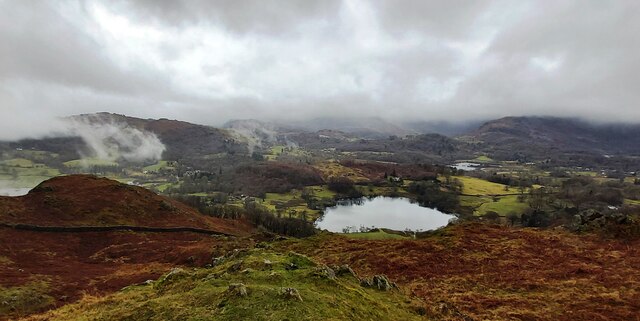
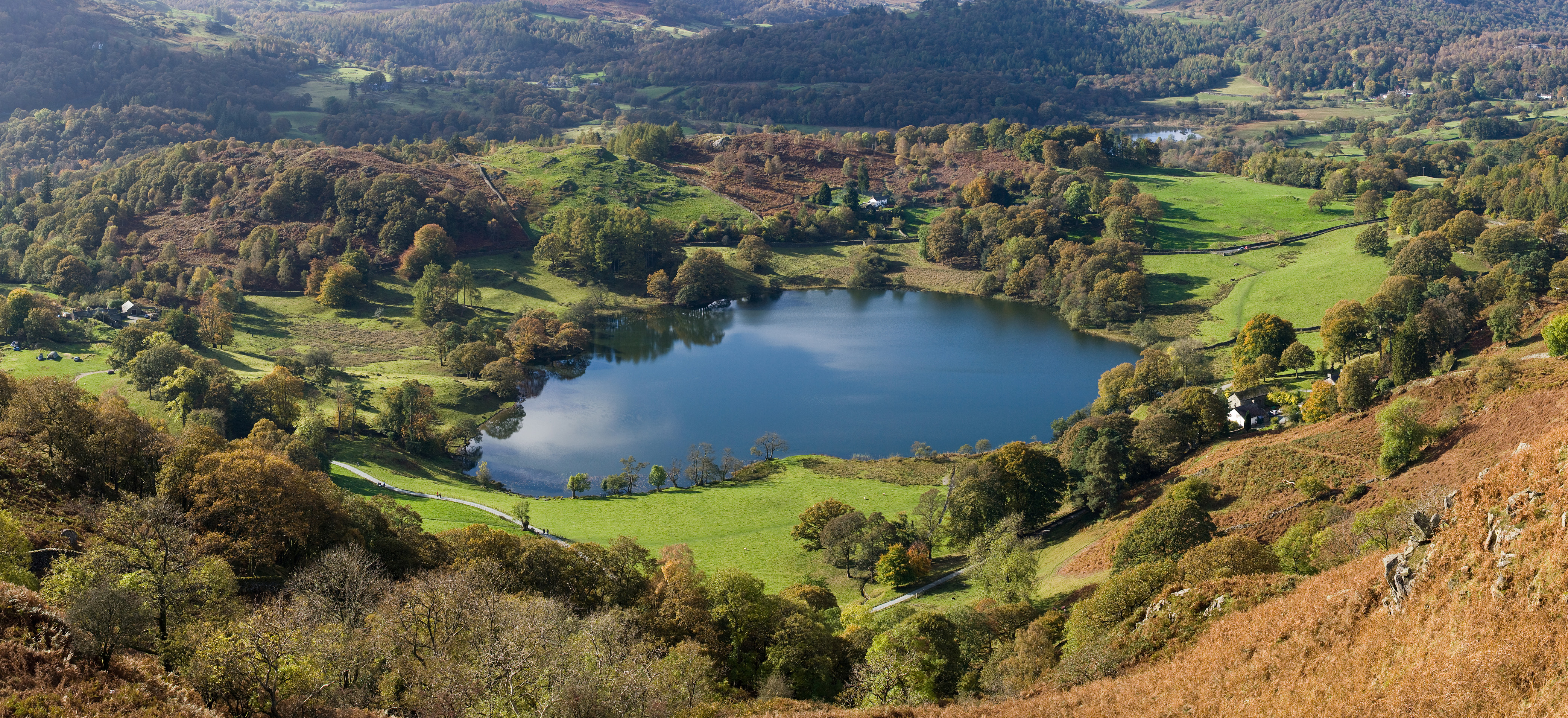
Elter Water is a picturesque body of water located in the county of Westmorland, England. Situated in the Lake District National Park, it is widely regarded as one of the most beautiful and tranquil spots in the region.

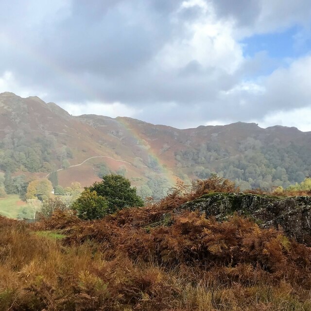
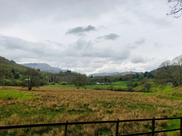
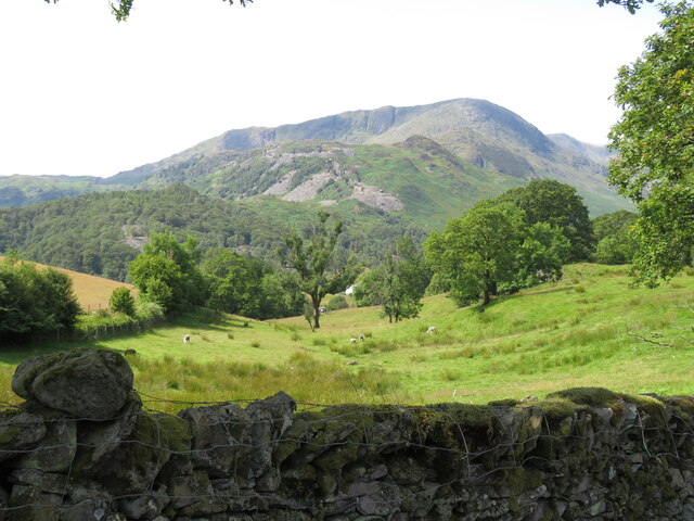
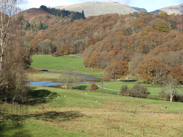
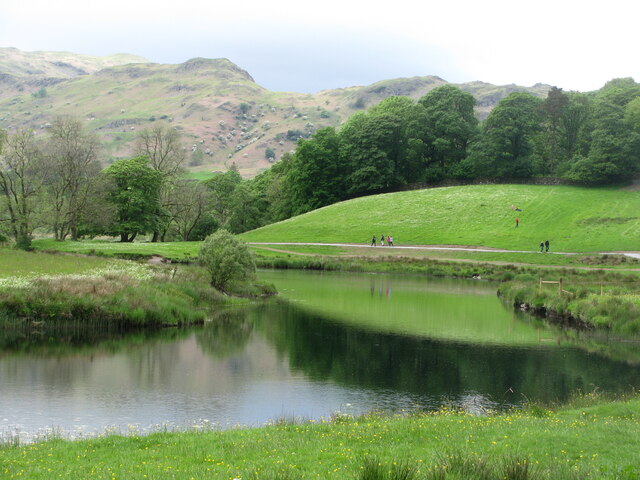
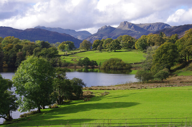
Covering an area of approximately 0.5 square kilometers, Elter Water is classified as a lake. However, its size and depth also classify it as a pool or pond. The water itself is crystal clear, reflecting the surrounding landscape of rolling hills, dense woodlands, and the majestic Langdale Pikes.

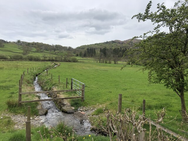
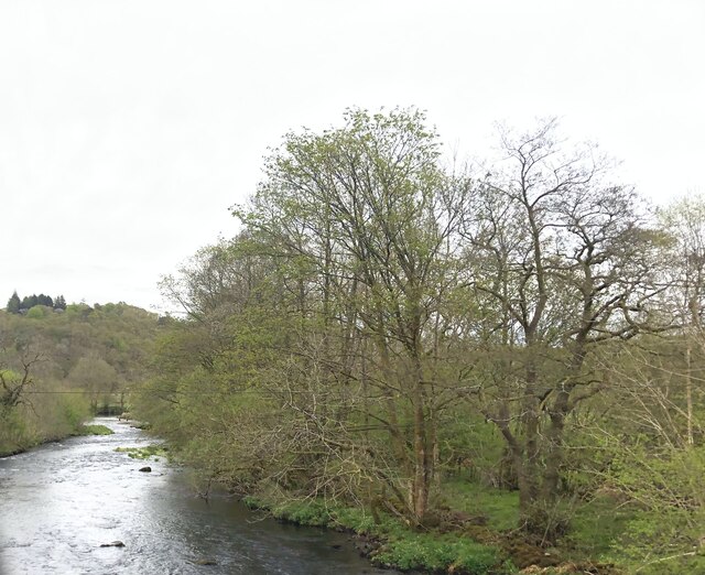
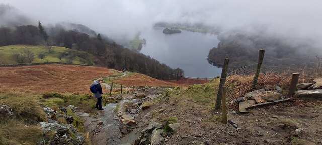
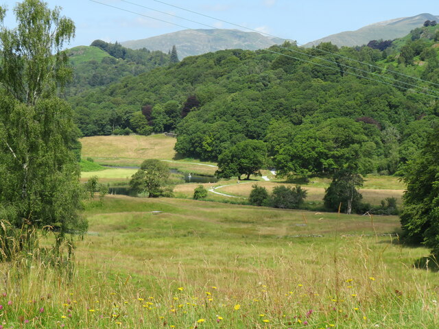
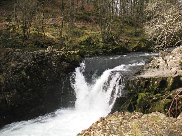
The lake is fed by the Great Langdale Beck, which flows through the nearby Elterwater village before reaching the water. It is also surrounded by a diverse range of plant and animal life. The shores of Elter Water are adorned with reed beds and freshwater marshes, creating a thriving habitat for various bird species, including herons, ducks, and swans.

The lake is also a popular spot for outdoor activities. The calm and pristine waters offer opportunities for kayaking, canoeing, and wild swimming. The surrounding area provides numerous walking and hiking trails, allowing visitors to explore the scenic landscape and enjoy breathtaking views of the lake.

Elter Water's idyllic location and natural beauty make it a favorite destination for nature lovers, photographers, and those seeking a peaceful retreat. Whether it's capturing the perfect photograph or simply enjoying the serenity of the surroundings, Elter Water offers a truly captivating experience for visitors of all ages.

If you have any feedback on the listing, please let us know in the comments section below.

Elter Water Images

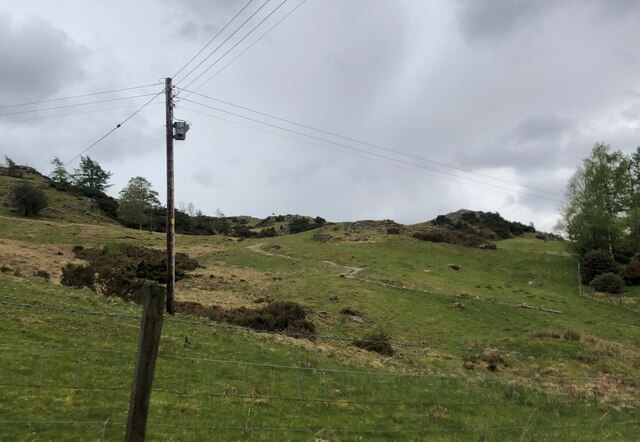
Images are sourced within 2km of 54.427842/-3.0243302 or Grid Reference NY3304. Thanks to Geograph Open Source API. All images are credited.

Rainbow and Loughrigg Fell - from Crag Head
River Brathay valley There is a large area of flood plain to the north of the river between Skelwith Bridge and Clappersgate
River Brathay valley
There is a large area of flood plain to the north of the river between Skelwith Bridge and Clappersgate
Marshy field near the River Brathay
Spring draining across the meadow to the River Brathay
River Brathay at Skelwith Bridge
Footpath to Tarn Hows From the A593 near Skelwith Bridge
Footpath to Tarn Hows
From the A593 near Skelwith Bridge
Loughrigg Tarn
Loughrigg Tarn
Path down from Loughrigg to Grasmere
View towards Elterwater from Cumbria Way View from Cumbria Way near to Park House looking towards River Brathay and the fells above Elterwater village
View towards Elterwater from Cumbria Way
View from Cumbria Way near to Park House looking towards River Brathay and the fells above Elterwater village
Wilson Place in Little Langdale One of the highlights of a delightful circular walk from Elterwater village by way of Little Langdale and Skelwith.
Wilson Place in Little Langdale
One of the highlights of a delightful circular walk from Elterwater village by way of Little Langdale and Skelwith.
View towards Tilberthwaite from Steady climb on rough path from Elterwater village reaps the reward of fine views over Little Langdale towards the scarred landscape of Tilberthwaite
View towards Tilberthwaite from
Steady climb on rough path from Elterwater village reaps the reward of fine views over Little Langdale towards the scarred landscape of Tilberthwaite
River Brathay from near Park House Autumn colours in Langdale - walking Cumbria Way between Colwith and Skelwith
River Brathay from near Park House
Autumn colours in Langdale - walking Cumbria Way between Colwith and Skelwith
River Brathay The easy access path provides passage for cyclists and wheelchair users following the river from Elterwater to Skelwith. Seen here from the Cumbria Way near Park House.
River Brathay
The easy access path provides passage for cyclists and wheelchair users following the river from Elterwater to Skelwith. Seen here from the Cumbria Way near Park House.
Loughrigg Tarn A classic view of the Langdale Pikes (centre right), with Bowfell on the left.
Loughrigg Tarn
A classic view of the Langdale Pikes (centre right), with Bowfell on the left.
Skelwith Force Below The Cumbria Way path (visible in the trees in the background) south-east of Woodburn Bridge, Skelwith Force is considered to be the most powerful waterfall in the Lake District.
Water was previously taken from the River Brathay upstream of the Force to provide power to the saw mill (now a slate works) at Skelwith Bridge; some remnants of the weir and headrace remain.
Prior to 1974 the River Brathay formed the county boundary of Lancashire and Westmorland.
Skelwith Force
Below The Cumbria Way path (visible in the trees in the background) south-east of Woodburn Bridge, Skelwith Force is considered to be the most powerful waterfall in the Lake District. Water was previously taken from the River Brathay upstream of the Force to provide power to the saw mill (now a slate works) at Skelwith Bridge; some remnants of the weir and headrace remain. Prior to 1974 the River Brathay formed the county boundary of Lancashire and Westmorland.
Tree Roots beside The Cumbria Way This mature tree adjacent to The Cumbria Way path near Skelwith Bridge has been felled in a long-ago storm and has re-grown from the uprooted roots, forming a new trunk and branches.
Tree Roots beside The Cumbria Way
This mature tree adjacent to The Cumbria Way path near Skelwith Bridge has been felled in a long-ago storm and has re-grown from the uprooted roots, forming a new trunk and branches.
Hollin Bank A public footpath from Shive of Cheese to Low Arnside follows the farmer's track.
Hollin Bank
A public footpath from Shive of Cheese to Low Arnside follows the farmer's track.
Back gate entrance to Skelwith Fold
Show me another place!

Elter Water is located at Grid Ref: NY3304 (Lat: 54.427842, Lng: -3.0243302)

Administrative County: Cumbria

District: South Lakeland

Police Authority: Cumbria

What 3 Words

///composed.averages.appoints. Near Ambleside, Cumbria

Related Wikis

Elter Water

Elter Water is a small lake in the Lake District in North West England, half a mile southeast of the village of the same name. It has a length of 0.62...

Loughrigg Tarn

Loughrigg Tarn () is a small, natural lake in the Lake District, Cumbria, England. It is situated north of Windermere, just north of the village of Skelwith...

Lakes, Cumbria

Lakes is a civil parish in the Westmorland and Furness district, in the ceremonial county of Cumbria, England. In the 2001 census the parish had a population...

Elterwater Bridge

Elterwater Bridge is a Grade II listed single-arch bridge spanning Great Langdale Beck in Elterwater, Cumbria, England. The structure dates to 1702. The...

Nearby Amenities

Located within 500m of 54.427842,-3.0243302
The Nab
Natural: bay
Lat/Long: 54.4276177/-3.0262352
Bench
Material: wood
Lat/Long: 54.4271068/-3.017135
Neaum Crag
Place: locality
Lat/Long: 54.4278437/-3.017184
Power: pole
Lat/Long: 54.4296875/-3.0195007
Power: pole
Lat/Long: 54.4299566/-3.0181449
Power: pole
Lat/Long: 54.4258038/-3.0178023
Power: pole
Lat/Long: 54.4267142/-3.0181716
Power: pole
Lat/Long: 54.427558/-3.0185568
Power: pole
Lat/Long: 54.4284343/-3.0194967
Power: pole
Lat/Long: 54.4289593/-3.01983
Power: pole
Lat/Long: 54.4299326/-3.0200806
Power: pole
Lat/Long: 54.4311694/-3.0203752
The data included in this document is from www.openstreetmap.org. The data is made available under ODbL.

Have you been to Elter Water?

Leave your review of Elter Water below (or comments, questions and feedback).