Rhyne Pool

Lake, Pool, Pond, Freshwater Marsh in Morayshire

Scotland

Rhyne Pool

Rough grazing, Blackholes
Rough grazing, Blackholes Credit: Richard Webb

Rhyne Pool, located in Morayshire, is a serene and picturesque freshwater marsh that captivates visitors with its natural beauty and diverse ecosystem. Spanning over a sizable area, this pool serves as a home to various aquatic plants and animals, making it an ideal spot for nature enthusiasts and wildlife lovers.

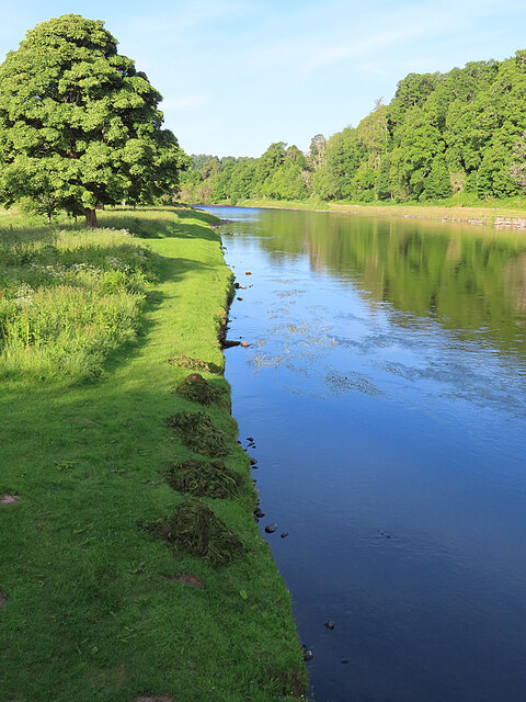
Surrounded by lush greenery, Rhyne Pool is characterized by its calm and crystal-clear waters, which reflect the surrounding landscape and create a tranquil atmosphere. The pool is fed by a combination of rainwater and underground springs, ensuring a constant flow of fresh water throughout the year.

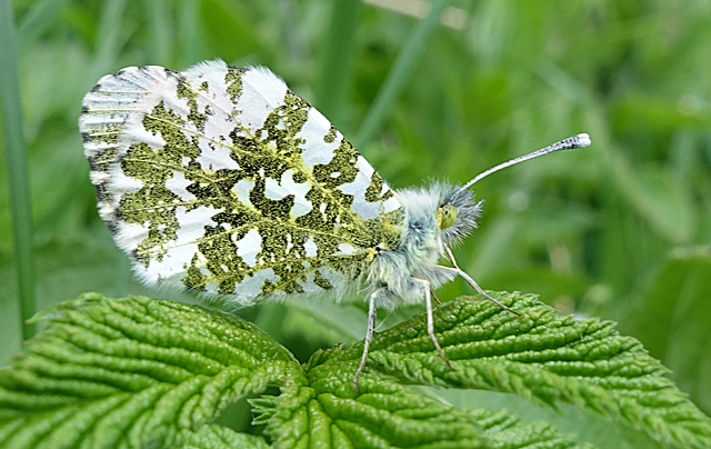
The flora around the pool includes an assortment of aquatic plants such as water lilies, reeds, and rushes. These plants not only add to the aesthetic appeal of the pool but also provide a sanctuary for a multitude of wildlife species. Visitors can often spot a variety of water-dwelling creatures, including frogs, newts, and dragonflies, as well as numerous species of birds that rely on the pool for food and shelter.

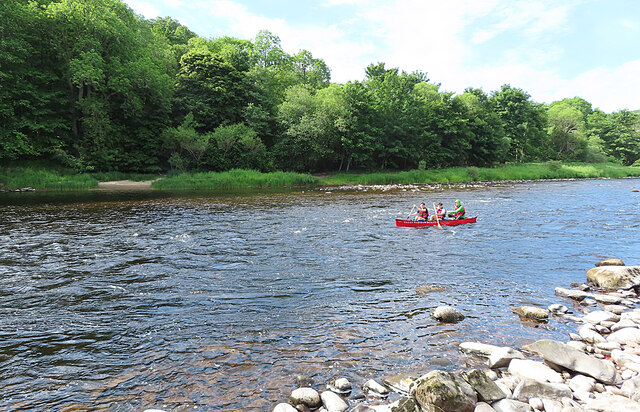
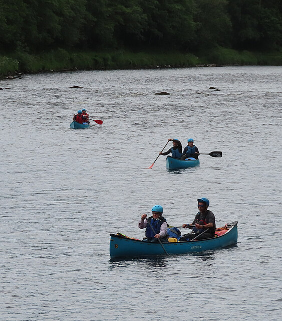
Rhyne Pool is also a popular spot for recreational activities such as fishing and boating. Anglers can try their luck at catching freshwater fish like trout and perch, while boaters can enjoy leisurely paddles or explore the nooks and crannies of the pool.

With its serene ambiance, diverse ecosystem, and recreational opportunities, Rhyne Pool in Morayshire is a haven for nature enthusiasts seeking a peaceful escape in the heart of Scotland.

If you have any feedback on the listing, please let us know in the comments section below.

Rhyne Pool Images

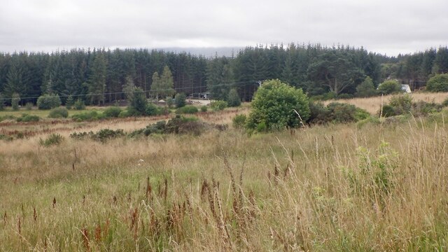
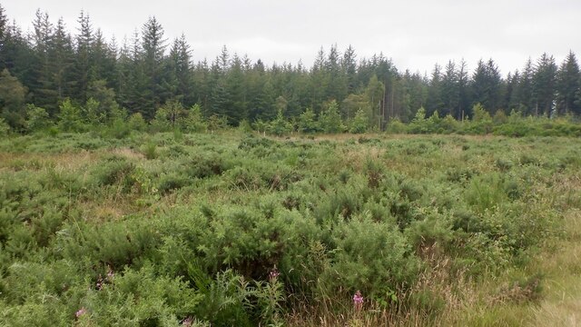
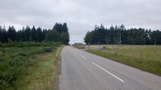
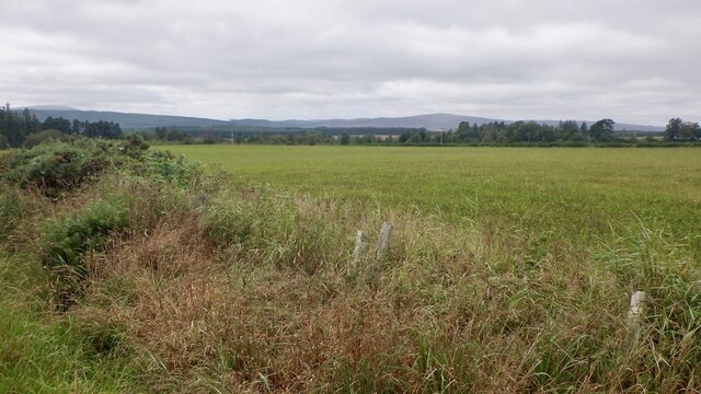
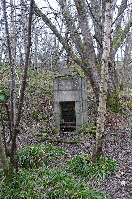
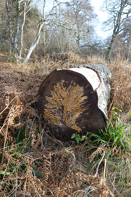
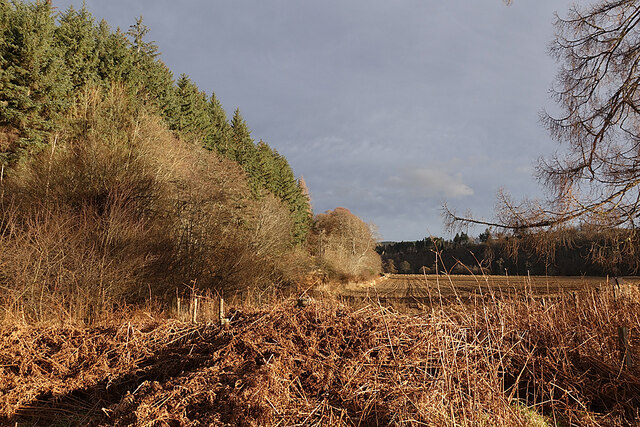
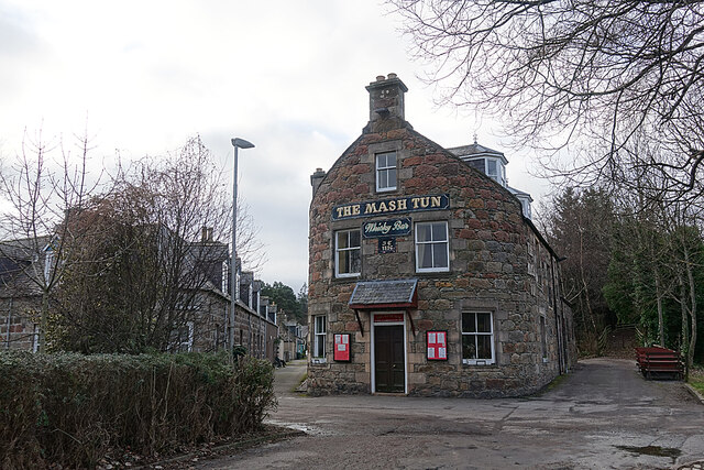
Images are sourced within 2km of 57.467404/-3.2479169 or Grid Reference NJ2542. Thanks to Geograph Open Source API. All images are credited.

Rough grazing, Blackholes
Cossack Wood
Cossack Wood
B9102 east of Archiestown Passing Cossack Wood.
B9102 east of Archiestown
Passing Cossack Wood.
Field near Archiestown
Orphaned Fireplace I surmise that this is the fireplace and chimney of a railwaymen's wooden hut that has long since vanished.
Orphaned Fireplace
I surmise that this is the fireplace and chimney of a railwaymen's wooden hut that has long since vanished.
Fungus Art We saw all sorts of pictures in the fungus on the cut end of a tree trunk. What can you see?
Fungus Art
We saw all sorts of pictures in the fungus on the cut end of a tree trunk. What can you see?
Haugh of Delltoulie Warm winter sunshine on the trees and ploughed field on the Haugh of Delltoulie.
Haugh of Delltoulie
Warm winter sunshine on the trees and ploughed field on the Haugh of Delltoulie.
The Mash Tun The former Station Bar is a Category C Listed Building. See <span class="nowrap"><a title="http://portal.historicenvironment.scot/designation/LB49987" rel="nofollow ugc noopener" href="http://portal.historicenvironment.scot/designation/LB49987">Link</a><img style="margin-left:2px;" alt="External link" title="External link - shift click to open in new window" src="https://s1.geograph.org.uk/img/external.png" width="10" height="10"/></span>. The Mash Tun's own web site <span class="nowrap"><a title="https://www.mashtun-aberlour.com/about-us" rel="nofollow ugc noopener" href="https://www.mashtun-aberlour.com/about-us">Link</a><img style="margin-left:2px;" alt="External link" title="External link - shift click to open in new window" src="https://s1.geograph.org.uk/img/external.png" width="10" height="10"/></span> says, "The building was originally constructed in 1896 by James Campbell, a sea captain, who instructed a marine architect to design the building in the shape of a small ship. ​A pledge contained in the title deeds, made in 1963 by the owner at the time, states that since Dr Beeching closed the railway in Aberlour then a name change was appropriate - but that if ever a train should pull up at the station again then the pub will revert to the Station Bar".
The Mash Tun
The former Station Bar is a Category C Listed Building. See LinkExternal link. The Mash Tun's own web site LinkExternal link says, "The building was originally constructed in 1896 by James Campbell, a sea captain, who instructed a marine architect to design the building in the shape of a small ship. ​A pledge contained in the title deeds, made in 1963 by the owner at the time, states that since Dr Beeching closed the railway in Aberlour then a name change was appropriate - but that if ever a train should pull up at the station again then the pub will revert to the Station Bar".
Aberlour Orphanage Clock Tower The clock tower is the only part of the Aberlour Orphanage buildings that survives, cramped and hemmed in by modern housing. It is a Category C Listed building. See <span class="nowrap"><a title="http://portal.historicenvironment.scot/designation/LB20865" rel="nofollow ugc noopener" href="http://portal.historicenvironment.scot/designation/LB20865">Link</a><img style="margin-left:2px;" alt="External link" title="External link - shift click to open in new window" src="https://s1.geograph.org.uk/img/external.png" width="10" height="10"/></span> for details.
Aberlour Orphanage Clock Tower
The clock tower is the only part of the Aberlour Orphanage buildings that survives, cramped and hemmed in by modern housing. It is a Category C Listed building. See LinkExternal link for details.
Memorial to Aberlour Orphanage Each panel tells part of the story of the orphanage that stood on this site in the late 19th and first part of the 20th century.
Memorial to Aberlour Orphanage
Each panel tells part of the story of the orphanage that stood on this site in the late 19th and first part of the 20th century.
Farm Close Modern housing in a quiet cul-de-sac on the site of the former Aberlour Orphanage.
Farm Close
Modern housing in a quiet cul-de-sac on the site of the former Aberlour Orphanage.
Oak Leaves Fresh new leaves on an alien species of oak, possibly American Red Oak (Quercus rubra).
Oak Leaves
Fresh new leaves on an alien species of oak, possibly American Red Oak (Quercus rubra).
Water Avens (Geum rivale) This delicate flower is commonly found in damp places such as the banks of burns and rivers.
Water Avens (Geum rivale)
This delicate flower is commonly found in damp places such as the banks of burns and rivers.
Orange Tip Butterfly (Anthocharis cardamines) The absence of the orange tip that gives the species its name shows that this one is a female, but the underwing is unmistakable.
Orange Tip Butterfly (Anthocharis cardamines)
The absence of the orange tip that gives the species its name shows that this one is a female, but the underwing is unmistakable.
River Spey at Aberlour I was a little saddened to see that someone has been gathering and removing the River Water-crowfoot that is currently flowering just upstream from the bridge, but at least they haven't cleared all of it. This was at seven o'clock in the morning. When I returned several hours later the heaps had been removed.
River Spey at Aberlour
I was a little saddened to see that someone has been gathering and removing the River Water-crowfoot that is currently flowering just upstream from the bridge, but at least they haven't cleared all of it. This was at seven o'clock in the morning. When I returned several hours later the heaps had been removed.
Canoeing on the River Spey While I was on the river bank I heard the sound of voices, and shortly afterwards this canoe appeared from usptream.
Canoeing on the River Spey
While I was on the river bank I heard the sound of voices, and shortly afterwards this canoe appeared from usptream.
Canoeing on the River Spey This was the second group of canoes I saw this morning, on their way from Aviemore to Spey Bay. The trip takes four days and involves camping each night.
Canoeing on the River Spey
This was the second group of canoes I saw this morning, on their way from Aviemore to Spey Bay. The trip takes four days and involves camping each night.
Show me another place!

Rhyne Pool is located at Grid Ref: NJ2542 (Lat: 57.467404, Lng: -3.2479169)

Unitary Authority: Moray

Police Authority: North East

What 3 Words

///mull.snapped.widely. Near Charlestown of Aberlour, Moray

Related Wikis

Victoria Bridge, Aberlour

The Victoria Bridge is a suspension footbridge near the village of Aberlour in Moray, Scotland. It was built in 1902, replacing a ferry that had previously...

A95 road

The A95 road is a major road of north-east Scotland connecting the A9 road in the Highlands to the A98 road near the coast. == Route == It leaves the A9...

Aberlour distillery

Aberlour distillery is a Speyside single malt Scotch whisky distillery, in Aberlour, Strathspey, Scotland, at the confluence of the Lour Burn and River...

Aberlour railway station

Aberlour railway station served the village of Aberlour, Scotland, from 1863 to 1965. == History == The station was opened by the Strathspey Railway when...

Nearby Amenities

Located within 500m of 57.467404,-3.2479169
Power: pole
Lat/Long: 57.4697682/-3.2463189
Power: pole
Lat/Long: 57.4697957/-3.2452402
Power: pole
Lat/Long: 57.4698276/-3.2442179
Power: pole
Lat/Long: 57.4698507/-3.243123
Power: pole
Lat/Long: 57.4698883/-3.2420308
Power: pole
Lat/Long: 57.4680699/-3.2461454
Power: pole
Lat/Long: 57.4692127/-3.2462907
Power: pole
Lat/Long: 57.4703758/-3.2461804
Power: pole
Lat/Long: 57.4708127/-3.2460593
Power: pole
Lat/Long: 57.4711527/-3.2461267
Power: pole
Lat/Long: 57.4716531/-3.246592
Power: pole
Lat/Long: 57.4707606/-3.2473264
Power: pole
Lat/Long: 57.4703932/-3.2483486
Power: pole
Lat/Long: 57.4699925/-3.2494516
Power: pole
Lat/Long: 57.4695614/-3.2506783
Power: pole
Lat/Long: 57.4688959/-3.252696
Power: pole
Lat/Long: 57.468365/-3.2529811
Power: pole
Lat/Long: 57.46774/-3.2533712
Power: pole
Lat/Long: 57.4670731/-3.2537693
Power: pole
Lat/Long: 57.4665277/-3.2540895
Power: pole
Lat/Long: 57.4659287/-3.254493
Power: pole
Lat/Long: 57.4654151/-3.254805
Power: pole
Lat/Long: 57.4718643/-3.2481792
Power: pole
Lat/Long: 57.4710058/-3.2466169
The data included in this document is from www.openstreetmap.org. The data is made available under ODbL.

Have you been to Rhyne Pool?

Leave your review of Rhyne Pool below (or comments, questions and feedback).