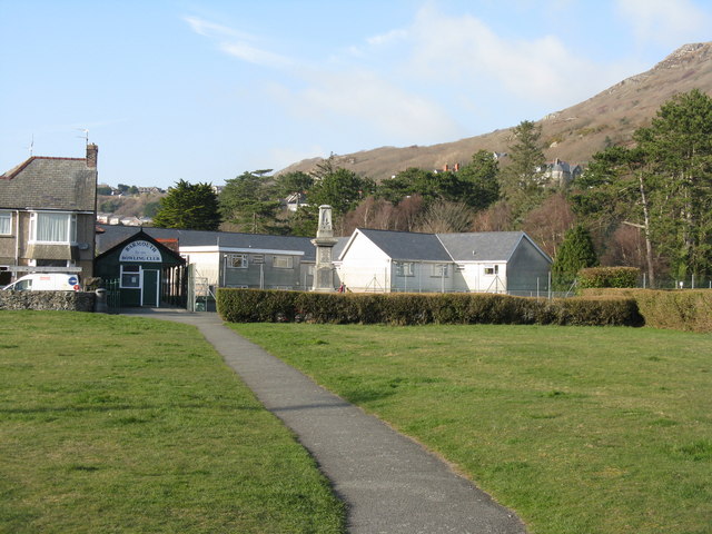
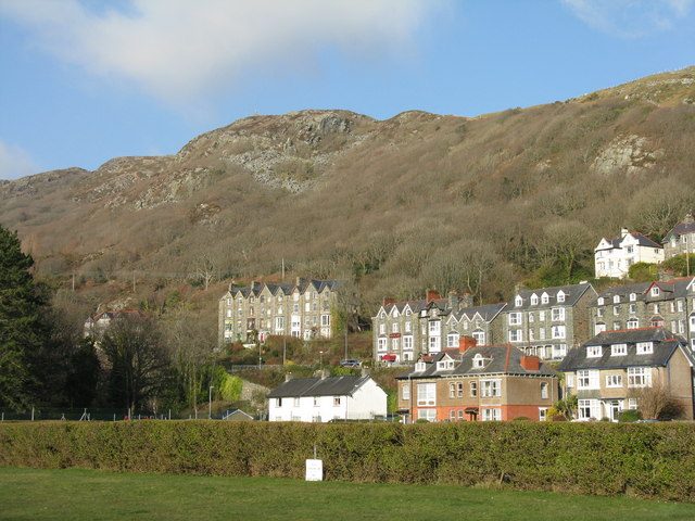
Abermaw
Settlement in Merionethshire
Wales
Abermaw
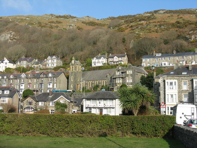
Abermaw, also known as Barmouth, is a picturesque coastal town located in the historic county of Merionethshire, Wales. Situated at the mouth of the River Mawddach, it lies on the west coast of Snowdonia National Park, offering breathtaking views of the mountains and the Irish Sea. With a population of around 2,500 residents, Abermaw is a popular tourist destination due to its natural beauty and vibrant atmosphere.
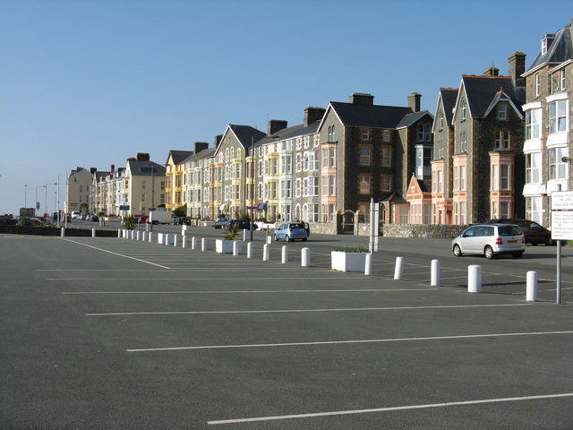
The town has a rich history, dating back to the medieval period when it served as a key port for the transportation of slate and other goods. Today, remnants of its maritime past can still be seen in the old harbor and the Victorian-era seafront promenade. The iconic Barmouth Bridge, a Grade II listed structure, connects the town to the neighboring village of Llanaber, providing a scenic route for pedestrians and cyclists.
Abermaw’s beautiful sandy beach stretches for over two miles, making it a haven for sun-seekers and water sports enthusiasts. The town offers a range of amenities, including shops, restaurants, and accommodation options to cater to the needs of visitors. The bustling town center features an array of independent boutiques and traditional Welsh gift shops, allowing visitors to explore and discover local crafts and produce.
For nature enthusiasts, Abermaw is a gateway to Snowdonia National Park, offering opportunities for hiking, mountain biking, and wildlife spotting. The nearby Mawddach Estuary, a Site of Special Scientific Interest, is a haven for birdwatchers and nature lovers, boasting a diverse range of flora and fauna.
Overall, Abermaw is a charming coastal town that seamlessly blends natural beauty, history, and modern amenities, making it a must-visit destination for travelers seeking a unique Welsh experience.
If you have any feedback on the listing, please let us know in the comments section below.
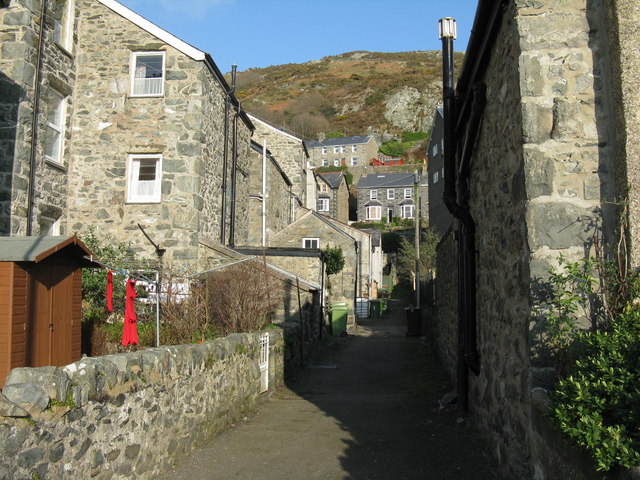
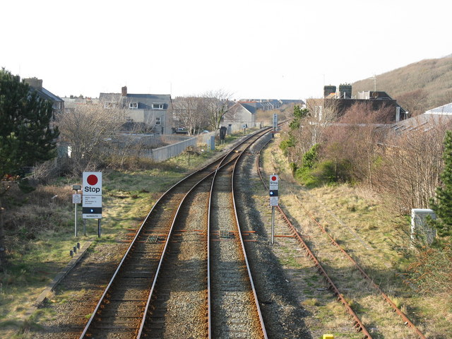
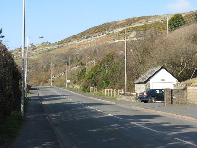
Abermaw Images
Images are sourced within 2km of 52.722018/-4.055956 or Grid Reference SH6115. Thanks to Geograph Open Source API. All images are credited.
![Be warned - Twmpathau Warning of humps on the promenade at Barmouth, and the Arbour Hotel [the same name in two places, so assumed not to have lost an 'H'].](https://s2.geograph.org.uk/geophotos/02/30/16/2301682_6bcfc648.jpg)
![The Promenade at Barmouth Looking south-east, towards the harbour, with the cliffs of [possibly] Craig-y-llyn on the western flanks of Cadair Idris in the distance.](https://s0.geograph.org.uk/geophotos/02/30/17/2301700_fb26c173.jpg)
![Wind turbine [stationary] On a sports field between Marine Parade East, Princes Gardens and Marine Avenue.](https://s0.geograph.org.uk/geophotos/02/30/17/2301720_2ffbb931.jpg)
![The beach at Llanaber Looking northwestwards from a house high up on the hillside. Between the beach and the photographer are the Barmouth-Harlech railway, caravan sites [currently empty in March] and the A496 [with NCN8] Barmouth-Harlech road.](https://s1.geograph.org.uk/geophotos/02/30/21/2302133_721917d1.jpg)
Abermaw is located at Grid Ref: SH6115 (Lat: 52.722018, Lng: -4.055956)
Unitary Authority: Gwynedd
Police Authority: North Wales
Also known as: Barmouth, Abermo
What 3 Words
///notifying.candle.issued. Near Barmouth, Gwynedd
Nearby Locations
Related Wikis

Barmouth
Barmouth (Welsh: Abermaw (formal); Y Bermo (colloquial)) is a seaside town and community in the county of Gwynedd, north-west Wales; it lies on the estuary...

Barmouth Lifeboat Station
Barmouth Lifeboat Station, based in Barmouth, Gwynedd, Wales, was established in the 1820s and the first lifeboat station was constructed in 1828 at a...

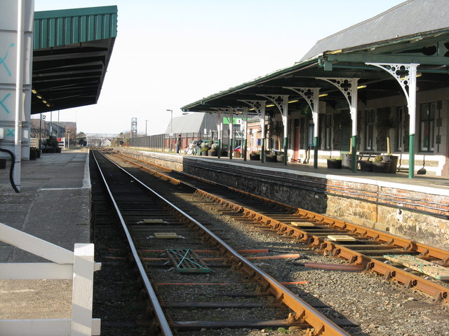
Barmouth railway station
Barmouth railway station serves the seaside town of Barmouth in Gwynedd, Wales. The station is on the Cambrian Coast Railway with passenger services to...
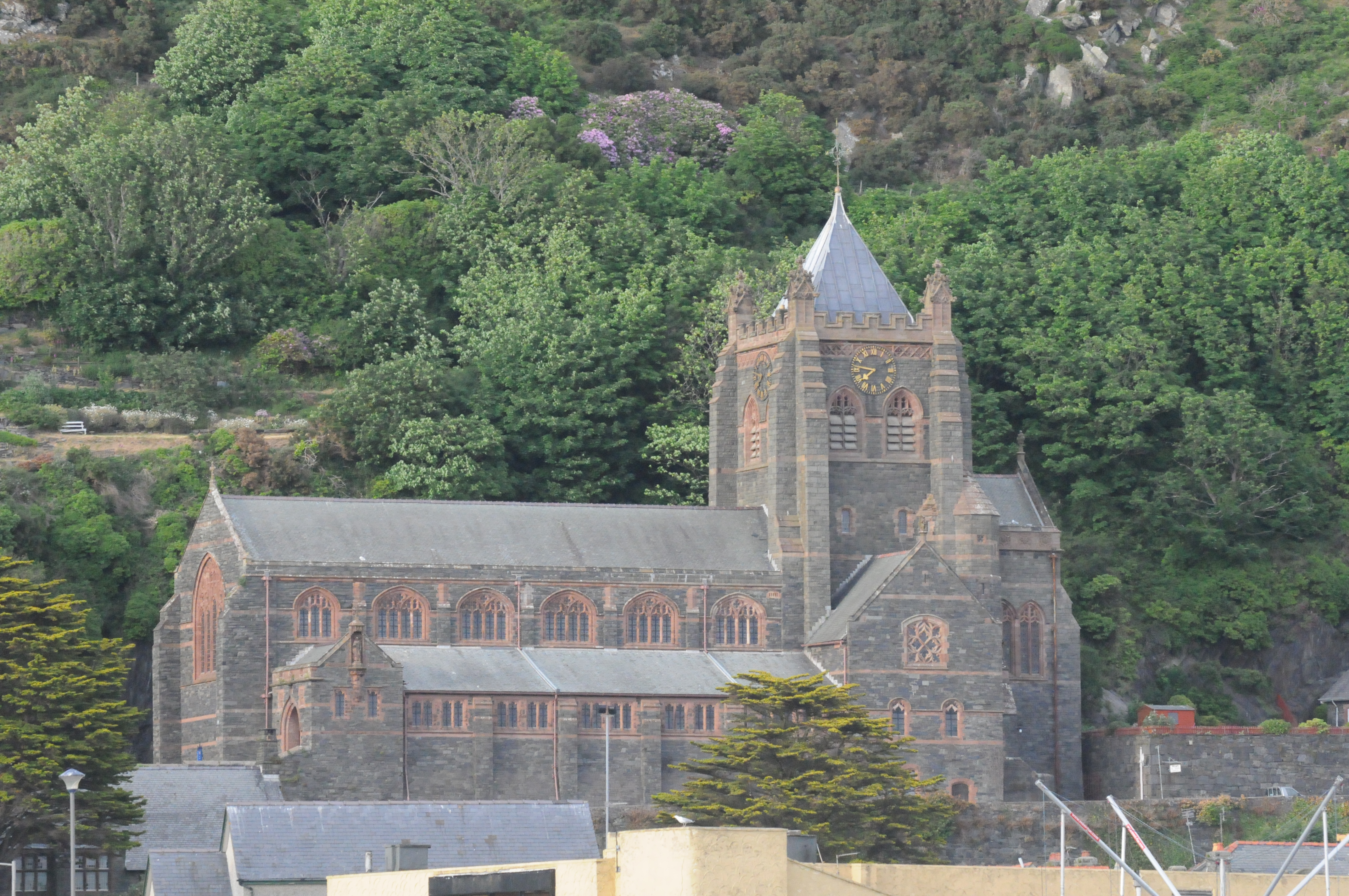
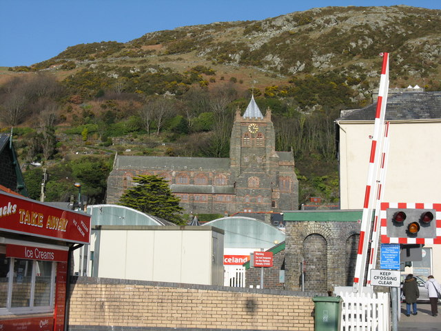
St John's Church, Barmouth
St John's Church, Barmouth, Gwynedd, Wales was built between 1889 and 1895 and designed by the Chester architects Douglas and Fordham. The foundation stone...
St David's Church, Barmouth
St David's Church is a Church in Wales church by the harbour of Barmouth, Gwynedd, west Wales. It is part of the Bro Ardudwy Ministry Area. == History... ==

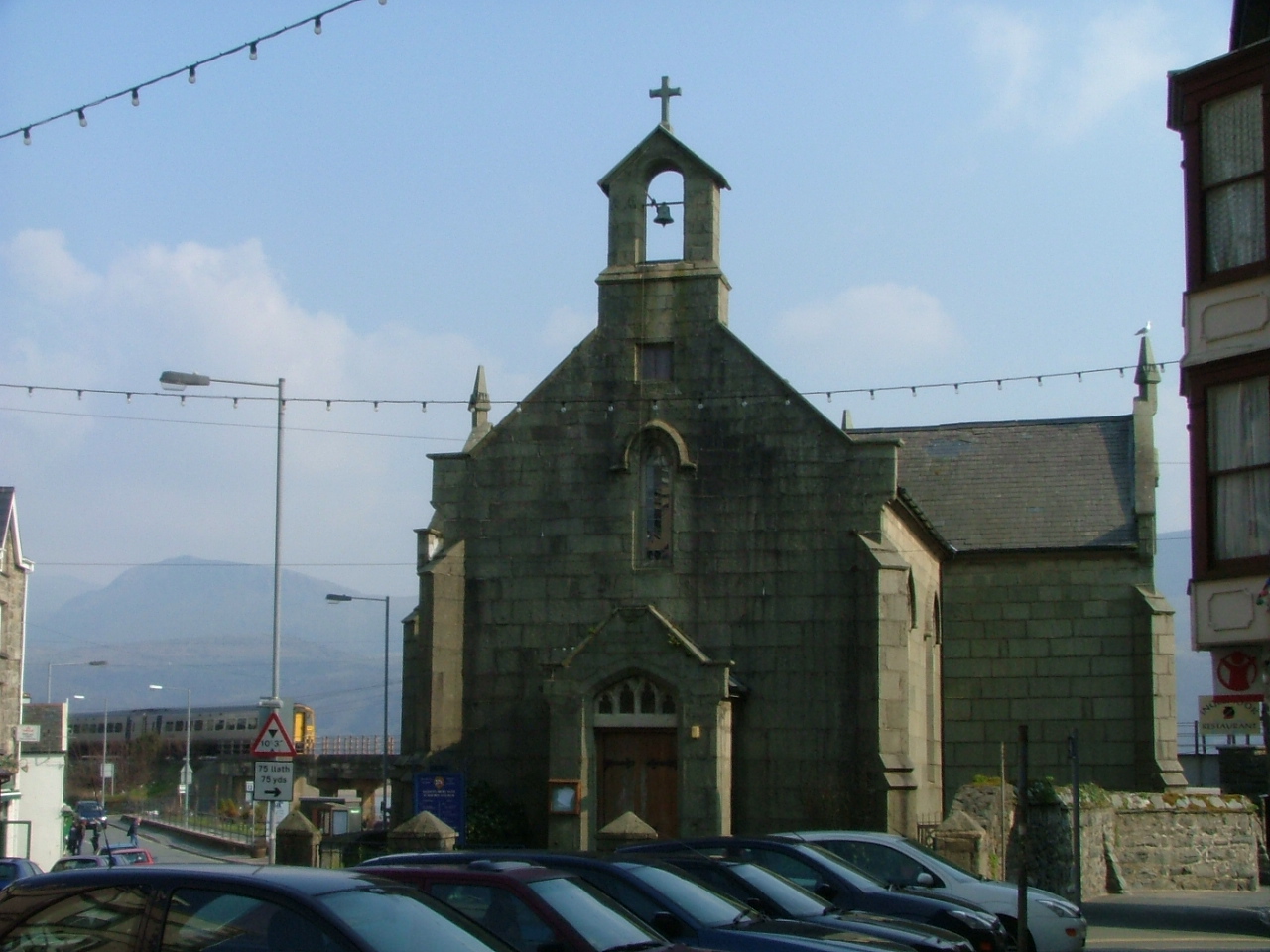
St Tudwal's Church, Barmouth
St Tudwal's Church is a Roman Catholic parish church in Barmouth, Gwynedd. It is situated on the King Edward Road leading from Barmouth to Llanaber. It...

Plas Mynach
Plas Mynach is a large country house in Barmouth, Gwynedd, Wales. It is designated by Cadw as a Grade II* listed building, and stands in a prominent position...

Fairbourne Spit
Fairbourne Spit (also known as Penrhyn Point) is a long spit of sand and shingle at the mouth of the River Mawddach where it reaches Cardigan Bay, on the...
Nearby Amenities
Located within 500m of 52.722018,-4.055956Have you been to Abermaw?
Leave your review of Abermaw below (or comments, questions and feedback).